
Presidential Towers
555 W Madison St,
Chicago, IL 60661
$1,686 - $6,604
Studio - 2 Beds


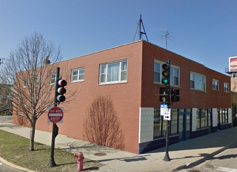
Come home to 2635-2639 W 79th St in Chicago. The convenient W. 79th St. location in the 60652 Zip code of Chicago is a great place to move to. Make a visit to see the current floorplan options. From amenities to floorplan options, the community staff is ready to help match you with the perfect place to live. Drop by 2635-2639 W 79th St today.
2635-2639 W 79th St is an apartment community located in Cook County and the 60652 ZIP Code. This area is served by the Chicago Public Schools attendance zone.
Chicago sprawls across roughly 228 square miles on the southwestern shore of Lake Michigan, with nearly 28 miles of lakefront where glass towers catch the morning light and commuter trains rumble through neighborhoods shaped by more than a century of reinvention. This is a city built on bold architecture and bolder ambition, where you can stand beneath the steel ribs of the “L” tracks one moment and find yourself strolling through Grant Park’s open lawns the next.
Renters here choose between classic greystone walk-ups in Lakeview, converted lofts in the West Loop’s Fulton Market district, and sleek high-rises with lake views in Streeterville. Logan Square draws crowds to its Milwaukee Avenue dining scene and the elevated 606 trail, while Lincoln Park offers tree-lined streets near the free zoo. River North packs art galleries alongside bustling restaurants, and Hyde Park anchors the South Side with the Museum of Science and Industry nearby.
Learn more about living in ChicagoCompare neighborhood and city base rent averages by bedroom.
| Wrightwood | Chicago, IL | |
|---|---|---|
| Studio | $1,136 | $1,657 |
| 1 Bedroom | $1,002 | $2,055 |
| 2 Bedrooms | $1,223 | $2,600 |
| 3 Bedrooms | $1,104 | $3,114 |
| Colleges & Universities | Distance | ||
|---|---|---|---|
| Colleges & Universities | Distance | ||
| Drive: | 4 min | 2.2 mi | |
| Drive: | 10 min | 4.2 mi | |
| Drive: | 14 min | 6.9 mi | |
| Drive: | 14 min | 7.3 mi |


Transportation options available in Chicago include Ashland & 63Rd Street Station, located 3.3 miles from 2635-2639 W 79th St. 2635-2639 W 79th St is near Chicago Midway International, located 6.4 miles or 12 minutes away, and Chicago O'Hare International, located 26.7 miles or 44 minutes away.
| Transit / Subway | Distance | ||
|---|---|---|---|
| Transit / Subway | Distance | ||
|
|
Drive: | 6 min | 3.3 mi |
|
|
Drive: | 7 min | 4.0 mi |
|
|
Drive: | 8 min | 4.3 mi |
|
|
Drive: | 8 min | 4.6 mi |
|
|
Drive: | 10 min | 6.3 mi |
| Commuter Rail | Distance | ||
|---|---|---|---|
| Commuter Rail | Distance | ||
|
|
Walk: | 15 min | 0.8 mi |
|
|
Drive: | 3 min | 1.6 mi |
|
|
Drive: | 5 min | 2.9 mi |
|
|
Drive: | 5 min | 3.1 mi |
|
|
Drive: | 7 min | 3.5 mi |
| Airports | Distance | ||
|---|---|---|---|
| Airports | Distance | ||
|
Chicago Midway International
|
Drive: | 12 min | 6.4 mi |
|
Chicago O'Hare International
|
Drive: | 44 min | 26.7 mi |
Scores provided by
Traffic
BusyAirport
CalmBusinesses
ActiveScores provided by
HowLoud What is a Sound Score Rating? A Sound Score Rating aggregates noise caused by vehicle traffic, airplane traffic and local sources. How It WorksTime and distance from 2635-2639 W 79th St.
| Shopping Centers | Distance | ||
|---|---|---|---|
| Shopping Centers | Distance | ||
| Walk: | 16 min | 0.8 mi | |
| Walk: | 17 min | 0.9 mi |
| Parks and Recreation | Distance | ||
|---|---|---|---|
| Parks and Recreation | Distance | ||
|
Dan Ryan Woods
|
Walk: | 19 min | 1.0 mi |
|
Marquette Park
|
Drive: | 3 min | 1.9 mi |
|
Foster Park
|
Drive: | 5 min | 2.3 mi |
|
Hamilton Park
|
Drive: | 6 min | 3.3 mi |
|
Ogden Park
|
Drive: | 7 min | 3.4 mi |
| Hospitals | Distance | ||
|---|---|---|---|
| Hospitals | Distance | ||
| Drive: | 4 min | 2.3 mi | |
| Drive: | 4 min | 2.8 mi | |
| Drive: | 7 min | 3.7 mi |
| Military Bases | Distance | ||
|---|---|---|---|
| Military Bases | Distance | ||
| Drive: | 48 min | 31.2 mi | |
| Drive: | 52 min | 34.4 mi | |
| Drive: | 59 min | 36.2 mi |
What Are Walk Score®, Transit Score®, and Bike Score® Ratings?
Walk Score® measures the walkability of any address. Transit Score® measures access to public transit. Bike Score® measures the bikeability of any address.
What is a Sound Score Rating?
A Sound Score Rating aggregates noise caused by vehicle traffic, airplane traffic and local sources.
2635-2639 W 79th St
Chicago, IL 60652


