$1,800 / Month
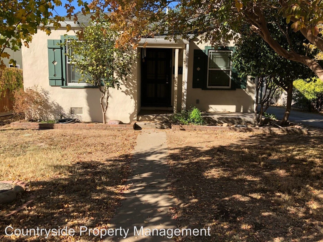
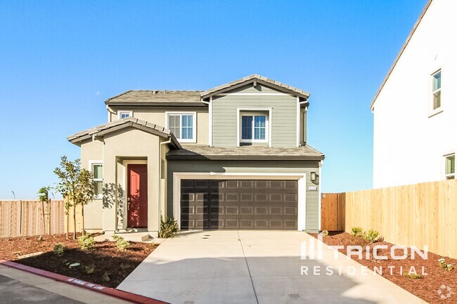
2624 57th St
Sacramento, CA 95817
2 Weeks Ago
Favorites
2624 57th St

Favorites
Check Back Soon for Upcoming Availability
| Beds | Baths | Average SF |
|---|---|---|
| 2 Bedrooms 2 Bedrooms 2 Br | 1 Bath 1 Bath 1 Ba | 782 SF |
About This Property
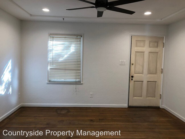
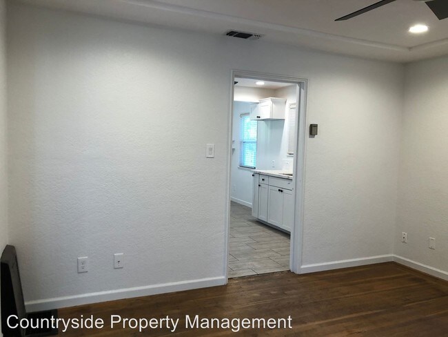
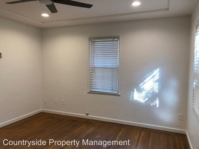
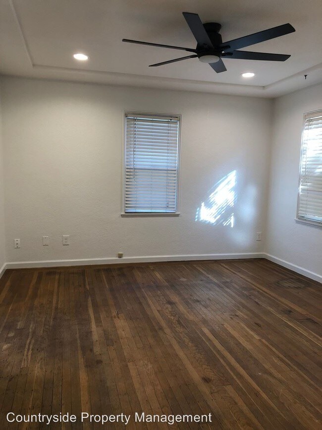
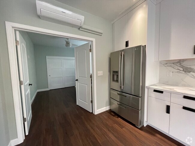
(209) 566-1800 - - This nicely remodeled home located in the desirable Elmhurst area is approximately 782 with a living room, dining area, hardwood and tile floors, blinds, granite counters, oven, gas range, dishwasher, garbage disposal, microwave, laundry room, central heat & air, 1 car spacious garage, front and large backyard with fruit trees. Close to schools, parks, shopping, UC Davis Medical Center Addendum to be signed: 12 Month lease & Renters insurance required. Pets negotiable. L/D (RLNE4454873)
2624 57th St is a house located in Sacramento County and the 95817 ZIP Code. This area is served by the Sacramento City Unified attendance zone.
Location
Get Directions
It may not have the flashy reputation of San Francisco or Los Angeles, but Sacramento embodies the very best of what makes California so unique. The city is well known for preserving its history, from early settlements like Sutter’s Fort to the gorgeous 19th century architecture of Old Sacramento to the artifacts in the Sacramento History Museum. Pop culture and the fine arts are well-represented, with local stages hosting symphony concerts and rock shows and galleries displaying works by the old masters as well as modern upstarts. The local restaurant scene is famous for its heavy emphasis on “farm to fork” principles, making it one of the best places to find fresh, locally sourced food.
Those living in Sacramento love to take advantage of the mild climate, whether that means biking the River Trail, taking the kids to Fairytale Town, or heading over to Sutter Health Park to catch a River Cats baseball game.
Learn more about living in SacramentoBelow are rent ranges for similar nearby apartments
Education
| Colleges & Universities | Distance | ||
|---|---|---|---|
| Colleges & Universities | Distance | ||
| Drive: | 6 min | 2.4 mi | |
| Drive: | 8 min | 3.6 mi | |
| Drive: | 17 min | 8.2 mi | |
| Drive: | 20 min | 13.0 mi |
2624 57th St is within 6 minutes or 2.4 miles from Sacramento State. It is also near Sacramento City College and Cosumnes River College.
Schools


Public Elementary School
Grades K-3
372 Students
Nearby
Public Elementary School
Grades K-6
449 Students
Attendance Zone
Public Middle & High School
Grades 7-12
536 Students
Attendance Zone
Public High School
Grades 9-12
1,733 Students
Attendance Zone
Private Elementary School
Grades PK-6
211 Students
Nearby
Private Elementary & Middle School
Grades PK-8
332 Students
Nearby
Private High School
Grades 9-12
1,091 Students
Nearby
School data provided by
 The GreatSchools Rating helps parents compare schools within a state based on a variety of school quality indicators and provides a helpful picture of how effectively each school serves all of its students. Ratings are on a scale of 1 (below average) to 10 (above average) and can include test scores, college readiness, academic progress, advanced courses, equity, discipline and attendance data. We also advise parents to visit schools, consider other information on school performance and programs, and consider family needs as part of the school selection process.
View GreatSchools Rating Methodology
View GreatSchools Rating Methodology
Transportation options available in Sacramento include 59Th Street Station (Eb), located 0.6 mile from 2624 57th St. 2624 57th St is near Sacramento International, located 16.3 miles or 23 minutes away.
| Transit / Subway | Distance | ||
|---|---|---|---|
| Transit / Subway | Distance | ||
|
|
Walk: | 11 min | 0.6 mi |
|
|
Walk: | 17 min | 0.9 mi |
| Drive: | 3 min | 1.3 mi | |
|
|
Drive: | 4 min | 1.5 mi |
|
|
Drive: | 6 min | 2.6 mi |
| Commuter Rail | Distance | ||
|---|---|---|---|
| Commuter Rail | Distance | ||
| Drive: | 10 min | 6.0 mi | |
|
|
Drive: | 22 min | 17.9 mi |
|
|
Drive: | 29 min | 21.6 mi |
|
|
Drive: | 30 min | 23.7 mi |
|
|
Drive: | 44 min | 32.3 mi |
| Airports | Distance | ||
|---|---|---|---|
| Airports | Distance | ||
|
Sacramento International
|
Drive: | 23 min | 16.3 mi |
Time and distance from 2624 57th St.
| Shopping Centers | Distance | ||
|---|---|---|---|
| Shopping Centers | Distance | ||
| Walk: | 6 min | 0.3 mi | |
| Walk: | 14 min | 0.8 mi | |
| Walk: | 17 min | 0.9 mi |
2624 57th St has 3 shopping centers within 0.9 mile, which is about a 17-minute walk. The miles and minutes will be for the farthest away property.
| Parks and Recreation | Distance | ||
|---|---|---|---|
| Parks and Recreation | Distance | ||
|
Paradise Beach County Recreation Area
|
Drive: | 5 min | 1.8 mi |
|
Sutter's Fort State Historical Monument
|
Drive: | 6 min | 3.0 mi |
|
California State Capitol Museum
|
Drive: | 7 min | 3.9 mi |
|
Leland Stanford Mansion State Historic Park
|
Drive: | 8 min | 4.0 mi |
|
Governor's Mansion State Historic Park
|
Drive: | 8 min | 4.9 mi |
2624 57th St has 5 parks within 4.9 miles, including Paradise Beach County Recreation Area, Sutter's Fort State Historical Monument, and Leland Stanford Mansion State Historic Park.
| Hospitals | Distance | ||
|---|---|---|---|
| Hospitals | Distance | ||
| Drive: | 3 min | 1.5 mi | |
| Drive: | 4 min | 1.7 mi | |
| Drive: | 4 min | 2.0 mi |
2624 57th St has 3 hospitals within 2.0 miles, the nearest is Shriners Hospitals for Children GÇö Northern California which is 1.5 miles away and a 3 minute drive.
| Military Bases | Distance | ||
|---|---|---|---|
| Military Bases | Distance | ||
| Drive: | 27 min | 13.9 mi |
2624 57th St is 13.9 miles and a 27 minute drive from McClellan Air Force Base.
You May Also Like
Similar Rentals Nearby

What Are Walk Score®, Transit Score®, and Bike Score® Ratings?
Walk Score® measures the walkability of any address. Transit Score® measures access to public transit. Bike Score® measures the bikeability of any address.
What is a Sound Score Rating?
A Sound Score Rating aggregates noise caused by vehicle traffic, airplane traffic and local sources

2624 57th St
Sacramento, CA 95817