
$1,750 / Month
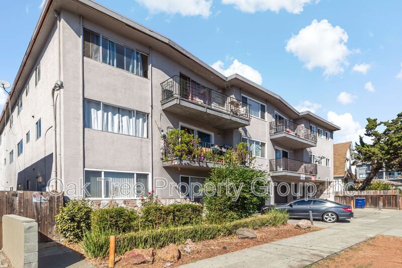
2619 High St
Oakland, CA 94619
Today
Favorites
-
Bedrooms
1
-
Bathrooms
1
-
Square Feet
600 sq ft
2619 High St

Favorites
About This Home
$1,750 deposit
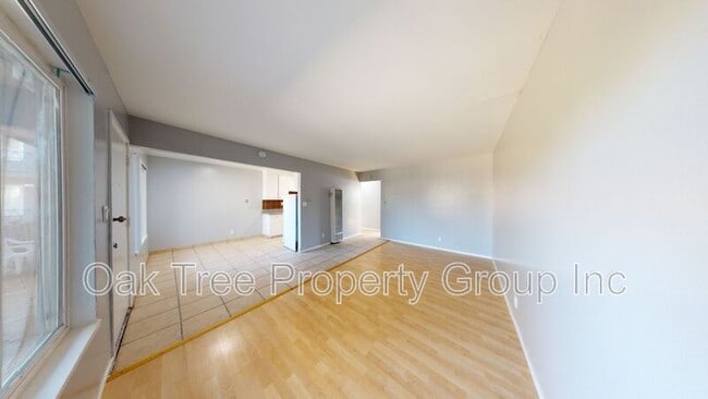
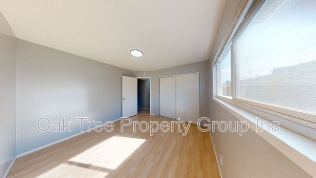
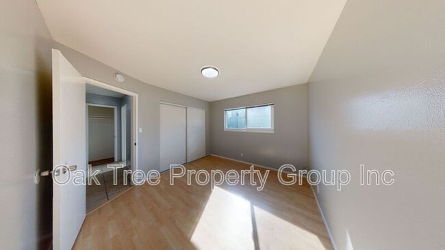
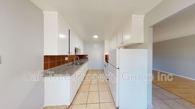
Virtual Tour: • 1 Bedroom/1 Bathroom • Open layout • Harwood floors • Laundry Onsite • Off-street parking (If Available) • The neighborhood's layout promotes a community-oriented atmosphere. • Walkable environment with access to small grocers, cafes, and specialty businesses, making daily errands convenient. • Allendale Elementary School is centrally located, allowing students to walk to class safely. The neighborhood is also served by Bret Harte Middle School and Fremont High School. • The Allendale Recreation Center provides a venue for outdoor activities and community events, contributing to the neighborhood's family-friendly environment. •Transportation: The area offers good transit options, with a transit score of 50, indicating that public transportation is readily accessible. • Small dogs and cats OK with $50 additional rent. • Recent Credit report and employment verification mandatory with all applications. **Pet Fee (2 pets max) - $50 (Monthly) ** Parking (if available) - $75 (Monthly) 1 Year Lease Requierements 650 Credit Score approx 2.5x Income As property owners or managers, we do not discriminate in the rental of property on the basis of race, color, religion, sex, sexual orientation, disability, familial status, or national origin. Amenities: laundry on-site
2619 High St is a house located in Alameda County and the 94619 ZIP Code.
* Price shown is base rent and may not include non-optional fees and utilities.
Price, availability, fees, and any applicable rent special are subject to change without notice.
* Square footage definitions vary. Displayed square footage is approximate.
Fees and Policies
The fees below are based on community-supplied data and may exclude additional fees and utilities.
- Dogs Allowed
-
Fees not specified
- Cats Allowed
-
Fees not specified
Contact
Location
Get Directions
Allendale is a mostly residential community just off the MacArthur Freeway. Residents enjoy a walkable landscape with a wide array of local amenities: Allendale Elementary School’s location in the north-central portion of the neighborhood gives students the option to walk to class safely; small grocers, cafes, and specialty businesses in the neighborhood keep folks well-fed and well-supplied; and Allendale Recreation Center provides a terrific venue for enjoying the sunshine with friends and neighbors.
A more diverse selection restaurants and shops can be found along MacArthur Boulevard just a few blocks to the northeast, and many more public parks surround Allendale on all sides. Numerous healthcare facilities in and around the neighborhood make it a great spot for medical professionals. Mills College is only a few blocks to the east, and of course the close proximity to the freeway makes it easy to reach anywhere in the Bay Area and beyond.
Learn more about living in Allendale
Education
| Colleges & Universities | Distance | ||
|---|---|---|---|
| Colleges & Universities | Distance | ||
| Drive: | 5 min | 1.6 mi | |
| Drive: | 7 min | 4.0 mi | |
| Drive: | 9 min | 5.4 mi | |
| Drive: | 12 min | 6.7 mi |
2619 High St is within 5 minutes or 1.6 miles from Mills College. It is also near Laney College and Lincoln University, Oakland.
Transportation options available in Oakland include Fruitvale Station, located 1.5 miles from 2619 High St. 2619 High St is near Metro Oakland International, located 6.5 miles or 10 minutes away, and San Francisco International, located 27.2 miles or 39 minutes away.
| Transit / Subway | Distance | ||
|---|---|---|---|
| Transit / Subway | Distance | ||
|
|
Drive: | 3 min | 1.5 mi |
|
|
Drive: | 5 min | 2.8 mi |
|
|
Drive: | 7 min | 4.8 mi |
|
|
Drive: | 8 min | 5.4 mi |
|
|
Drive: | 9 min | 5.7 mi |
| Commuter Rail | Distance | ||
|---|---|---|---|
| Commuter Rail | Distance | ||
|
|
Drive: | 8 min | 4.8 mi |
|
|
Drive: | 11 min | 8.2 mi |
|
|
Drive: | 14 min | 10.2 mi |
|
|
Drive: | 16 min | 11.7 mi |
| Drive: | 16 min | 11.7 mi |
| Airports | Distance | ||
|---|---|---|---|
| Airports | Distance | ||
|
Metro Oakland International
|
Drive: | 10 min | 6.5 mi |
|
San Francisco International
|
Drive: | 39 min | 27.2 mi |
Time and distance from 2619 High St.
| Shopping Centers | Distance | ||
|---|---|---|---|
| Shopping Centers | Distance | ||
| Walk: | 14 min | 0.7 mi | |
| Walk: | 17 min | 0.9 mi | |
| Drive: | 3 min | 1.5 mi |
2619 High St has 3 shopping centers within 1.5 miles, which is about a 3-minute walk. The miles and minutes will be for the farthest away property.
| Parks and Recreation | Distance | ||
|---|---|---|---|
| Parks and Recreation | Distance | ||
|
Roberts Regional Recreation Area
|
Drive: | 9 min | 4.3 mi |
|
Redwood Regional Park
|
Drive: | 9 min | 4.6 mi |
|
Chabot Space & Science Center
|
Drive: | 12 min | 5.0 mi |
|
Joaquin Miller Park
|
Drive: | 12 min | 5.1 mi |
|
Martin Luther King Jr. Regional Shoreline
|
Drive: | 10 min | 5.5 mi |
2619 High St has 5 parks within 5.5 miles, including Joaquin Miller Park, Martin Luther King Jr. Regional Shoreline, and Roberts Regional Recreation Area.
| Hospitals | Distance | ||
|---|---|---|---|
| Hospitals | Distance | ||
| Drive: | 4 min | 2.1 mi | |
| Drive: | 5 min | 2.9 mi | |
| Drive: | 8 min | 3.6 mi |
2619 High St has 3 hospitals within 3.6 miles, the nearest is Telecare Heritage Psychiatric Health Facility which is 2.1 miles away and a 4 minute drive.
| Military Bases | Distance | ||
|---|---|---|---|
| Military Bases | Distance | ||
| Drive: | 16 min | 8.2 mi | |
| Drive: | 16 min | 8.4 mi |
2619 High St is 8.2 miles from Alameda/US Naval Air Station Alameda, and is convenient to other military bases, including Oakland Army Base.
You May Also Like
Similar Rentals Nearby


What Are Walk Score®, Transit Score®, and Bike Score® Ratings?
Walk Score® measures the walkability of any address. Transit Score® measures access to public transit. Bike Score® measures the bikeability of any address.
What is a Sound Score Rating?
A Sound Score Rating aggregates noise caused by vehicle traffic, airplane traffic and local sources

2619 High St
Oakland, CA 94619