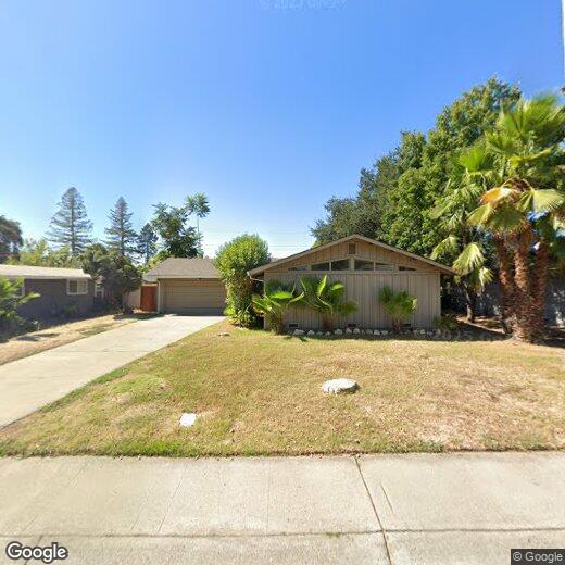

2612 Dawes St
2612 Dawes St
Rancho Cordova, CA 95670
2 Weeks Ago
Favorites
2612 Dawes St

Favorites
Check Back Soon for Upcoming Availability
Location
Get Directions
Rancho Cordova is one of the Sacramento area’s biggest business centers, attracting thousands of commuters from around the region every day. The active commercial sector makes it highly convenient spot for in-town professionals, and the close proximity to Sacramento makes it an appealing community for folks who work in and around the capital city as well.
While industry is a major part of the local character, the environment is surprisingly suburban, with extensive quiet neighborhoods, playgrounds, and shopping centers all over town. Locals love to spend time in the numerous public parks along the American River, as well as up the road at Folsom Lake and Eldorado National Forest.
Learn more about living in Rancho Cordova
Education
| Colleges & Universities | Distance | ||
|---|---|---|---|
| Colleges & Universities | Distance | ||
| Drive: | 12 min | 7.9 mi | |
| Drive: | 20 min | 10.6 mi | |
| Drive: | 18 min | 12.6 mi | |
| Drive: | 22 min | 15.3 mi |
2612 Dawes St is within 12 minutes or 7.9 miles from Sacramento State. It is also near American River College and Sacramento City College.
Transportation options available in Rancho Cordova include Mather Field/Mills, located 1.2 miles from 2612 Dawes St. 2612 Dawes St is near Sacramento International, located 24.2 miles or 32 minutes away.
| Transit / Subway | Distance | ||
|---|---|---|---|
| Transit / Subway | Distance | ||
|
|
Drive: | 2 min | 1.2 mi |
|
|
Drive: | 2 min | 1.5 mi |
|
|
Drive: | 3 min | 2.0 mi |
|
|
Drive: | 5 min | 2.9 mi |
|
|
Drive: | 5 min | 3.0 mi |
| Commuter Rail | Distance | ||
|---|---|---|---|
| Commuter Rail | Distance | ||
| Drive: | 18 min | 13.9 mi | |
|
|
Drive: | 27 min | 14.2 mi |
|
|
Drive: | 28 min | 16.0 mi |
|
|
Drive: | 31 min | 25.9 mi |
|
|
Drive: | 41 min | 28.2 mi |
| Airports | Distance | ||
|---|---|---|---|
| Airports | Distance | ||
|
Sacramento International
|
Drive: | 32 min | 24.2 mi |
Time and distance from 2612 Dawes St.
| Shopping Centers | Distance | ||
|---|---|---|---|
| Shopping Centers | Distance | ||
| Walk: | 8 min | 0.5 mi | |
| Walk: | 11 min | 0.6 mi | |
| Walk: | 11 min | 0.6 mi |
2612 Dawes St has 3 shopping centers within 0.6 mile, which is about a 11-minute walk. The miles and minutes will be for the farthest away property.
| Parks and Recreation | Distance | ||
|---|---|---|---|
| Parks and Recreation | Distance | ||
|
Rossmoor Bar County Park
|
Drive: | 5 min | 2.4 mi |
|
River Bend Park
|
Drive: | 9 min | 2.6 mi |
|
Lower Sunrise Recreational Area
|
Drive: | 7 min | 3.3 mi |
|
Ancil Hoffman Park
|
Drive: | 20 min | 10.0 mi |
|
Effie Yeaw Nature Center
|
Drive: | 20 min | 10.1 mi |
2612 Dawes St has 5 parks within 10.1 miles, including River Bend Park, Rossmoor Bar County Park, and Lower Sunrise Recreational Area.
| Hospitals | Distance | ||
|---|---|---|---|
| Hospitals | Distance | ||
| Drive: | 10 min | 7.4 mi | |
| Drive: | 13 min | 8.6 mi | |
| Drive: | 16 min | 8.9 mi |
2612 Dawes St has 3 hospitals within 8.9 miles, the nearest is Sutter Center for Psychiatry which is 7.4 miles away and a 10 minute drive.
| Military Bases | Distance | ||
|---|---|---|---|
| Military Bases | Distance | ||
| Drive: | 34 min | 17.9 mi |
2612 Dawes St is 17.9 miles and a 34 minute drive from McClellan Air Force Base.
You May Also Like
Similar Rentals Nearby


What Are Walk Score®, Transit Score®, and Bike Score® Ratings?
Walk Score® measures the walkability of any address. Transit Score® measures access to public transit. Bike Score® measures the bikeability of any address.
What is a Sound Score Rating?
A Sound Score Rating aggregates noise caused by vehicle traffic, airplane traffic and local sources