
Presidential Towers
555 W Madison St,
Chicago, IL 60661
$1,800 - $5,000
Studio - 2 Beds


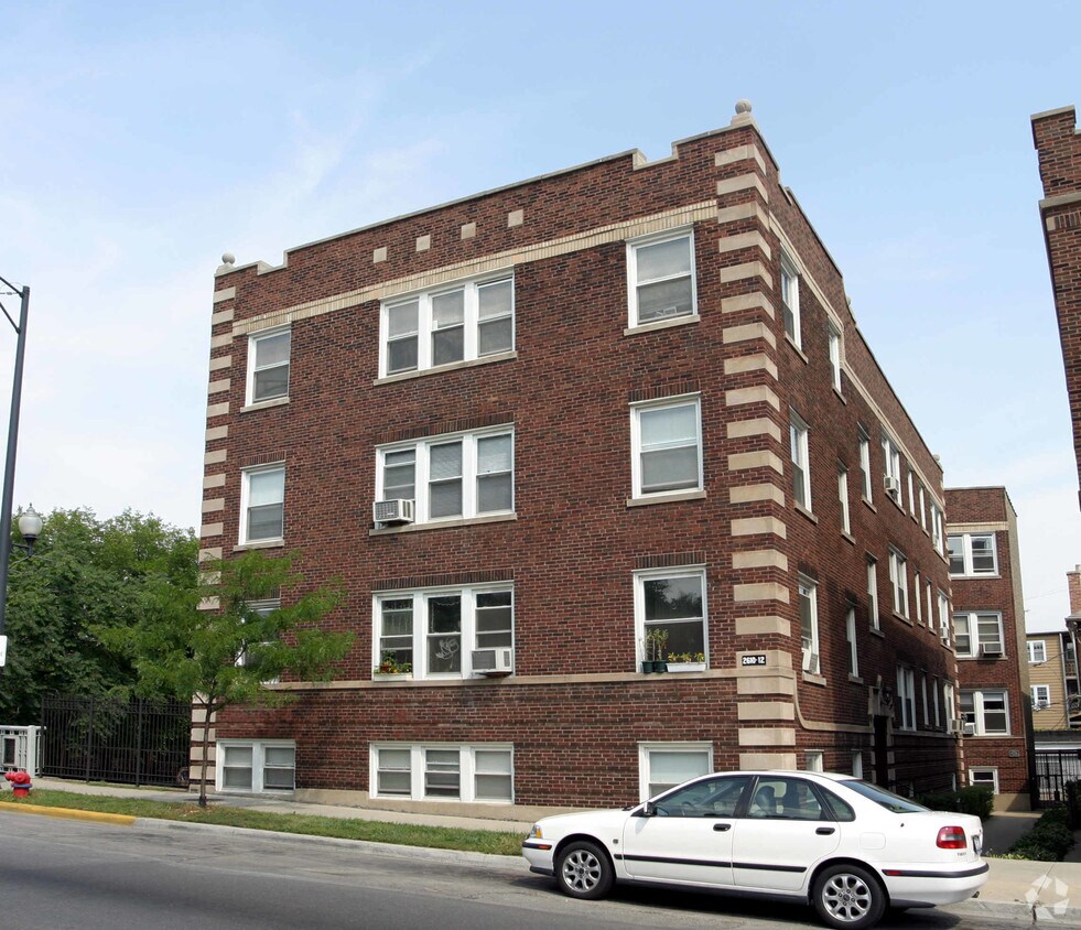
2610 W Montrose Ave offers a mixture of quality and comfort. Located in Chicago's 60618 Zip code, moving here gives you a wide variety of nearby highlights. The team of leasing professionals will assist you in finding your new place. Make a visit to check out the current floorplan options. Stop by the leasing office to check the current floorplan availability.
2610 W Montrose Ave is an apartment community located in Cook County and the 60618 ZIP Code. This area is served by the Chicago Public Schools attendance zone.
Ravenswood is a historic gem just 10 miles northwest of downtown Chicago. This neighborhood is family-friendly with extensive public transportation and easy access to major highways. People walk the neighborhood and also bike from place to place. You’ll want to visit Ravenswood’s Historic District where you’ll find 100-year old houses and Victorian mansions. In an old school space, you can watch popular films in this neighborhood staple, the Davis Theater.
Funky, hip, and chic restaurants, bars, and coffee shops reside in Ravenswood like Band of Bohemia on North Ravenswood Avenue. There’s a mix of public, private, and charter schools in the area that give residents a multitude of choices for their children. Community festivals are long-standing tradition in Ravenswood. The Ravenswood Art Walk occurs every September, and the Annual Taste of Ravenswood is an annual affair that celebrates its local eateries and craft beers.
Learn more about living in RavenswoodCompare neighborhood and city base rent averages by bedroom.
| Ravenswood | Chicago, IL | |
|---|---|---|
| Studio | $1,239 | $1,632 |
| 1 Bedroom | $1,525 | $2,023 |
| 2 Bedrooms | $2,298 | $2,543 |
| 3 Bedrooms | $3,136 | $3,064 |
| Colleges & Universities | Distance | ||
|---|---|---|---|
| Colleges & Universities | Distance | ||
| Drive: | 4 min | 1.9 mi | |
| Drive: | 5 min | 2.0 mi | |
| Drive: | 5 min | 2.2 mi | |
| Drive: | 7 min | 3.1 mi |


Transportation options available in Chicago include Rockwell Station, located 0.4 mile from 2610 W Montrose Ave. 2610 W Montrose Ave is near Chicago O'Hare International, located 11.9 miles or 21 minutes away, and Chicago Midway International, located 14.4 miles or 27 minutes away.
| Transit / Subway | Distance | ||
|---|---|---|---|
| Transit / Subway | Distance | ||
|
|
Walk: | 7 min | 0.4 mi |
|
|
Walk: | 12 min | 0.6 mi |
|
|
Walk: | 13 min | 0.7 mi |
|
|
Drive: | 2 min | 1.2 mi |
|
|
Drive: | 2 min | 1.2 mi |
| Commuter Rail | Distance | ||
|---|---|---|---|
| Commuter Rail | Distance | ||
|
|
Drive: | 4 min | 1.6 mi |
|
|
Drive: | 5 min | 2.6 mi |
|
|
Drive: | 6 min | 3.0 mi |
| Drive: | 7 min | 3.1 mi | |
|
|
Drive: | 7 min | 3.7 mi |
| Airports | Distance | ||
|---|---|---|---|
| Airports | Distance | ||
|
Chicago O'Hare International
|
Drive: | 21 min | 11.9 mi |
|
Chicago Midway International
|
Drive: | 27 min | 14.4 mi |
Scores provided by
Traffic
ActiveAirport
CalmBusinesses
ActiveScores provided by
HowLoud What is a Sound Score Rating? A Sound Score Rating aggregates noise caused by vehicle traffic, airplane traffic and local sources. How It WorksTime and distance from 2610 W Montrose Ave.
| Shopping Centers | Distance | ||
|---|---|---|---|
| Shopping Centers | Distance | ||
| Walk: | 6 min | 0.3 mi | |
| Walk: | 17 min | 0.9 mi | |
| Drive: | 3 min | 1.3 mi |
| Parks and Recreation | Distance | ||
|---|---|---|---|
| Parks and Recreation | Distance | ||
|
Winnemac Park
|
Drive: | 4 min | 1.5 mi |
|
Chase Park
|
Drive: | 4 min | 1.8 mi |
|
Gompers Park
|
Drive: | 6 min | 3.2 mi |
|
North Park Village Nature Center
|
Drive: | 7 min | 3.6 mi |
|
Kilbourn Park
|
Drive: | 8 min | 3.7 mi |
| Hospitals | Distance | ||
|---|---|---|---|
| Hospitals | Distance | ||
| Drive: | 4 min | 1.8 mi | |
| Drive: | 5 min | 2.1 mi | |
| Drive: | 5 min | 2.6 mi |
| Military Bases | Distance | ||
|---|---|---|---|
| Military Bases | Distance | ||
| Drive: | 29 min | 19.6 mi |
What Are Walk Score®, Transit Score®, and Bike Score® Ratings?
Walk Score® measures the walkability of any address. Transit Score® measures access to public transit. Bike Score® measures the bikeability of any address.
What is a Sound Score Rating?
A Sound Score Rating aggregates noise caused by vehicle traffic, airplane traffic and local sources.
2610 W Montrose Ave
Chicago, IL 60618


