$2,700 / Month
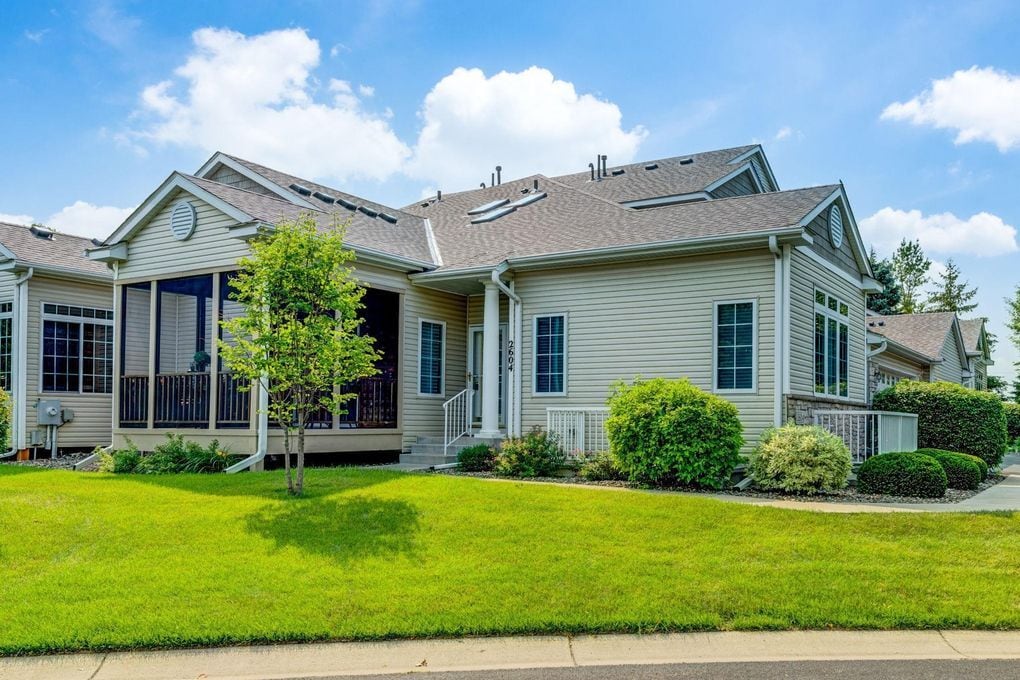
2604 Boulder Way
Burnsville, MN 55337
Today
Favorites
651-412-3238
-
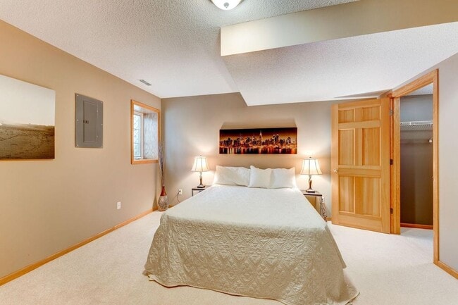
Bedrooms
3
-
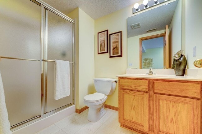
Bathrooms
4
-
Square Feet
2,850 sq ft
-
Available
Available Aug 18
2604 Boulder Way

Favorites
About This Home
$2,700 deposit,
Available Aug 18
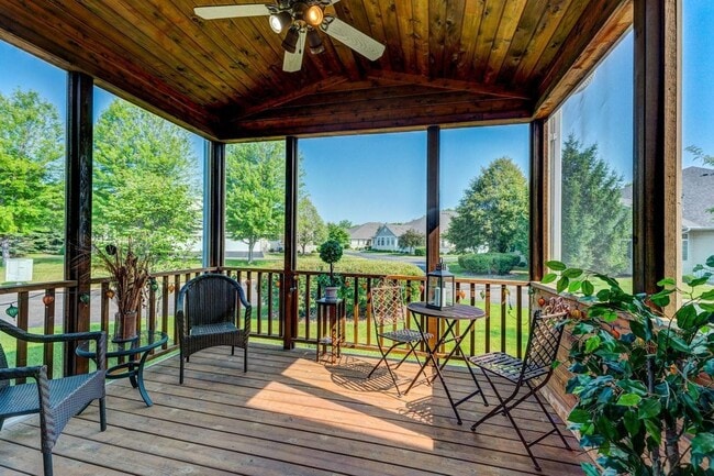
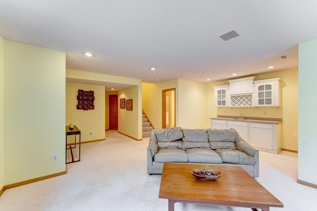
Unbelievable townhouse fully remodeled. High Ceilings. Tons of natural light. Beautiful porch with screens.
2604 Boulder Way is a townhome located in Dakota County and the 55337 ZIP Code. This area is served by the Burnsville Public attendance zone.
* Price shown is base rent and may not include non-optional fees and utilities.
Price, availability, fees, and any applicable rent special are subject to change without notice.
* Square footage definitions vary. Displayed square footage is approximate.
Contact
- Listed by Tenant
- Phone Number
- Contact
Location
Get Directions
15 miles south of Minneapolis sits Burnsville, a quiet suburban community with the feel of a small town and the amenities of a large city. It’s a great hometown for commuters – Interstates 35E and 35W run through town, giving folks renting in Burnsville a direct route to each of the Twin Cities and beyond.
Nowhere in the city is far from outdoor activities—Burnsville contains over 1,800 acres of parkland and outdoor recreation area, including Buck Hill ski area, Crystal Lake, and large swaths of Murphy-Hanrehan Park and the Minnesota Valley National Wildlife Refuge.
Thanks to an initiative known as “Heart of the City,” Burnsville’s downtown area is a thriving business district full of unique shopping, dining, and entertainment amidst an attractive layout of sidewalks, trees, and public artwork.
Learn more about living in Burnsville
Education
| Colleges & Universities | Distance | ||
|---|---|---|---|
| Colleges & Universities | Distance | ||
| Drive: | 17 min | 9.9 mi | |
| Drive: | 16 min | 11.4 mi | |
| Drive: | 29 min | 17.9 mi | |
| Drive: | 27 min | 18.0 mi |
2604 Boulder Way is within 17 minutes or 9.9 miles from Normandale Community College. It is also near Argosy University, Twin Cities and Inver Hills Community College.
Schools


Public Elementary School
Grades PK-5
484 Students
Nearby
Public Elementary School
Grades PK-5
396 Students
Attendance Zone
Public Middle School
Grades 6-8
78 Students
Attendance Zone
Public High School
Grades 9-12
2,119 Students
Attendance Zone
Private Elementary, Middle & High School
Grades PK-12
267 Students
Nearby
Private Elementary & Middle School
Grades PK-8
46 Students
Nearby
Private Elementary & Middle School
Grades PK-6 & 8-9
52 Students
Nearby
Private Elementary & Middle School
Grades K-8
76 Students
Nearby
School data provided by
 The GreatSchools Rating helps parents compare schools within a state based on a variety of school quality indicators and provides a helpful picture of how effectively each school serves all of its students. Ratings are on a scale of 1 (below average) to 10 (above average) and can include test scores, college readiness, academic progress, advanced courses, equity, discipline and attendance data. We also advise parents to visit schools, consider other information on school performance and programs, and consider family needs as part of the school selection process.
View GreatSchools Rating Methodology
Data provided by GreatSchools.org © 2025. All rights reserved.
View GreatSchools Rating Methodology
Data provided by GreatSchools.org © 2025. All rights reserved.
Transportation options available in Burnsville include Mall Of America Station, located 11.6 miles from 2604 Boulder Way. 2604 Boulder Way is near Minneapolis-St Paul International/Wold-Chamberlain, located 15.0 miles or 22 minutes away.
| Transit / Subway | Distance | ||
|---|---|---|---|
| Transit / Subway | Distance | ||
|
|
Drive: | 18 min | 11.6 mi |
|
|
Drive: | 18 min | 11.9 mi |
|
|
Drive: | 18 min | 12.0 mi |
|
|
Drive: | 18 min | 13.7 mi |
|
John P Humphrey Interlocking
|
Drive: | 19 min | 14.1 mi |
| Commuter Rail | Distance | ||
|---|---|---|---|
| Commuter Rail | Distance | ||
|
|
Drive: | 29 min | 19.7 mi |
|
|
Drive: | 27 min | 20.8 mi |
|
|
Drive: | 38 min | 27.7 mi |
|
|
Drive: | 51 min | 37.2 mi |
|
|
Drive: | 52 min | 38.8 mi |
| Airports | Distance | ||
|---|---|---|---|
| Airports | Distance | ||
|
Minneapolis-St Paul International/Wold-Chamberlain
|
Drive: | 22 min | 15.0 mi |
Time and distance from 2604 Boulder Way.
| Shopping Centers | Distance | ||
|---|---|---|---|
| Shopping Centers | Distance | ||
| Walk: | 19 min | 1.0 mi | |
| Walk: | 20 min | 1.1 mi | |
| Walk: | 25 min | 1.3 mi |
2604 Boulder Way has 3 shopping centers within 1.3 miles, which is about a 25-minute walk. The miles and minutes will be for the farthest away property.
| Parks and Recreation | Distance | ||
|---|---|---|---|
| Parks and Recreation | Distance | ||
|
Buck Hill
|
Drive: | 6 min | 2.9 mi |
|
Minnesota Valley National Wildlife Refuge
|
Drive: | 12 min | 6.1 mi |
|
Murphy-Hanrehan Park Reserve
|
Drive: | 13 min | 6.6 mi |
|
Cleary Lake Regional Park
|
Drive: | 16 min | 7.8 mi |
|
Normandale Community College Japanese Garden
|
Drive: | 16 min | 9.5 mi |
2604 Boulder Way has 5 parks within 9.5 miles, including Buck Hill, Murphy-Hanrehan Park Reserve, and Minnesota Valley National Wildlife Refuge.
| Hospitals | Distance | ||
|---|---|---|---|
| Hospitals | Distance | ||
| Drive: | 4 min | 2.3 mi | |
| Drive: | 14 min | 11.2 mi | |
| Drive: | 19 min | 13.2 mi |
2604 Boulder Way has 3 hospitals within 13.2 miles, the nearest is Fairview Ridges Hospital which is 2.3 miles away and a 4 minute drive.
| Military Bases | Distance | ||
|---|---|---|---|
| Military Bases | Distance | ||
| Drive: | 25 min | 17.0 mi |
2604 Boulder Way is 17.0 miles and a 25 minute drive from Fort Snelling Military Reservation.
You May Also Like
Similar Rentals Nearby


")


What Are Walk Score®, Transit Score®, and Bike Score® Ratings?
Walk Score® measures the walkability of any address. Transit Score® measures access to public transit. Bike Score® measures the bikeability of any address.
What is a Sound Score Rating?
A Sound Score Rating aggregates noise caused by vehicle traffic, airplane traffic and local sources

2604 Boulder Way
Burnsville, MN 55337