
$3,350 / Month
2601 34th Ave
San Francisco, CA 94116
2 Weeks Ago
Favorites
2601 34th Ave

Favorites
Check Back Soon for Upcoming Availability
| Beds | Baths | Average SF |
|---|---|---|
| 2 Bedrooms 2 Bedrooms 2 Br | 1 Bath 1 Bath 1 Ba | — |
About This Property
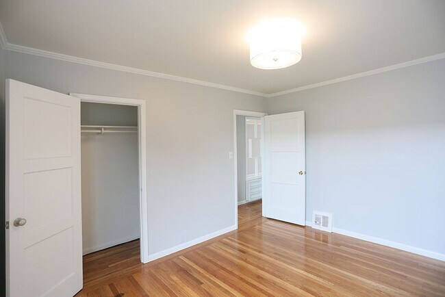
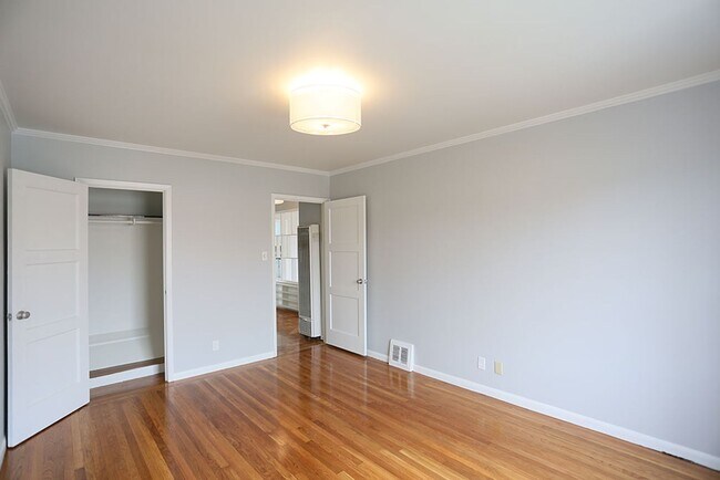
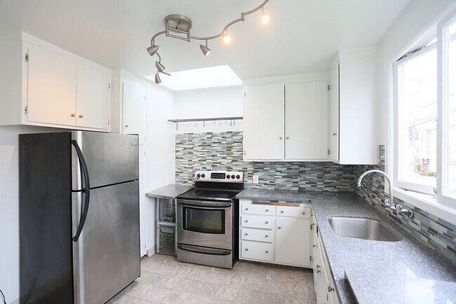
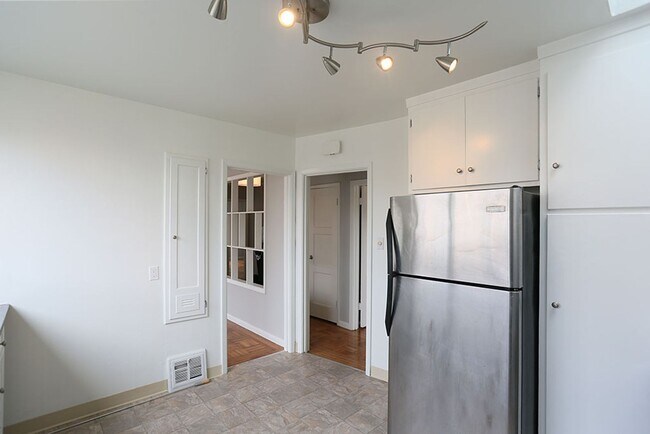
1st, Top Floor 2BR/1BA Full Flat * $3,350/month annual lease * Skylights * Small Pets Considered * Available: October 1st or sooner OPEN HOUSE: Please call ADDRESS: 2601 34th Avenue Top floor light filled 2BR/1BA full flat on 34th Avenue at Vicente. It feels like a single family home as it is located over an office which is closed in the evening and most weekends. Floors are beautiful parquet floors in the living and dining area. The bedrooms are also hardwood. The home has been completely repainted a beautiful shade of blue gray and the floors have been refinished. Three skylights throughout the home. Both bedrooms are large with fair sized closets. The kitchen is large with granite countertops and a skylight. The classic bathroom has a separate bath and shower...and a skylight. Decorative fireplace (no burning of wood permitted). Easy street parking. Building is located on the corner of 34th Avenue and Vicente, one block from the western end of Stern Grove. It is two blocks from shopping, dining and transportation on Taraval Street, two short blocks from transportation on Sunset Boulevard. Walk Score is 84, Transit Score is 60. L-Taraval and bus line 29 are within easy walking distance. Tenant pays a one-time broker's fee. Everest Mwamba DRE# 01717299 Kenney & Everest Real Estate DRE# 01984640 office Apply at: Leasing and Real Estate: Our Family Business for Over 100 Years.
2601 34th Ave is a house located in San Francisco County and the 94116 ZIP Code. This area is served by the San Francisco Unified attendance zone.
Location
Get Directions
Central Sunset is a densely populated area about one mile east of the beach and five miles west of the heart of San Francisco. Renters have a large selection of apartments, single-family homes, and condos to choose from. Central Sunset’s residential neighborhoods are paired with parks like Stern Grove Park and McCoppin Square. For in-town shopping and dining, residents head to Taraval Street, Irving Street, and Noriega Street. A variety of eateries serving everything from seafood and barbecue can be found along these roads. This Bay Area suburb is also in proximity to the world-renowned dining, shopping, and entertainment offered by Downtown San Francisco and its neighboring cities.
Learn more about living in Central SunsetBelow are rent ranges for similar nearby apartments
Education
| Colleges & Universities | Distance | ||
|---|---|---|---|
| Colleges & Universities | Distance | ||
| Drive: | 6 min | 1.7 mi | |
| Drive: | 10 min | 3.2 mi | |
| Drive: | 10 min | 3.4 mi | |
| Drive: | 13 min | 5.0 mi |
2601 34th Ave is within 6 minutes or 1.7 miles from San Francisco State University. It is also near City College of San Francisco and UC San Francisco, Parnassus.
Schools


Public Elementary School
Grades K-5
394 Students
Nearby
Public Elementary School
Grades K-5
394 Students
Attendance Zone
Public Middle School
Grades 6-8
848 Students
Attendance Zone
Public High School
Grades 9-12
1,997 Students
Attendance Zone
Public High School
Grades 9-12
2,632 Students
Attendance Zone
Private Elementary & Middle School
Grades PK-8
131 Students
Nearby
Private Elementary & Middle School
Grades PK-8
472 Students
Nearby
Private Elementary, Middle & High School
Grades 3-12
28 Students
Nearby
School data provided by
 The GreatSchools Rating helps parents compare schools within a state based on a variety of school quality indicators and provides a helpful picture of how effectively each school serves all of its students. Ratings are on a scale of 1 (below average) to 10 (above average) and can include test scores, college readiness, academic progress, advanced courses, equity, discipline and attendance data. We also advise parents to visit schools, consider other information on school performance and programs, and consider family needs as part of the school selection process.
View GreatSchools Rating Methodology
Data provided by GreatSchools.org © 2025. All rights reserved.
View GreatSchools Rating Methodology
Data provided by GreatSchools.org © 2025. All rights reserved.
Transportation options available in San Francisco include Taraval St & 32Nd Ave, located 0.4 mile from 2601 34th Ave. 2601 34th Ave is near San Francisco International, located 13.3 miles or 23 minutes away, and Metro Oakland International, located 27.6 miles or 44 minutes away.
| Transit / Subway | Distance | ||
|---|---|---|---|
| Transit / Subway | Distance | ||
| Walk: | 7 min | 0.4 mi | |
| Walk: | 7 min | 0.4 mi | |
| Walk: | 9 min | 0.5 mi | |
| Walk: | 11 min | 0.6 mi | |
| Walk: | 14 min | 0.7 mi |
| Commuter Rail | Distance | ||
|---|---|---|---|
| Commuter Rail | Distance | ||
| Drive: | 15 min | 7.1 mi | |
| Drive: | 15 min | 8.1 mi | |
| Drive: | 15 min | 8.1 mi | |
| Drive: | 16 min | 9.0 mi | |
| Drive: | 16 min | 9.0 mi |
| Airports | Distance | ||
|---|---|---|---|
| Airports | Distance | ||
|
San Francisco International
|
Drive: | 23 min | 13.3 mi |
|
Metro Oakland International
|
Drive: | 44 min | 27.6 mi |
Time and distance from 2601 34th Ave.
| Shopping Centers | Distance | ||
|---|---|---|---|
| Shopping Centers | Distance | ||
| Walk: | 8 min | 0.4 mi | |
| Drive: | 5 min | 1.6 mi | |
| Drive: | 7 min | 2.5 mi |
2601 34th Ave has 3 shopping centers within 2.5 miles, which is about a 7-minute walk. The miles and minutes will be for the farthest away property.
| Parks and Recreation | Distance | ||
|---|---|---|---|
| Parks and Recreation | Distance | ||
|
San Francisco Zoo
|
Walk: | 25 min | 1.3 mi |
|
San Francisco State Univ. Observatory
|
Drive: | 6 min | 1.8 mi |
|
Charles F. Hagar Planetarium
|
Drive: | 6 min | 1.8 mi |
|
Golden Gate Park
|
Drive: | 9 min | 3.0 mi |
|
San Francisco Botanical Garden
|
Drive: | 9 min | 3.1 mi |
2601 34th Ave has 5 parks within 3.1 miles, including San Francisco Zoo, San Francisco State Univ. Observatory, and Charles F. Hagar Planetarium.
| Hospitals | Distance | ||
|---|---|---|---|
| Hospitals | Distance | ||
| Drive: | 6 min | 2.2 mi | |
| Drive: | 9 min | 3.5 mi | |
| Drive: | 9 min | 3.6 mi |
2601 34th Ave has 3 hospitals within 3.6 miles, the nearest is Laguna Honda Hospital & Rehabilitation Center which is 2.2 miles away and a 6 minute drive.
| Military Bases | Distance | ||
|---|---|---|---|
| Military Bases | Distance | ||
| Drive: | 12 min | 4.0 mi | |
| Drive: | 14 min | 4.5 mi |
2601 34th Ave is 4.0 miles from West Fort Miley, and is convenient to other military bases, including East Fort Miley.
You May Also Like
Similar Rentals Nearby


What Are Walk Score®, Transit Score®, and Bike Score® Ratings?
Walk Score® measures the walkability of any address. Transit Score® measures access to public transit. Bike Score® measures the bikeability of any address.
What is a Sound Score Rating?
A Sound Score Rating aggregates noise caused by vehicle traffic, airplane traffic and local sources

2601 34th Ave
San Francisco, CA 94116