

$2,350
/ Month
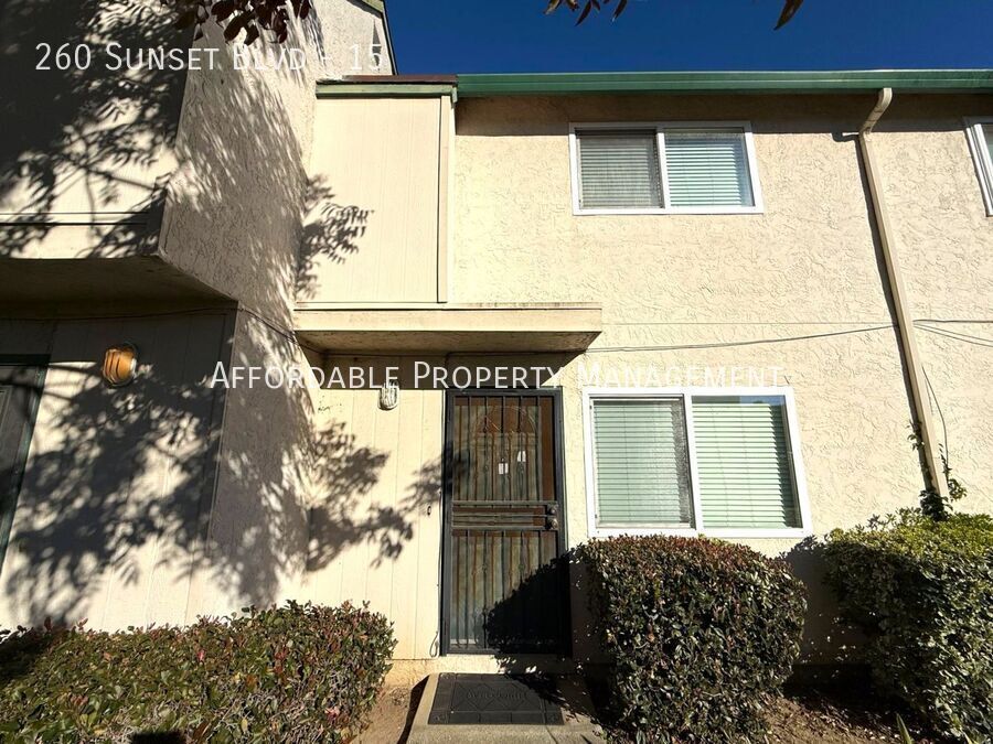
260 Sunset Blvd
Hayward, CA 94541
Today
|
Edit
Favorites
510-650-0956
-
Bedrooms
2
-
Bathrooms
1.5
-
Square Feet
986 sq ft
-
Available
Available Now
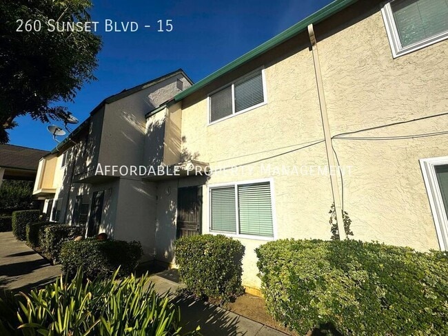
260 Sunset Blvd

Favorites
About This Home
Available Now
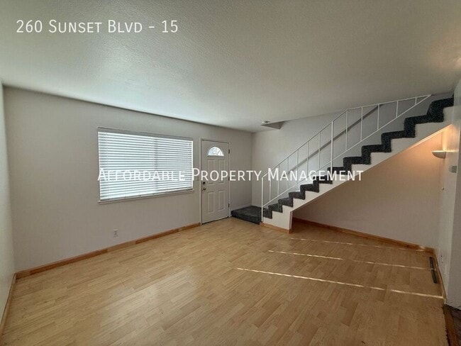
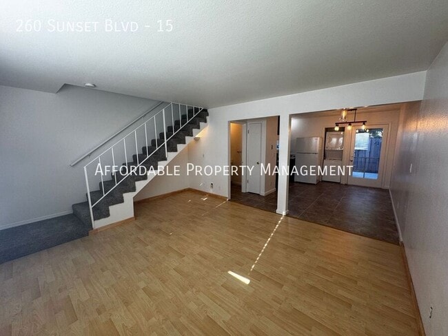
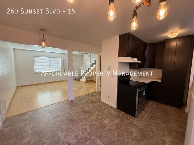
This property is only available to view in person by checking out a key from our office. Please give us a call at ext.1 to set up an appointment. This property is available NOW! Introducing this charming two-story townhome located in Hayward. Featuring two bedrooms, one and one half bathrooms, a living room, dining area, and two parking spaces. The kitchen is equipped with a stove, refrigerator, and dishwasher. There is carpet and laminate flooring throughout the unit. Additional amenities include a stackable washer & dryer (as-is), patio, and access to the community pool. New bathroom vanity in downstairs bathroom. Located near major highways, dining and shopping options. The owner is providing water and garbage; all other utilities are to be paid by the tenant(s); No Pets Firm; Renters insurance is required upon move-in. This a 12-month lease term. Garage will not be part of the Rental Agreement. CalBRE #01275192 1.5 Bathrooms 2 Bedrooms 2 Parking Spaces Carpet Community Pool Dining Area Garbage Included Laminate Flooring No Pets Firm Renters Insurance Is Required Stackable Washer & Dryer (As Is) Stove Townhouse Two Stories Window Coverings
260 Sunset Blvd is a townhome located in Alameda County and the 94541 ZIP Code. This area is served by the Hayward Unified attendance zone.
* Price shown is base rent. Excludes user-selected optional fees and variable or usage-based fees and required charges due at or prior to move-in or at move-out. Price, availability, fees, and any applicable rent special are subject to change without notice.
* Square footage definitions vary. Displayed square footage is approximate.
Contact
- Listed by Affordable Property Management
- Phone Number
- Contact
Location
Get Directions
South of Oakland and north of Hayward lies the dreamily named Cherryland, an unincorporated community of quiet residential streets and lush parks. Clues to its namesake dot the neighborhood's streets, from Cherry Way to Blossom Way. The San Lorenzo Creek connects the area via water to the San Francisco Bay, cementing its place in the greater East Bay region.
Learn more about living in Cherryland
Education
| Colleges & Universities | Distance | ||
|---|---|---|---|
| Colleges & Universities | Distance | ||
| Drive: | 9 min | 3.3 mi | |
| Drive: | 10 min | 4.4 mi | |
| Drive: | 20 min | 11.7 mi | |
| Drive: | 41 min | 21.0 mi |
260 Sunset Blvd is within 9 minutes or 3.3 miles from Cal State East Bay. It is also near Chabot College and Mills College.
Schools


Public Elementary School
Grades K-6
903 Students
Attendance Zone
Charter Elementary School
Grades K-5
483 Students
Nearby
Public Middle School
Grades 7-8
498 Students
Attendance Zone
Public High School
Grades 9-12
1,712 Students
Attendance Zone
Private Elementary, Middle & High School
Grades 4-12
Nearby
Private Elementary, Middle & High School
Grades K-12
Nearby
Private Elementary School
Grades PK-3
18 Students
Nearby
School data provided by
 The GreatSchools Rating helps parents compare schools within a state based on a variety of school quality indicators and provides a helpful picture of how effectively each school serves all of its students. Ratings are on a scale of 1 (below average) to 10 (above average) and can include test scores, college readiness, academic progress, advanced courses, equity, discipline and attendance data. We also advise parents to visit schools, consider other information on school performance and programs, and consider family needs as part of the school selection process.
View GreatSchools Rating Methodology
Data provided by GreatSchools.org © 2025. All rights reserved.
View GreatSchools Rating Methodology
Data provided by GreatSchools.org © 2025. All rights reserved.
Transportation options available in Hayward include Hayward Station, located 1.0 miles from 260 Sunset Blvd. 260 Sunset Blvd is near Metro Oakland International, located 10.0 miles or 16 minutes away, and San Francisco International, located 23.7 miles or 32 minutes away.
| Transit / Subway | Distance | ||
|---|---|---|---|
| Transit / Subway | Distance | ||
|
|
Walk: | 19 min | 1.0 mi |
|
|
Drive: | 6 min | 2.7 mi |
|
|
Drive: | 8 min | 3.2 mi |
|
|
Drive: | 12 min | 5.9 mi |
|
|
Drive: | 12 min | 7.3 mi |
| Commuter Rail | Distance | ||
|---|---|---|---|
| Commuter Rail | Distance | ||
|
|
Walk: | 14 min | 0.8 mi |
| Walk: | 14 min | 0.8 mi | |
| Drive: | 17 min | 10.7 mi | |
| Drive: | 18 min | 10.9 mi | |
| Drive: | 24 min | 16.0 mi |
| Airports | Distance | ||
|---|---|---|---|
| Airports | Distance | ||
|
Metro Oakland International
|
Drive: | 16 min | 10.0 mi |
|
San Francisco International
|
Drive: | 32 min | 23.7 mi |
Time and distance from 260 Sunset Blvd.
| Shopping Centers | Distance | ||
|---|---|---|---|
| Shopping Centers | Distance | ||
| Walk: | 16 min | 0.8 mi | |
| Drive: | 4 min | 1.2 mi | |
| Drive: | 4 min | 1.2 mi |
260 Sunset Blvd has 3 shopping centers within 1.2 miles, which is about a 4-minute drive. The miles and minutes will be for the farthest away property.
| Parks and Recreation | Distance | ||
|---|---|---|---|
| Parks and Recreation | Distance | ||
|
Sulphur Creek Nature Center
|
Drive: | 8 min | 2.6 mi |
|
Don Castro Regional Recreation Area
|
Drive: | 8 min | 3.7 mi |
|
Lake Chabot Regional Park
|
Drive: | 9 min | 4.3 mi |
|
Hayward Regional Shoreline
|
Drive: | 14 min | 4.9 mi |
|
Cull Canyon Regional Recreation Area
|
Drive: | 12 min | 5.2 mi |
260 Sunset Blvd has 5 parks within 5.2 miles, including Sulphur Creek Nature Center, Don Castro Regional Recreation Area, and Lake Chabot Regional Park.
| Hospitals | Distance | ||
|---|---|---|---|
| Hospitals | Distance | ||
| Drive: | 8 min | 3.9 mi | |
| Drive: | 8 min | 4.2 mi | |
| Drive: | 11 min | 6.4 mi |
260 Sunset Blvd has 3 hospitals within 6.4 miles, the nearest is Willow Rock Center which is 3.9 miles away and a 8 minute drive.
| Military Bases | Distance | ||
|---|---|---|---|
| Military Bases | Distance | ||
| Drive: | 28 min | 17.5 mi |
260 Sunset Blvd is 17.5 miles and a 28 minute drive from Alameda/US Naval Air Station Alameda.
You May Also Like
Similar Rentals Nearby


")


What Are Walk Score®, Transit Score®, and Bike Score® Ratings?
Walk Score® measures the walkability of any address. Transit Score® measures access to public transit. Bike Score® measures the bikeability of any address.
What is a Sound Score Rating?
A Sound Score Rating aggregates noise caused by vehicle traffic, airplane traffic and local sources
260 Sunset Blvd
Hayward, CA 94541