$2,300
/ Month
26 Tylers Ct
Somerdale, NJ 08083
Favorites
26 Tylers Ct

Favorites
Check Back Soon for Upcoming Availability
| Beds | Baths | Average SF |
|---|---|---|
| 2 Bedrooms 2 Bedrooms 2 Br | 3 Baths 3 Baths 3 Ba | — |
About This Property
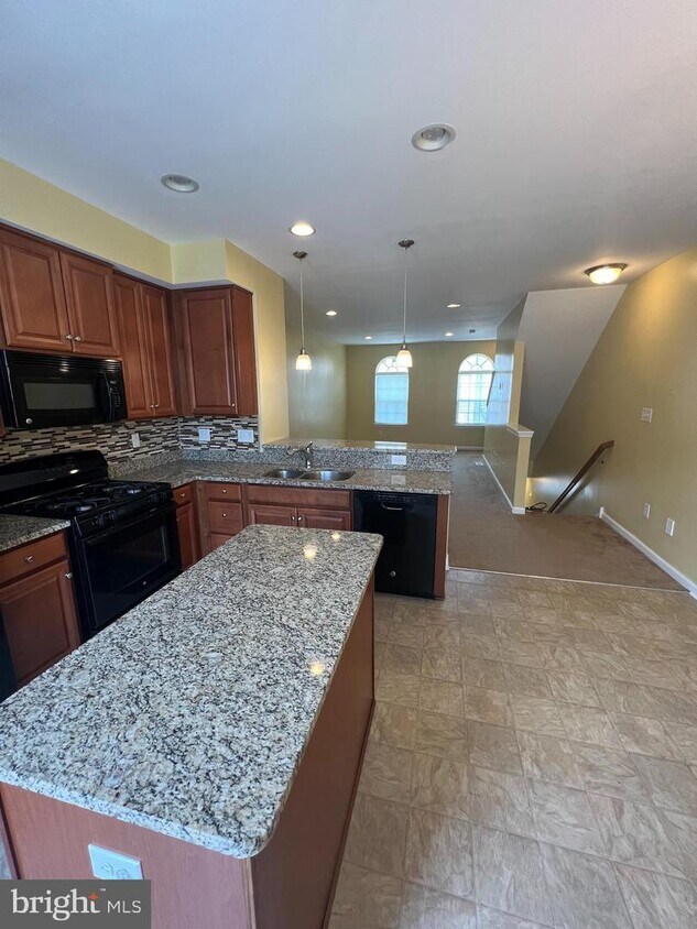
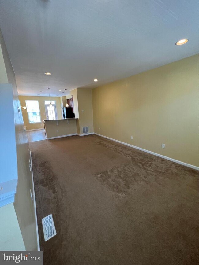
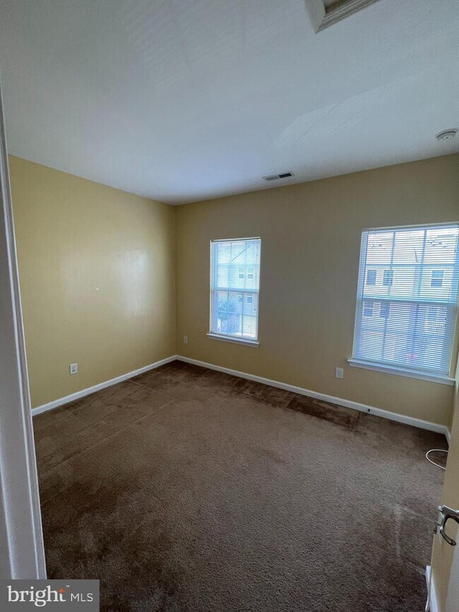
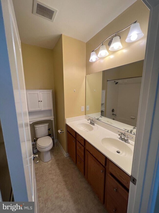
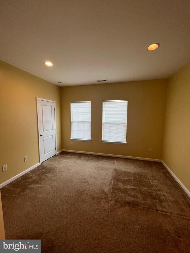
Beautiful three story town home in desired Coopertowne Village, with a one car garage. This home has all the upgrades!! When you enter on the lower level there is a family room and a powder room. On the main level, there is a large gourmet kitchen complete with 42 cabinets, granite countertops, custom backsplash and kitchen island.The kitchen opens up to a large living room complete with recessed lighting. There is a deck off of the kitchen perfect for summer grilling!It is equipped with stackable washer and dryer on the upper level, conveniently located next to two spacious bedrooms. The master bedroom has a master bathroom complete with double sink and tub. The home is in the process of being freshly painted a neutral color. Make your appt today!!"
26 Tylers Ct is a townhome located in Camden County and the 08083 ZIP Code. This area is served by the Somerdale Public School District attendance zone.
Townhome Features
- Dishwasher
26 Tylers Ct,
Somerdale,
NJ
08083
Roughly 34 miles southwest of Trenton and 12 miles southeast of Philadelphia, Somerdale provides fast access to a wide variety of history, attractions, theaters, and museums. Minutes from the Philadelphia International Airport, Clementon Park and Splash World, Adventure Aquarium, and several golf courses, Somerdale is considered the "Crossroads of South Jersey."
Consisting of tree-filled neighborhoods lined with single-family homes on large lots, Somerdale offers a much more rural feel than many of its neighboring suburbs. White Horse Pike, which runs the length of the neighborhood and beyond, offers a variety of shops, restaurants, and specialty stores. Mores shops and restaurants are available just outside the borough at Voorhees Town Center and Eagle Plaza.
Learn more about living in Somerdale
Amenities
- Dishwasher
Education
| Colleges & Universities | Distance | ||
|---|---|---|---|
| Colleges & Universities | Distance | ||
| Drive: | 13 min | 7.1 mi | |
| Drive: | 18 min | 9.9 mi | |
| Drive: | 16 min | 11.0 mi | |
| Drive: | 17 min | 11.4 mi |
26 Tylers Ct is within 13 minutes or 7.1 miles from Camden Co. Coll., Blackwood. It is also near Camden Co. Coll., Camden City and Gloucester County College.
Schools

Public Elementary & Middle School
Grades PK-8
445 Students
Attendance Zone
Public High School
Grades 9-12
894 Students
Attendance Zone
Private Elementary School
Grades PK-5
Nearby
Private Elementary, Middle & High School
Grades K-12
Nearby
School data provided by
 The GreatSchools Rating helps parents compare schools within a state based on a variety of school quality indicators and provides a helpful picture of how effectively each school serves all of its students. Ratings are on a scale of 1 (below average) to 10 (above average) and can include test scores, college readiness, academic progress, advanced courses, equity, discipline and attendance data. We also advise parents to visit schools, consider other information on school performance and programs, and consider family needs as part of the school selection process.
View GreatSchools Rating Methodology
Data provided by GreatSchools.org © 2026. All rights reserved.
View GreatSchools Rating Methodology
Data provided by GreatSchools.org © 2026. All rights reserved.
Transportation options available in Somerdale include Ashland, located 0.8 mile from 26 Tylers Ct. 26 Tylers Ct is near Philadelphia International, located 17.2 miles or 29 minutes away, and Trenton Mercer, located 39.9 miles or 56 minutes away.
| Transit / Subway | Distance | ||
|---|---|---|---|
| Transit / Subway | Distance | ||
|
|
Walk: | 15 min | 0.8 mi |
|
|
Drive: | 6 min | 2.2 mi |
|
|
Drive: | 6 min | 3.2 mi |
|
|
Drive: | 7 min | 4.1 mi |
|
|
Drive: | 9 min | 5.3 mi |
| Commuter Rail | Distance | ||
|---|---|---|---|
| Commuter Rail | Distance | ||
|
|
Drive: | 5 min | 3.1 mi |
|
|
Drive: | 12 min | 7.2 mi |
|
|
Drive: | 14 min | 10.1 mi |
| Drive: | 19 min | 10.8 mi | |
|
|
Drive: | 20 min | 13.3 mi |
| Airports | Distance | ||
|---|---|---|---|
| Airports | Distance | ||
|
Philadelphia International
|
Drive: | 29 min | 17.2 mi |
|
Trenton Mercer
|
Drive: | 56 min | 39.9 mi |
Walkability Near 26 Tylers Ct Somerdale, NJ 08083
Getting Around
 What do Walkability, Transit, Drivability, and Bikeability mean?
Walkability measures the walking distance to day-to-day needs.
Transit measures access to public transportation.
Drivability measures congestion, parking availability, and access to major roads.
Bikeability measures the suitability for cycling.
How It Works
What do Walkability, Transit, Drivability, and Bikeability mean?
Walkability measures the walking distance to day-to-day needs.
Transit measures access to public transportation.
Drivability measures congestion, parking availability, and access to major roads.
Bikeability measures the suitability for cycling.
How It Works
Fairly Walkable
Walkability
50
/ 100
Some Public Transit
Transit
50
/ 100
Exceptionally Drivable
Drivability
100
/ 100
Fairly Bikeable
Bikeability
40
/ 100
Scores provided by
-
Soundscore™
-
/ 100
Traffic
-Airport
-Businesses
-Scores provided by
HowLoud What is a Sound Score Rating? A Sound Score Rating aggregates noise caused by vehicle traffic, airplane traffic and local sources. How It WorksTime and distance from 26 Tylers Ct.
| Shopping Centers | Distance | ||
|---|---|---|---|
| Shopping Centers | Distance | ||
| Walk: | 6 min | 0.3 mi | |
| Walk: | 13 min | 0.7 mi | |
| Walk: | 17 min | 0.9 mi |
26 Tylers Ct has 3 shopping centers within 0.9 mile, which is about a 17-minute walk. The miles and minutes will be for the farthest away property.
| Parks and Recreation | Distance | ||
|---|---|---|---|
| Parks and Recreation | Distance | ||
|
Downs Farms Trails
|
Drive: | 3 min | 1.5 mi |
|
Croft Farm Nature Trail
|
Drive: | 8 min | 3.8 mi |
|
Kresson Nature Trails
|
Drive: | 9 min | 4.3 mi |
|
Erlton North Trails
|
Drive: | 11 min | 5.6 mi |
|
Barclay Farmstead Nature Trail
|
Drive: | 12 min | 6.4 mi |
26 Tylers Ct has 5 parks within 6.4 miles, including Downs Farms Trails, Croft Farm Nature Trail, and Kresson Nature Trails.
| Hospitals | Distance | ||
|---|---|---|---|
| Hospitals | Distance | ||
| Drive: | 5 min | 3.0 mi | |
| Drive: | 12 min | 6.1 mi | |
| Drive: | 13 min | 7.8 mi |
26 Tylers Ct has 3 hospitals within 7.8 miles, the nearest is Jefferson Stratford Hospital which is 3.0 miles away and a 5 minute drive.
| Military Bases | Distance | ||
|---|---|---|---|
| Military Bases | Distance | ||
| Drive: | 18 min | 11.9 mi | |
| Drive: | 19 min | 12.3 mi | |
| Drive: | 33 min | 18.5 mi |
26 Tylers Ct has 3 military bases within 18.5 miles, the nearest is Defense Personnel Support Center which is 11.9 miles away and a 18 minute drive.
You May Also Like
How do I access Social Services in New Jersey?
Statewide service is free, confidential, multilingual and always open. Three easy ways to reach Social Services in NJ: Dial 2-1-1; text your zip code to 898-211; or chat at https://www.nj211.org
Similar Rentals Nearby


What Are Walk Score®, Transit Score®, and Bike Score® Ratings?
Walk Score® measures the walkability of any address. Transit Score® measures access to public transit. Bike Score® measures the bikeability of any address.
What is a Sound Score Rating?
A Sound Score Rating aggregates noise caused by vehicle traffic, airplane traffic and local sources.

26 Tylers Ct
Somerdale, NJ 08083