
$3,050 / Month

255 Malcolm Dr

,

Pasadena, CA 91105

Share Listing
Favorites
641-426-2090
  • Bedrooms

    2

  • Bathrooms

    1.5

  • Square Feet

    1,244 sq ft

  • Available

    Available Aug 31

255 Malcolm Dr
Share Listing
Favorites

About This Home

$3,050 deposit, Available Aug 31

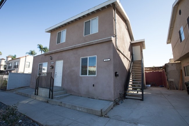
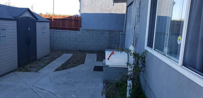
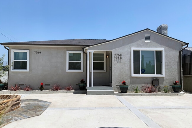
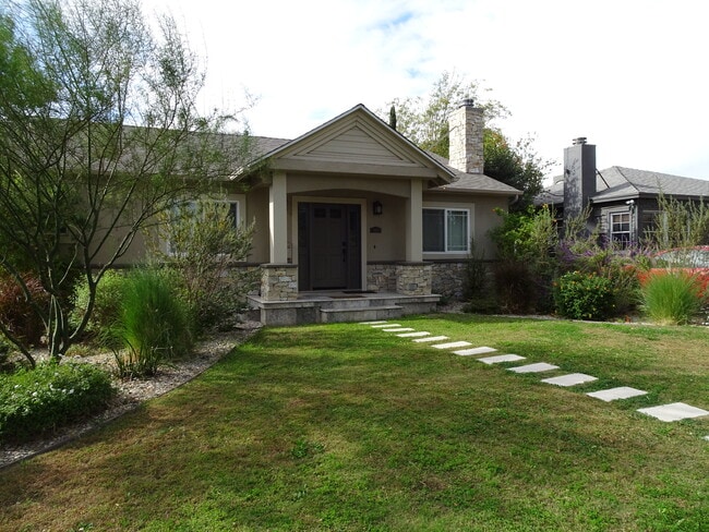
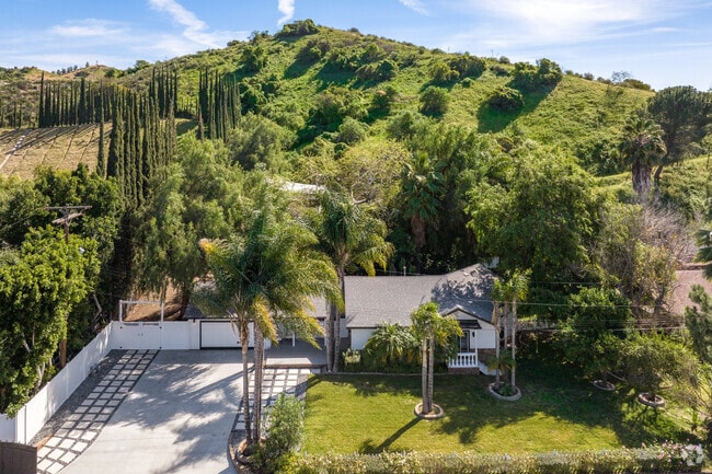
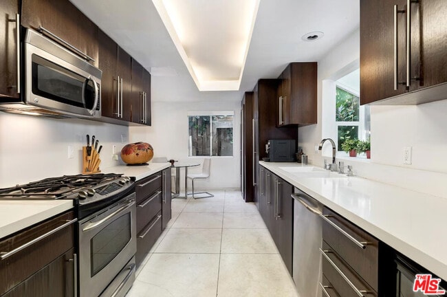
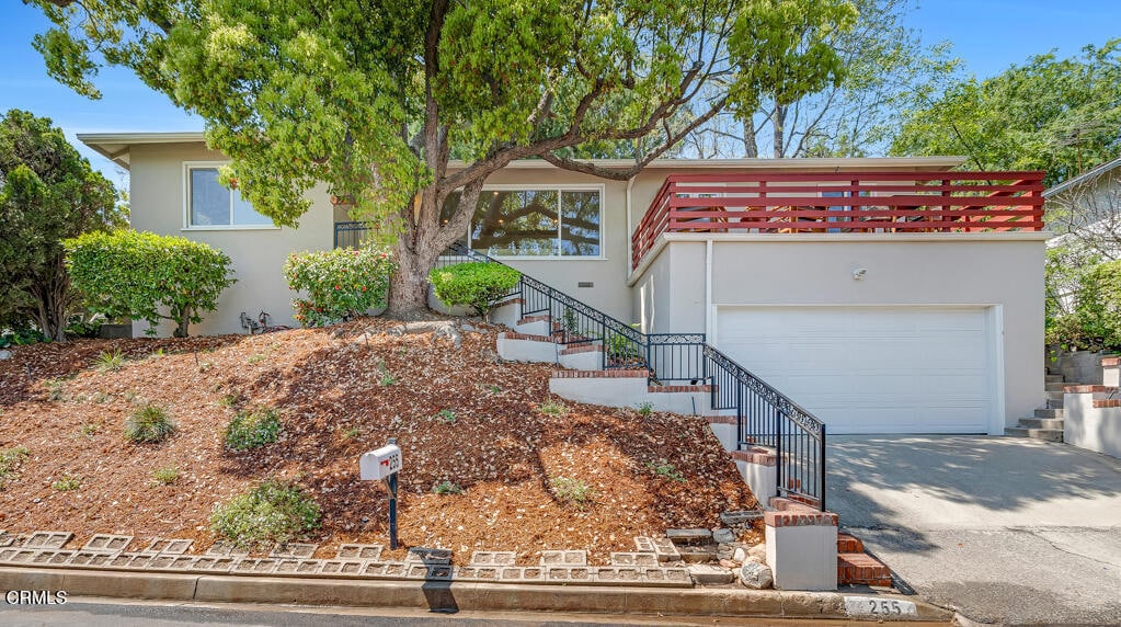
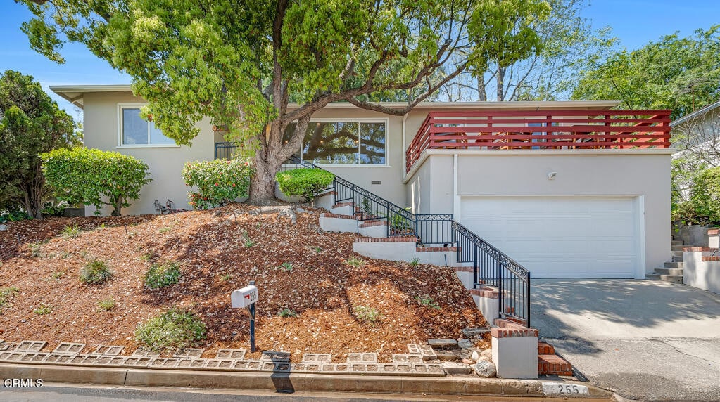
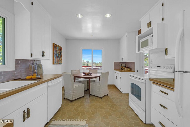
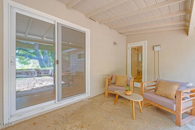
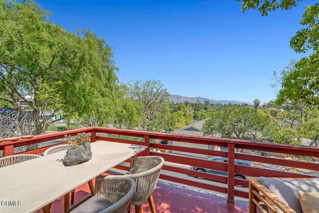
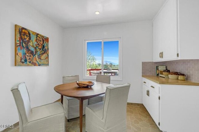
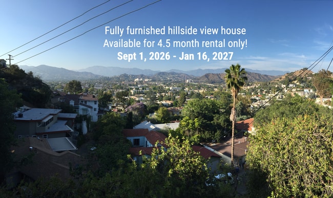
Nestled in the prestigious San Rafael Hills of West Pasadena, this classic Mid-Century home offers a prime location surrounded by lush greenery and manicured estates. Boasting easy access to Downtown Los Angeles and nearby neighborhoods, this charming single-level walk-up residence features 2 bedrooms and 2 bathrooms, perfect for effortless entertaining. Set above the street with a garage at ground level, the home offers surprising views of the San Gabriel Mountains from the front deck, overlooking the treetops. Inside, the bright and airy living space includes two bedrooms that share a hallway bathroom, while a convenient half-bath is located just beyond the kitchen and laundry room. The terraced backyard includes a covered patio and a flat area ideal for a grassy play space.

255 Malcolm Dr is a house located in Los Angeles County and the 91105 ZIP Code.

* Price shown is base rent. Excludes user-selected optional fees and variable or usage-based fees and required charges due at or prior to move-in or at move-out. Price, availability, fees, and any applicable rent special are subject to change without notice.
* Square footage definitions vary. Displayed square footage is approximate.

Fees and Policies

The fees listed below are community-provided and may exclude utilities or add-ons. All payments are made directly to the property and are non-refundable unless otherwise specified. Use the Cost Calculator to determine costs based on your needs.

  • One-Time Basics
    • Security Deposit - Refundable
      $3,050

Property Fee Disclaimer: Based on community-supplied data and independent market research. Subject to change without notice. May exclude fees for mandatory or optional services and usage-based utilities.

Contact

  • Listed by Frank
  • Phone Number
  • Contact
| Edit

Under 30 minutes

Commute Time is calculated at rush hour.
Neighborhood

Annandale is nestled in a quaint, high-end section of Pasadena in the outskirts of Los Angeles. Many visitors pass through Annandale to cross the landmark Colorado Street Bridge or exit the Ventura Freeway heading to events at the Rose Bowl. The neighborhood contains mostly million-dollar homes and grand estates, along with a few upscale rental properties. The only commercial zone rests along Colorado Boulevard, comprising of a few small businesses. The Arroyo Seco defines the eastern border, a dry riverbed that extends from the San Gabriel Mountains down to Elysian Park. Annandale sits only two miles west of Pasadena City Hall and nine miles northeast of Downtown Los Angeles.

Learn more about living in Annandale 
Education
Colleges & Universities Distance
Drive: 6 min 3.0 mi
Drive: 7 min 3.5 mi
Drive: 8 min 3.5 mi
Drive: 8 min 3.6 mi
255 Malcolm Dr is within 7 minutes or 3.5 miles from Art Center College of Design. It is also near Occidental College and Fuller Theological Seminary.
Transportation

Transportation options available in Pasadena include Memorial Park Station, located 2.3 miles from 255 Malcolm Dr. 255 Malcolm Dr is near Bob Hope, located 15.4 miles or 22 minutes away, and Los Angeles International, located 22.6 miles or 37 minutes away.

Transit / Subway Distance
Drive: 4 min 2.3 mi
Drive: 5 min 2.4 mi
Drive: 6 min 2.5 mi
Drive: 7 min 2.7 mi
Drive: 6 min 3.0 mi
Commuter Rail Distance
Drive: 14 min 7.6 mi
Drive: 16 min 7.6 mi
Drive: 11 min 7.9 mi
Drive: 14 min 10.0 mi
Drive: 18 min 11.7 mi
Airports Distance
Airports Distance
Bob Hope
Drive: 22 min 15.4 mi
Los Angeles International
Drive: 37 min 22.6 mi
Getting Around
Fairly Walkable
Walkability
50 / 100
Limited Public Transit
Transit
30 / 100
Exceptionally Drivable
Drivability
90 / 100
Fairly Bikeable
Bikeability
40 / 100

Scores provided by

What do Walkability, Transit, Drivability, and Bikeability mean? Walkability measures the walking distance to day-to-day needs. Transit measures access to public transportation. Drivability measures congestion, parking availability, and access to major roads. Bikeability measures the suitability for cycling. How It Works
-
Soundscore
- / 100

Traffic

-

Airport

-

Businesses

-

Scores provided by

HowLoud What is a Sound Score Rating? A Sound Score Rating aggregates noise caused by vehicle traffic, airplane traffic and local sources. How It Works
Points of Interest

Time and distance from 255 Malcolm Dr.

Shopping Centers Distance
Drive: 3 min 1.3 mi
Drive: 4 min 1.6 mi
Drive: 3 min 1.8 mi
255 Malcolm Dr has 3 shopping centers within 1.8 miles, which is about a 3-minute drive. The miles and minutes will be for the farthest away property.
Parks and Recreation Distance
Kidspace Children's Museum
Drive: 4 min 2.1 mi
Audubon Center at Debs Park
Drive: 8 min 3.6 mi
Jet Propulsion Laboratory
Drive: 8 min 4.8 mi
Huntington Botanical Gardens
Drive: 12 min 5.3 mi
Elyria Canyon Park
Drive: 13 min 6.0 mi
255 Malcolm Dr has 5 parks within 6.0 miles, including Kidspace Children's Museum, Audubon Center at Debs Park, and Jet Propulsion Laboratory.
Hospitals Distance
Hospitals Distance
Drive: 5 min 2.8 mi
Drive: 6 min 3.2 mi
Drive: 8 min 4.5 mi
255 Malcolm Dr has 3 hospitals within 4.5 miles, the nearest is Huntington Memorial Hospital which is 2.8 miles away and a 5 minute drive.
Military Bases Distance
Drive: 34 min 24.2 mi
Drive: 47 min 31.7 mi
Drive: 48 min 35.0 mi
255 Malcolm Dr has 3 military bases within 35.0 miles, the nearest is Los Angeles Air Force Base which is 24.2 miles away and a 34 minute drive.

You May Also Like

Similar Rentals Nearby