
$2,950
/ Month
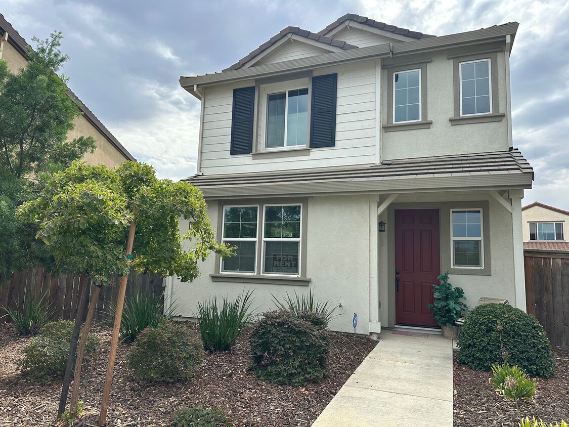
2520 Curlicue Alley
Sacramento, CA 95834
Today
Favorites
916-628-7240
-
Bedrooms
3
-
Bathrooms
2
-
Square Feet
1,713 sq ft
-
Available
Available Now
2520 Curlicue Alley

Favorites
About This Home
$2,950 deposit,
Available Now
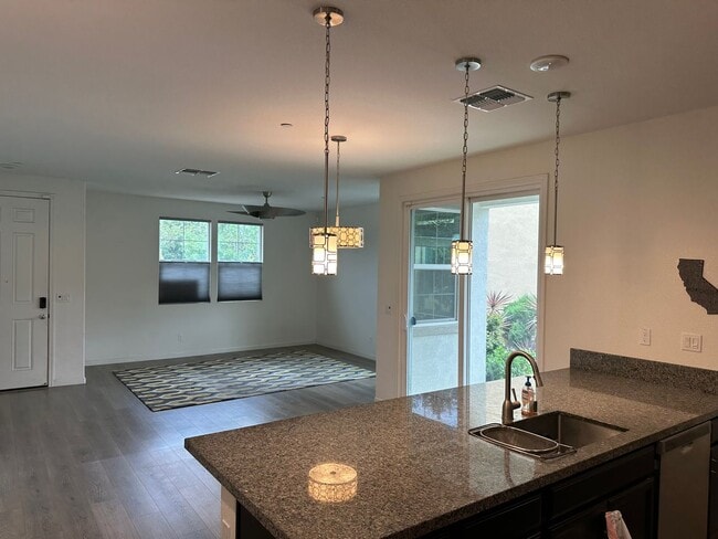
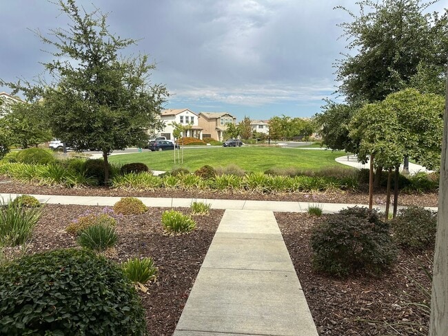
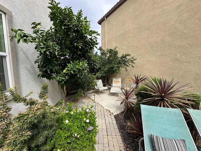
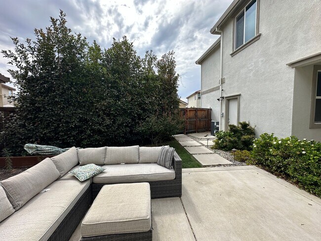
Natomas convenience can be yours in this 2 story, 3 bedroom plus loft, 2.5 bath home! Close to the new Costco and located close to I-5, downtown, Sacramento airport. Large side yard perfect for entertaining BBQs and relaxation and privacy. 2 car garage with overhead storage, tankless water heater. Downstairs is fully laminate and tile flooring. Large kitchen with pantry. Low energy bills with SMUD and dual pane windows. Front yard landscaping maintained by HOA. Located near two large parks and walking trails and fronts to small HOA maintained open space.
Unique Features
- TENANT PAYS ALL
2520 Curlicue Alley is a house located in Sacramento County and the 95834 ZIP Code. This area is served by the Natomas Unified attendance zone.
* Price shown is base rent. Excludes user-selected optional fees and variable or usage-based fees and required charges due at or prior to move-in or at move-out. Price, availability, fees, and any applicable rent special are subject to change without notice.
* Square footage definitions vary. Displayed square footage is approximate.
Contact
- Listed by All About Realty, Inc. | All About Realty, Inc.
- Phone Number
- Contact
Location
Get Directions
Amenities
- TENANT PAYS ALL
Natomas Crossing, situated in the heart of Sacramento, California, is a vibrant neighborhood home to about 3,722 residents. This eclectic village is nestled in northwestern Sacramento, providing easy access to area amenities. If you're an outdoor enthusiast, you'll be able to enjoy multiple gyms, walking trails, and biking trails. Head to North Natomas Regional Park to enjoy a variety of amenities, including two dog parks, a playground, and a splash zone.
Many residents work in the neighborhood itself, but commuting to nearby cities is a breeze thanks to the excellent transit options. Natomas Crossing features a variety of rental housing, from cozy apartments and stylish townhomes to spacious rental houses. Natomas Crossing is renowned for its sense of community, making it a fantastic place to call home.
Learn more about living in Natomas Crossing
Education
| Colleges & Universities | Distance | ||
|---|---|---|---|
| Colleges & Universities | Distance | ||
| Drive: | 17 min | 10.7 mi | |
| Drive: | 18 min | 10.8 mi | |
| Drive: | 21 min | 10.9 mi | |
| Drive: | 27 min | 18.0 mi |
2520 Curlicue Alley is within 17 minutes or 10.7 miles from Sacramento City College. It is also near Sacramento State and American River College.
Schools


Public Elementary School
Grades K-5
690 Students
Attendance Zone
Public Elementary School
Grades K-3
372 Students
Nearby
Public Middle School
Grades 6-8
662 Students
Attendance Zone
Public High School
Grades 9-12
2,266 Students
Attendance Zone
Private Elementary, Middle & High School
Grades K-12
Nearby
Private Elementary School
Grades PK-1
Nearby
School data provided by
 The GreatSchools Rating helps parents compare schools within a state based on a variety of school quality indicators and provides a helpful picture of how effectively each school serves all of its students. Ratings are on a scale of 1 (below average) to 10 (above average) and can include test scores, college readiness, academic progress, advanced courses, equity, discipline and attendance data. We also advise parents to visit schools, consider other information on school performance and programs, and consider family needs as part of the school selection process.
View GreatSchools Rating Methodology
Data provided by GreatSchools.org © 2025. All rights reserved.
View GreatSchools Rating Methodology
Data provided by GreatSchools.org © 2025. All rights reserved.
Transportation options available in Sacramento include Globe Avenue, located 5.3 miles from 2520 Curlicue Alley. 2520 Curlicue Alley is near Sacramento International, located 7.4 miles or 14 minutes away.
| Transit / Subway | Distance | ||
|---|---|---|---|
| Transit / Subway | Distance | ||
|
|
Drive: | 11 min | 5.3 mi |
| Drive: | 9 min | 5.5 mi | |
| Drive: | 9 min | 5.6 mi | |
|
|
Drive: | 10 min | 6.2 mi |
|
|
Drive: | 12 min | 6.6 mi |
| Commuter Rail | Distance | ||
|---|---|---|---|
| Commuter Rail | Distance | ||
| Drive: | 10 min | 6.2 mi | |
|
|
Drive: | 23 min | 16.8 mi |
|
|
Drive: | 28 min | 19.4 mi |
|
|
Drive: | 29 min | 21.5 mi |
|
|
Drive: | 43 min | 33.8 mi |
| Airports | Distance | ||
|---|---|---|---|
| Airports | Distance | ||
|
Sacramento International
|
Drive: | 14 min | 7.4 mi |
Time and distance from 2520 Curlicue Alley.
| Shopping Centers | Distance | ||
|---|---|---|---|
| Shopping Centers | Distance | ||
| Walk: | 12 min | 0.6 mi | |
| Walk: | 13 min | 0.7 mi | |
| Walk: | 15 min | 0.8 mi |
2520 Curlicue Alley has 3 shopping centers within 0.8 mile, which is about a 15-minute walk. The miles and minutes will be for the farthest away property.
| Parks and Recreation | Distance | ||
|---|---|---|---|
| Parks and Recreation | Distance | ||
|
Bannon Creek Parkway
|
Drive: | 6 min | 2.0 mi |
|
Discovery County Park
|
Drive: | 7 min | 3.2 mi |
|
Natomas Oaks Park
|
Drive: | 8 min | 4.8 mi |
|
California State Railroad Museum
|
Drive: | 10 min | 6.1 mi |
|
Old Sacramento Historic District
|
Drive: | 10 min | 6.2 mi |
2520 Curlicue Alley has 5 parks within 6.2 miles, including Bannon Creek Parkway, Discovery County Park, and Natomas Oaks Park.
| Hospitals | Distance | ||
|---|---|---|---|
| Hospitals | Distance | ||
| Drive: | 14 min | 8.1 mi | |
| Drive: | 16 min | 8.8 mi | |
| Drive: | 16 min | 9.8 mi |
2520 Curlicue Alley has 3 hospitals within 9.8 miles, the nearest is Sutter Medical Center, Sacramento which is 8.1 miles away and a 14 minute drive.
| Military Bases | Distance | ||
|---|---|---|---|
| Military Bases | Distance | ||
| Drive: | 22 min | 9.6 mi |
2520 Curlicue Alley is 9.6 miles and a 22 minute drive from McClellan Air Force Base.
You May Also Like
Similar Rentals Nearby


What Are Walk Score®, Transit Score®, and Bike Score® Ratings?
Walk Score® measures the walkability of any address. Transit Score® measures access to public transit. Bike Score® measures the bikeability of any address.
What is a Sound Score Rating?
A Sound Score Rating aggregates noise caused by vehicle traffic, airplane traffic and local sources

2520 Curlicue Alley
Sacramento, CA 95834