

$2,200
/ Month
2511 Millvale Ave
District Heights, MD 20747
Today
|
Edit
Favorites
301-938-4086
-
Bedrooms
3
-
Bathrooms
1
-
Square Feet
--
-
Available
Available Now
2511 Millvale Ave

Favorites
About This Home
$2,200 deposit,
Available Now
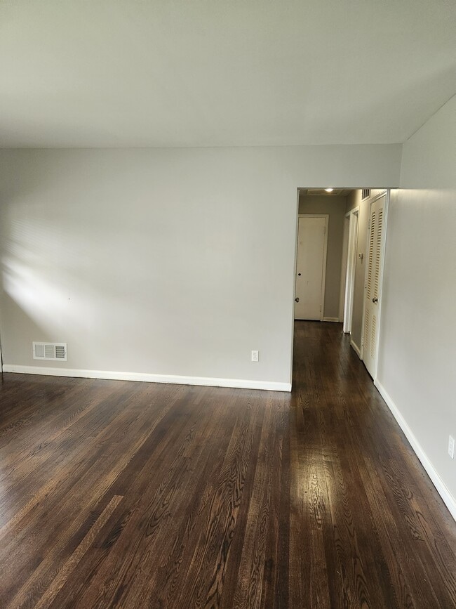
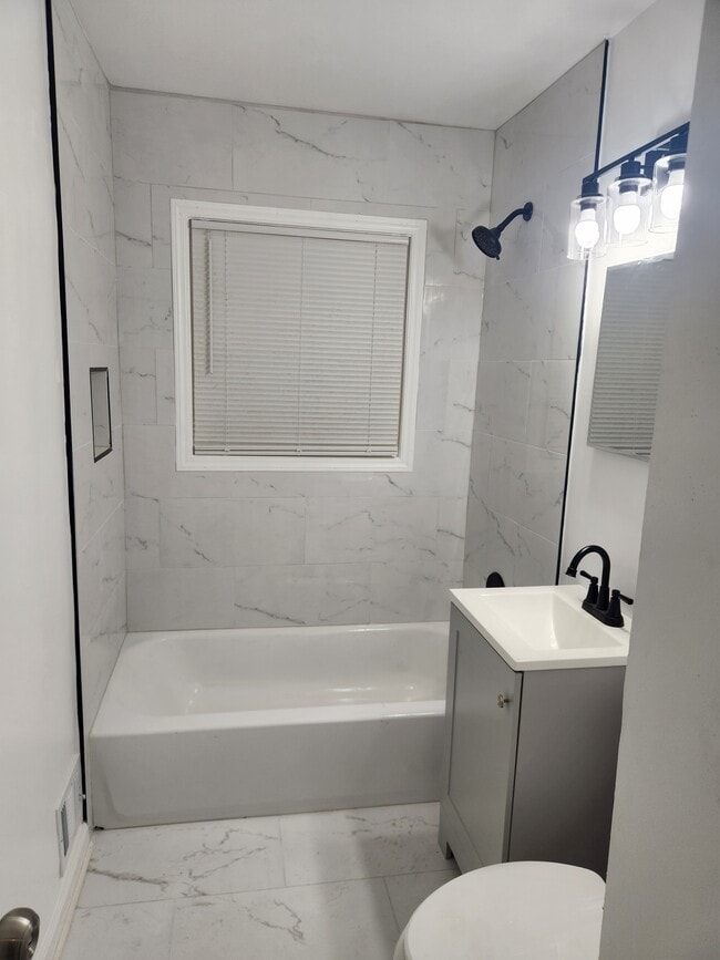
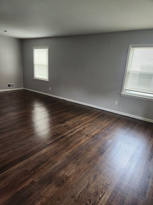
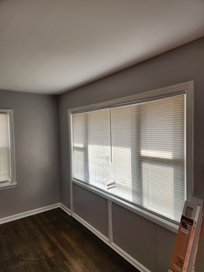
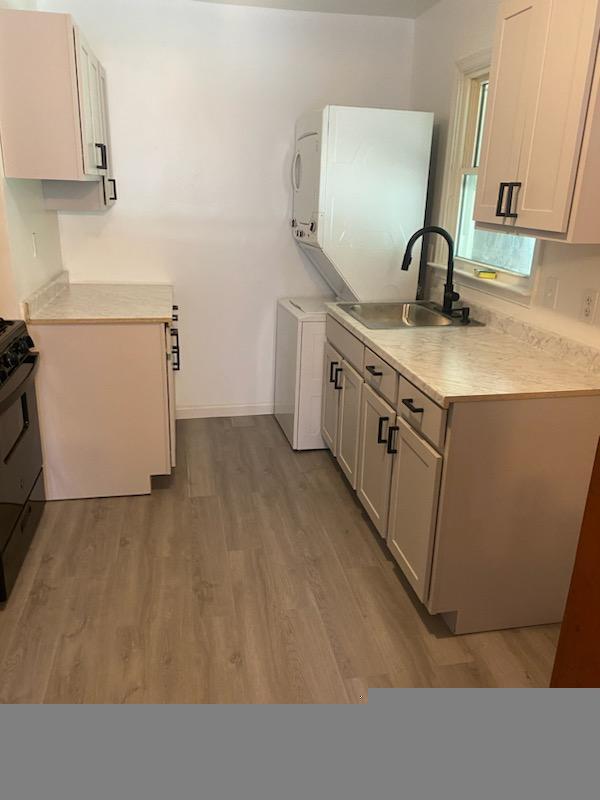
Cozy 3 bedroom, 1 bathroom house in District Heights. Amenities included: hardwood floors, updated kitchen, updated bathroom, washer dryer, and yard. No Utilities included. Is not pet friendly. Date Available: Nov. 20, 2025. $2,200/month rent. $2,200 security deposit required. Please submit the form on this page or contact Vanessa Edwards at to learn more.
2511 Millvale Ave is a house located in Prince George's County and the 20747 ZIP Code. This area is served by the Prince George's County Public Schools attendance zone.
* Price shown is base rent. Excludes user-selected optional fees and variable or usage-based fees and required charges due at or prior to move-in or at move-out. Price, availability, fees, and any applicable rent special are subject to change without notice.
* Square footage definitions vary. Displayed square footage is approximate.
Fees and Policies
The fees below are based on community-supplied data and may exclude additional fees and utilities.
- One-Time Basics
- Due at Move-In
- Security Deposit - RefundableCharged per unit.$2,200
- Due at Move-In
Property Fee Disclaimer: Based on community-supplied data and independent market research. Subject to change without notice. May exclude fees for mandatory or optional services and usage-based utilities.
House Features
- Washer/Dryer
- Washer/Dryer Hookup
Contact
- Listed by Vanessa Edwards
- Phone Number
- Contact
Location
Get Directions
Amenities
- Washer/Dryer
- Washer/Dryer Hookup
As far as distance goes, District Heights is less than 10 miles from the heart of DC. But the landscape couldn't be more different -- instead of monuments, there are trees. In place of politicians in suits, there are kids riding bicycles. District Heights is southeast of Washington, DC -- just follow Pennsylvania Avenue toward I-495.
Sports lovers will appreciate District Heights apartments for the proximity they'll enjoy to FedEx Field, which is only about three miles north. In addition to being the home field of the NFL's Washington Redskins, FedEx Field also hosts concerts and other events. District Heights residents enjoy easy access to nearby Joint Base Andrews, located just south of the city.
Learn more about living in District Heights
Education
| Colleges & Universities | Distance | ||
|---|---|---|---|
| Colleges & Universities | Distance | ||
| Drive: | 12 min | 6.3 mi | |
| Drive: | 13 min | 7.0 mi | |
| Drive: | 19 min | 8.5 mi | |
| Drive: | 19 min | 9.6 mi |
2511 Millvale Ave is within 12 minutes or 6.3 miles from Prince George's Comm. Coll.. It is also near Univ. of Md. Univ. Coll. and Gallaudet University.
Schools

Public Elementary School
Grades PK-5
284 Students
Attendance Zone
Public Middle School
Grades 6-8
693 Students
Attendance Zone
Public High School
Grades 9-12
2,257 Students
Attendance Zone
Private Elementary & Middle School
Grades PK-8
26 Students
Nearby
Private High School
Grades 9-12
858 Students
Nearby
School data provided by
 The GreatSchools Rating helps parents compare schools within a state based on a variety of school quality indicators and provides a helpful picture of how effectively each school serves all of its students. Ratings are on a scale of 1 (below average) to 10 (above average) and can include test scores, college readiness, academic progress, advanced courses, equity, discipline and attendance data. We also advise parents to visit schools, consider other information on school performance and programs, and consider family needs as part of the school selection process.
View GreatSchools Rating Methodology
Data provided by GreatSchools.org © 2025. All rights reserved.
View GreatSchools Rating Methodology
Data provided by GreatSchools.org © 2025. All rights reserved.
Transportation options available in District Heights include Addison Road-Seat Pleasant, located 3.5 miles from 2511 Millvale Ave. 2511 Millvale Ave is near Ronald Reagan Washington Ntl, located 13.3 miles or 26 minutes away, and Baltimore/Washington International Thurgood Marshall, located 32.0 miles or 48 minutes away.
| Transit / Subway | Distance | ||
|---|---|---|---|
| Transit / Subway | Distance | ||
|
|
Drive: | 7 min | 3.5 mi |
|
|
Drive: | 11 min | 4.0 mi |
|
Capitol Heights, Blue/Silver Line Center Platform
|
Drive: | 9 min | 4.1 mi |
|
|
Drive: | 9 min | 4.3 mi |
|
|
Drive: | 12 min | 5.7 mi |
| Commuter Rail | Distance | ||
|---|---|---|---|
| Commuter Rail | Distance | ||
|
|
Drive: | 18 min | 8.8 mi |
|
|
Drive: | 19 min | 8.9 mi |
|
|
Drive: | 18 min | 9.2 mi |
| Drive: | 19 min | 10.7 mi | |
|
|
Drive: | 19 min | 10.7 mi |
| Airports | Distance | ||
|---|---|---|---|
| Airports | Distance | ||
|
Ronald Reagan Washington Ntl
|
Drive: | 26 min | 13.3 mi |
|
Baltimore/Washington International Thurgood Marshall
|
Drive: | 48 min | 32.0 mi |
Time and distance from 2511 Millvale Ave.
| Shopping Centers | Distance | ||
|---|---|---|---|
| Shopping Centers | Distance | ||
| Walk: | 19 min | 1.0 mi | |
| Walk: | 19 min | 1.0 mi | |
| Drive: | 3 min | 1.1 mi |
2511 Millvale Ave has 3 shopping centers within 1.1 miles, which is about a 3-minute walk. The miles and minutes will be for the farthest away property.
| Parks and Recreation | Distance | ||
|---|---|---|---|
| Parks and Recreation | Distance | ||
|
Walker Mill Regional Park
|
Drive: | 6 min | 3.0 mi |
|
Suitland Bog
|
Drive: | 7 min | 3.5 mi |
|
Fort Dupont Park
|
Drive: | 12 min | 5.4 mi |
|
Oxon Cove Park
|
Drive: | 14 min | 6.4 mi |
|
Watkins Regional Park
|
Drive: | 18 min | 9.1 mi |
2511 Millvale Ave has 5 parks within 9.1 miles, including Walker Mill Regional Park, Suitland Bog, and Fort Dupont Park.
| Hospitals | Distance | ||
|---|---|---|---|
| Hospitals | Distance | ||
| Drive: | 16 min | 7.3 mi | |
| Drive: | 16 min | 7.7 mi | |
| Drive: | 17 min | 8.0 mi |
2511 Millvale Ave has 3 hospitals within 8.0 miles, the nearest is United Medical Center which is 7.3 miles away and a 16 minute drive.
| Military Bases | Distance | ||
|---|---|---|---|
| Military Bases | Distance | ||
| Drive: | 9 min | 3.7 mi | |
| Drive: | 17 min | 8.1 mi |
2511 Millvale Ave is 3.7 miles from Andrews Airforce Base, and is convenient to other military bases, including Washington Navy Yard.
You May Also Like
Similar Rentals Nearby


What Are Walk Score®, Transit Score®, and Bike Score® Ratings?
Walk Score® measures the walkability of any address. Transit Score® measures access to public transit. Bike Score® measures the bikeability of any address.
What is a Sound Score Rating?
A Sound Score Rating aggregates noise caused by vehicle traffic, airplane traffic and local sources
2511 Millvale Ave
District Heights, MD 20747