$1,300
/ Month
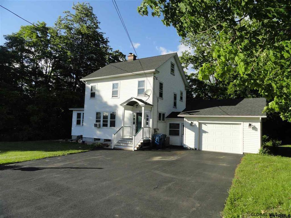
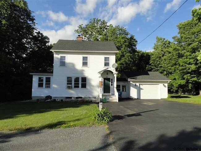
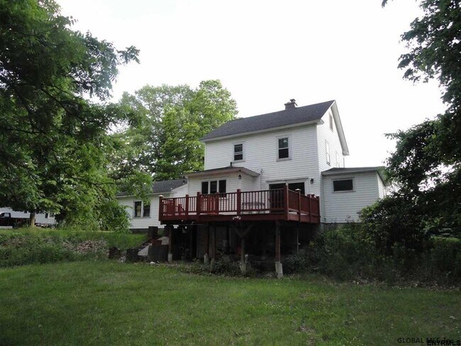
251 Troy Schenectady Rd Unit 2nd and 3rd Floor
Latham, NY 12110
Favorites
251 Troy Schenectady Rd Unit 2nd and 3rd Floor

Favorites
Check Back Soon for Upcoming Availability
| Beds | Baths | Average SF |
|---|---|---|
| 2 Bedrooms 2 Bedrooms 2 Br | 1 Bath 1 Bath 1 Ba | — |
Fees and Policies
Details
Lease Options
-
12 Months
About This Property
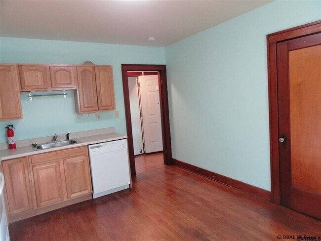
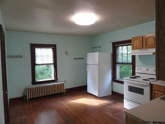
This is a convenient location right on Troy Schenectady Road yet very private with a great back and side yard. This apartment occupies the 2nd and 3rd floors of the building and include heat, hot water and electric all for a flat fee. There are 2 bedrooms, a kitchen and full bath on the 2nd floor. The living room is the 3rd floor. There is a NO pet policy and NO Smoking policy. Listing agent will accompany all showings by qualified applicants. The client uses a 3rd party for credit checks. See documents for details.
251 Troy Schenectady Rd is an apartment community located in Albany County and the 12110 ZIP Code.
Features
- Smoke Free
- Hardwood Floors
- Porch
251 Troy Schenectady Rd,
Latham,
NY
12110
Amenities
- Smoke Free
- Hardwood Floors
- Porch
Education
| Colleges & Universities | Distance | ||
|---|---|---|---|
| Colleges & Universities | Distance | ||
| Drive: | 6 min | 2.7 mi | |
| Drive: | 7 min | 3.0 mi | |
| Drive: | 9 min | 4.1 mi | |
| Drive: | 15 min | 6.7 mi |
251 Troy Schenectady Rd Unit 2nd and 3rd Floor is within 6 minutes or 2.7 miles from Siena College. It is also near The Sage Colleges, Troy Campus and Rensselaer Polytechnic Inst..
Walkability Near 251 Troy Schenectady Rd Latham, NY 12110
Getting Around
 What do Walkability, Transit, Drivability, and Bikeability mean?
Walkability measures the walking distance to day-to-day needs.
Transit measures access to public transportation.
Drivability measures congestion, parking availability, and access to major roads.
Bikeability measures the suitability for cycling.
How It Works
What do Walkability, Transit, Drivability, and Bikeability mean?
Walkability measures the walking distance to day-to-day needs.
Transit measures access to public transportation.
Drivability measures congestion, parking availability, and access to major roads.
Bikeability measures the suitability for cycling.
How It Works
Fairly Walkable
Walkability
40
/ 100
Limited Public Transit
Transit
30
/ 100
Exceptionally Drivable
Drivability
100
/ 100
Somewhat Bikeable
Bikeability
30
/ 100
Scores provided by
-
Soundscore™
-
/ 100
Traffic
-Airport
-Businesses
-Scores provided by
HowLoud What is a Sound Score Rating? A Sound Score Rating aggregates noise caused by vehicle traffic, airplane traffic and local sources. How It WorksYou May Also Like
Similar Rentals Nearby


What Are Walk Score®, Transit Score®, and Bike Score® Ratings?
Walk Score® measures the walkability of any address. Transit Score® measures access to public transit. Bike Score® measures the bikeability of any address.
What is a Sound Score Rating?
A Sound Score Rating aggregates noise caused by vehicle traffic, airplane traffic and local sources.

251 Troy Schenectady Rd
Latham, NY 12110