

$2,880 / Month
251 Independence Dr
Chestnut Hill, MA 02467
2 Weeks Ago
Favorites
251 Independence Dr

Favorites
Check Back Soon for Upcoming Availability
| Beds | Baths | Average SF |
|---|---|---|
| 2 Bedrooms 2 Bedrooms 2 Br | 1 Bath 1 Bath 1 Ba | 984 SF |
Fees and Policies
The fees below are based on community-supplied data and may exclude additional fees and utilities.
- Parking
-
Surface Lot--
Details
Utilities Included
-
Gas
-
Heat
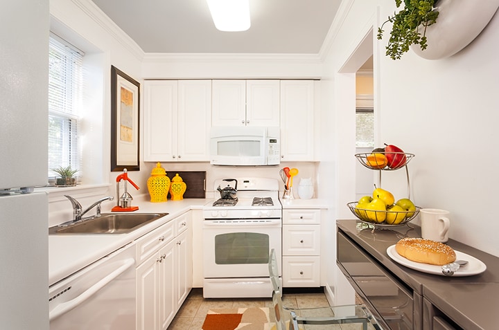
251 Independence Dr is a townhome located in Suffolk County and the 02467 ZIP Code.
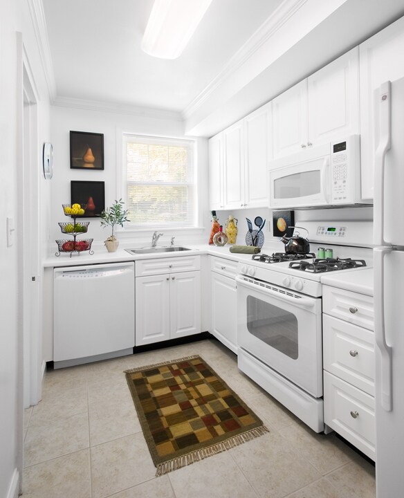
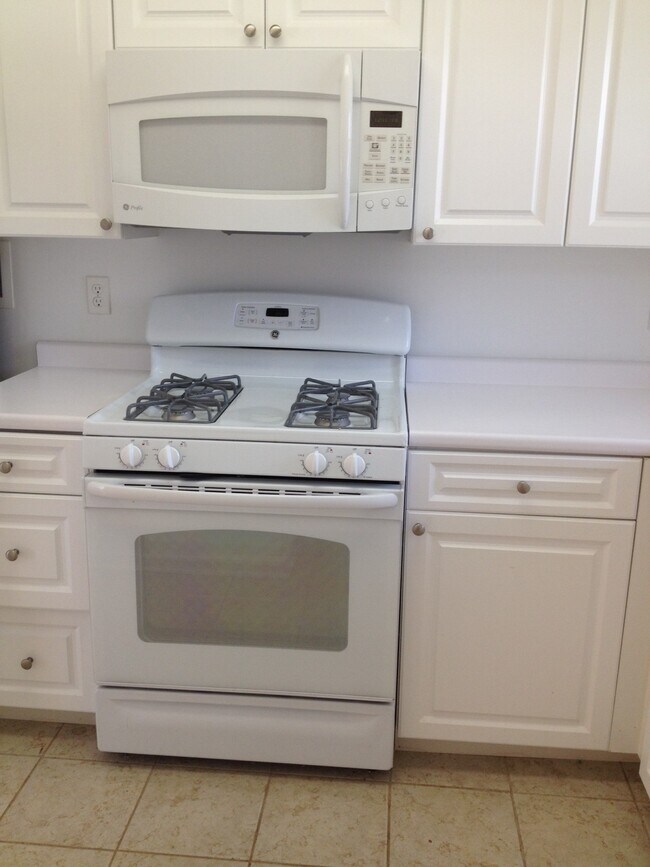
Townhome Features
- Washer/Dryer
Location
Get Directions
One of the more upscale communities in the Boston area, Chestnut Hill apartments deliver a stylish lifestyle and a beautiful atmosphere. Boston College’s campus is the main landmark on the northeast corner of the village, and the school’s museums, libraries, and other resources add considerable intellectual capital to the broader community—of course, Eagles games are quite popular as well. The shopping center known as “The Street” on Boylston Street provides a trendy retail experience in a unique setting. The area is loaded with parks and green spaces, particularly Hancock Woods in the south, Webster Conservation Area in the west, and Chestnut Hill Reservoir in the north.
Learn more about living in Chestnut Hill
Amenities
- Washer/Dryer
Expenses
Utilities Included
Gas, Heat
Included
Education
| Colleges & Universities | Distance | ||
|---|---|---|---|
| Colleges & Universities | Distance | ||
| Drive: | 10 min | 4.5 mi | |
| Drive: | 9 min | 4.6 mi | |
| Drive: | 9 min | 4.8 mi | |
| Drive: | 10 min | 5.2 mi |
251 Independence Dr is within 9 minutes or 4.6 miles from Boston College. It is also near Boston College, Brighton and MCPHS University, Boston.
Transportation options available in Chestnut Hill include Chestnut Hill Station, located 2.5 miles from 251 Independence Dr. 251 Independence Dr is near General Edward Lawrence Logan International, located 11.4 miles or 22 minutes away.
| Transit / Subway | Distance | ||
|---|---|---|---|
| Transit / Subway | Distance | ||
|
|
Drive: | 5 min | 2.5 mi |
|
|
Drive: | 5 min | 3.3 mi |
|
|
Drive: | 6 min | 3.3 mi |
|
|
Drive: | 7 min | 3.4 mi |
|
|
Drive: | 7 min | 3.5 mi |
| Commuter Rail | Distance | ||
|---|---|---|---|
| Commuter Rail | Distance | ||
|
|
Drive: | 3 min | 1.2 mi |
|
|
Drive: | 3 min | 1.6 mi |
|
|
Drive: | 3 min | 1.7 mi |
|
|
Drive: | 5 min | 2.6 mi |
|
|
Drive: | 5 min | 3.3 mi |
| Airports | Distance | ||
|---|---|---|---|
| Airports | Distance | ||
|
General Edward Lawrence Logan International
|
Drive: | 22 min | 11.4 mi |
Time and distance from 251 Independence Dr.
| Shopping Centers | Distance | ||
|---|---|---|---|
| Shopping Centers | Distance | ||
| Walk: | 3 min | 0.2 mi | |
| Drive: | 4 min | 2.0 mi | |
| Drive: | 5 min | 2.1 mi |
251 Independence Dr has 3 shopping centers within 2.1 miles, which is about a 5-minute walk. The miles and minutes will be for the farthest away property.
| Parks and Recreation | Distance | ||
|---|---|---|---|
| Parks and Recreation | Distance | ||
|
Brook Farm Historic Site
|
Drive: | 2 min | 1.4 mi |
|
Arnold Arboretum of Harvard University
|
Drive: | 3 min | 1.7 mi |
|
Frederick Law Olmsted National Historic Site
|
Drive: | 5 min | 2.8 mi |
|
Hammond Pond Reservation
|
Drive: | 5 min | 3.0 mi |
|
Stony Brook Reservation
|
Drive: | 7 min | 3.4 mi |
251 Independence Dr has 5 parks within 3.4 miles, including Brook Farm Historic Site, Arnold Arboretum of Harvard University, and Frederick Law Olmsted National Historic Site.
| Hospitals | Distance | ||
|---|---|---|---|
| Hospitals | Distance | ||
| Walk: | 8 min | 0.4 mi | |
| Drive: | 3 min | 2.0 mi | |
| Drive: | 7 min | 3.2 mi |
251 Independence Dr has 3 hospitals within 3.2 miles, the nearest is Bournewood Hospital which is 0.4 mile away and a 8 minute walk.
| Military Bases | Distance | ||
|---|---|---|---|
| Military Bases | Distance | ||
| Drive: | 23 min | 13.5 mi | |
| Drive: | 29 min | 17.3 mi |
251 Independence Dr is 13.5 miles from US Military Reservation, and is convenient to other military bases, including Hanscom Air Force Base.
You May Also Like
Similar Rentals Nearby


What Are Walk Score®, Transit Score®, and Bike Score® Ratings?
Walk Score® measures the walkability of any address. Transit Score® measures access to public transit. Bike Score® measures the bikeability of any address.
What is a Sound Score Rating?
A Sound Score Rating aggregates noise caused by vehicle traffic, airplane traffic and local sources
251 Independence Dr
Chestnut Hill, MA 02467