
$590
Total Monthly Price
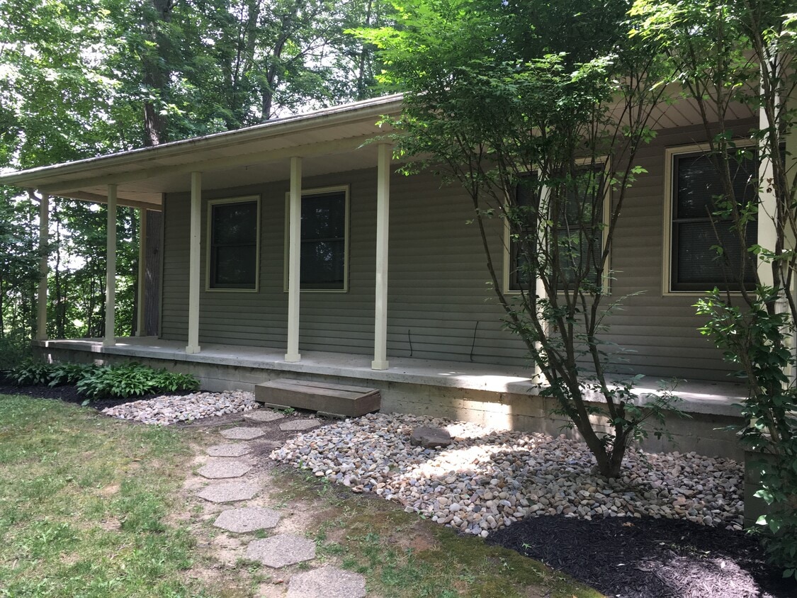
2505 Meloy Rd
Kent, OH 44240
Today
|
Edit
Favorites
-
Bedrooms
4
-
Bathrooms
2
-
Square Feet
1,600 sq ft
-
Available
Available Aug 8
Highlights
- Pets Allowed
- Deck
2505 Meloy Rd

Favorites
About This Home
12 Month Lease,
$200 deposit,
Available Aug 8
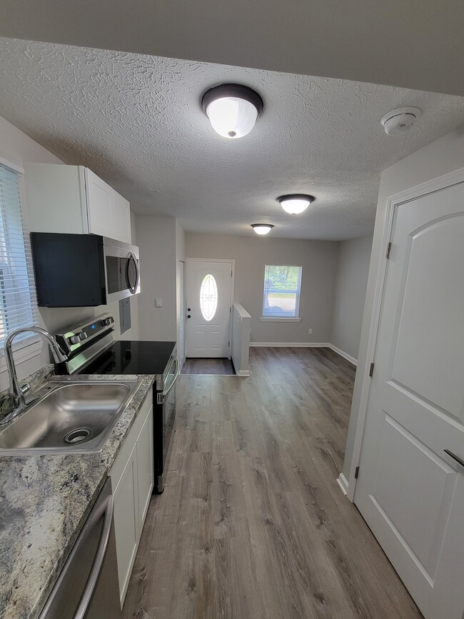
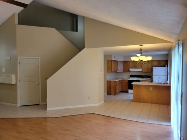
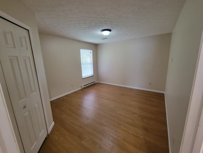
Hidden Pines is situated on 15 acres with large bedrooms, pet friendly, minutes from campus, lots of privacy, decks, fire pits and tons of space inside and out. Pet friendly and parking is free. A washer and dryer are provided in all units except studios. Utilities included. Tenants pay cable/internet only. We have FREE level 2 charging in some garages! Level 2 charges at 30 mph. Free parking. Starting at $590 per room per month. Individual leases so you only pay your rent! We also have a very limited number of studio, 2 bedroom and 3 bedroom units available.
2505 Meloy Rd is a townhome located in Portage County and the 44240 ZIP Code. This area is served by the Ravenna City School District attendance zone.
* Price shown is total price based on community-supplied monthly required fees. Excludes user-selected optional fees and variable or usage-based fees and required charges due at or prior to move-in or at move-out. Price, availability, fees, and any applicable rent special are subject to change without notice.
* Square footage definitions vary. Displayed square footage is approximate.
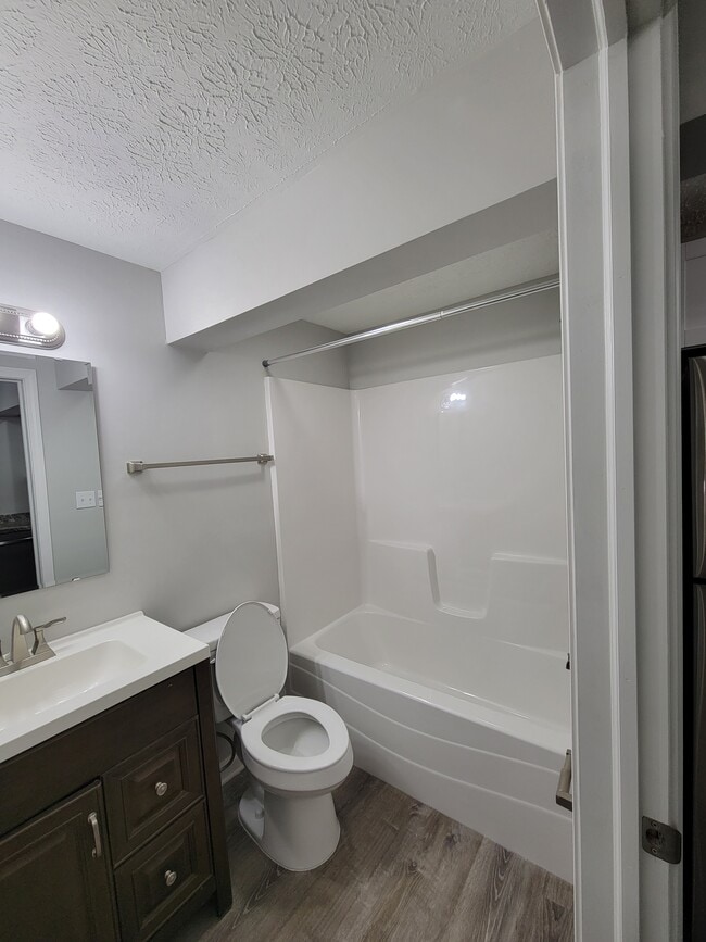
Townhome Features
Washer/Dryer
High Speed Internet Access
Tub/Shower
Ceiling Fans
- High Speed Internet Access
- Washer/Dryer
- Heating
- Ceiling Fans
- Cable Ready
- Storage Space
- Tub/Shower
- Deck
Fees and Policies
The fees listed below are community-provided and may exclude utilities or add-ons. All payments are made directly to the property and are non-refundable unless otherwise specified.
- Dogs Allowed
-
Fees not specified
- Cats Allowed
-
Fees not specified
- Parking
-
Surface Lot--
Details
Utilities Included
-
Gas
-
Water
-
Electricity
-
Heat
-
Trash Removal
-
Sewer
-
Air Conditioning
Property Information
-
Built in 1993
Contact
- Contact
Location
Get Directions
Kent, Ohio carries the unmistakable pulse of a college town rooted in real history, sitting along the Cuyahoga River in the heart of Portage County. Kent State University anchors daily life here, drawing a steady mix of students, educators, and healthcare workers who all call this compact, 10-square-mile city home. Originally settled in 1805 as Franklin Mills, the city grew around water-powered industry and canal trade before evolving into the academic and cultural hub it is today. Kent State's May 4 memorial remains one of the most significant historical sites in the country, a reminder that this small city has carried genuine weight in American history.
Neighborhoods close to campus offer walkable streets lined with locally owned shops and coffee houses, while areas farther from the university feel quieter and more residential.
Learn more about living in Kent
Education
| Colleges & Universities | Distance | ||
|---|---|---|---|
| Colleges & Universities | Distance | ||
| Drive: | 8 min | 3.0 mi | |
| Drive: | 23 min | 14.9 mi | |
| Drive: | 36 min | 20.8 mi | |
| Drive: | 39 min | 23.9 mi |
2505 Meloy Rd is within 8 minutes or 3.0 miles from Kent State University. It is also near University of Akron and Walsh University.
Schools
Public Elementary School
Grades K-5
298 Students
Nearby
Private High School
Grades 9-12
1,012 Students
Nearby
School data provided by
 The GreatSchools Rating helps parents compare schools within a state based on a variety of school quality indicators and provides a helpful picture of how effectively each school serves all of its students. Ratings are on a scale of 1 (below average) to 10 (above average) and can include test scores, college readiness, academic progress, advanced courses, equity, discipline and attendance data. We also advise parents to visit schools, consider other information on school performance and programs, and consider family needs as part of the school selection process.
View GreatSchools Rating Methodology
Data provided by GreatSchools.org © 2026. All rights reserved.
View GreatSchools Rating Methodology
Data provided by GreatSchools.org © 2026. All rights reserved.
Getting Around
 What do Walkability, Transit, Drivability, and Bikeability mean?
Walkability measures the walking distance to day-to-day needs.
Transit measures access to public transportation.
Drivability measures congestion, parking availability, and access to major roads.
Bikeability measures the suitability for cycling.
How It Works
What do Walkability, Transit, Drivability, and Bikeability mean?
Walkability measures the walking distance to day-to-day needs.
Transit measures access to public transportation.
Drivability measures congestion, parking availability, and access to major roads.
Bikeability measures the suitability for cycling.
How It Works
Somewhat Walkable
Walkability
20
/ 100
Minimal Public Transit
Transit
0
/ 100
Exceptionally Drivable
Drivability
90
/ 100
Somewhat Bikeable
Bikeability
30
/ 100
Scores provided by
-
Soundscore™
-
/ 100
Traffic
-Airport
-Businesses
-Scores provided by
HowLoud What is a Sound Score Rating? A Sound Score Rating aggregates noise caused by vehicle traffic, airplane traffic and local sources. How It Works
Amenities
- High Speed Internet Access
- Washer/Dryer
- Heating
- Ceiling Fans
- Cable Ready
- Storage Space
- Tub/Shower
- Deck
2505 Meloy Rd Photos
What Are Walk Score®, Transit Score®, and Bike Score® Ratings?
Walk Score® measures the walkability of any address. Transit Score® measures access to public transit. Bike Score® measures the bikeability of any address.
What is a Sound Score Rating?
A Sound Score Rating aggregates noise caused by vehicle traffic, airplane traffic and local sources.
2505 Meloy Rd
Kent, OH 44240