
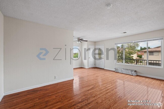
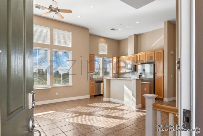
$2,150 / Month
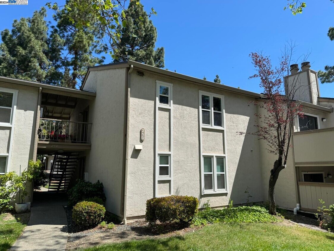
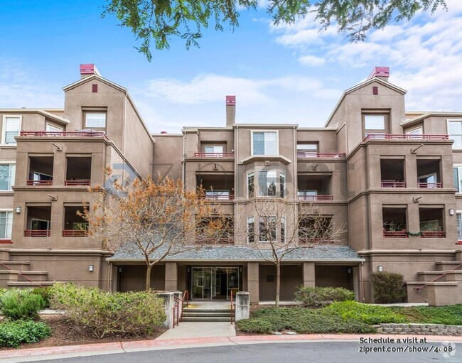
250 Chilpancingo Pkwy
Pleasant Hill, CA 94523
2 Weeks Ago
Favorites
250 Chilpancingo Pkwy

Favorites
Check Back Soon for Upcoming Availability
| Beds | Baths | Average SF |
|---|---|---|
| 2 Bedrooms 2 Bedrooms 2 Br | 1 Bath 1 Bath 1 Ba | 801 SF |
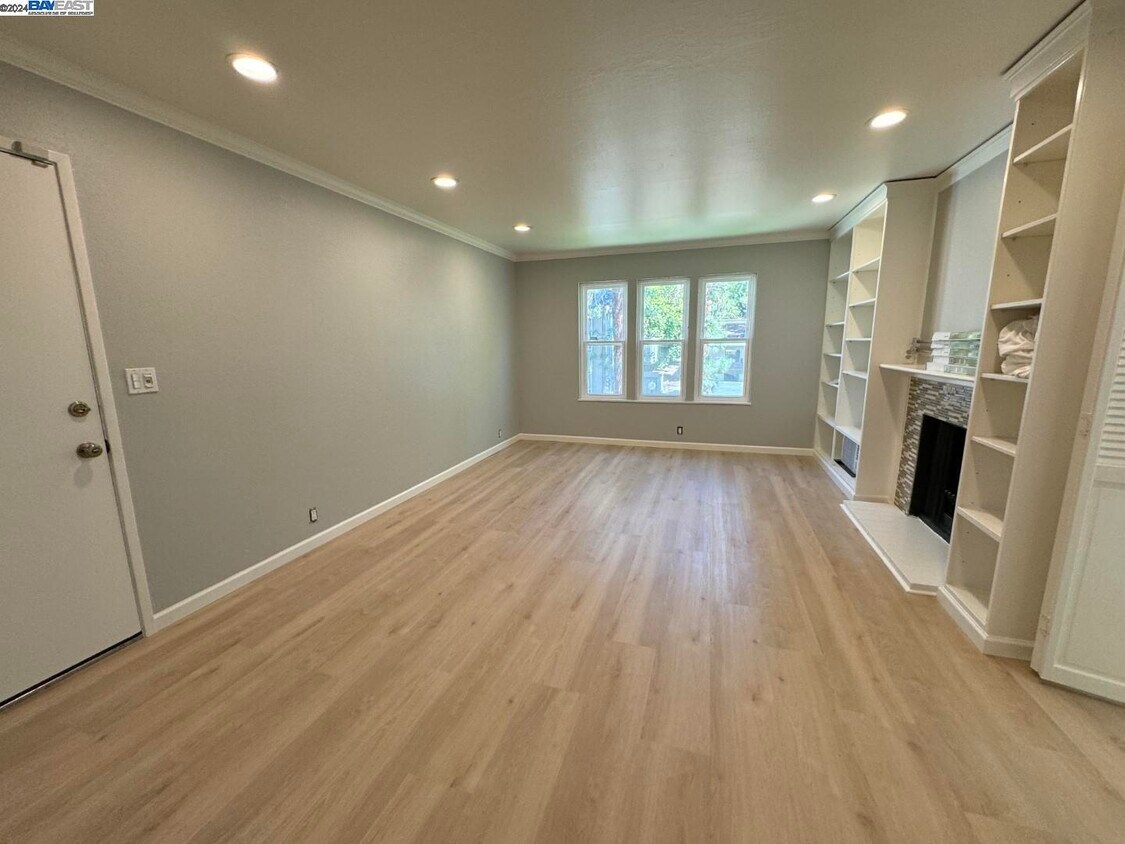
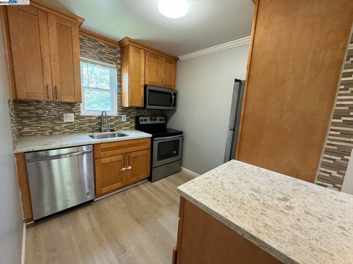
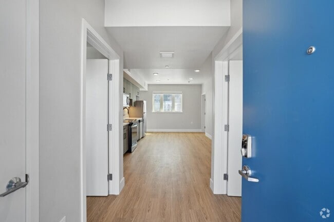
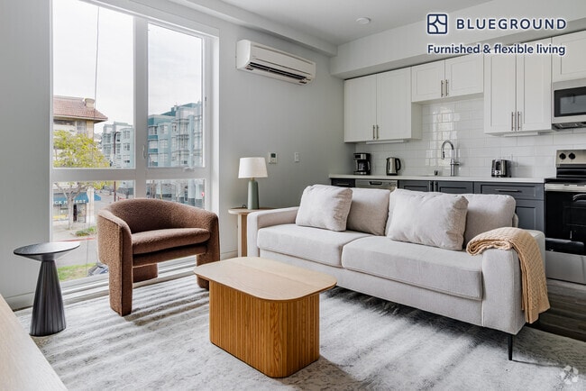
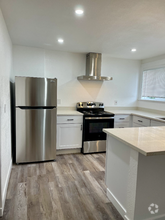
About This Property
Convenient location: Minutes to Diablo Valley College (DVC),Target,CVS,Sun Valley Shopping Center,many retails and restaurants,close to Walnut Creek,Pleasant Hill and Concord downtown,close to Highway 680,4 and 242 freeway and close to Bart Station. Excellent location for students and commuters.
250 Chilpancingo Pkwy is a condo located in Contra Costa County and the 94523 ZIP Code. This area is served by the Mt. Diablo Unified attendance zone.
Location
Get Directions
Pleasant Hill is exactly what you’d expect: a pleasant community in the California hills. This suburb offers urban amenities and small-town charm, along with upscale rentals ranging from single-family homes to modern apartments. A charming outdoor shopping center sits in the heart of downtown, along with neighborhood parks, movie theaters, and top-notch public schools like Sequoia Middle. Pleasant Hill offers proximity to even more shopping and entertainment options like Sunvalley Shopping Center and Six Flags in Concord. Suisun Bay is only a few miles north of town, and Walnut Creek sits directly south. Residents of this upscale suburb also have easy access to Berkeley, Oakland, Richmond, and San Francisco thanks to Interstate 680 and State Route 24.
Learn more about living in Pleasant Hill
Education
| Colleges & Universities | Distance | ||
|---|---|---|---|
| Colleges & Universities | Distance | ||
| Drive: | 5 min | 1.8 mi | |
| Drive: | 23 min | 12.4 mi | |
| Drive: | 24 min | 15.2 mi | |
| Drive: | 30 min | 19.5 mi |
250 Chilpancingo Pkwy is within 5 minutes or 1.8 miles from Diablo Valley, Pleasant Hill. It is also near Saint Marys Coll. of Calif. and Los Medanos College, Pittsburg.
Schools


Public Elementary School
Grades K-5
270 Students
Nearby
Public Elementary School
Grades K-5
809 Students
Attendance Zone
Public Middle School
Grades 6-8
777 Students
Attendance Zone
Public High School
Grades 9-12
1,956 Students
Attendance Zone
Private Elementary School
Grades PK-5
78 Students
Nearby
Private Elementary, Middle & High School
Grades K-12
6 Students
Nearby
Private Elementary, Middle & High School
Grades 1-12
8 Students
Nearby
School data provided by
 The GreatSchools Rating helps parents compare schools within a state based on a variety of school quality indicators and provides a helpful picture of how effectively each school serves all of its students. Ratings are on a scale of 1 (below average) to 10 (above average) and can include test scores, college readiness, academic progress, advanced courses, equity, discipline and attendance data. We also advise parents to visit schools, consider other information on school performance and programs, and consider family needs as part of the school selection process.
View GreatSchools Rating Methodology
View GreatSchools Rating Methodology
Transportation options available in Pleasant Hill include Concord Station, located 3.0 miles from 250 Chilpancingo Pkwy. 250 Chilpancingo Pkwy is near Metro Oakland International, located 29.3 miles or 40 minutes away, and San Francisco International, located 41.3 miles or 58 minutes away.
| Transit / Subway | Distance | ||
|---|---|---|---|
| Transit / Subway | Distance | ||
|
|
Drive: | 7 min | 3.0 mi |
|
|
Drive: | 8 min | 4.3 mi |
|
Pleasant Hill Station
|
Drive: | 8 min | 4.8 mi |
|
|
Drive: | 9 min | 6.0 mi |
|
|
Drive: | 12 min | 9.3 mi |
| Commuter Rail | Distance | ||
|---|---|---|---|
| Commuter Rail | Distance | ||
|
|
Drive: | 11 min | 7.4 mi |
|
|
Drive: | 24 min | 17.0 mi |
|
|
Drive: | 30 min | 20.7 mi |
|
|
Drive: | 29 min | 22.4 mi |
|
|
Drive: | 33 min | 24.4 mi |
| Airports | Distance | ||
|---|---|---|---|
| Airports | Distance | ||
|
Metro Oakland International
|
Drive: | 40 min | 29.3 mi |
|
San Francisco International
|
Drive: | 58 min | 41.3 mi |
Time and distance from 250 Chilpancingo Pkwy.
| Shopping Centers | Distance | ||
|---|---|---|---|
| Shopping Centers | Distance | ||
| Walk: | 5 min | 0.3 mi | |
| Walk: | 7 min | 0.4 mi | |
| Walk: | 10 min | 0.5 mi |
250 Chilpancingo Pkwy has 3 shopping centers within 0.5 mile, which is about a 10-minute walk. The miles and minutes will be for the farthest away property.
| Parks and Recreation | Distance | ||
|---|---|---|---|
| Parks and Recreation | Distance | ||
|
Markham Nature Park and Arboretum
|
Drive: | 12 min | 4.6 mi |
|
Larkey Park
|
Drive: | 8 min | 5.1 mi |
|
Lindsay Wildlife Museum
|
Drive: | 9 min | 5.1 mi |
|
Waterbird Regional Preserve
|
Drive: | 9 min | 6.0 mi |
|
John Muir National Historic Site
|
Drive: | 12 min | 6.2 mi |
250 Chilpancingo Pkwy has 5 parks within 6.2 miles, including John Muir National Historic Site, Lindsay Wildlife Museum, and Larkey Park.
| Hospitals | Distance | ||
|---|---|---|---|
| Hospitals | Distance | ||
| Drive: | 7 min | 2.9 mi | |
| Drive: | 6 min | 3.0 mi | |
| Drive: | 11 min | 6.4 mi |
250 Chilpancingo Pkwy has 3 hospitals within 6.4 miles, the nearest is John Muir Medical Center - Concord Campus which is 2.9 miles away and a 7 minute drive.
You May Also Like
Similar Rentals Nearby
What Are Walk Score®, Transit Score®, and Bike Score® Ratings?
Walk Score® measures the walkability of any address. Transit Score® measures access to public transit. Bike Score® measures the bikeability of any address.
What is a Sound Score Rating?
A Sound Score Rating aggregates noise caused by vehicle traffic, airplane traffic and local sources

250 Chilpancingo Pkwy
Pleasant Hill, CA 94523