$1,550
Total Monthly Price
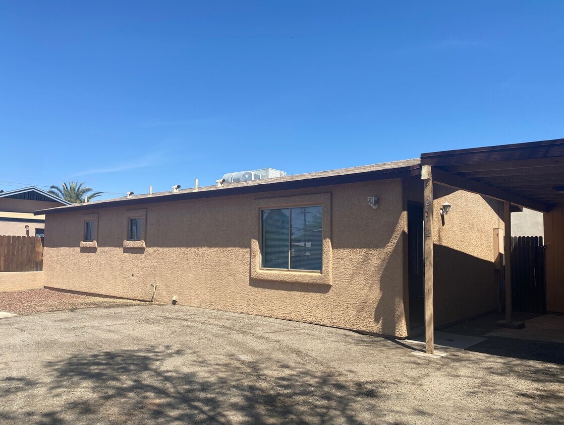
247 S Cherry Ave
Tucson, AZ 85719
Favorites
-
Bedrooms
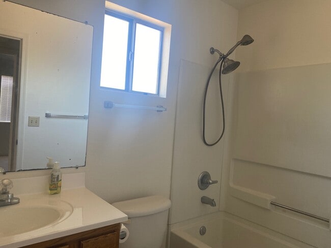
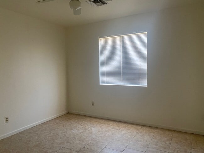
2
-
Bathrooms
2
-
Square Feet
860 sq ft
-
Available
Available Now
Highlights
- Pets Allowed
- Yard
- Security System
247 S Cherry Ave

Favorites
About This Home
12 Month Lease,
$1,550 deposit,
Available Now
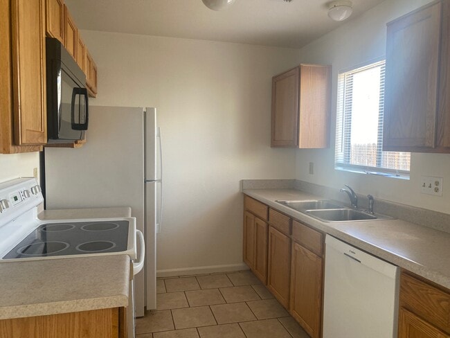
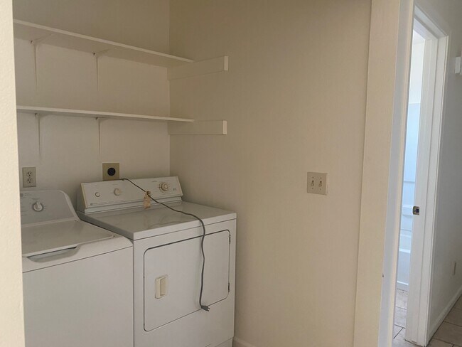
2 bedroom/2 bath home with one car carport and storage shed. Recently updated, this home has tile throughout, fresh interior paint, new blinds and a home alarm. Small yard. Pets upon owner approval.
247 S Cherry Ave is a house located in Pima County and the 85719 ZIP Code. This area is served by the Tucson Unified District attendance zone.
* Price shown is total price based on community-supplied monthly required fees. Excludes user-selected optional fees and variable or usage-based fees and required charges due at or prior to move-in or at move-out. Price, availability, fees, and any applicable rent special are subject to change without notice.
* Square footage definitions vary. Displayed square footage is approximate.
House Features
Washer/Dryer
Ceiling Fans
Security System
Heating
- Washer/Dryer
- Heating
- Ceiling Fans
- Security System
- Yard
Fees and Policies
The fees listed below are community-provided and may exclude utilities or add-ons. All payments are made directly to the property and are non-refundable unless otherwise specified.
- Dogs Allowed
-
Fees not specified
- Cats Allowed
-
Fees not specified
- Parking
-
Covered--
Contact
- Contact
Location
Get Directions
Located within 10 minutes of downtown Tucson, the Barrio San Antonio neighborhood offers adobe-style homes and an established neighborhood where the same residents live for decades. On the weekend, the more adventurous head to the Barrio BMX trails for some breathtaking rides, while others enjoy walking around the trails at San Antonio Park.
In the evenings, locals enjoy authentic Mexican food at Maico Restaurant. Ask for an order of Papa Tacos or chow down on an order of super nachos. After moving to a Barrio San Antonio rental, you'll find it easy to get around the neighborhood or city with the numerous bus stops in the area and its close proximity to Interstate 10.
Learn more about living in Barrio San Antonio
Education
| Colleges & Universities | Distance | ||
|---|---|---|---|
| Colleges & Universities | Distance | ||
| Drive: | 5 min | 2.0 mi | |
| Drive: | 7 min | 2.7 mi | |
| Drive: | 8 min | 2.9 mi | |
| Drive: | 14 min | 5.4 mi |
247 S Cherry Ave is within 5 minutes or 2.0 miles from University of Arizona. It is also near Pima C.C., Downtown Campus and Pima C.C., Community Campus.
Schools


Public Elementary School
Grades PK-5
246 Students
Attendance Zone
Public Elementary & Middle School
Grades PK-8
285 Students
Attendance Zone
Public Middle & High School
Grades 6-12
2,932 Students
Attendance Zone
Public Middle School
Grades 6-8
792 Students
Attendance Zone
Private Elementary School
Grades PK-5
75 Students
Nearby
Private Elementary, Middle & High School
Grades K-12
Nearby
School data provided by
 The GreatSchools Rating helps parents compare schools within a state based on a variety of school quality indicators and provides a helpful picture of how effectively each school serves all of its students. Ratings are on a scale of 1 (below average) to 10 (above average) and can include test scores, college readiness, academic progress, advanced courses, equity, discipline and attendance data. We also advise parents to visit schools, consider other information on school performance and programs, and consider family needs as part of the school selection process.
View GreatSchools Rating Methodology
Data provided by GreatSchools.org © 2026. All rights reserved.
View GreatSchools Rating Methodology
Data provided by GreatSchools.org © 2026. All rights reserved.
Transportation options available in Tucson include Sl/Congress/4Th Av (Se), located 1.2 miles from 247 S Cherry Ave. 247 S Cherry Ave is near Tucson International, located 7.7 miles or 16 minutes away.
| Transit / Subway | Distance | ||
|---|---|---|---|
| Transit / Subway | Distance | ||
| Drive: | 3 min | 1.2 mi | |
| Drive: | 4 min | 1.4 mi | |
| Drive: | 4 min | 1.5 mi | |
| Drive: | 5 min | 1.6 mi | |
| Drive: | 5 min | 1.7 mi |
| Commuter Rail | Distance | ||
|---|---|---|---|
| Commuter Rail | Distance | ||
|
|
Drive: | 4 min | 1.4 mi |
| Airports | Distance | ||
|---|---|---|---|
| Airports | Distance | ||
|
Tucson International
|
Drive: | 16 min | 7.7 mi |
Getting Around
 What do Walkability, Transit, Drivability, and Bikeability mean?
Walkability measures the walking distance to day-to-day needs.
Transit measures access to public transportation.
Drivability measures congestion, parking availability, and access to major roads.
Bikeability measures the suitability for cycling.
How It Works
What do Walkability, Transit, Drivability, and Bikeability mean?
Walkability measures the walking distance to day-to-day needs.
Transit measures access to public transportation.
Drivability measures congestion, parking availability, and access to major roads.
Bikeability measures the suitability for cycling.
How It Works
Moderately Walkable
Walkability
60
/ 100
Some Public Transit
Transit
40
/ 100
Moderately Drivable
Drivability
70
/ 100
Exceptionally Bikeable
Bikeability
90
/ 100
Scores provided by
Active
Soundscore™
72
/ 100
Traffic
ActiveAirport
CalmBusinesses
ActiveScores provided by
HowLoud What is a Sound Score Rating? A Sound Score Rating aggregates noise caused by vehicle traffic, airplane traffic and local sources. How It WorksTime and distance from 247 S Cherry Ave.
| Shopping Centers | Distance | ||
|---|---|---|---|
| Shopping Centers | Distance | ||
| Walk: | 6 min | 0.3 mi | |
| Walk: | 6 min | 0.3 mi | |
| Walk: | 10 min | 0.5 mi |
247 S Cherry Ave has 3 shopping centers within 0.5 mile, which is about a 10-minute walk. The miles and minutes will be for the farthest away property.
| Parks and Recreation | Distance | ||
|---|---|---|---|
| Parks and Recreation | Distance | ||
|
Iron Horse Park
|
Drive: | 3 min | 1.1 mi |
|
Flandrau: University of Arizona Science Center
|
Drive: | 3 min | 1.4 mi |
|
University of Arizona Mineral Museum
|
Drive: | 4 min | 1.4 mi |
|
Steward Observatory
|
Drive: | 4 min | 1.4 mi |
|
University of Arizona Campus Arboretum
|
Drive: | 5 min | 1.8 mi |
247 S Cherry Ave has 5 parks within 1.8 miles, including Flandrau: University of Arizona Science Center, Iron Horse Park, and University of Arizona Mineral Museum.
| Hospitals | Distance | ||
|---|---|---|---|
| Hospitals | Distance | ||
| Drive: | 4 min | 1.9 mi | |
| Drive: | 8 min | 3.4 mi | |
| Drive: | 8 min | 4.0 mi |
247 S Cherry Ave has 3 hospitals within 4.0 miles, the nearest is Banner - University Medical Center Tucson Campus which is 1.9 miles away and a 4 minute drive.
| Military Bases | Distance | ||
|---|---|---|---|
| Military Bases | Distance | ||
| Drive: | 16 min | 7.1 mi | |
| Drive: | 17 min | 10.1 mi | |
| Drive: | 87 min | 73.2 mi |
247 S Cherry Ave has 3 military bases within 73.2 miles, the nearest is Tucson Airport Air Guard Station which is 7.1 miles away and a 16 minute drive.
Amenities
- Washer/Dryer
- Heating
- Ceiling Fans
- Security System
- Yard
247 S Cherry Ave Photos

247 S Cherry Ave
Tucson, AZ 85719