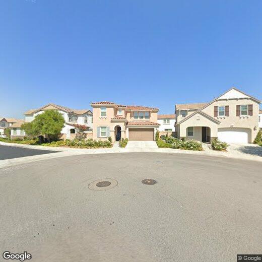
24188 Paseo del Rancho Dr
24188 Paseo del Rancho Dr
Santa Clarita, CA 91354
2 Weeks Ago
|
Edit
Favorites
24188 Paseo del Rancho Dr

Favorites
Check Back Soon for Upcoming Availability
| Beds | Baths | Average SF |
|---|---|---|
| 4 Bedrooms 4 Bedrooms 4 Br | 3 Baths 3 Baths 3 Ba | 2,361 SF |
24188 Paseo del Rancho Dr,
Santa Clarita,
CA
91354
Saugus grants residents a laid-back lifestyle that allows them to take in the natural beauty of the region without the noise and crowds of the big city. Driving around the neighborhood, you can see the vast expanses of open space and sense of historic charm that made this area the site of so many early Western films.
East of Interstate 5, Saugus sits about five miles from Downtown Santa Clarita. The neighborhood’s central location provides easy access to all the amenities of the city while also giving residents a peaceful place to call home. Multiple high-quality school districts and a strong sense of community make Saugus a top choice for numerous families.
Learn more about living in SaugusBelow are rent ranges for similar nearby apartments
Education
| Colleges & Universities | Distance | ||
|---|---|---|---|
| Colleges & Universities | Distance | ||
| Drive: | 13 min | 5.7 mi | |
| Drive: | 25 min | 18.2 mi | |
| Drive: | 32 min | 19.6 mi | |
| Drive: | 42 min | 31.5 mi |
24188 Paseo del Rancho Dr is within 13 minutes or 5.7 miles from College of the Canyons. It is also near Mission College and Cal State Northridge.
Walkability Near 24188 Paseo del Rancho Dr Santa Clarita, CA 91354
Getting Around
 What do Walkability, Transit, Drivability, and Bikeability mean?
Walkability measures the walking distance to day-to-day needs.
Transit measures access to public transportation.
Drivability measures congestion, parking availability, and access to major roads.
Bikeability measures the suitability for cycling.
How It Works
What do Walkability, Transit, Drivability, and Bikeability mean?
Walkability measures the walking distance to day-to-day needs.
Transit measures access to public transportation.
Drivability measures congestion, parking availability, and access to major roads.
Bikeability measures the suitability for cycling.
How It Works
Somewhat Walkable
Walkability
30
/ 100
Minimal Public Transit
Transit
10
/ 100
Exceptionally Drivable
Drivability
90
/ 100
Fairly Bikeable
Bikeability
40
/ 100
Scores provided by
-
Soundscore™
-
/ 100
Traffic
-Airport
-Businesses
-Scores provided by
HowLoud What is a Sound Score Rating? A Sound Score Rating aggregates noise caused by vehicle traffic, airplane traffic and local sources. How It WorksYou May Also Like
Similar Rentals Nearby
-
-

-

-

-

-

-
-

-

-
 5 Beds, 4 Baths, 3,084 sq ft$5,000Total Monthly PriceTotal Monthly Price NewPrices include all required monthly fees.27016 Island Rd


What Are Walk Score®, Transit Score®, and Bike Score® Ratings?
Walk Score® measures the walkability of any address. Transit Score® measures access to public transit. Bike Score® measures the bikeability of any address.
What is a Sound Score Rating?
A Sound Score Rating aggregates noise caused by vehicle traffic, airplane traffic and local sources.

24188 Paseo del Rancho Dr
Santa Clarita, CA 91354