

$2,795 / Month
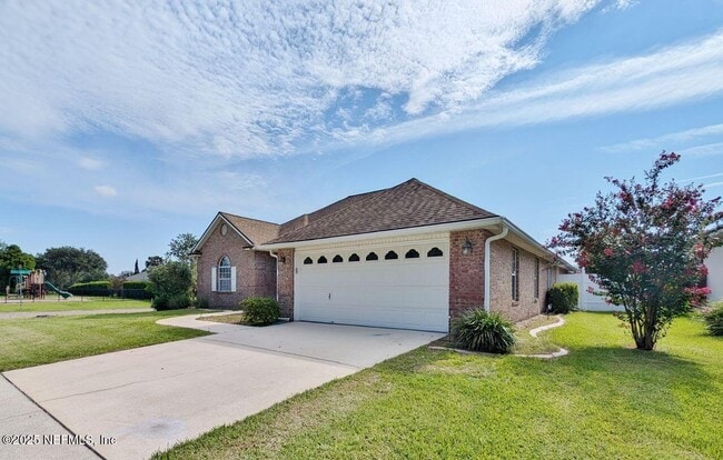
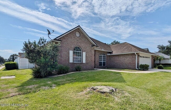
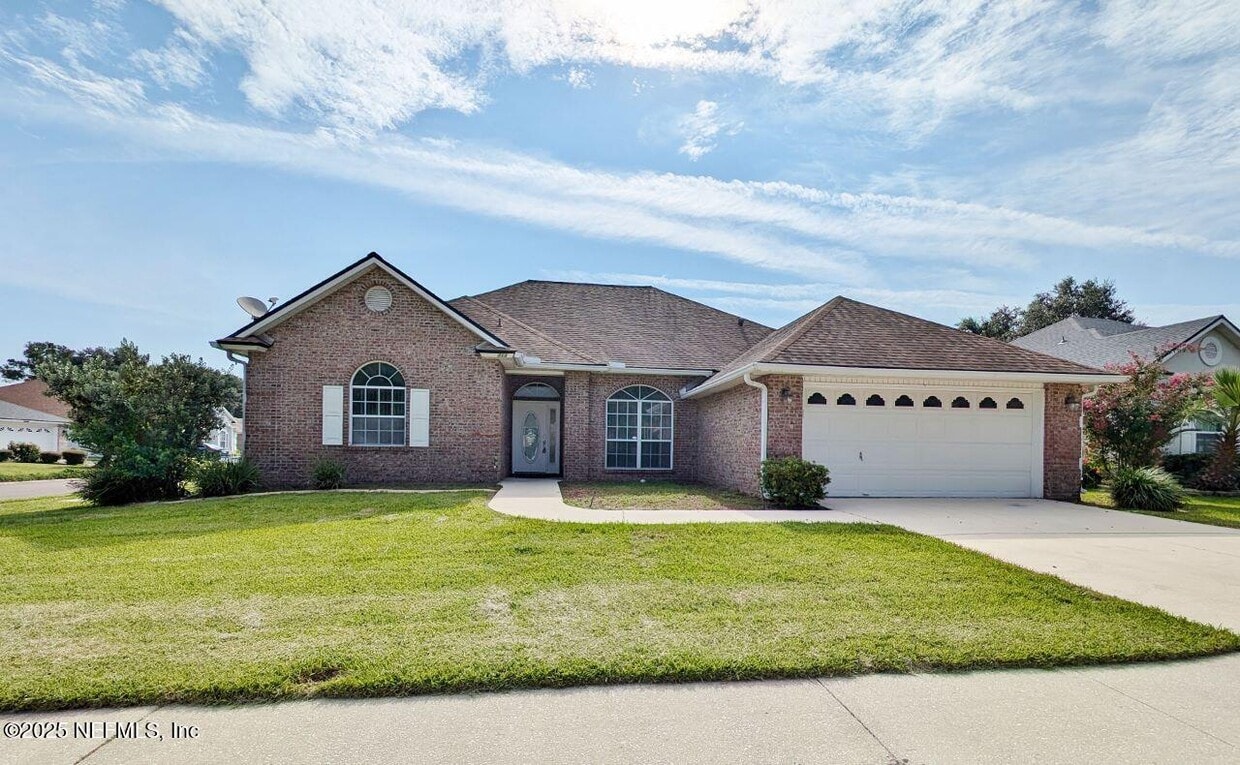
2413 Cedar Trace Dr W
Jacksonville, FL 32246
Today
Favorites
904-536-2349
-
Bedrooms
4
-
Bathrooms
2
-
Square Feet
2,233 sq ft
-
Available
Available Oct 1
Highlights
- Traditional Architecture
- Screened Porch
- Split Bedroom Floorplan
- Eat-In Kitchen
- Walk-In Closet
- Community Playground
2413 Cedar Trace Dr W

Favorites
About This Home
$2,795 deposit,
Available Oct 1
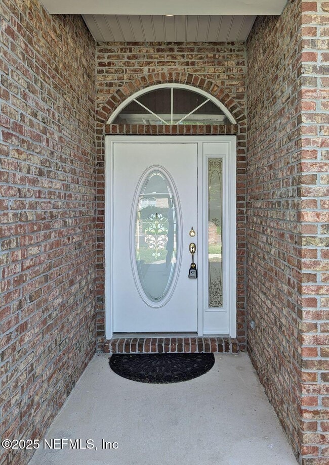
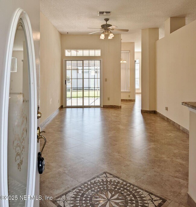
Beautiful designer 4/2 brick home on corner lot in prestigious Windsor Chase close to school,highways,beaches and naval base. Large open floor plan with gourmet kitchen and island. Granite counter tops and two pantrys. Separate family room with lots of natural light and den for extra living area. Split floor plan with master suite boasting upgraded walk in shower and double vanities. House is completley tiled throughout with double set of sliders open into large screened in lanai for relaxing in secluded completely fenced in yard with vinyl fencing. Washer and dryer included in the rent and house is across from neighborhood playground and community also has gorgeous pool overlooking man made lake with covered gazebo. You wont be disappointed in this gorgeous home minutes from everything!
2413 Cedar Trace Dr W is a house located in Duval County and the 32246 ZIP Code. This area is served by the Duval County Public Schools attendance zone.
* Price shown is base rent and may not include non-optional fees and utilities.
Price, availability, fees, and any applicable rent special are subject to change without notice.
* Square footage definitions vary. Displayed square footage is approximate.
Home Details
Home Type
Single Family Detached Home
Year Built
Built in 2001
Accessible Home Design
Entry on the 1st floor
Bedrooms and Bathrooms
Bathtub and Shower Combination in Primary Bathroom
Split Bedroom Floorplan
Walk-In Closet
2 Full Bathrooms
4 Bedrooms
Home Design
Traditional Architecture
Interior Spaces
Screened Porch
Entrance Foyer
Ceiling Fan
2,233 Sq Ft Home
1-Story Property
Kitchen
Eat-In Kitchen
Kitchen Island
Ice Maker
Disposal
Laundry
Dryer
Laundry in unit
Washer
Listing and Financial Details
12 Months Lease Term
Assessor Parcel Number 1652868065
Tenant pays for all utilities, grounds care
Lot Details
9,148 Sq Ft Lot
West Facing Home
Vinyl Fence
Back Yard Fenced
Parking
2 Car Garage
Garage Door Opener
Schools
Kernan Trail Elementary School
Kernan Middle School
Utilities
Central Air
Heating Available
Electric Water Heater
Community Details
Overview
On-Site Maintenance
Property has a Home Owners Association
Windsor Chase Subdivision
Pet Policy
Dogs Allowed
Limit on the number of pets
Pet Size Limit
Recreation
Community Playground
Contact
- Listed by KATRIN J RABREN | INI Realty
- Phone Number
- Contact
-
Source
Northeast Florida Multiple Listing Service, Inc.
Copyright 2025 realMLS. All rights reserved. Information is deemed reliable but not guaranteed.
Location
Get Directions
Development on the Sandalwood neighborhood began in the spring of 1960. Designed to provide inhabitants with the ideal balance of work and play, Sandalwood sits approximately half way between Jacksonville city center and its nearest beach, which lies roughly six miles east of the neighborhood.
Developer Pearce-Uible's primary Sandalwood concept contained 500 houses. To give the neighborhood an exotic ambiance, Sandalwood's original streets were all named after Pacific Islands. Mindanao Drive, Hawaii Drive East, and Kusai Drive are three of those original roadways. Two more streets, Majuro Drive and Luana Drive, were added to the neighborhood in 1969.
Nearly half the houses in the modern Sandalwood neighborhood are quite new. The original 1960s properties reside in the northern half of the area, whereas newer houses extend to the southern part of the neighborhood. Several educational establishments call the area home, including Sandalwood High School, established in 1971.
Learn more about living in Sandalwood
Education
| Colleges & Universities | Distance | ||
|---|---|---|---|
| Colleges & Universities | Distance | ||
| Drive: | 7 min | 3.9 mi | |
| Drive: | 21 min | 11.0 mi | |
| Drive: | 21 min | 11.8 mi | |
| Drive: | 24 min | 12.7 mi |
2413 Cedar Trace Dr W is within 7 minutes or 3.9 miles from University of North Florida. It is also near Jacksonville University and Florida Coastal School of Law.
Schools


Public Elementary School
Grades K-5
646 Students
Attendance Zone
Public Middle School
Grades 6-8
1,136 Students
Attendance Zone
Public High School
Grades 9-12
2,771 Students
Attendance Zone
Private Elementary, Middle & High School
Grades PK-11
254 Students
Nearby
Private Elementary, Middle & High School
Grades 5-12
56 Students
Nearby
School data provided by
 The GreatSchools Rating helps parents compare schools within a state based on a variety of school quality indicators and provides a helpful picture of how effectively each school serves all of its students. Ratings are on a scale of 1 (below average) to 10 (above average) and can include test scores, college readiness, academic progress, advanced courses, equity, discipline and attendance data. We also advise parents to visit schools, consider other information on school performance and programs, and consider family needs as part of the school selection process.
View GreatSchools Rating Methodology
Data provided by GreatSchools.org © 2025. All rights reserved.
View GreatSchools Rating Methodology
Data provided by GreatSchools.org © 2025. All rights reserved.
Transportation options available in Jacksonville include Kings Ave Station, located 11.9 miles from 2413 Cedar Trace Dr W. 2413 Cedar Trace Dr W is near Jacksonville International, located 22.1 miles or 34 minutes away.
| Transit / Subway | Distance | ||
|---|---|---|---|
| Transit / Subway | Distance | ||
| Drive: | 23 min | 11.9 mi | |
|
|
Drive: | 24 min | 12.0 mi |
|
|
Drive: | 24 min | 12.4 mi |
| Commuter Rail | Distance | ||
|---|---|---|---|
| Commuter Rail | Distance | ||
|
|
Drive: | 32 min | 18.3 mi |
| Airports | Distance | ||
|---|---|---|---|
| Airports | Distance | ||
|
Jacksonville International
|
Drive: | 34 min | 22.1 mi |
Time and distance from 2413 Cedar Trace Dr W.
| Shopping Centers | Distance | ||
|---|---|---|---|
| Shopping Centers | Distance | ||
| Drive: | 4 min | 1.3 mi | |
| Drive: | 4 min | 1.4 mi | |
| Drive: | 4 min | 1.5 mi |
2413 Cedar Trace Dr W has 3 shopping centers within 1.5 miles, which is about a 4-minute drive. The miles and minutes will be for the farthest away property.
| Parks and Recreation | Distance | ||
|---|---|---|---|
| Parks and Recreation | Distance | ||
|
Beach and Peach Park
|
Drive: | 11 min | 5.3 mi |
|
Castaway Island Preserve
|
Drive: | 11 min | 5.5 mi |
|
Ed Austin Regional Park
|
Drive: | 11 min | 5.9 mi |
|
Touchton Road Park
|
Drive: | 13 min | 6.5 mi |
|
Jacksonville Arboretum and Gardens
|
Drive: | 14 min | 8.0 mi |
2413 Cedar Trace Dr W has 5 parks within 8.0 miles, including Beach and Peach Park, Castaway Island Preserve, and Ed Austin Regional Park.
| Hospitals | Distance | ||
|---|---|---|---|
| Hospitals | Distance | ||
| Drive: | 12 min | 6.0 mi | |
| Drive: | 15 min | 7.5 mi | |
| Drive: | 17 min | 7.7 mi |
2413 Cedar Trace Dr W has 3 hospitals within 7.7 miles, the nearest is Mayo Clinic Florida which is 6.0 miles away and a 12 minute drive.
| Military Bases | Distance | ||
|---|---|---|---|
| Military Bases | Distance | ||
| Drive: | 19 min | 10.7 mi | |
| Drive: | 37 min | 26.2 mi |
2413 Cedar Trace Dr W is 10.7 miles from Mayport Naval Air Station, and is convenient to other military bases, including Jacksonville Naval Air Station.
You May Also Like
Similar Rentals Nearby


What Are Walk Score®, Transit Score®, and Bike Score® Ratings?
Walk Score® measures the walkability of any address. Transit Score® measures access to public transit. Bike Score® measures the bikeability of any address.
What is a Sound Score Rating?
A Sound Score Rating aggregates noise caused by vehicle traffic, airplane traffic and local sources
2413 Cedar Trace Dr W
Jacksonville, FL 32246