$1,195
/ Month
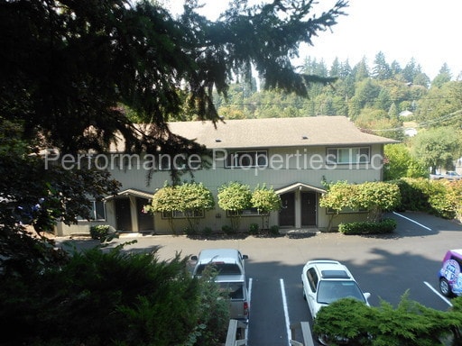
236 Pearl St
Oregon City, OR 97045
2 Weeks Ago
|
Edit
Favorites
236 Pearl St

Favorites
Check Back Soon for Upcoming Availability
| Beds | Baths | Average SF |
|---|---|---|
| 2 Bedrooms 2 Bedrooms 2 Br | 1 Bath 1 Bath 1 Ba | 900 SF |
Fees and Policies
The fees below are based on community-supplied data and may exclude additional fees and utilities.
- Dogs Allowed
-
No fees required
- Cats Allowed
-
No fees required
About This Property
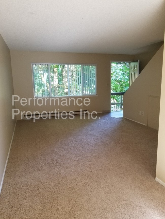
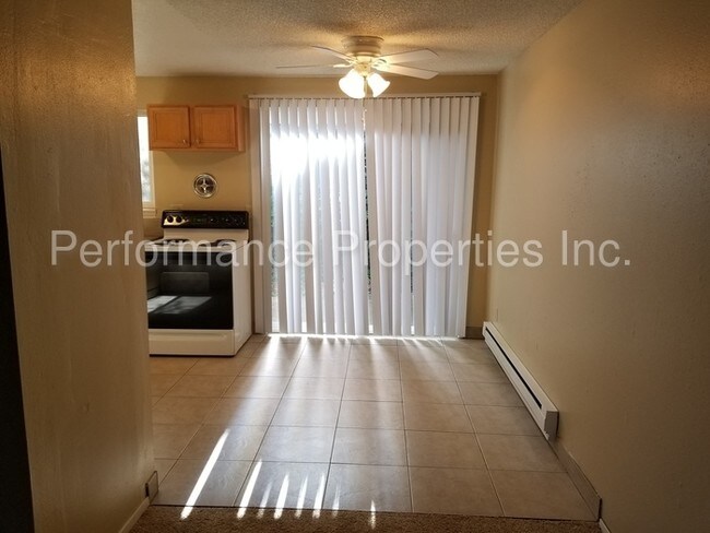
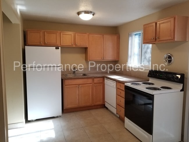
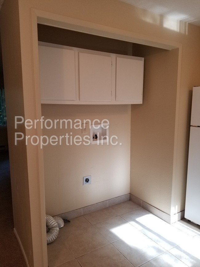
FOR MORE INFORMATION OR TO SCHEDULE A VIEWING, PLEASE CALL 503-444-8875 OR EMAIL LEASING1@PPIRENTALS.COM Website: http://ppirentals.com/ Application Form: http://ppirentals.com/applicants/ Vacant Properties: http://ppirentals.com/vacancies/ Available 7/14/17. 2 Bedroom/1.5 bath, 900 sq. ft. Townhouse just off Molalla Ave. in Oregon City on a quiet street. This bright unit has lots of windows providing natural light. The main level includes the updated kitchen and sliding doors that lead to a private patio. Also on the main level find the living room, dining area, half bath and laundry area with washer/dryer. Both roomy bedrooms are located upstairs with the updated bath. Pets ok with additional deposit. Utility co-payment of $50.00 per month for water/sewer and garbage. Assigned off street parking. Upper level parking spot is available for an additional $20.00 per month. One year lease required. Photos may be of a similar unit. Schools: Candy Lane/Jennings Lodge Elementary, Gardiner Middle and Oregon City High. PPI~Portland's Professional Property Management Experts! Directions: Linn Ave.; East on Pearl/From Molalla Ave. West on Pearl Information deemed reliable but not guaranteed. ES 7/10 Rental Terms: Rent: $1,195, Application Fee: $50, Security Deposit: $1,195, Available 7/14/17 Pet Policy: Cats allowed, Small dogs allowed Contact us to schedule a showing.
236 Pearl St is a townhome located in Clackamas County and the 97045 ZIP Code.
Location
Get Directions
Located just under two miles south of downtown Oregon City, Barclay Hills lies near the Trails End Highway. Residents who rent an apartment along Molalla Avenue have plenty of access to shopping areas and restaurants, from Loncheria Mitzil Mexican Eatery to New China. Locals enjoy exploring the wooded areas around Newell Creek, which runs through the neighborhood, or hanging out in Singer Creek Park. Running and hiking trails thread the 18-acre area, which features fruit orchards and a disk golf course.
For a little more action, make your way north to the downtown area, where you can walk along the Willamette River or dine at one of the many eateries overlooking the water, such as McMenamins or the Verdict Bar and Grill.
Learn more about living in Barclay HillsBelow are rent ranges for similar nearby apartments
Expenses
One-Time
Cat Fee
$0
Dog Fee
$0
Education
| Colleges & Universities | Distance | ||
|---|---|---|---|
| Colleges & Universities | Distance | ||
| Drive: | 7 min | 3.0 mi | |
| Drive: | 13 min | 7.1 mi | |
| Drive: | 22 min | 9.6 mi | |
| Drive: | 24 min | 15.5 mi |
236 Pearl St is within 7 minutes or 3.0 miles from Clackamas C.C., Oregon City. It is also near Clackamas C.C., Harmony Campus and Lewis & Clark College.
Transportation options available in Oregon City include Se Park Ave Max Station, located 6.6 miles from 236 Pearl St. 236 Pearl St is near Portland International, located 19.5 miles or 31 minutes away.
| Transit / Subway | Distance | ||
|---|---|---|---|
| Transit / Subway | Distance | ||
| Drive: | 12 min | 6.6 mi | |
|
|
Drive: | 14 min | 7.5 mi |
| Drive: | 15 min | 7.6 mi | |
|
|
Drive: | 15 min | 8.9 mi |
| Drive: | 18 min | 9.0 mi |
| Commuter Rail | Distance | ||
|---|---|---|---|
| Commuter Rail | Distance | ||
|
|
Drive: | 5 min | 1.7 mi |
|
|
Drive: | 18 min | 11.5 mi |
|
|
Drive: | 24 min | 15.8 mi |
|
|
Drive: | 25 min | 15.9 mi |
|
|
Drive: | 26 min | 17.0 mi |
| Airports | Distance | ||
|---|---|---|---|
| Airports | Distance | ||
|
Portland International
|
Drive: | 31 min | 19.5 mi |
Time and distance from 236 Pearl St.
| Shopping Centers | Distance | ||
|---|---|---|---|
| Shopping Centers | Distance | ||
| Drive: | 4 min | 1.4 mi | |
| Drive: | 3 min | 1.5 mi | |
| Drive: | 4 min | 1.7 mi |
236 Pearl St has 3 shopping centers within 1.7 miles, which is about a 4-minute drive. The miles and minutes will be for the farthest away property.
| Parks and Recreation | Distance | ||
|---|---|---|---|
| Parks and Recreation | Distance | ||
|
McLoughlin House
|
Walk: | 16 min | 0.9 mi |
|
John Inskeep Environmental Learning Center
|
Drive: | 6 min | 2.6 mi |
|
Haggart Observatory
|
Drive: | 6 min | 2.6 mi |
|
Mary S. Young State Recreation Area
|
Drive: | 9 min | 3.6 mi |
|
Luscher Farm
|
Drive: | 17 min | 6.4 mi |
236 Pearl St has 5 parks within 6.4 miles, including McLoughlin House, John Inskeep Environmental Learning Center, and Haggart Observatory.
| Hospitals | Distance | ||
|---|---|---|---|
| Hospitals | Distance | ||
| Walk: | 19 min | 1.0 mi | |
| Drive: | 12 min | 7.1 mi | |
| Drive: | 16 min | 8.3 mi |
236 Pearl St has 3 hospitals within 8.3 miles, the nearest is Providence Willamette Falls Medical Center which is 1.0 miles away and a 19 minute walk.
| Military Bases | Distance | ||
|---|---|---|---|
| Military Bases | Distance | ||
| Drive: | 31 min | 18.8 mi | |
| Drive: | 55 min | 33.4 mi |
236 Pearl St is 18.8 miles from Portland Airport Air Guard Station, and is convenient to other military bases, including Camp Bonneville Military Reservation.
You May Also Like
Similar Rentals Nearby


What Are Walk Score®, Transit Score®, and Bike Score® Ratings?
Walk Score® measures the walkability of any address. Transit Score® measures access to public transit. Bike Score® measures the bikeability of any address.
What is a Sound Score Rating?
A Sound Score Rating aggregates noise caused by vehicle traffic, airplane traffic and local sources

236 Pearl St
Oregon City, OR 97045