

$3,400
/ Month
2315 Astoria Blvd
Long Island City, NY 11102
2 Weeks Ago
|
Edit
Favorites
2315 Astoria Blvd

Favorites
Check Back Soon for Upcoming Availability
| Beds | Baths | Average SF |
|---|---|---|
| 1 Bedroom 1 Bedroom 1 Br | 1 Bath 1 Bath 1 Ba | 1,000 SF |
About This Property
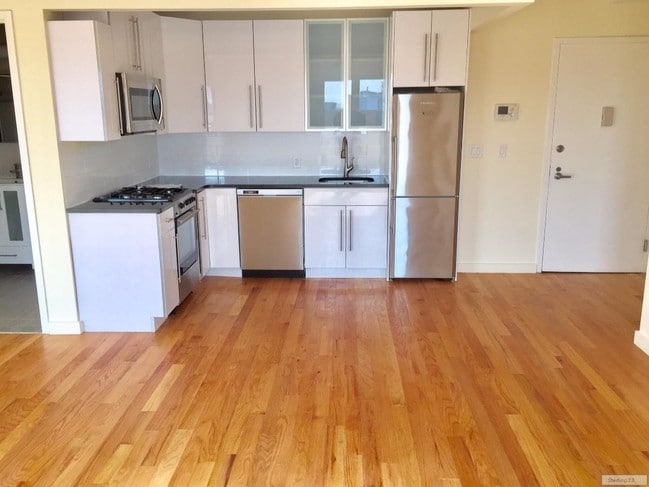
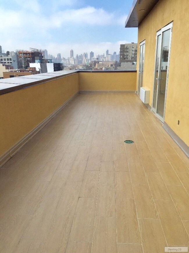
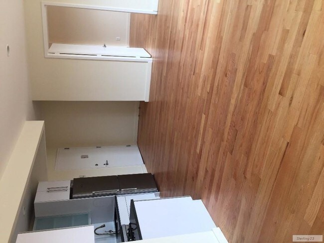
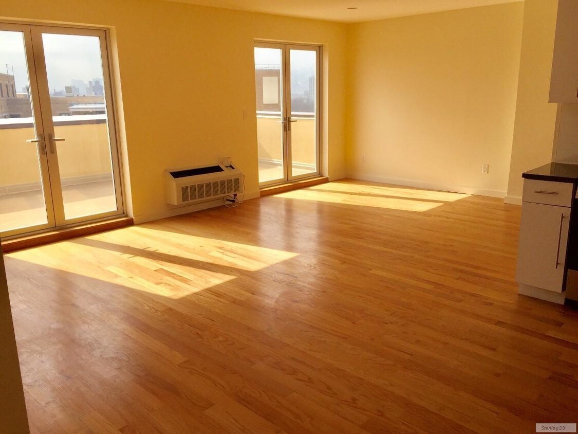
1000 sq ft**NO BROKER FEE**Breathtaking views of Manhattan and Triboro bridgeOpen kitchen with all modern appliances/dishwasherHeated floors in the bathroomAmple closet spaceFloor-to-ceiling well insulated windowsBedroom easily fits a king size bedBike storage, laundry room, package room, common furnished rooftopSmall dogs allowedGreat location: 4 min walk to NQ on Astoria blvdContact Anna 347-559-9285 Sterling1764
2315 Astoria Blvd is a condo located in Queens County and the 11102 ZIP Code. This area is served by the New York City Geographic District #30 attendance zone.
2315 Astoria Blvd,
Long Island City,
NY
11102
Hunters Point sits on the south end of Long Island City in New York City's Queens borough. The small waterfront neighborhood also houses a historic district with row homes from the 19th century. The neighborhood attracts new residents due to its convenient location and beautiful waterfront properties. Views from Hunters Point overlook the East River into downtown Manhattan and several high-rise apartment buildings provide panoramic views of the river and city. The fantastic view of the New York City skyline is a major calling card for the area.
Those who work in Manhattan while living in Hunters Point enjoy a relatively short commute distance of only 6.4 miles, averaging 24 minutes one way. Many major roadways can be found in and around the neighborhood, as well as access to several metro lines in and out of Manhattan and surrounding boroughs.
Learn more about living in Hunters PointBelow are rent ranges for similar nearby apartments
Education
| Colleges & Universities | Distance | ||
|---|---|---|---|
| Colleges & Universities | Distance | ||
| Walk: | 12 min | 0.6 mi | |
| Drive: | 6 min | 2.7 mi | |
| Drive: | 7 min | 2.8 mi | |
| Drive: | 7 min | 3.1 mi |
2315 Astoria Blvd is within 12 minutes or 0.6 mile from LaGuardia Community College. It is also near Weill Cornell Medical College and Marymount Manhattan College.
Schools


Public Elementary & Middle School
Grades PK-8
559 Students
Nearby
Public Elementary & Middle School
Grades PK-8
800 Students
Attendance Zone
Public High School
Grades 9-12
1,628 Students
Attendance Zone
Private Elementary, Middle & High School
Grades PK-12
437 Students
Nearby
School data provided by
 The GreatSchools Rating helps parents compare schools within a state based on a variety of school quality indicators and provides a helpful picture of how effectively each school serves all of its students. Ratings are on a scale of 1 (below average) to 10 (above average) and can include test scores, college readiness, academic progress, advanced courses, equity, discipline and attendance data. We also advise parents to visit schools, consider other information on school performance and programs, and consider family needs as part of the school selection process.
View GreatSchools Rating Methodology
Data provided by GreatSchools.org © 2026. All rights reserved.
View GreatSchools Rating Methodology
Data provided by GreatSchools.org © 2026. All rights reserved.
Transportation options available in Long Island City include Queens Plaza, located 0.2 mile from 2315 Astoria Blvd. 2315 Astoria Blvd is near LaGuardia, located 5.5 miles or 12 minutes away, and John F Kennedy International, located 14.8 miles or 22 minutes away.
| Transit / Subway | Distance | ||
|---|---|---|---|
| Transit / Subway | Distance | ||
|
|
Walk: | 4 min | 0.2 mi |
|
|
Walk: | 6 min | 0.3 mi |
|
|
Walk: | 6 min | 0.3 mi |
|
|
Walk: | 8 min | 0.4 mi |
| Drive: | 7 min | 3.5 mi |
| Commuter Rail | Distance | ||
|---|---|---|---|
| Commuter Rail | Distance | ||
|
|
Walk: | 17 min | 0.9 mi |
|
|
Drive: | 4 min | 1.4 mi |
|
|
Drive: | 4 min | 2.2 mi |
|
|
Drive: | 7 min | 3.0 mi |
|
|
Drive: | 8 min | 3.3 mi |
| Airports | Distance | ||
|---|---|---|---|
| Airports | Distance | ||
|
LaGuardia
|
Drive: | 12 min | 5.5 mi |
|
John F Kennedy International
|
Drive: | 22 min | 14.8 mi |
Walkability Near 2315 Astoria Blvd Long Island City, NY 11102
Getting Around
 What do Walkability, Transit, Drivability, and Bikeability mean?
Walkability measures the walking distance to day-to-day needs.
Transit measures access to public transportation.
Drivability measures congestion, parking availability, and access to major roads.
Bikeability measures the suitability for cycling.
How It Works
What do Walkability, Transit, Drivability, and Bikeability mean?
Walkability measures the walking distance to day-to-day needs.
Transit measures access to public transportation.
Drivability measures congestion, parking availability, and access to major roads.
Bikeability measures the suitability for cycling.
How It Works
Exceptionally Walkable
Walkability
100
/ 100
Exceptional Public Transit
Transit
100
/ 100
Fairly Drivable
Drivability
50
/ 100
Moderately Bikeable
Bikeability
60
/ 100
Scores provided by
-
Soundscore™
-
/ 100
Traffic
-Airport
-Businesses
-Scores provided by
HowLoud What is a Sound Score Rating? A Sound Score Rating aggregates noise caused by vehicle traffic, airplane traffic and local sources. How It WorksTime and distance from 2315 Astoria Blvd.
| Shopping Centers | Distance | ||
|---|---|---|---|
| Shopping Centers | Distance | ||
| Drive: | 5 min | 2.1 mi | |
| Drive: | 5 min | 2.2 mi | |
| Drive: | 7 min | 2.2 mi |
2315 Astoria Blvd has 3 shopping centers within 2.2 miles, which is about a 7-minute drive. The miles and minutes will be for the farthest away property.
| Parks and Recreation | Distance | ||
|---|---|---|---|
| Parks and Recreation | Distance | ||
|
Queensbridge Park
|
Walk: | 13 min | 0.7 mi |
|
Gantry Plaza State Park
|
Drive: | 4 min | 1.3 mi |
|
Socrates Sculpture Park
|
Drive: | 5 min | 1.9 mi |
|
St. Catherine's Park
|
Drive: | 6 min | 2.5 mi |
|
John Jay Park
|
Drive: | 8 min | 3.5 mi |
2315 Astoria Blvd has 5 parks within 3.5 miles, including Queensbridge Park, Gantry Plaza State Park, and Socrates Sculpture Park.
| Hospitals | Distance | ||
|---|---|---|---|
| Hospitals | Distance | ||
| Drive: | 6 min | 2.7 mi | |
| Drive: | 6 min | 2.8 mi | |
| Drive: | 8 min | 3.2 mi |
2315 Astoria Blvd has 3 hospitals within 3.2 miles, the nearest is New York - Presbyterian Hospital which is 2.7 miles away and a 6 minute drive.
| Military Bases | Distance | ||
|---|---|---|---|
| Military Bases | Distance | ||
| Drive: | 20 min | 9.1 mi | |
| Drive: | 22 min | 11.1 mi |
2315 Astoria Blvd is 9.1 miles from Governors Island Support Center, and is convenient to other military bases, including Fort Totten US Govt Reservation.
You May Also Like
Similar Rentals Nearby


What Are Walk Score®, Transit Score®, and Bike Score® Ratings?
Walk Score® measures the walkability of any address. Transit Score® measures access to public transit. Bike Score® measures the bikeability of any address.
What is a Sound Score Rating?
A Sound Score Rating aggregates noise caused by vehicle traffic, airplane traffic and local sources.
2315 Astoria Blvd
Long Island City, NY 11102