-
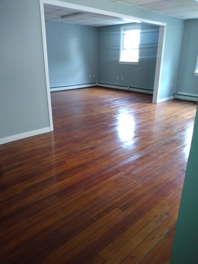
living room/dining room
$3,200
Total Monthly Price
23 Narragansett Ave Unit 2nd floor
Jamestown, RI 02835
Favorites
23 Narragansett Ave Unit 2nd floor

Favorites
Check Back Soon for Upcoming Availability
| Beds | Baths | Average SF |
|---|---|---|
| 3 Bedrooms 3 Bedrooms 3 Br | 1 Bath 1 Bath 1 Ba | 1,700 SF |
Fees and Policies
The fees listed below are community-provided and may exclude utilities or add-ons. All payments are made directly to the property and are non-refundable unless otherwise specified.
- Parking
-
Other--
Details
Property Information
-
4 units
About This Property
Yearly rental, beautiful hard wood floors, very clean, walk to ocean/beach restaurants, shops. Spacious and beautiful. Call for appt.
23 Narragansett Ave is an apartment community located in Newport County and the 02835 ZIP Code.
Apartment Features
- Dishwasher
- Hardwood Floors
23 Narragansett Ave,
Jamestown,
RI
02835
Amenities
- Dishwasher
- Hardwood Floors
Education
| Colleges & Universities | Distance | ||
|---|---|---|---|
| Colleges & Universities | Distance | ||
| Drive: | 11 min | 5.6 mi | |
| Drive: | 15 min | 6.7 mi | |
| Drive: | 16 min | 8.8 mi | |
| Drive: | 26 min | 14.3 mi |
23 Narragansett Ave Unit 2nd floor is within 15 minutes or 6.7 miles from Salve Regina University. It is also near C.C. of Rhode Island, Newport and Rhode Island, Narragansett.
Walkability Near 23 Narragansett Ave Jamestown, RI 02835
Getting Around
 What do Walkability, Transit, Drivability, and Bikeability mean?
Walkability measures the walking distance to day-to-day needs.
Transit measures access to public transportation.
Drivability measures congestion, parking availability, and access to major roads.
Bikeability measures the suitability for cycling.
How It Works
What do Walkability, Transit, Drivability, and Bikeability mean?
Walkability measures the walking distance to day-to-day needs.
Transit measures access to public transportation.
Drivability measures congestion, parking availability, and access to major roads.
Bikeability measures the suitability for cycling.
How It Works
Somewhat Walkable
Walkability
30
/ 100
Limited Public Transit
Transit
30
/ 100
Exceptionally Drivable
Drivability
100
/ 100
Fairly Bikeable
Bikeability
50
/ 100
Scores provided by
-
Soundscore™
-
/ 100
Traffic
-Airport
-Businesses
-Scores provided by
HowLoud What is a Sound Score Rating? A Sound Score Rating aggregates noise caused by vehicle traffic, airplane traffic and local sources. How It WorksYou May Also Like
Similar Rentals Nearby
-
-
-
-
-
-
-
Plus Fees3 Beds$2,995
-
Plus Fees3 Beds$2,800+
-
Plus Fees3 Beds$2,666+
-


What Are Walk Score®, Transit Score®, and Bike Score® Ratings?
Walk Score® measures the walkability of any address. Transit Score® measures access to public transit. Bike Score® measures the bikeability of any address.
What is a Sound Score Rating?
A Sound Score Rating aggregates noise caused by vehicle traffic, airplane traffic and local sources.

23 Narragansett Ave
Jamestown, RI 02835