
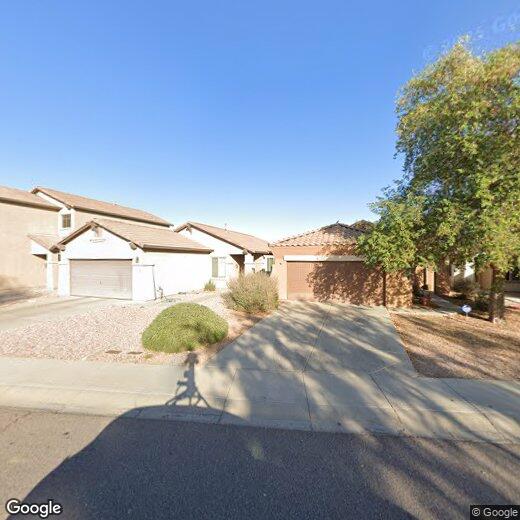
229 N 110th St
229 N 110th St
Apache Junction, AZ 85120
Favorites
229 N 110th St

Favorites
Check Back Soon for Upcoming Availability
| Beds | Baths | Average SF |
|---|---|---|
| 3 Bedrooms 3 Bedrooms 3 Br | 2 Baths 2 Baths 2 Ba | — |
229 N 110th St,
Apache Junction,
AZ
85120
Sitting at the base of the Superstition Mountains about 35 miles east of Downtown Phoenix, Apache Junction carries a distinctly Western identity that sets it apart from the sprawling suburbs closer to the city core. The area's roots trace back to the legend of Jacob Waltz, a prospector who claimed to have discovered a hidden gold mine in the Superstition Mountains in the late 1800s — a story that still draws curiosity seekers and shapes the city's character today. Apache Junction spans roughly 46 square miles and maintains a small-town pace that feels a world away from the metro bustle, even while remaining connected via the Superstition Freeway.
The rental landscape here leans toward single-story apartment communities, manufactured home parks, and townhome-style units, giving renters more space and a quieter setting than denser urban areas.
Learn more about living in Apache Junction
Education
| Colleges & Universities | Distance | ||
|---|---|---|---|
| Colleges & Universities | Distance | ||
| Drive: | 12 min | 6.4 mi | |
| Drive: | 16 min | 9.7 mi | |
| Drive: | 22 min | 13.3 mi | |
| Drive: | 22 min | 13.7 mi |
229 N 110th St is within 12 minutes or 6.4 miles from Mesa C.C., Red Mountain Campus. It is also near A.T. Still Univ. AZ and Chandler-Gilbert C.C., Mesa.
Walkability Near 229 N 110th St Apache Junction, AZ 85120
Getting Around
 What do Walkability, Transit, Drivability, and Bikeability mean?
Walkability measures the walking distance to day-to-day needs.
Transit measures access to public transportation.
Drivability measures congestion, parking availability, and access to major roads.
Bikeability measures the suitability for cycling.
How It Works
What do Walkability, Transit, Drivability, and Bikeability mean?
Walkability measures the walking distance to day-to-day needs.
Transit measures access to public transportation.
Drivability measures congestion, parking availability, and access to major roads.
Bikeability measures the suitability for cycling.
How It Works
Somewhat Walkable
Walkability
30
/ 100
Exceptionally Drivable
Drivability
90
/ 100
Fairly Bikeable
Bikeability
50
/ 100
Scores provided by
-
Soundscore™
-
/ 100
Traffic
-Airport
-Businesses
-Scores provided by
HowLoud What is a Sound Score Rating? A Sound Score Rating aggregates noise caused by vehicle traffic, airplane traffic and local sources. How It WorksYou May Also Like
Similar Rentals Nearby
-
-
-
-
-
-
3 Beds$2,740+Total Monthly Price12 Month LeaseTotal Monthly Price NewPrices include base rent and required monthly fees of $264. Variable costs based on usage may apply.Base Rent:3 Beds$2,475+Specials
Pets Allowed Fitness Center Dishwasher In Unit Washer & Dryer Stainless Steel Appliances Gated Yard
-
-
-
-
1 / 5


What Are Walk Score®, Transit Score®, and Bike Score® Ratings?
Walk Score® measures the walkability of any address. Transit Score® measures access to public transit. Bike Score® measures the bikeability of any address.
What is a Sound Score Rating?
A Sound Score Rating aggregates noise caused by vehicle traffic, airplane traffic and local sources.
229 N 110th St
Apache Junction, AZ 85120