

$3,100 / Month
2275 Bennington Ln
Hayward, CA 94545
Today
Favorites
510-489-4150
-
Bedrooms
3
-
Bathrooms
2.5
-
Square Feet
1,107 sq ft
-
Available
Available Jul 18
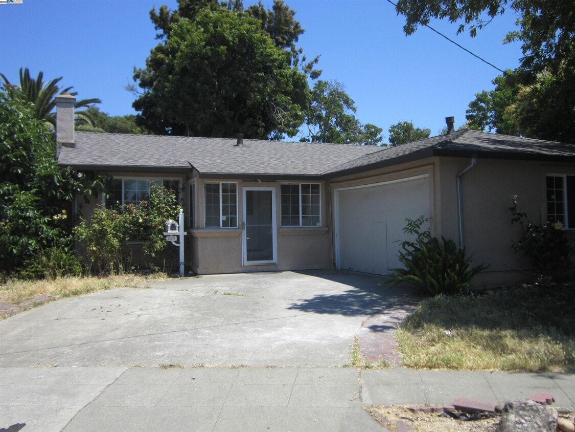
2275 Bennington Ln

Favorites
About This Home
Available Jul 18
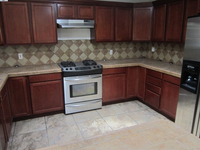
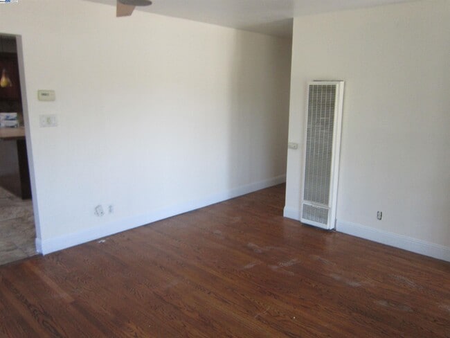
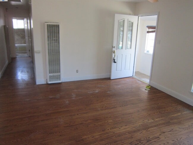
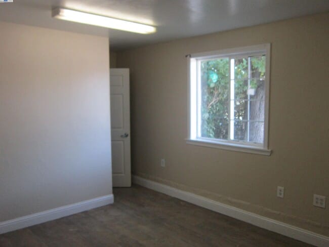
This home is very close to Chabot College. It has 3 -4 bedrooms,2.5 bathrooms,a new roof with sun tunnels,hardwood floors,an updated kitchen with granite countertops and a gas stove,and a covered patio. The garage is presently converted to a 4th bedroom and a half bath. We have our own application with no charge to apply Apply with RentSpree
2275 Bennington Ln is a house located in Alameda County and the 94545 ZIP Code. This area is served by the Hayward Unified attendance zone.
* Price shown is base rent and may not include non-optional fees and utilities.
Price, availability, fees, and any applicable rent special are subject to change without notice.
* Square footage definitions vary. Displayed square footage is approximate.
Contact
- Listed by John Miller | Miller Service Real Estate
- Phone Number
- Contact
-
Source
 Bay East Association of REALTORS ®
Copyright© 2025 Bay East, Contra Costa, bridgeMLS. All rights reserved. All information provided by the listing agent/broker is deemed reliable but is not guaranteed and should be independently verified.
Location
Get Directions
The name Mount Eden is a slight misnomer as this Bay Area neighborhood is not a mountainside enclave. However, this beautiful neighborhood does boast an excellent central location. Mount Eden is about four miles southwest of Downtown Hayward and is convenient to several shopping hubs including Southland Mall. Along with housing several neighborhood parks, Mount Eden is just a short drive away from Hayward Regional Shoreline, Eden Landing Ecological Reserve, and Coyote Hills Regional Park. Mount Eden is also home to Chabot College. This conveniently located neighborhood has single-family houses and apartments available for rent. Interstate 880 and Highway 92 nearby allow residents to travel across the Bay Area with ease.
Learn more about living in Mt Eden
Education
| Colleges & Universities | Distance | ||
|---|---|---|---|
| Colleges & Universities | Distance | ||
| Walk: | 12 min | 0.6 mi | |
| Drive: | 9 min | 4.1 mi | |
| Drive: | 16 min | 11.8 mi | |
| Drive: | 23 min | 14.4 mi |
2275 Bennington Ln is within 12 minutes or 0.6 mile from Chabot College. It is also near Cal State East Bay and Ohlone College, Newark.
Schools


Public Elementary School
Grades K-6
481 Students
Attendance Zone
Charter Elementary School
Grades K-5
483 Students
Nearby
Public Middle School
Grades 7-8
407 Students
Attendance Zone
Public High School
Grades 9-12
1,947 Students
Attendance Zone
Private Elementary School
Grades PK-5
92 Students
Nearby
Private Elementary, Middle & High School
Grades K-12
Nearby
Private Elementary School
Grades PK-3
18 Students
Nearby
School data provided by
 The GreatSchools Rating helps parents compare schools within a state based on a variety of school quality indicators and provides a helpful picture of how effectively each school serves all of its students. Ratings are on a scale of 1 (below average) to 10 (above average) and can include test scores, college readiness, academic progress, advanced courses, equity, discipline and attendance data. We also advise parents to visit schools, consider other information on school performance and programs, and consider family needs as part of the school selection process.
View GreatSchools Rating Methodology
Data provided by GreatSchools.org © 2025. All rights reserved.
View GreatSchools Rating Methodology
Data provided by GreatSchools.org © 2025. All rights reserved.
Transportation options available in Hayward include South Hayward Station, located 3.5 miles from 2275 Bennington Ln. 2275 Bennington Ln is near Metro Oakland International, located 12.1 miles or 17 minutes away, and San Francisco International, located 20.2 miles or 27 minutes away.
| Transit / Subway | Distance | ||
|---|---|---|---|
| Transit / Subway | Distance | ||
|
|
Drive: | 8 min | 3.5 mi |
|
|
Drive: | 8 min | 3.5 mi |
|
|
Drive: | 11 min | 5.9 mi |
|
|
Drive: | 10 min | 6.0 mi |
|
|
Drive: | 14 min | 8.0 mi |
| Commuter Rail | Distance | ||
|---|---|---|---|
| Commuter Rail | Distance | ||
| Drive: | 7 min | 3.9 mi | |
|
|
Drive: | 7 min | 3.9 mi |
| Drive: | 14 min | 9.1 mi | |
| Drive: | 15 min | 9.3 mi | |
| Drive: | 28 min | 18.2 mi |
| Airports | Distance | ||
|---|---|---|---|
| Airports | Distance | ||
|
Metro Oakland International
|
Drive: | 17 min | 12.1 mi |
|
San Francisco International
|
Drive: | 27 min | 20.2 mi |
Time and distance from 2275 Bennington Ln.
| Shopping Centers | Distance | ||
|---|---|---|---|
| Shopping Centers | Distance | ||
| Walk: | 11 min | 0.6 mi | |
| Walk: | 13 min | 0.7 mi | |
| Walk: | 16 min | 0.9 mi |
2275 Bennington Ln has 3 shopping centers within 0.9 mile, which is about a 16-minute walk. The miles and minutes will be for the farthest away property.
| Parks and Recreation | Distance | ||
|---|---|---|---|
| Parks and Recreation | Distance | ||
|
Hayward Shoreline Interpretive Center
|
Drive: | 7 min | 2.3 mi |
|
Sulphur Creek Nature Center
|
Drive: | 11 min | 4.6 mi |
|
Coyote Hills Regional Park
|
Drive: | 12 min | 5.4 mi |
|
Don Castro Regional Recreation Area
|
Drive: | 11 min | 5.5 mi |
|
Hayward Regional Shoreline
|
Drive: | 15 min | 6.3 mi |
2275 Bennington Ln has 5 parks within 6.3 miles, including Hayward Shoreline Interpretive Center, Sulphur Creek Nature Center, and Coyote Hills Regional Park.
| Hospitals | Distance | ||
|---|---|---|---|
| Hospitals | Distance | ||
| Drive: | 5 min | 1.6 mi | |
| Drive: | 11 min | 6.9 mi | |
| Drive: | 12 min | 8.4 mi |
2275 Bennington Ln has 3 hospitals within 8.4 miles, the nearest is St. Rose Hospital which is 1.6 miles away and a 5 minute drive.
| Military Bases | Distance | ||
|---|---|---|---|
| Military Bases | Distance | ||
| Drive: | 29 min | 19.5 mi | |
| Drive: | 36 min | 25.2 mi |
2275 Bennington Ln is 19.5 miles from Alameda/US Naval Air Station Alameda, and is convenient to other military bases, including Ames Research Center.
You May Also Like
Similar Rentals Nearby


What Are Walk Score®, Transit Score®, and Bike Score® Ratings?
Walk Score® measures the walkability of any address. Transit Score® measures access to public transit. Bike Score® measures the bikeability of any address.
What is a Sound Score Rating?
A Sound Score Rating aggregates noise caused by vehicle traffic, airplane traffic and local sources
2275 Bennington Ln
Hayward, CA 94545