

$1,500
/ Month
2235 S Lambert St
Philadelphia, PA 19145
Today
|
Edit
Favorites
215-813-9744
-
Bedrooms
3
-
Bathrooms
1
-
Square Feet
1,250 sq ft
-
Available
Available Dec 1
2235 S Lambert St

Favorites
About This Home
$3,000 deposit,
Available Dec 1
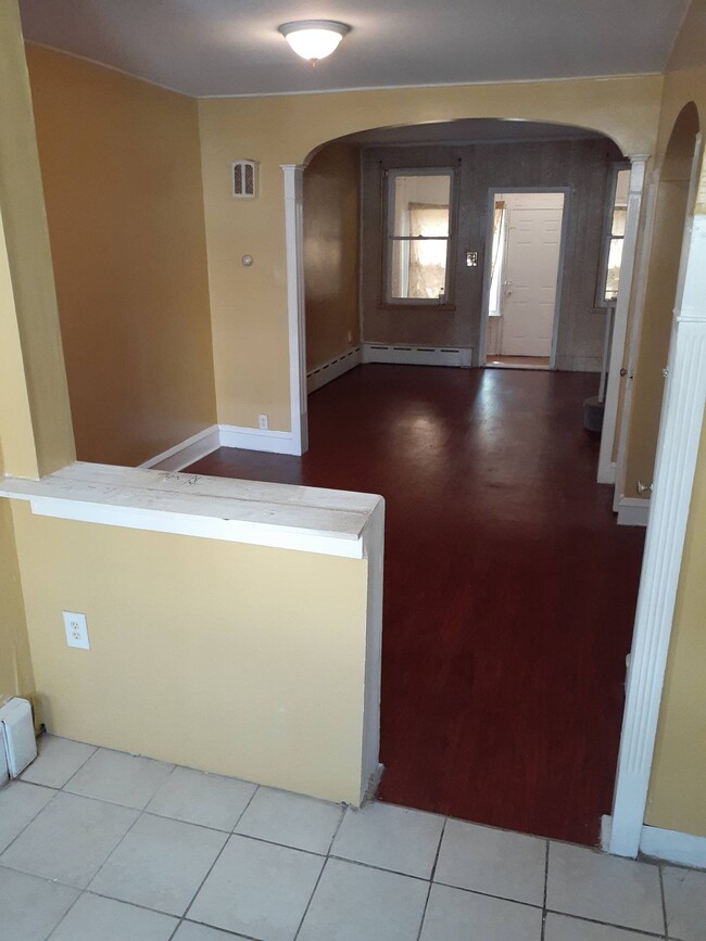
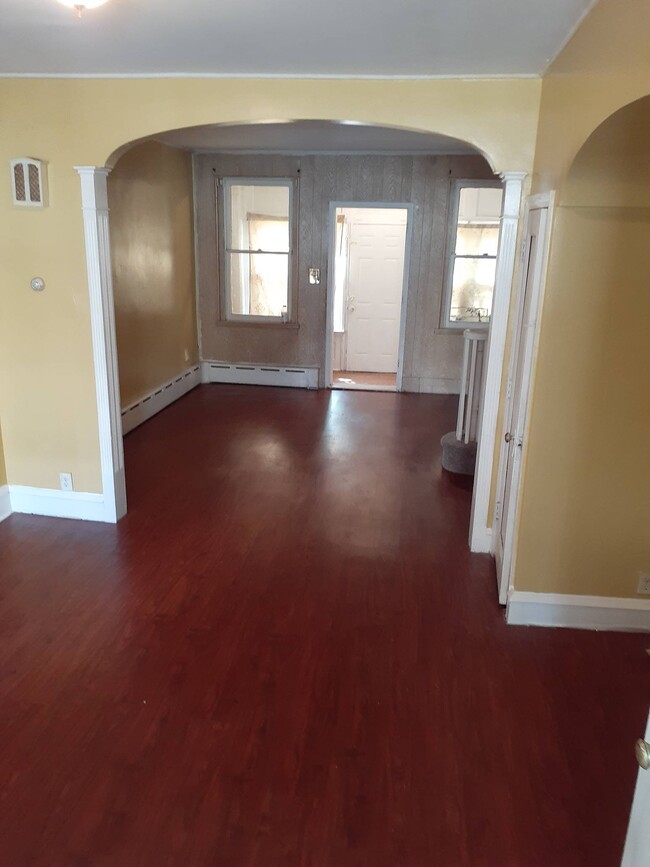
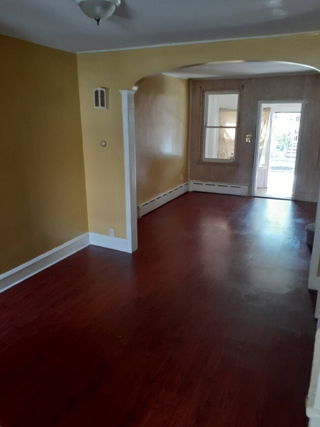
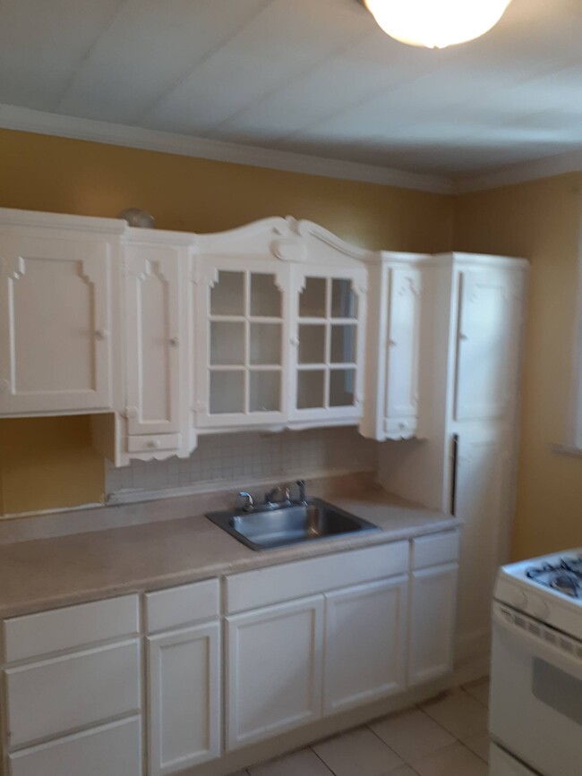
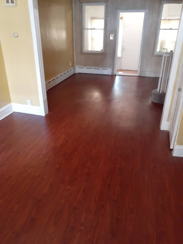
Property Newly renovated with a finished basment. Nice area to live or rise a family Newly renovated in a very nice area
2235 S Lambert St is a house located in Philadelphia County and the 19145 ZIP Code. This area is served by the The School District of Philadelphia attendance zone.
* Price shown is base rent. Excludes user-selected optional fees and variable or usage-based fees and required charges due at or prior to move-in or at move-out. Price, availability, fees, and any applicable rent special are subject to change without notice.
* Square footage definitions vary. Displayed square footage is approximate.
Fees and Policies
The fees below are based on community-supplied data and may exclude additional fees and utilities.
- One-Time Basics
- Due at Move-In
- Security Deposit - Refundable$3,000
- Due at Move-In
Property Fee Disclaimer: Based on community-supplied data and independent market research. Subject to change without notice. May exclude fees for mandatory or optional services and usage-based utilities.
House Features
- Washer/Dryer Hookup
- Range
- Hardwood Floors
Contact
- Listed by IDS. Enterprise, Inc.
- Phone Number
- Contact
Location
Get Directions
Amenities
- Washer/Dryer Hookup
- Range
- Hardwood Floors
If it's cheesesteaks and sports that piqued your interest in Philadelphia, you're looking for the neighborhood of South Philadelphia West. At its southeastern tip, this area borders the Wells Fargo Center and the Lincoln Financial Field, home of the Flyers and Phillies respectively. Located south of Moore Street, between busy Broad St. and the Schuykill River, the area offers a range of densely packed urban shopping districts and a riverfront oasis, all within minutes of Center City.
Bordered by Interstate 76 and 95, South Philly West encompasses several neighborhoods and entertainment hotspots. There’s a little something for everyone here, from the urban amenities of Melrose and South Philly, to FDR Park and the nearby Philadelphia International Airport.
Learn more about living in South Philadelphia West
Education
| Colleges & Universities | Distance | ||
|---|---|---|---|
| Colleges & Universities | Distance | ||
| Drive: | 7 min | 2.6 mi | |
| Drive: | 8 min | 2.9 mi | |
| Drive: | 6 min | 3.0 mi | |
| Drive: | 7 min | 3.2 mi |
2235 S Lambert St is within 7 minutes or 2.6 miles from The Art Inst. of Philadelphia. It is also near Thomas Jefferson University and University of Pennsylvania.
Schools


Public Elementary & Middle School
Grades PK-8
248 Students
Nearby
Charter Elementary & Middle School
Grades 5-8
150 Students
Attendance Zone
Public Elementary School
Grades K-4
293 Students
Attendance Zone
Charter High School
Grades 9-12
546 Students
Attendance Zone
Private Elementary & Middle School
Grades PK-8
565 Students
Nearby
Private Elementary School
Grades PK-K
11 Students
Nearby
Private High School
Grades 9-12
690 Students
Nearby
School data provided by
 The GreatSchools Rating helps parents compare schools within a state based on a variety of school quality indicators and provides a helpful picture of how effectively each school serves all of its students. Ratings are on a scale of 1 (below average) to 10 (above average) and can include test scores, college readiness, academic progress, advanced courses, equity, discipline and attendance data. We also advise parents to visit schools, consider other information on school performance and programs, and consider family needs as part of the school selection process.
View GreatSchools Rating Methodology
Data provided by GreatSchools.org © 2025. All rights reserved.
View GreatSchools Rating Methodology
Data provided by GreatSchools.org © 2025. All rights reserved.
Transportation options available in Philadelphia include Snyder, located 0.6 mile from 2235 S Lambert St. 2235 S Lambert St is near Philadelphia International, located 6.9 miles or 15 minutes away, and Trenton Mercer, located 36.1 miles or 55 minutes away.
| Transit / Subway | Distance | ||
|---|---|---|---|
| Transit / Subway | Distance | ||
|
|
Walk: | 12 min | 0.6 mi |
|
|
Walk: | 18 min | 1.0 mi |
|
|
Walk: | 18 min | 1.0 mi |
|
|
Drive: | 4 min | 1.5 mi |
|
|
Drive: | 4 min | 1.8 mi |
| Commuter Rail | Distance | ||
|---|---|---|---|
| Commuter Rail | Distance | ||
|
|
Drive: | 8 min | 2.7 mi |
| Drive: | 6 min | 2.9 mi | |
|
|
Drive: | 8 min | 3.0 mi |
|
|
Drive: | 7 min | 3.0 mi |
|
|
Drive: | 6 min | 3.5 mi |
| Airports | Distance | ||
|---|---|---|---|
| Airports | Distance | ||
|
Philadelphia International
|
Drive: | 15 min | 6.9 mi |
|
Trenton Mercer
|
Drive: | 55 min | 36.1 mi |
Time and distance from 2235 S Lambert St.
| Shopping Centers | Distance | ||
|---|---|---|---|
| Shopping Centers | Distance | ||
| Walk: | 8 min | 0.5 mi | |
| Walk: | 8 min | 0.5 mi | |
| Walk: | 9 min | 0.5 mi |
2235 S Lambert St has 3 shopping centers within 0.5 mile, which is about a 9-minute walk. The miles and minutes will be for the farthest away property.
| Parks and Recreation | Distance | ||
|---|---|---|---|
| Parks and Recreation | Distance | ||
|
Franklin D. Roosevelt Park
|
Drive: | 7 min | 1.9 mi |
|
Schuylkill River Park
|
Drive: | 7 min | 2.6 mi |
|
Penn Museum
|
Drive: | 6 min | 2.9 mi |
|
University of Pennsylvania Observatory
|
Drive: | 6 min | 3.1 mi |
|
Bartram's Garden
|
Drive: | 8 min | 3.3 mi |
2235 S Lambert St has 5 parks within 3.3 miles, including Franklin D. Roosevelt Park, Schuylkill River Park, and Penn Museum.
| Hospitals | Distance | ||
|---|---|---|---|
| Hospitals | Distance | ||
| Drive: | 8 min | 2.5 mi | |
| Drive: | 9 min | 2.7 mi | |
| Drive: | 8 min | 2.7 mi |
2235 S Lambert St has 3 hospitals within 2.7 miles, the nearest is Pennsylvania Hospital which is 2.5 miles away and a 8 minute drive.
| Military Bases | Distance | ||
|---|---|---|---|
| Military Bases | Distance | ||
| Drive: | 7 min | 3.0 mi |
2235 S Lambert St is 3.0 miles and a 7 minute drive from Philadelphia Naval Busi Center.
You May Also Like
Similar Rentals Nearby


What Are Walk Score®, Transit Score®, and Bike Score® Ratings?
Walk Score® measures the walkability of any address. Transit Score® measures access to public transit. Bike Score® measures the bikeability of any address.
What is a Sound Score Rating?
A Sound Score Rating aggregates noise caused by vehicle traffic, airplane traffic and local sources
2235 S Lambert St
Philadelphia, PA 19145