

$850
Total Monthly Price
2231 Westwood Northern Blvd Unit 4
Cincinnati, OH 45225
Favorites
-
Bedrooms
1
-
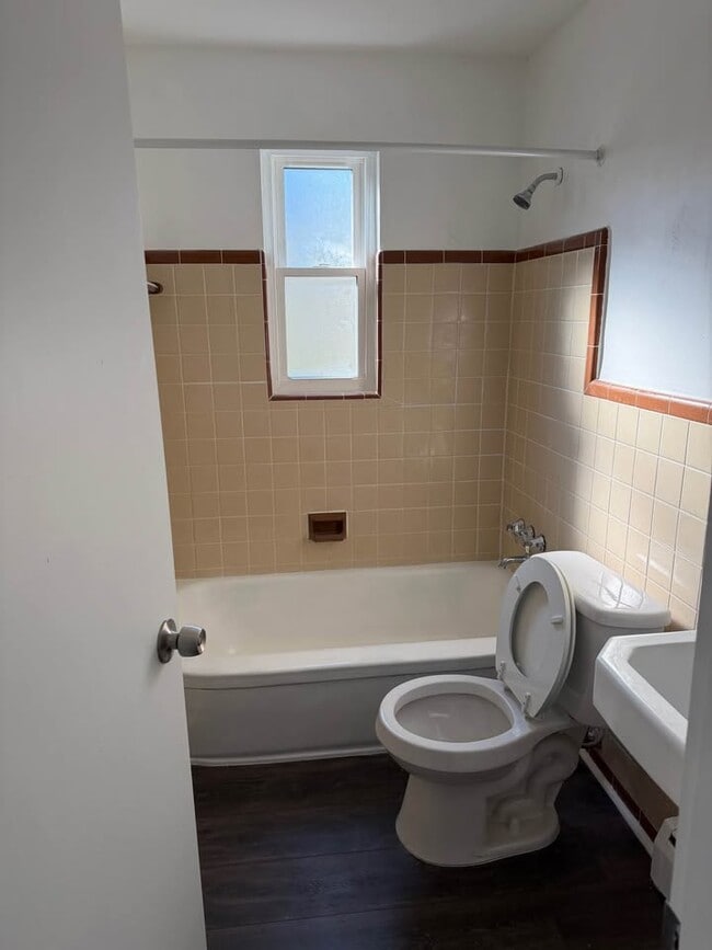
Bathrooms
1
-
Square Feet
500 sq ft
-
Available
Available Now
Highlight
- Smoke Free
2231 Westwood Northern Blvd Unit 4

Favorites
About This Home
12 Month Lease,
$850 deposit,
Available Now
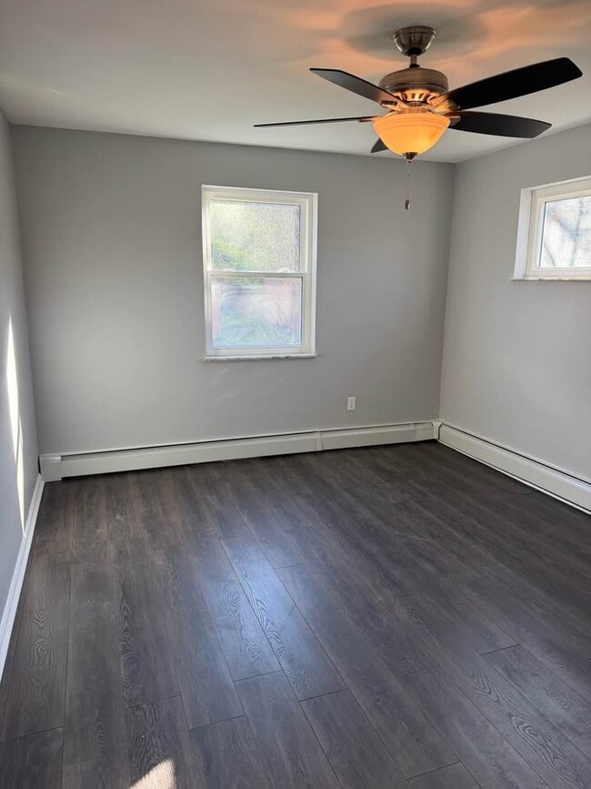
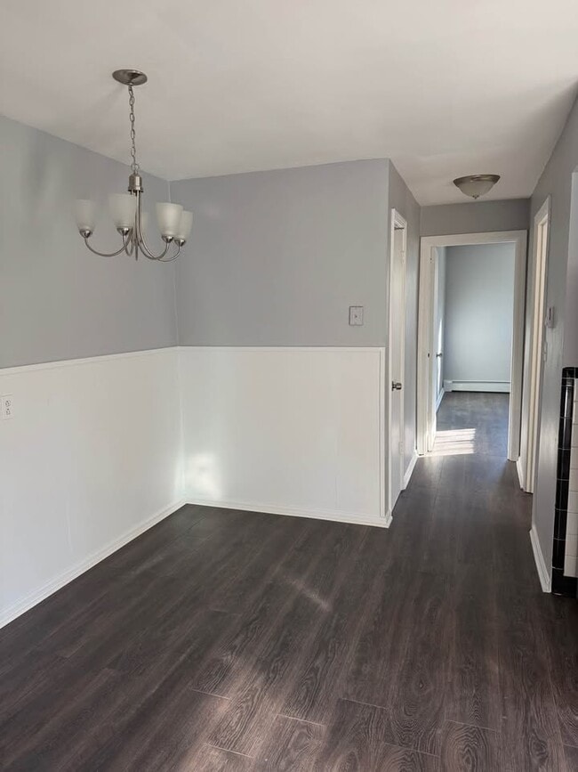
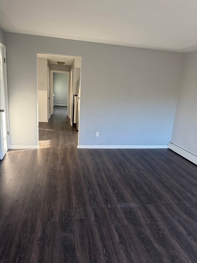
Features updated kitchen with new cabinets, and stainless steel appliances. Fresh paint, new windows, new lighting and all new laminate flooring throughout. Includes heat. $50 water. No pets. No smoking
2231 Westwood Northern Blvd is an apartment community located in Hamilton County and the 45225 ZIP Code. This area is served by the Cincinnati Public Schools attendance zone.
* Price shown is total price based on community-supplied monthly required fees. Excludes user-selected optional fees and variable or usage-based fees and required charges due at or prior to move-in or at move-out. Price, availability, fees, and any applicable rent special are subject to change without notice.
* Square footage definitions vary. Displayed square footage is approximate.
Apartment Features
Refrigerator
Stainless Steel Appliances
Ceiling Fans
Smoke Free
- Heating
- Ceiling Fans
- Smoke Free
- Stainless Steel Appliances
- Kitchen
- Refrigerator
- Laundry Facilities
Fees and Policies
The fees listed below are community-provided and may exclude utilities or add-ons. All payments are made directly to the property and are non-refundable unless otherwise specified.
Details
Utilities Included
-
Heat
Property Information
-
4 units
Contact
- Contact
Location
Get Directions
East Westwood is a small but popular neighborhood roughly six miles northwest of Downtown Cincinnati. It is close to everything you love about the city – the Cincinnati Zoo and Botanical Garden, the University of Cincinnati, and the Duke Energy Convention Center – while still providing a somewhat quieter place to call home. East Westwood is directly south of Interstate 74, making this area popular with commuters. The vast Mt. Airy Forest borders East Westwood on its north end, providing a fantastic back yard filled with hiking trails, a disc golf course, a dog park, the Maple Ridge Lodge, and the Unnewehr House. Single-family homes make up the bulk of the rental scene here, but there’s charm to be found in every listing in East Westwood.
Learn more about living in East Westwood
Education
| Colleges & Universities | Distance | ||
|---|---|---|---|
| Colleges & Universities | Distance | ||
| Drive: | 9 min | 3.3 mi | |
| Drive: | 7 min | 3.6 mi | |
| Drive: | 9 min | 4.0 mi | |
| Drive: | 15 min | 6.1 mi |
2231 Westwood Northern Blvd Unit 4 is within 9 minutes or 3.3 miles from Cincinnati State. It is also near University of Cincinnati and Univ. of Cincinnati, Medical.
Schools


Public Elementary School
Grades PK-5
397 Students
Attendance Zone
Public Elementary, Middle & High School
Grades K-12
1,197 Students
Attendance Zone
Public Middle & High School
Grades 6-12
683 Students
Attendance Zone
Public Middle & High School
Grades 6-12
1,289 Students
Attendance Zone
Private Elementary & Middle School
Grades K-8
161 Students
Nearby
Private Elementary School
Grades PK-5
165 Students
Nearby
Private High School
Grades 9-12
322 Students
Nearby
School data provided by
 The GreatSchools Rating helps parents compare schools within a state based on a variety of school quality indicators and provides a helpful picture of how effectively each school serves all of its students. Ratings are on a scale of 1 (below average) to 10 (above average) and can include test scores, college readiness, academic progress, advanced courses, equity, discipline and attendance data. We also advise parents to visit schools, consider other information on school performance and programs, and consider family needs as part of the school selection process.
View GreatSchools Rating Methodology
Data provided by GreatSchools.org © 2026. All rights reserved.
View GreatSchools Rating Methodology
Data provided by GreatSchools.org © 2026. All rights reserved.
Transportation options available in Cincinnati include Brewery District Station - Elm & Henry, located 4.3 miles from 2231 Westwood Northern Blvd Unit 4. 2231 Westwood Northern Blvd Unit 4 is near Cincinnati/Northern Kentucky International, located 18.3 miles or 33 minutes away.
| Transit / Subway | Distance | ||
|---|---|---|---|
| Transit / Subway | Distance | ||
| Drive: | 9 min | 4.3 mi | |
| Drive: | 9 min | 4.4 mi | |
| Drive: | 9 min | 4.5 mi | |
| Drive: | 10 min | 4.5 mi | |
| Drive: | 10 min | 4.6 mi |
| Commuter Rail | Distance | ||
|---|---|---|---|
| Commuter Rail | Distance | ||
|
|
Drive: | 8 min | 4.3 mi |
| Airports | Distance | ||
|---|---|---|---|
| Airports | Distance | ||
|
Cincinnati/Northern Kentucky International
|
Drive: | 33 min | 18.3 mi |
Getting Around
 What do Walkability, Transit, Drivability, and Bikeability mean?
Walkability measures the walking distance to day-to-day needs.
Transit measures access to public transportation.
Drivability measures congestion, parking availability, and access to major roads.
Bikeability measures the suitability for cycling.
How It Works
What do Walkability, Transit, Drivability, and Bikeability mean?
Walkability measures the walking distance to day-to-day needs.
Transit measures access to public transportation.
Drivability measures congestion, parking availability, and access to major roads.
Bikeability measures the suitability for cycling.
How It Works
Somewhat Walkable
Walkability
30
/ 100
Limited Public Transit
Transit
20
/ 100
Exceptionally Drivable
Drivability
100
/ 100
Fairly Bikeable
Bikeability
40
/ 100
Scores provided by
-
Soundscore™
-
/ 100
Traffic
-Airport
-Businesses
-Scores provided by
HowLoud What is a Sound Score Rating? A Sound Score Rating aggregates noise caused by vehicle traffic, airplane traffic and local sources. How It WorksTime and distance from 2231 Westwood Northern Blvd Unit 4.
| Shopping Centers | Distance | ||
|---|---|---|---|
| Shopping Centers | Distance | ||
| Drive: | 4 min | 2.0 mi | |
| Drive: | 6 min | 2.5 mi | |
| Drive: | 8 min | 3.7 mi |
2231 Westwood Northern Blvd Unit 4 has 3 shopping centers within 3.7 miles, which is about a 8-minute drive. The miles and minutes will be for the farthest away property.
| Parks and Recreation | Distance | ||
|---|---|---|---|
| Parks and Recreation | Distance | ||
|
Mt. Airy Forest
|
Drive: | 6 min | 2.6 mi |
|
Burnet Woods
|
Drive: | 7 min | 3.3 mi |
|
Buttercup Valley
|
Drive: | 9 min | 3.5 mi |
|
Trailside Nature Center
|
Drive: | 8 min | 3.5 mi |
|
Imago Earth Center
|
Drive: | 12 min | 4.9 mi |
2231 Westwood Northern Blvd Unit 4 has 5 parks within 4.9 miles, including Mt. Airy Forest, Buttercup Valley, and Trailside Nature Center.
| Hospitals | Distance | ||
|---|---|---|---|
| Hospitals | Distance | ||
| Drive: | 6 min | 2.8 mi | |
| Drive: | 9 min | 4.1 mi | |
| Drive: | 11 min | 4.6 mi |
2231 Westwood Northern Blvd Unit 4 has 3 hospitals within 4.6 miles, the nearest is Good Samaritan Hospital which is 2.8 miles away and a 6 minute drive.
| Military Bases | Distance | ||
|---|---|---|---|
| Military Bases | Distance | ||
| Drive: | 71 min | 54.0 mi | |
| Drive: | 77 min | 59.0 mi | |
| Drive: | 80 min | 62.3 mi |
2231 Westwood Northern Blvd Unit 4 has 3 military bases within 62.3 miles, the nearest is Gentile Air Force Station which is 54.0 miles away and a 71 minute drive.
Amenities
- Heating
- Ceiling Fans
- Smoke Free
- Stainless Steel Appliances
- Kitchen
- Refrigerator
- Laundry Facilities
2231 Westwood Northern Blvd Unit 4 Photos
What Are Walk Score®, Transit Score®, and Bike Score® Ratings?
Walk Score® measures the walkability of any address. Transit Score® measures access to public transit. Bike Score® measures the bikeability of any address.
What is a Sound Score Rating?
A Sound Score Rating aggregates noise caused by vehicle traffic, airplane traffic and local sources.
2231 Westwood Northern Blvd
Cincinnati, OH 45225