
$5,000 / Month
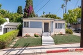
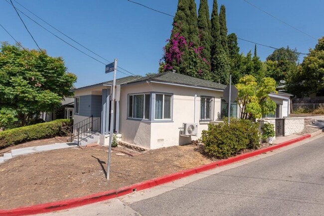
2231 India St
Los Angeles, CA 90039
2 Weeks Ago
Favorites
2231 India St

Favorites
Check Back Soon for Upcoming Availability
| Beds | Baths | Average SF |
|---|---|---|
| 3 Bedrooms 3 Bedrooms 3 Br | 2 Baths 2 Baths 2 Ba | 1,400 SF |
About This Property
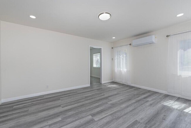
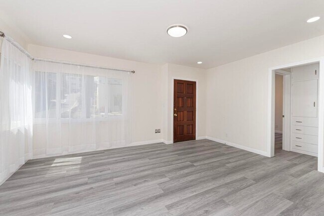
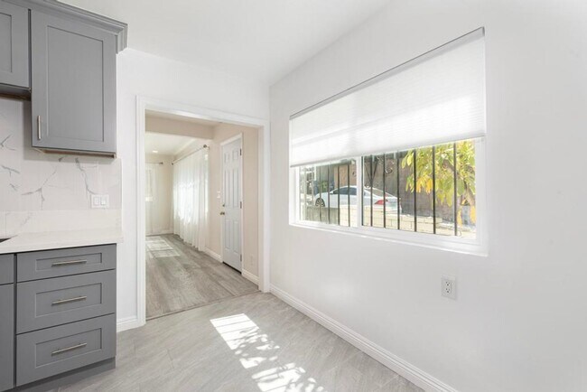
Newly remodeled 3bd 2ba home in Silverlake just up the street from Whole Foods. Great layout with separate living room and family room, remodeled kitchen, laundry room and private primary suite. Split system AC units. No use of garage but can park in driveway. Great location, just up the hill from Whole Foods, Red Lion Tavern, Griffith Park and all that Silverlake, Atwater and Frogtown have to offer. Easy access to 2 and 5 freeways. Pet security deposit depends with your pets paw score ( pet screening ) Pet fee $50 for first pet, $35 for second. Owner pays water, tenant pays electricity, gas, trash. available immediately.
2231 India St is a house located in Los Angeles County and the 90039 ZIP Code. This area is served by the Los Angeles Unified attendance zone.
Location
Get Directions
A large sector of the city, Northeast Los Angeles encompasses neighborhoods like Echo Park and Highland Park. This expansive LA area offers rentals for every type of renter and every budget. Abundant apartments, houses, condos, and townhomes can be found in Northeast Los Angeles, ranging from affordable to upscale. Residents of this area can enjoy the great outdoors at locales like Ernest E. Debs Regional Park, Hermon Park, Rio De Los Angeles State Park, and Elysian Park. Although Northeast LA offers an escape from big-city living, residents can easily travel into downtown for work or leisure. Amenities and attractions like Dodger Stadium, Los Angeles State Historic Park, and Chinatown are all within reach of this sprawling district.
Learn more about living in Northeast Los AngelesBelow are rent ranges for similar nearby apartments
Education
| Colleges & Universities | Distance | ||
|---|---|---|---|
| Colleges & Universities | Distance | ||
| Drive: | 7 min | 3.4 mi | |
| Drive: | 8 min | 3.8 mi | |
| Drive: | 9 min | 4.1 mi | |
| Drive: | 9 min | 4.4 mi |
2231 India St is within 7 minutes or 3.4 miles from City College. It is also near Occidental College and Southwestern Law School.
Schools


Charter Elementary School
Grades K-5
75 Students
Nearby
Public Elementary School
Grades K-6
310 Students
Attendance Zone
Public Middle School
Grades 6-8
695 Students
Attendance Zone
Charter High School
Grades 9-12
205 Students
Attendance Zone
Private Elementary, Middle & High School
Grades PK-12
163 Students
Nearby
Private Elementary, Middle & High School
Grades K-12
Nearby
Private Elementary & Middle School
Grades K-8
115 Students
Nearby
Private Elementary & Middle School
Grades 1-9
11 Students
Nearby
School data provided by
 The GreatSchools Rating helps parents compare schools within a state based on a variety of school quality indicators and provides a helpful picture of how effectively each school serves all of its students. Ratings are on a scale of 1 (below average) to 10 (above average) and can include test scores, college readiness, academic progress, advanced courses, equity, discipline and attendance data. We also advise parents to visit schools, consider other information on school performance and programs, and consider family needs as part of the school selection process.
View GreatSchools Rating Methodology
Data provided by GreatSchools.org © 2025. All rights reserved.
View GreatSchools Rating Methodology
Data provided by GreatSchools.org © 2025. All rights reserved.
Transportation options available in Los Angeles include Vermont / Sunset Station, located 3.0 miles from 2231 India St. 2231 India St is near Bob Hope, located 12.2 miles or 18 minutes away, and Los Angeles International, located 18.7 miles or 32 minutes away.
| Transit / Subway | Distance | ||
|---|---|---|---|
| Transit / Subway | Distance | ||
| Drive: | 6 min | 3.0 mi | |
| Drive: | 7 min | 3.2 mi | |
| Drive: | 7 min | 3.2 mi | |
| Drive: | 7 min | 3.5 mi | |
| Drive: | 9 min | 4.4 mi |
| Commuter Rail | Distance | ||
|---|---|---|---|
| Commuter Rail | Distance | ||
| Drive: | 5 min | 2.3 mi | |
| Drive: | 10 min | 4.5 mi | |
|
|
Drive: | 10 min | 4.6 mi |
|
|
Drive: | 10 min | 6.8 mi |
| Drive: | 13 min | 8.7 mi |
| Airports | Distance | ||
|---|---|---|---|
| Airports | Distance | ||
|
Bob Hope
|
Drive: | 18 min | 12.2 mi |
|
Los Angeles International
|
Drive: | 32 min | 18.7 mi |
Time and distance from 2231 India St.
| Shopping Centers | Distance | ||
|---|---|---|---|
| Shopping Centers | Distance | ||
| Drive: | 3 min | 1.2 mi | |
| Drive: | 3 min | 1.4 mi | |
| Drive: | 5 min | 2.3 mi |
2231 India St has 3 shopping centers within 2.3 miles, which is about a 5-minute drive. The miles and minutes will be for the farthest away property.
| Parks and Recreation | Distance | ||
|---|---|---|---|
| Parks and Recreation | Distance | ||
|
Marsh Park
|
Drive: | 4 min | 1.2 mi |
|
Chavez Ravine Arboretum
|
Drive: | 5 min | 2.4 mi |
|
Echo Park Lake
|
Drive: | 6 min | 2.5 mi |
|
Elyria Canyon Park
|
Drive: | 7 min | 3.1 mi |
|
Elysian Park
|
Drive: | 9 min | 3.2 mi |
2231 India St has 5 parks within 3.2 miles, including Marsh Park, Chavez Ravine Arboretum, and Echo Park Lake.
| Hospitals | Distance | ||
|---|---|---|---|
| Hospitals | Distance | ||
| Drive: | 5 min | 2.1 mi | |
| Drive: | 5 min | 2.3 mi | |
| Drive: | 6 min | 2.9 mi |
2231 India St has 3 hospitals within 2.9 miles, the nearest is Gateways Hospital Mental Health Center which is 2.1 miles away and a 5 minute drive.
| Military Bases | Distance | ||
|---|---|---|---|
| Military Bases | Distance | ||
| Drive: | 29 min | 20.2 mi |
2231 India St is 20.2 miles and a 29 minute drive from Los Angeles Air Force Base.
You May Also Like
Similar Rentals Nearby


What Are Walk Score®, Transit Score®, and Bike Score® Ratings?
Walk Score® measures the walkability of any address. Transit Score® measures access to public transit. Bike Score® measures the bikeability of any address.
What is a Sound Score Rating?
A Sound Score Rating aggregates noise caused by vehicle traffic, airplane traffic and local sources

2231 India St
Los Angeles, CA 90039