
2206 E 24th St
Oakland, CA 94606
-
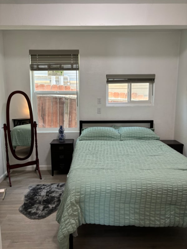
Bedrooms
2
-
Bathrooms
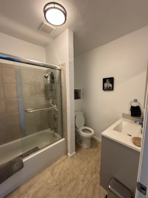
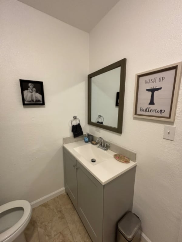
1
-
Square Feet
1,584 sq ft
-
Available
Available Jul 1
Highlights
- Pets Allowed
- Fenced Lot

About This Home
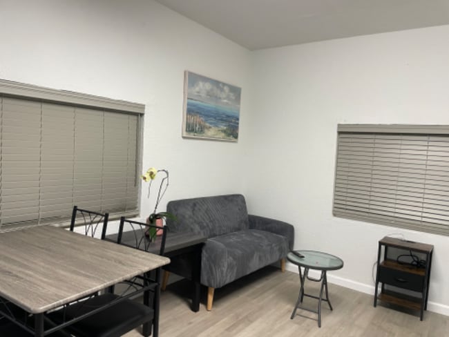
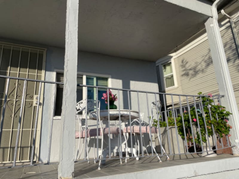
Property Id: 1889085 Newly renovated, clean, new appliances, quit neighborhood, safe and friendly. spouse front/back yard. Great view w/golden hour of sunset. Prompt response from manager team. Near Fruitvale district, diamond park, near 2 Bart stations. Walking distance(10min) to Higland Hospital and 5 min drive to Kaiser. A 30-40-minute walk to the Lake and area around property pleasant for daily walks with great sightseeing.
2206 E 24th St is a house located in Alameda County and the 94606 ZIP Code. This area is served by the Oakland Unified attendance zone.
House Features
Microwave
Refrigerator
Disposal
Freezer
- Disposal
- Microwave
- Oven
- Refrigerator
- Freezer
- Bicycle Storage
- Fenced Lot
Fees and Policies
The fees below are based on community-supplied data and may exclude additional fees and utilities.
- Dogs Allowed
-
Fees not specified
- Cats Allowed
-
Fees not specified
Details
Utilities Included
-
Gas
-
Water
-
Trash Removal
-
Sewer
Contact
- Phone Number
- Contact
-
Source

- Disposal
- Microwave
- Oven
- Refrigerator
- Freezer
- Fenced Lot
- Bicycle Storage
Ten minutes east of downtown Oakland between the MacArthur and Nimitz Freeways, Highlands Terrace is a historic neighborhood full of antique homes and vibrant character. Small bodega-type grocery stores can be found throughout the community, making it a breeze to walk down the street for day-to-day necessities.
Locals have several options for outdoor fun with recreation facilities such as Morgan Plaza and Manzanita Recreation Center on the northeast side and San Antonio Park to the southwest. With Highlands Hospital just across 14th Avenue to the north, Highland Terrace is an excellent location for healthcare workers.
Manzanita Community School and Roosevelt Middle School are just a couple of blocks away, allowing students to walk to school quickly and safely. Downtown Oakland is close at hand, and the cafes and nightlife of the Dimond District is only a few blocks to the northeast.
Learn more about living in Highland Terrace| Colleges & Universities | Distance | ||
|---|---|---|---|
| Colleges & Universities | Distance | ||
| Drive: | 5 min | 2.2 mi | |
| Drive: | 7 min | 3.2 mi | |
| Drive: | 10 min | 4.0 mi | |
| Drive: | 11 min | 4.5 mi |


View GreatSchools Rating Methodology
Data provided by GreatSchools.org © 2025. All rights reserved.
Transportation options available in Oakland include Fruitvale Station, located 1.7 miles from 2206 E 24th St. 2206 E 24th St is near Metro Oakland International, located 7.9 miles or 13 minutes away, and San Francisco International, located 25.6 miles or 38 minutes away.
| Transit / Subway | Distance | ||
|---|---|---|---|
| Transit / Subway | Distance | ||
|
|
Drive: | 3 min | 1.7 mi |
|
|
Drive: | 6 min | 2.6 mi |
|
|
Drive: | 6 min | 3.2 mi |
|
|
Drive: | 6 min | 3.2 mi |
|
|
Drive: | 7 min | 3.5 mi |
| Commuter Rail | Distance | ||
|---|---|---|---|
| Commuter Rail | Distance | ||
|
|
Drive: | 7 min | 3.6 mi |
|
|
Drive: | 11 min | 6.6 mi |
|
|
Drive: | 13 min | 8.6 mi |
| Drive: | 20 min | 13.1 mi | |
| Drive: | 20 min | 13.2 mi |
| Airports | Distance | ||
|---|---|---|---|
| Airports | Distance | ||
|
Metro Oakland International
|
Drive: | 13 min | 7.9 mi |
|
San Francisco International
|
Drive: | 38 min | 25.6 mi |
Time and distance from 2206 E 24th St.
| Shopping Centers | Distance | ||
|---|---|---|---|
| Shopping Centers | Distance | ||
| Drive: | 3 min | 1.3 mi | |
| Drive: | 3 min | 1.6 mi | |
| Drive: | 3 min | 1.6 mi |
| Parks and Recreation | Distance | ||
|---|---|---|---|
| Parks and Recreation | Distance | ||
|
Oakland Museum of California
|
Drive: | 6 min | 2.6 mi |
|
Juan Bautista de Anza National Historic Trail
|
Drive: | 6 min | 2.8 mi |
|
Lakeside Park
|
Drive: | 6 min | 2.9 mi |
|
Rotary Nature Center
|
Drive: | 7 min | 3.3 mi |
|
Lakeside Park Garden Center
|
Drive: | 6 min | 3.3 mi |
| Hospitals | Distance | ||
|---|---|---|---|
| Hospitals | Distance | ||
| Walk: | 11 min | 0.6 mi | |
| Walk: | 14 min | 0.7 mi | |
| Drive: | 7 min | 3.6 mi |
| Military Bases | Distance | ||
|---|---|---|---|
| Military Bases | Distance | ||
| Drive: | 15 min | 6.0 mi | |
| Drive: | 15 min | 7.1 mi |
You May Also Like
What Are Walk Score®, Transit Score®, and Bike Score® Ratings?
Walk Score® measures the walkability of any address. Transit Score® measures access to public transit. Bike Score® measures the bikeability of any address.
What is a Sound Score Rating?
A Sound Score Rating aggregates noise caused by vehicle traffic, airplane traffic and local sources
2206 E 24th St
Oakland, CA 94606