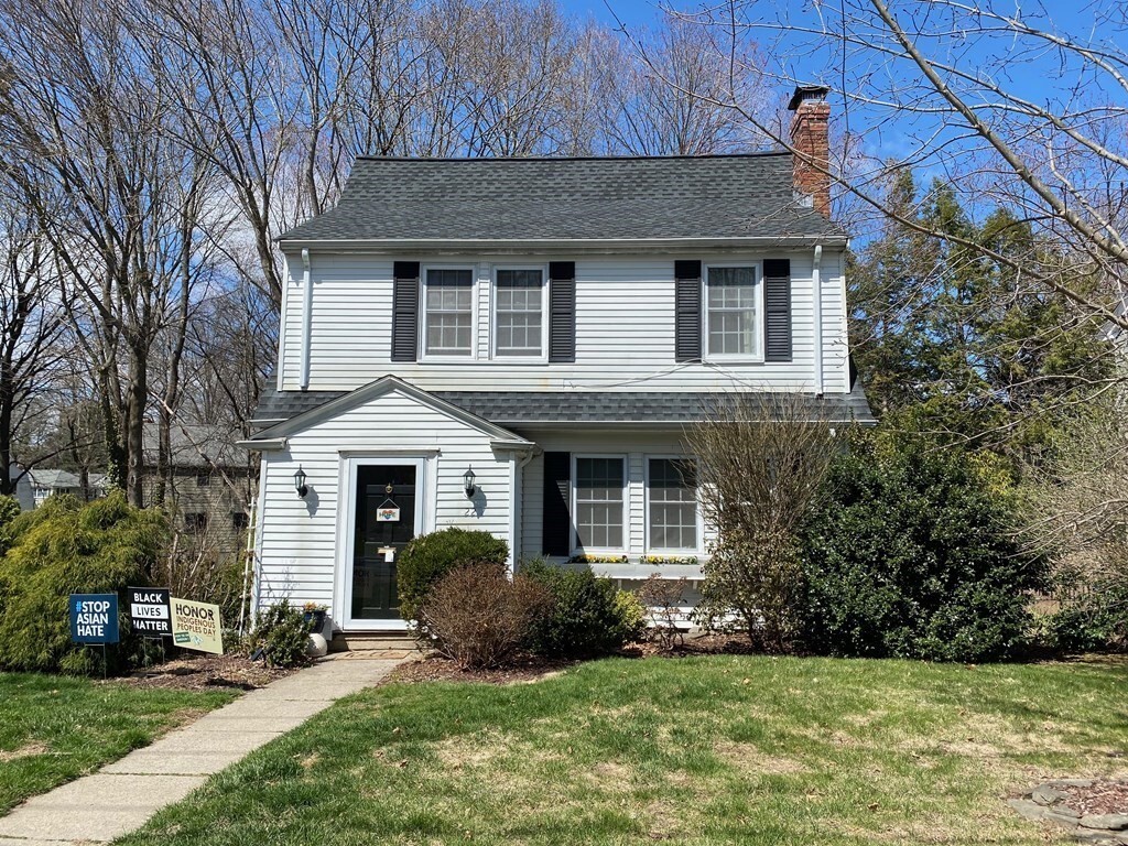

22 Cleveland Rd
22 Cleveland Rd
Wellesley, MA 02481
2 Weeks Ago
Favorites
22 Cleveland Rd

Favorites
Check Back Soon for Upcoming Availability
| Beds | Baths | Average SF |
|---|---|---|
| 3 Bedrooms 3 Bedrooms 3 Br | 1.5 Baths 1.5 Baths 1.5 Ba | 1,625 SF |
Fees and Policies
The fees below are based on community-supplied data and may exclude additional fees and utilities.
- Dogs Allowed
-
Fees not specified
- Cats Allowed
-
Fees not specified
- Parking
-
Surface Lot--
Details
Utilities Included
-
Water
-
Sewer
About This Property
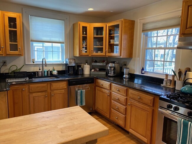
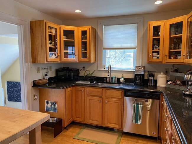
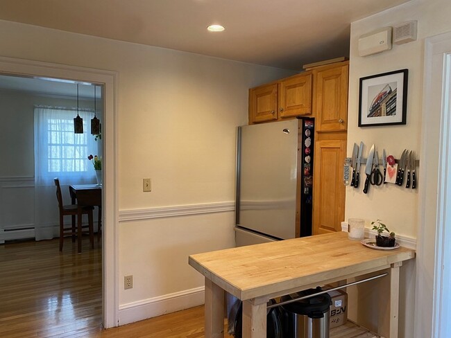
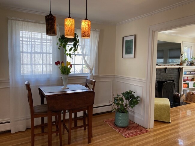
This traditional colonial style house located in Wellesley Hills has old world charm all while enjoying the comforts of a modern day house. Beautiful hardwood floors throughout, a stainless chef's kitchen with granite, updated High Efficiency Water Heater, high ceilings with crown molding and a deck leading out to a landscaped backyard. All three bedrooms have ample closet space. Location Location Location, this house is 4 minutes away from the notable Katharine Lee Bates School; rated 10/10 on GreatSchools an independent public and private rating service for eduction. It is also 7 minutes away from Wellesley Middle and High Schools know for their outstanding and supportive education. Bordered by Natick, Needham, and Newton and close to I-90 Mass Pike, Rt 16 and I-95. Bathroom 1 Features: Bathroom - Half Community Features: Public Transportation Shopping Park Walk/Jog Trails Golf Conservation Area
22 Cleveland Rd is a townhome located in Norfolk County and the 02481 ZIP Code.
Townhome Features
Washer/Dryer
Hardwood Floors
Crown Molding
Kitchen
- Washer/Dryer
- Kitchen
- Hardwood Floors
- Crown Molding
- Deck
Location
Get Directions
Just west of Boston and East of Worcester sits Metro West, a region that houses a group of towns and cities with significant historical backgrounds. A total of 19 municipalities make up the core of this community, but other municipalities are considered to be a part of the Interstate 495/Metro West Corridor.
Learn more about living in Metro WestBelow are rent ranges for similar nearby apartments
| Beds | Average Size | Lowest | Typical | Premium |
|---|---|---|---|---|
| Studio Studio Studio | 615-617 Sq Ft | $1,125 | $2,213 | $3,630 |
| 1 Bed 1 Bed 1 Bed | 875-876 Sq Ft | $1,140 | $2,867 | $9,323 |
| 2 Beds 2 Beds 2 Beds | 1276-1277 Sq Ft | $1,800 | $3,612 | $17,713 |
| 3 Beds 3 Beds 3 Beds | 1573-1577 Sq Ft | $1,000 | $4,789 | $21,131 |
| 4 Beds 4 Beds 4 Beds | 3741 Sq Ft | $1,210 | $6,709 | $30,000 |
Amenities
- Washer/Dryer
- Kitchen
- Hardwood Floors
- Crown Molding
- Deck
Expenses
Utilities Included
Water, Sewer
Included
Education
| Colleges & Universities | Distance | ||
|---|---|---|---|
| Colleges & Universities | Distance | ||
| Drive: | 6 min | 2.3 mi | |
| Drive: | 7 min | 3.2 mi | |
| Drive: | 12 min | 6.9 mi | |
| Drive: | 14 min | 7.0 mi |
22 Cleveland Rd is within 6 minutes or 2.3 miles from Wellesley College. It is also near Babson College and Brandeis University.
Transportation options available in Wellesley include Woodland Station, located 4.7 miles from 22 Cleveland Rd. 22 Cleveland Rd is near General Edward Lawrence Logan International, located 18.7 miles or 31 minutes away, and Worcester Regional, located 30.9 miles or 52 minutes away.
| Transit / Subway | Distance | ||
|---|---|---|---|
| Transit / Subway | Distance | ||
|
|
Drive: | 9 min | 4.7 mi |
|
|
Drive: | 10 min | 4.8 mi |
|
|
Drive: | 10 min | 5.4 mi |
|
|
Drive: | 11 min | 6.0 mi |
|
|
Drive: | 11 min | 6.2 mi |
| Commuter Rail | Distance | ||
|---|---|---|---|
| Commuter Rail | Distance | ||
|
|
Drive: | 3 min | 1.5 mi |
|
|
Drive: | 5 min | 2.7 mi |
|
|
Drive: | 7 min | 3.5 mi |
|
|
Drive: | 7 min | 4.2 mi |
|
|
Drive: | 10 min | 4.9 mi |
| Airports | Distance | ||
|---|---|---|---|
| Airports | Distance | ||
|
General Edward Lawrence Logan International
|
Drive: | 31 min | 18.7 mi |
|
Worcester Regional
|
Drive: | 52 min | 30.9 mi |
Time and distance from 22 Cleveland Rd.
| Shopping Centers | Distance | ||
|---|---|---|---|
| Shopping Centers | Distance | ||
| Drive: | 2 min | 1.4 mi | |
| Drive: | 4 min | 1.7 mi | |
| Drive: | 4 min | 2.0 mi |
22 Cleveland Rd has 3 shopping centers within 2.0 miles, which is about a 4-minute drive. The miles and minutes will be for the farthest away property.
| Parks and Recreation | Distance | ||
|---|---|---|---|
| Parks and Recreation | Distance | ||
|
Whitin Observatory
|
Drive: | 4 min | 1.4 mi |
|
Wellesley College Botanic Gardens
|
Drive: | 3 min | 1.7 mi |
|
Weezie's Garden for Children
|
Drive: | 9 min | 3.5 mi |
|
Elm Bank Reservation
|
Drive: | 9 min | 3.5 mi |
|
Horticultural Society at Elm Bank
|
Drive: | 10 min | 3.7 mi |
22 Cleveland Rd has 5 parks within 3.7 miles, including Whitin Observatory, Wellesley College Botanic Gardens, and Horticultural Society at Elm Bank.
| Hospitals | Distance | ||
|---|---|---|---|
| Hospitals | Distance | ||
| Drive: | 8 min | 4.5 mi | |
| Drive: | 9 min | 5.1 mi | |
| Drive: | 14 min | 7.5 mi |
22 Cleveland Rd has 3 hospitals within 7.5 miles, the nearest is Newton - Wellesley Hospital which is 4.5 miles away and a 8 minute drive.
| Military Bases | Distance | ||
|---|---|---|---|
| Military Bases | Distance | ||
| Drive: | 7 min | 3.8 mi | |
| Drive: | 26 min | 13.2 mi |
22 Cleveland Rd is 3.8 miles from US Military Reservation, and is convenient to other military bases, including Hanscom Air Force Base.
You May Also Like
-
Windsor Village at Waltham
976 Lexington St
Waltham, MA 02452
$3,490 - $6,295 Plus Fees
3 Br 8.1 mi
-
Windsor Ridge at Westborough
1 Windsor Ridge Dr
Westborough, MA 01581
$3,415 - $7,515 Plus Fees
3 Br 14.2 mi
-
Chestnut Place Townhomes
135 Chestnut St
Foxborough, MA 02035
$2,900 Plus Fees
3 Br 16.7 mi
Similar Rentals Nearby
-
-

-

-
 $5,900Total Monthly Price4 Beds, 2 Baths, 1,600 sq ftTownhome for Rent
 -
 $4,700 - $5,600Total Monthly Price3-4 Beds, 1-2 BathsTownhome for Rent
 -
 $4,650Total Monthly Price4 Beds, 1 Bath, 1,300 sq ftTownhome for Rent
 -
 $4,400Total Monthly Price4 Beds, 1 Bath, 1,576 sq ftTownhome for Rent
 -
 $3,600Total Monthly Price3 Beds, 1.5 Baths, 1,350 sq ftTownhome for Rent
 -
 $1,275Total Monthly Price4 Beds, 2 Baths, 2,000 sq ftTownhome for Rent
 -
 $3,200Total Monthly Price3 Beds, 2.5 Baths, 1,488 sq ftTownhome for Rent
What Are Walk Score®, Transit Score®, and Bike Score® Ratings?
Walk Score® measures the walkability of any address. Transit Score® measures access to public transit. Bike Score® measures the bikeability of any address.
What is a Sound Score Rating?
A Sound Score Rating aggregates noise caused by vehicle traffic, airplane traffic and local sources

22 Cleveland Rd
Wellesley, MA 02481