$4,495 / Month
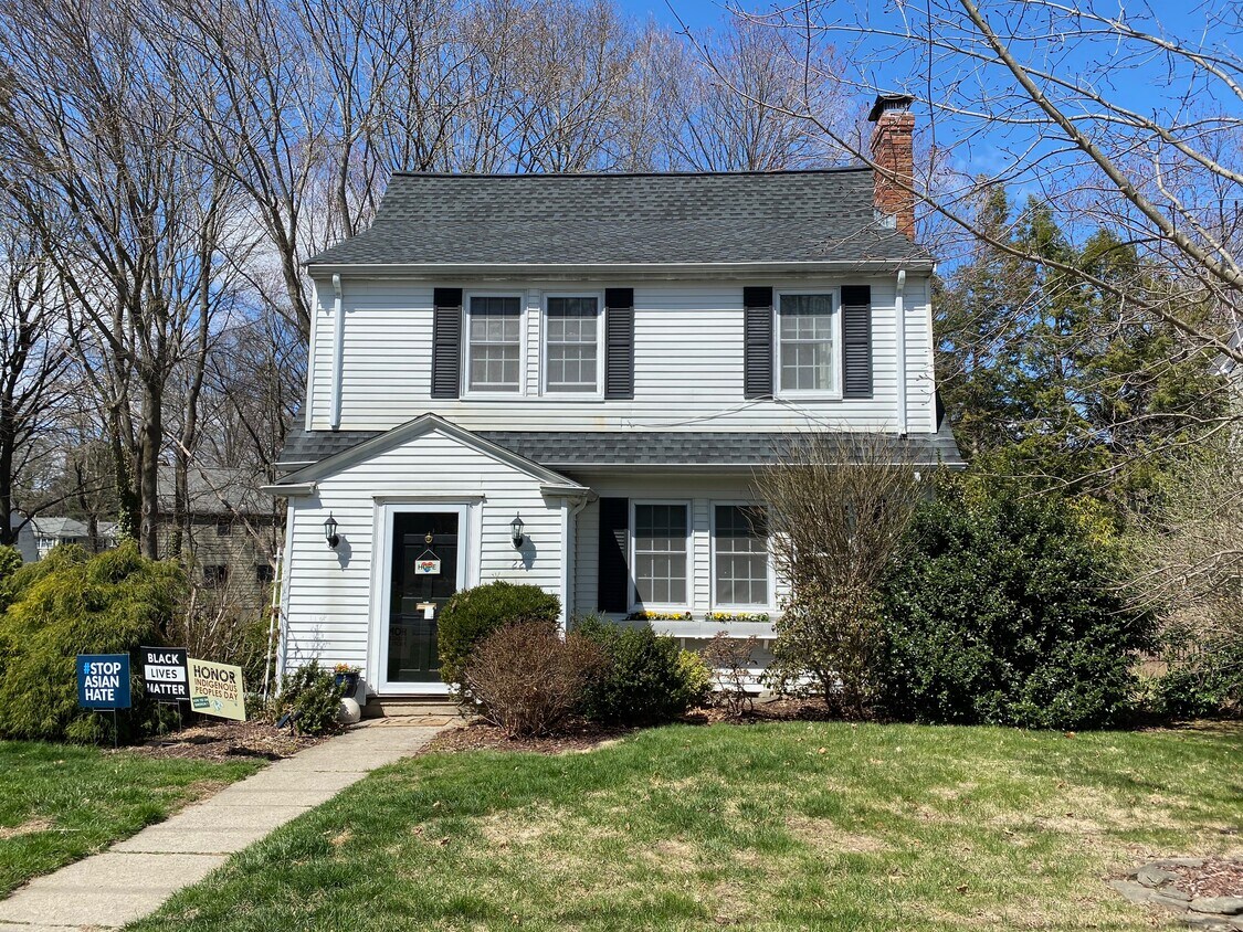
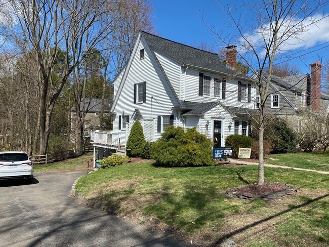
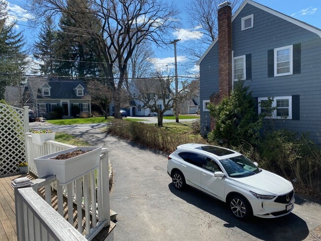
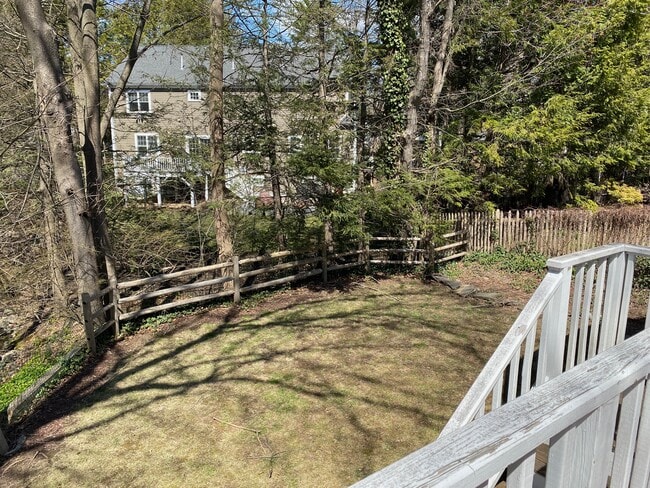
22 Cleveland Rd
Wellesley, MA 02481
2 Weeks Ago
Favorites
617-693-5103
-
Bedrooms
3
-
Bathrooms
1.5
-
Square Feet
1,625 sq ft
-
Available
Available Now
Highlights
- Pets Allowed
- Balcony
- Hardwood Floors
- Fireplace
22 Cleveland Rd

Favorites
About This Home
12 Month Lease,
$4,495 deposit,
Available Now
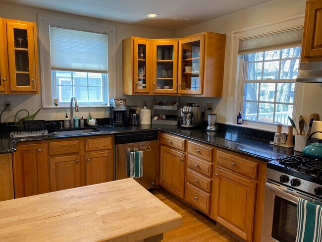
Great Single Family in Wellesley Available Now! Unit Features Balcony Dining Room Dishwasher Disposal Eat-in Kitchen Fireplace Granite Counter Tops Hardwood Floors Laundry in Unit Stainless Steel Appliance(s)
22 Cleveland Rd is a house located in Norfolk County and the 02481 ZIP Code. This area is served by the Wellesley attendance zone.
* Price shown is base rent and may not include non-optional fees and utilities.
Price, availability, fees, and any applicable rent special are subject to change without notice.
* Square footage definitions vary. Displayed square footage is approximate.
House Features
Washer/Dryer
Dishwasher
High Speed Internet Access
Hardwood Floors
- High Speed Internet Access
- Washer/Dryer
- Heating
- Cable Ready
- Storage Space
- Tub/Shower
- Fireplace
- Handrails
- Dishwasher
- Disposal
- Granite Countertops
- Stainless Steel Appliances
- Eat-in Kitchen
- Hardwood Floors
- Dining Room
- Balcony
Fees and Policies
The fees below are based on community-supplied data and may exclude additional fees and utilities.
- Dogs Allowed
-
Fees not specified
- Cats Allowed
-
Fees not specified
- Parking
-
Surface Lot--
Contact
- Phone Number
- Contact
Location
Get Directions
Just west of Boston and East of Worcester sits Metro West, a region that houses a group of towns and cities with significant historical backgrounds. A total of 19 municipalities make up the core of this community, but other municipalities are considered to be a part of the Interstate 495/Metro West Corridor.
Learn more about living in Metro West
Education
| Colleges & Universities | Distance | ||
|---|---|---|---|
| Colleges & Universities | Distance | ||
| Drive: | 6 min | 2.3 mi | |
| Drive: | 7 min | 3.2 mi | |
| Drive: | 12 min | 6.9 mi | |
| Drive: | 14 min | 7.0 mi |
22 Cleveland Rd is within 6 minutes or 2.3 miles from Wellesley College. It is also near Babson College and Brandeis University.
Schools


Public Elementary School
Grades PK-5
699 Students
Nearby
Public Elementary School
Grades K-5
271 Students
Attendance Zone
Public Middle School
Grades 6-8
922 Students
Attendance Zone
Public High School
Grades 9-12
1,412 Students
Attendance Zone
Private Elementary & Middle School
Grades PK-8
185 Students
Nearby
Private Middle & High School
Grades 6-12
496 Students
Nearby
School data provided by
 The GreatSchools Rating helps parents compare schools within a state based on a variety of school quality indicators and provides a helpful picture of how effectively each school serves all of its students. Ratings are on a scale of 1 (below average) to 10 (above average) and can include test scores, college readiness, academic progress, advanced courses, equity, discipline and attendance data. We also advise parents to visit schools, consider other information on school performance and programs, and consider family needs as part of the school selection process.
View GreatSchools Rating Methodology
Data provided by GreatSchools.org © 2025. All rights reserved.
View GreatSchools Rating Methodology
Data provided by GreatSchools.org © 2025. All rights reserved.
Transportation options available in Wellesley include Woodland Station, located 4.7 miles from 22 Cleveland Rd. 22 Cleveland Rd is near General Edward Lawrence Logan International, located 18.7 miles or 31 minutes away, and Worcester Regional, located 30.9 miles or 52 minutes away.
| Transit / Subway | Distance | ||
|---|---|---|---|
| Transit / Subway | Distance | ||
|
|
Drive: | 9 min | 4.7 mi |
|
|
Drive: | 10 min | 4.8 mi |
|
|
Drive: | 10 min | 5.4 mi |
|
|
Drive: | 11 min | 6.0 mi |
|
|
Drive: | 11 min | 6.2 mi |
| Commuter Rail | Distance | ||
|---|---|---|---|
| Commuter Rail | Distance | ||
|
|
Drive: | 3 min | 1.5 mi |
|
|
Drive: | 5 min | 2.7 mi |
|
|
Drive: | 7 min | 3.5 mi |
|
|
Drive: | 7 min | 4.2 mi |
|
|
Drive: | 10 min | 4.9 mi |
| Airports | Distance | ||
|---|---|---|---|
| Airports | Distance | ||
|
General Edward Lawrence Logan International
|
Drive: | 31 min | 18.7 mi |
|
Worcester Regional
|
Drive: | 52 min | 30.9 mi |
Time and distance from 22 Cleveland Rd.
| Shopping Centers | Distance | ||
|---|---|---|---|
| Shopping Centers | Distance | ||
| Drive: | 2 min | 1.4 mi | |
| Drive: | 4 min | 1.7 mi | |
| Drive: | 4 min | 2.0 mi |
22 Cleveland Rd has 3 shopping centers within 2.0 miles, which is about a 4-minute drive. The miles and minutes will be for the farthest away property.
| Parks and Recreation | Distance | ||
|---|---|---|---|
| Parks and Recreation | Distance | ||
|
Whitin Observatory
|
Drive: | 4 min | 1.4 mi |
|
Wellesley College Botanic Gardens
|
Drive: | 3 min | 1.7 mi |
|
Weezie's Garden for Children
|
Drive: | 9 min | 3.5 mi |
|
Elm Bank Reservation
|
Drive: | 9 min | 3.5 mi |
|
Horticultural Society at Elm Bank
|
Drive: | 10 min | 3.7 mi |
22 Cleveland Rd has 5 parks within 3.7 miles, including Whitin Observatory, Wellesley College Botanic Gardens, and Horticultural Society at Elm Bank.
| Hospitals | Distance | ||
|---|---|---|---|
| Hospitals | Distance | ||
| Drive: | 8 min | 4.5 mi | |
| Drive: | 9 min | 5.1 mi | |
| Drive: | 14 min | 7.5 mi |
22 Cleveland Rd has 3 hospitals within 7.5 miles, the nearest is Newton - Wellesley Hospital which is 4.5 miles away and a 8 minute drive.
| Military Bases | Distance | ||
|---|---|---|---|
| Military Bases | Distance | ||
| Drive: | 7 min | 3.8 mi | |
| Drive: | 26 min | 13.2 mi |
22 Cleveland Rd is 3.8 miles from US Military Reservation, and is convenient to other military bases, including Hanscom Air Force Base.
Amenities
- High Speed Internet Access
- Washer/Dryer
- Heating
- Cable Ready
- Storage Space
- Tub/Shower
- Fireplace
- Handrails
- Dishwasher
- Disposal
- Granite Countertops
- Stainless Steel Appliances
- Eat-in Kitchen
- Hardwood Floors
- Dining Room
- Balcony
22 Cleveland Rd Photos
What Are Walk Score®, Transit Score®, and Bike Score® Ratings?
Walk Score® measures the walkability of any address. Transit Score® measures access to public transit. Bike Score® measures the bikeability of any address.
What is a Sound Score Rating?
A Sound Score Rating aggregates noise caused by vehicle traffic, airplane traffic and local sources

22 Cleveland Rd
Wellesley, MA 02481