$1,795
/ Month
22 Amberlady Ct
Owings Mills, MD 21117
Favorites
22 Amberlady Ct

Favorites
Check Back Soon for Upcoming Availability
| Beds | Baths | Average SF |
|---|---|---|
| 2 Bedrooms 2 Bedrooms 2 Br | 3 Baths 3 Baths 3 Ba | 2,000 SF |
About This Property
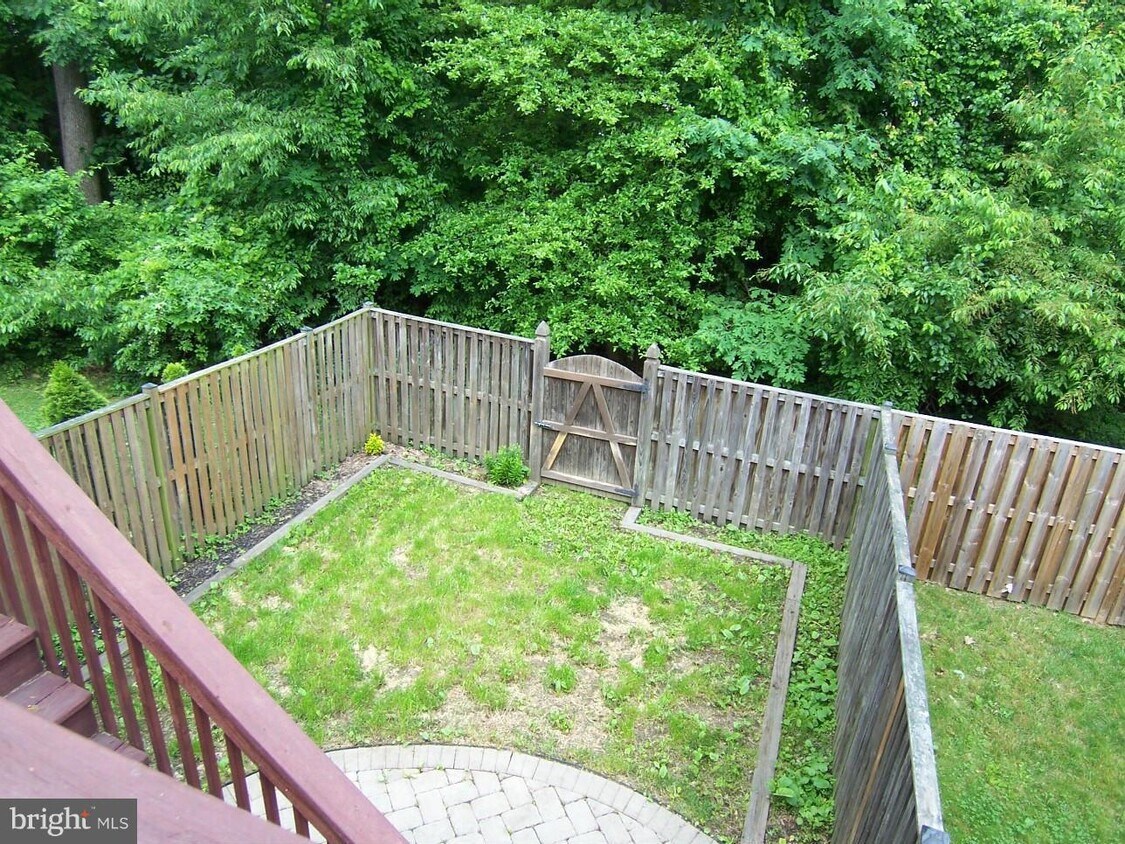
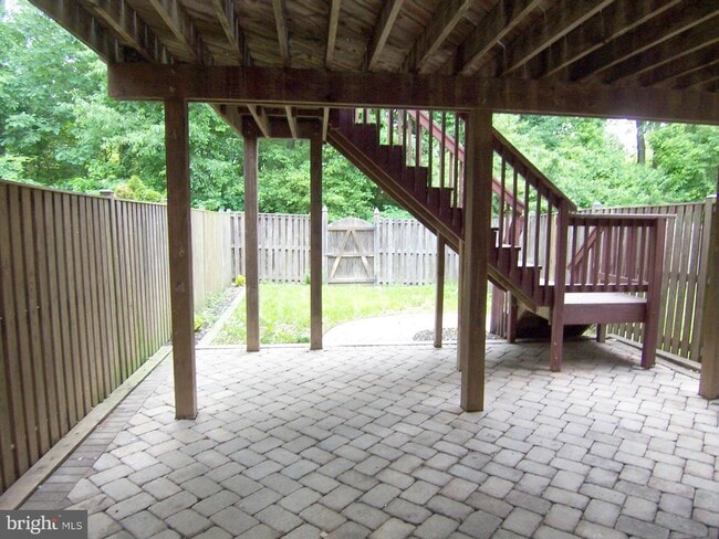
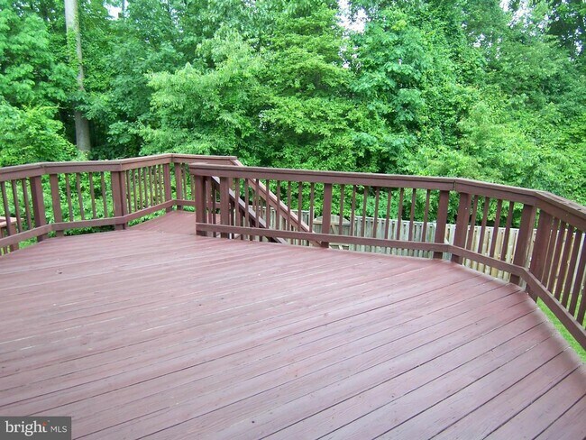
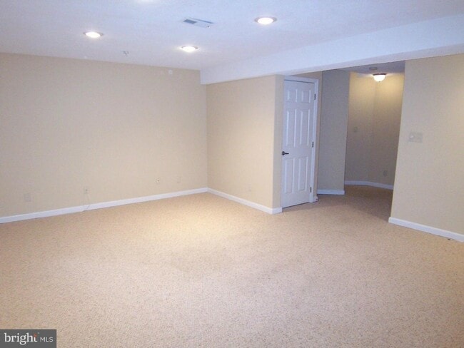
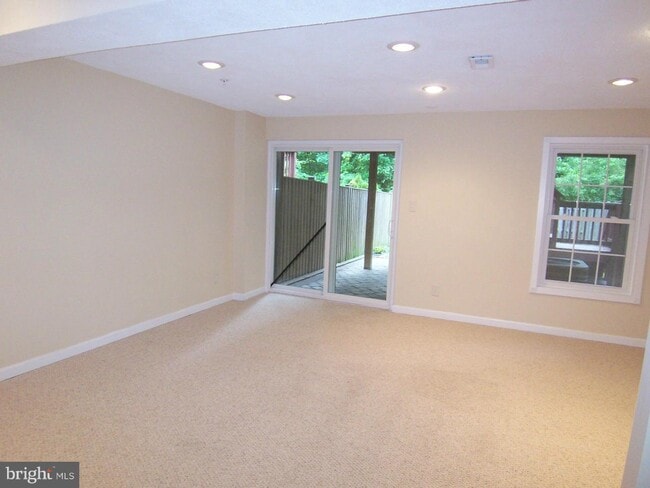
OWINGS MILLS WINTERSET BRICK-FRONT TOWNHOME FEATURES OVERSIZED LIVING ROOM W/ WOOD FLOORS & EAT-IN KITCHEN W/ STAINLESS STEEL APPLIANCES, PANTRY & SLIDER TO HUGE CUSTOM DECK. MASTER SUITE W/ WALK-IN CLOSET & GARDEN BATH W/ SOAKING TUB & SEPARATE SHOWER. SPACIOUS 2ND BEDROOM. VAULTED CEILINGS. POSSIBLE 3RD BR IN PRIVATE LOFT. SKYLIGHTS. LOWER LEVEL REC ROOM W/ WALKOUT TO BRICK PATIO & FENCED YARD.
22 Amberlady Ct is a townhome located in Baltimore County and the 21117 ZIP Code. This area is served by the Baltimore County Public Schools attendance zone.
Townhome Features
- Dishwasher
- Basement
22 Amberlady Ct,
Owings Mills,
MD
21117
Owings Mills is an unincorporated community in Baltimore County, sitting along Interstate 795 roughly 15 miles northwest of downtown Baltimore, where suburban scale and city access genuinely coexist. The Baltimore Metro Subway terminates here, making the commute into the city straightforward without requiring a car. Major employers with a local presence include T. Rowe Price, CareFirst BlueCross BlueShield, and the Baltimore Ravens' training and headquarters facility, giving the area a steady economic foundation. Maryland Public Television also operates its studios here, adding a notable media anchor to the community. Stevenson University calls Owings Mills home, contributing an academic presence that shapes the pace and personality of the area. Distinct pockets like New Town, Metro Centre, and the Foundry Row corridor each carry their own character, from walkable retail and dining to quieter, wooded residential streets.
Learn more about living in Owings Mills
Amenities
- Dishwasher
- Basement
Education
| Colleges & Universities | Distance | ||
|---|---|---|---|
| Colleges & Universities | Distance | ||
| Drive: | 9 min | 4.2 mi | |
| Drive: | 19 min | 8.1 mi | |
| Drive: | 28 min | 12.0 mi | |
| Drive: | 26 min | 15.4 mi |
22 Amberlady Ct is within 9 minutes or 4.2 miles from Stevenson Univ., Owings Mills. It is also near Stevenson Univ., Greenspring and Coppin State University.
Schools


Public Elementary School
Grades PK-5
414 Students
Nearby
Public Elementary School
Grades PK-5
809 Students
Attendance Zone
Public Middle School
Grades 6-8
1,322 Students
Attendance Zone
Public High School
Grades 9-12
1,316 Students
Attendance Zone
Private Elementary, Middle & High School
Grades PK-12
1,458 Students
Nearby
Private Elementary & Middle School
Grades K-8
114 Students
Nearby
Private Elementary School
Grades PK-5
14 Students
Nearby
School data provided by
 The GreatSchools Rating helps parents compare schools within a state based on a variety of school quality indicators and provides a helpful picture of how effectively each school serves all of its students. Ratings are on a scale of 1 (below average) to 10 (above average) and can include test scores, college readiness, academic progress, advanced courses, equity, discipline and attendance data. We also advise parents to visit schools, consider other information on school performance and programs, and consider family needs as part of the school selection process.
View GreatSchools Rating Methodology
Data provided by GreatSchools.org © 2026. All rights reserved.
View GreatSchools Rating Methodology
Data provided by GreatSchools.org © 2026. All rights reserved.
Transportation options available in Owings Mills include Old Court, located 5.9 miles from 22 Amberlady Ct. 22 Amberlady Ct is near Baltimore/Washington International Thurgood Marshall, located 21.4 miles or 34 minutes away.
| Transit / Subway | Distance | ||
|---|---|---|---|
| Transit / Subway | Distance | ||
| Drive: | 11 min | 5.9 mi | |
| Drive: | 17 min | 7.4 mi | |
| Drive: | 20 min | 9.1 mi | |
| Drive: | 16 min | 9.3 mi | |
| Drive: | 21 min | 9.9 mi |
| Commuter Rail | Distance | ||
|---|---|---|---|
| Commuter Rail | Distance | ||
| Drive: | 26 min | 16.8 mi | |
| Drive: | 26 min | 16.8 mi | |
| Drive: | 31 min | 17.3 mi | |
|
|
Drive: | 31 min | 17.9 mi |
| Drive: | 34 min | 21.4 mi |
| Airports | Distance | ||
|---|---|---|---|
| Airports | Distance | ||
|
Baltimore/Washington International Thurgood Marshall
|
Drive: | 34 min | 21.4 mi |
Walkability Near 22 Amberlady Ct Owings Mills, MD 21117
Getting Around
 What do Walkability, Transit, Drivability, and Bikeability mean?
Walkability measures the walking distance to day-to-day needs.
Transit measures access to public transportation.
Drivability measures congestion, parking availability, and access to major roads.
Bikeability measures the suitability for cycling.
How It Works
What do Walkability, Transit, Drivability, and Bikeability mean?
Walkability measures the walking distance to day-to-day needs.
Transit measures access to public transportation.
Drivability measures congestion, parking availability, and access to major roads.
Bikeability measures the suitability for cycling.
How It Works
Somewhat Walkable
Walkability
30
/ 100
Minimal Public Transit
Transit
0
/ 100
Exceptionally Drivable
Drivability
90
/ 100
Fairly Bikeable
Bikeability
40
/ 100
Scores provided by
-
Soundscore™
-
/ 100
Traffic
-Airport
-Businesses
-Scores provided by
HowLoud What is a Sound Score Rating? A Sound Score Rating aggregates noise caused by vehicle traffic, airplane traffic and local sources. How It WorksTime and distance from 22 Amberlady Ct.
| Shopping Centers | Distance | ||
|---|---|---|---|
| Shopping Centers | Distance | ||
| Drive: | 4 min | 1.3 mi | |
| Drive: | 4 min | 1.5 mi | |
| Drive: | 4 min | 1.7 mi |
22 Amberlady Ct has 3 shopping centers within 1.7 miles, which is about a 4-minute drive. The miles and minutes will be for the farthest away property.
| Parks and Recreation | Distance | ||
|---|---|---|---|
| Parks and Recreation | Distance | ||
|
Soldiers Delight Natural Environment Area (NEA)
|
Drive: | 6 min | 2.6 mi |
|
Irvine Nature Center
|
Drive: | 11 min | 5.2 mi |
|
Patapsco Valley State Park
|
Drive: | 20 min | 7.2 mi |
|
Rodgers Farms
|
Drive: | 16 min | 7.4 mi |
|
Mt Pleasant - Howard County Conservancy
|
Drive: | 21 min | 8.6 mi |
22 Amberlady Ct has 5 parks within 8.6 miles, including Soldiers Delight Natural Environment Area (NEA), Irvine Nature Center, and Patapsco Valley State Park.
| Hospitals | Distance | ||
|---|---|---|---|
| Hospitals | Distance | ||
| Drive: | 8 min | 4.4 mi | |
| Drive: | 15 min | 8.9 mi | |
| Drive: | 20 min | 9.4 mi |
22 Amberlady Ct has 3 hospitals within 9.4 miles, the nearest is Northwest Hospital Center which is 4.4 miles away and a 8 minute drive.
| Military Bases | Distance | ||
|---|---|---|---|
| Military Bases | Distance | ||
| Drive: | 48 min | 29.4 mi | |
| Drive: | 57 min | 36.2 mi | |
| Drive: | 64 min | 44.4 mi |
22 Amberlady Ct has 3 military bases within 44.4 miles, the nearest is Fort George Meade which is 29.4 miles away and a 48 minute drive.
You May Also Like
Similar Rentals Nearby


What Are Walk Score®, Transit Score®, and Bike Score® Ratings?
Walk Score® measures the walkability of any address. Transit Score® measures access to public transit. Bike Score® measures the bikeability of any address.
What is a Sound Score Rating?
A Sound Score Rating aggregates noise caused by vehicle traffic, airplane traffic and local sources.

22 Amberlady Ct
Owings Mills, MD 21117