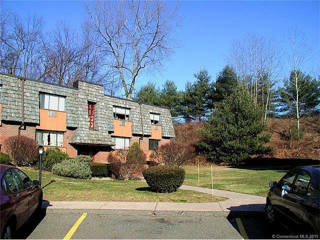
219 High Path Rd
Windsor, CT 06095
-
Bedrooms
2
-
Bathrooms
2
-
Square Feet
961 sq ft
-
Available
Available Now

About This Home
Property Id: 1364923 Heat and hot water are included in the rent. Laundry facility and storage room downstairs.
219 High Path Rd is a condo located in Hartford County and the 06095 ZIP Code. This area is served by the Windsor Locks School District attendance zone.
Fees and Policies
The fees listed below are community-provided and may exclude utilities or add-ons. All payments are made directly to the property and are non-refundable unless otherwise specified. Use the Cost Calculator to determine costs based on your needs.
-
One-Time Basics
-
Due at Move-In
-
Security Deposit - RefundableCharged per unit.$2,000
-
-
Due at Move-In
Property Fee Disclaimer: Based on community-supplied data and independent market research. Subject to change without notice. May exclude fees for mandatory or optional services and usage-based utilities.
Details
Utilities Included
-
Gas
-
Water
-
Trash Removal
-
Sewer
Condo Features
Dishwasher
Refrigerator
Oven
Vinyl Flooring
- Dishwasher
- Oven
- Refrigerator
- Vinyl Flooring
Contact
- Phone Number
- Contact
-
Source

The towns of Bloomfield and Windsor border the Connecticut River, with Bloomfield directly north of the University of Hartford. This area is rich with history and provides a fantastic, tree-filled setting dotted with historic architecture. Bloomfield is bordered by Penwood State Park and Talcott Mountain State Park, both of which offer stunning views and terrific places for hiking and nature-watching. As the first English settlement in Connecticut, Windsor was settled in 1633. It still features its colonial charm with fantastic historic sites like the Oliver Ellsworth Homestead, a National Historic Landmark dating to 1781, and the Hezekiah Chaffee House, a historic house museum that was built around 1765.
Bloomfield and Windsor are located on the north side of Hartford, and Interstate 91 divides these two towns for easy commutes to downtown, just six miles away.
Learn more about living in Bloomfield/Windsor- Dishwasher
- Oven
- Refrigerator
- Vinyl Flooring
| Colleges & Universities | Distance | ||
|---|---|---|---|
| Colleges & Universities | Distance | ||
| Drive: | 16 min | 10.6 mi | |
| Drive: | 19 min | 12.0 mi | |
| Drive: | 21 min | 12.7 mi | |
| Drive: | 20 min | 13.5 mi |


 The GreatSchools Rating helps parents compare schools within a state based on a variety of school quality indicators and provides a helpful picture of how effectively each school serves all of its students. Ratings are on a scale of 1 (below average) to 10 (above average) and can include test scores, college readiness, academic progress, advanced courses, equity, discipline and attendance data. We also advise parents to visit schools, consider other information on school performance and programs, and consider family needs as part of the school selection process.
View GreatSchools Rating Methodology
Data provided by GreatSchools.org © 2026. All rights reserved.
Scores provided by
 What do Walkability, Transit, Drivability, and Bikeability mean?
Walkability measures the walking distance to day-to-day needs.
Transit measures access to public transportation.
Drivability measures congestion, parking availability, and access to major roads.
Bikeability measures the suitability for cycling.
How It Works
What do Walkability, Transit, Drivability, and Bikeability mean?
Walkability measures the walking distance to day-to-day needs.
Transit measures access to public transportation.
Drivability measures congestion, parking availability, and access to major roads.
Bikeability measures the suitability for cycling.
How It Works
Traffic
-Airport
-Businesses
-Scores provided by
HowLoud What is a Sound Score Rating? A Sound Score Rating aggregates noise caused by vehicle traffic, airplane traffic and local sources. How It WorksYou May Also Like
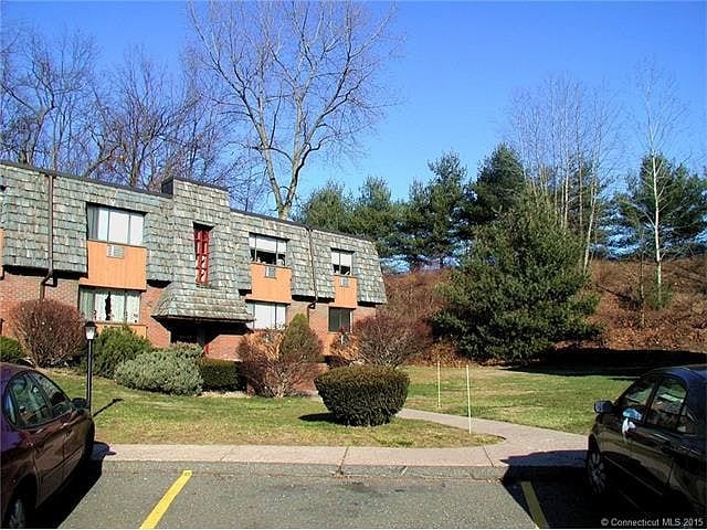
219 High Path Rd
Windsor, CT 06095