
$6,000
Total Monthly Price
219 Freeman St
Brookline, MA 02446
Today
|
Edit
Favorites
617-650-7636
-
Bedrooms
4
-
Bathrooms
2
-
Square Feet
1,550 sq ft
-
Available
Available Sep 1
219 Freeman St

Favorites
About This Home
Available Sep 1
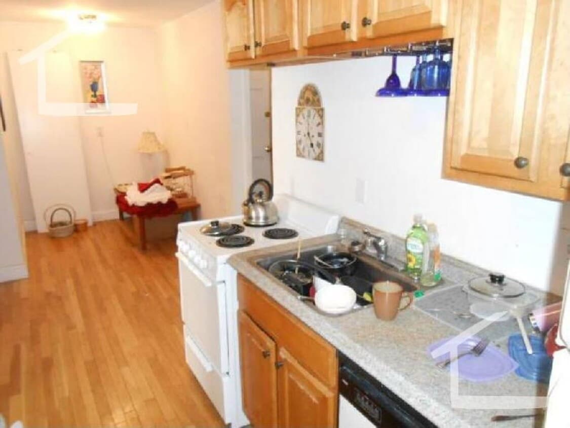
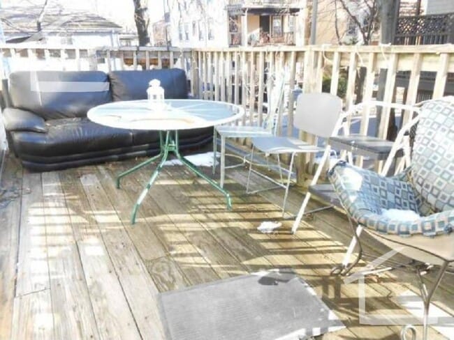
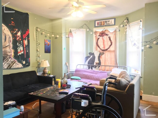
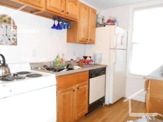
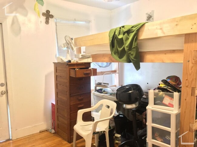
Available September 1 No Brokers Fee Large Unit Walking Distance to BU Large Bedrooms Eat-in Kitchen With Dishwasher Lots of Closets Large Private Deck Laundry on a Site Two Full Bathrooms PROPERTY INFO ID: 401591155 Rent: $6000 / Month Beds: 4 Bath: 2 Available Date: 09/01/2025 Pet: Negotiable Parking:: off-street parking FEATURES Dining Room Dishwasher Disposal Eat-In Kitchen Hardwood Floors Laundry in Building Microwave multiple closets Oven/Range Refrigerator Storage
219 Freeman St is a condo located in Norfolk County and the 02446 ZIP Code. This area is served by the Boston Public Schools attendance zone.
* Price shown is total price based on community-supplied monthly required fees. Excludes user-selected optional fees and variable or usage-based fees and required charges due at or prior to move-in or at move-out. Price, availability, fees, and any applicable rent special are subject to change without notice.
* Square footage definitions vary. Displayed square footage is approximate.
Contact
- Listed by Modern Real Estate (AD) | Modern Real Estate (AD)
- Phone Number
- Contact
Location
Get Directions
Located just four miles west of Downtown Boston, Coolidge Corner is a vibrant commercial hub brimming with activity and gorgeous historical buildings. Residents enjoy a large selection of shops, bookstores, restaurants, and coffee houses in Coolidge Corner as well as access to the landmark Coolidge Theatre, an Art Deco-inspired venue showcasing the best of contemporary art house and independent film.
Coolidge Corner exudes a nostalgic charm, and has attracted shoppers for more than 150 years. There’s a healthy mix of local businesses and familiar chains in Coolidge Corner, offering residents the best of both worlds. Home to its own T stop, Coolidge Corner is an ideal spot for commuters and college students alike.
Learn more about living in Coolidge Corner
Education
| Colleges & Universities | Distance | ||
|---|---|---|---|
| Colleges & Universities | Distance | ||
| Walk: | 14 min | 0.7 mi | |
| Drive: | 3 min | 1.3 mi | |
| Drive: | 4 min | 1.5 mi | |
| Drive: | 4 min | 1.5 mi |
219 Freeman St is within 14 minutes or 0.7 mile from Boston University. It is also near Lesley Univ., Art Institute and Simmons College.
Schools


Public Elementary School
Grades PK-6
315 Students
Attendance Zone
Public Elementary & Middle School
Grades PK-8
544 Students
Attendance Zone
Public Middle & High School
Grades 7-12
1,181 Students
Attendance Zone
Public Middle & High School
Grades 7-12
646 Students
Attendance Zone
Public Middle & High School
Grades 6-12
575 Students
Attendance Zone
Public Middle School
Grades 6-8
362 Students
Attendance Zone
Private Elementary & Middle School
Grades K-8
Nearby
Private Elementary School
Grades PK-3
Nearby
Private Elementary School
Grades PK-2
28 Students
Nearby
Private High School
Grades 9-12
24 Students
Nearby
School data provided by
 The GreatSchools Rating helps parents compare schools within a state based on a variety of school quality indicators and provides a helpful picture of how effectively each school serves all of its students. Ratings are on a scale of 1 (below average) to 10 (above average) and can include test scores, college readiness, academic progress, advanced courses, equity, discipline and attendance data. We also advise parents to visit schools, consider other information on school performance and programs, and consider family needs as part of the school selection process.
View GreatSchools Rating Methodology
Data provided by GreatSchools.org © 2026. All rights reserved.
View GreatSchools Rating Methodology
Data provided by GreatSchools.org © 2026. All rights reserved.
Transportation options available in Brookline include Babcock Street Station, located 0.4 mile from 219 Freeman St. 219 Freeman St is near General Edward Lawrence Logan International, located 7.3 miles or 17 minutes away.
| Transit / Subway | Distance | ||
|---|---|---|---|
| Transit / Subway | Distance | ||
|
|
Walk: | 7 min | 0.4 mi |
|
|
Walk: | 7 min | 0.4 mi |
|
|
Walk: | 8 min | 0.4 mi |
|
|
Walk: | 8 min | 0.4 mi |
|
|
Walk: | 8 min | 0.4 mi |
| Commuter Rail | Distance | ||
|---|---|---|---|
| Commuter Rail | Distance | ||
|
|
Drive: | 6 min | 2.3 mi |
|
|
Drive: | 10 min | 3.0 mi |
|
|
Drive: | 6 min | 3.0 mi |
|
|
Drive: | 11 min | 3.9 mi |
| Drive: | 14 min | 5.9 mi |
| Airports | Distance | ||
|---|---|---|---|
| Airports | Distance | ||
|
General Edward Lawrence Logan International
|
Drive: | 17 min | 7.3 mi |
Time and distance from 219 Freeman St.
| Shopping Centers | Distance | ||
|---|---|---|---|
| Shopping Centers | Distance | ||
| Walk: | 9 min | 0.5 mi | |
| Walk: | 20 min | 1.0 mi | |
| Drive: | 4 min | 1.5 mi |
219 Freeman St has 3 shopping centers within 1.5 miles, which is about a 4-minute drive. The miles and minutes will be for the farthest away property.
| Parks and Recreation | Distance | ||
|---|---|---|---|
| Parks and Recreation | Distance | ||
|
John Fitzgerald Kennedy National Historic Site
|
Walk: | 7 min | 0.4 mi |
|
Coit Observatory
|
Drive: | 4 min | 1.2 mi |
|
Chestnut Hill Reservation
|
Drive: | 4 min | 2.1 mi |
|
Frederick Law Olmsted National Historic Site
|
Drive: | 6 min | 2.1 mi |
|
Charles River Reservation
|
Drive: | 6 min | 2.3 mi |
219 Freeman St has 5 parks within 2.3 miles, including John Fitzgerald Kennedy National Historic Site, Coit Observatory, and Charles River Reservation.
| Hospitals | Distance | ||
|---|---|---|---|
| Hospitals | Distance | ||
| Walk: | 5 min | 0.3 mi | |
| Drive: | 3 min | 1.2 mi | |
| Drive: | 3 min | 1.2 mi |
219 Freeman St has 3 hospitals within 1.2 miles, the nearest is Arbour Human Resource Institute which is 0.3 mile away and a 5 minute walk.
| Military Bases | Distance | ||
|---|---|---|---|
| Military Bases | Distance | ||
| Drive: | 30 min | 13.8 mi | |
| Drive: | 27 min | 14.7 mi |
219 Freeman St is 13.8 miles from Hanscom Air Force Base, and is convenient to other military bases, including US Military Reservation.
You May Also Like
-
Room in Shared 4 bed/1.5 bath home
17 Kenneson Rd
Somerville, MA 02145
$880 Plus Fees
4 Br 3.3 mi
-
Room in Shared 4 bed/1.5 bath home
114 Boston St
Boston, MA 02125
$1,210 Plus Fees
4 Br 3.5 mi
-
31-33 Raymond Ave. Unit 33-2
31-33 Raymond Ave
Somerville, MA 02144
$5,200 Plus Fees
4 Br 12 Month Lease 4.1 mi
Similar Rentals Nearby


What Are Walk Score®, Transit Score®, and Bike Score® Ratings?
Walk Score® measures the walkability of any address. Transit Score® measures access to public transit. Bike Score® measures the bikeability of any address.
What is a Sound Score Rating?
A Sound Score Rating aggregates noise caused by vehicle traffic, airplane traffic and local sources

219 Freeman St
Brookline, MA 02446