
Sevens
777 W Middlefield Rd,
Mountain View, CA 94043
$3,752 - $7,137 Total Monthly Price
Studio - 2 Beds
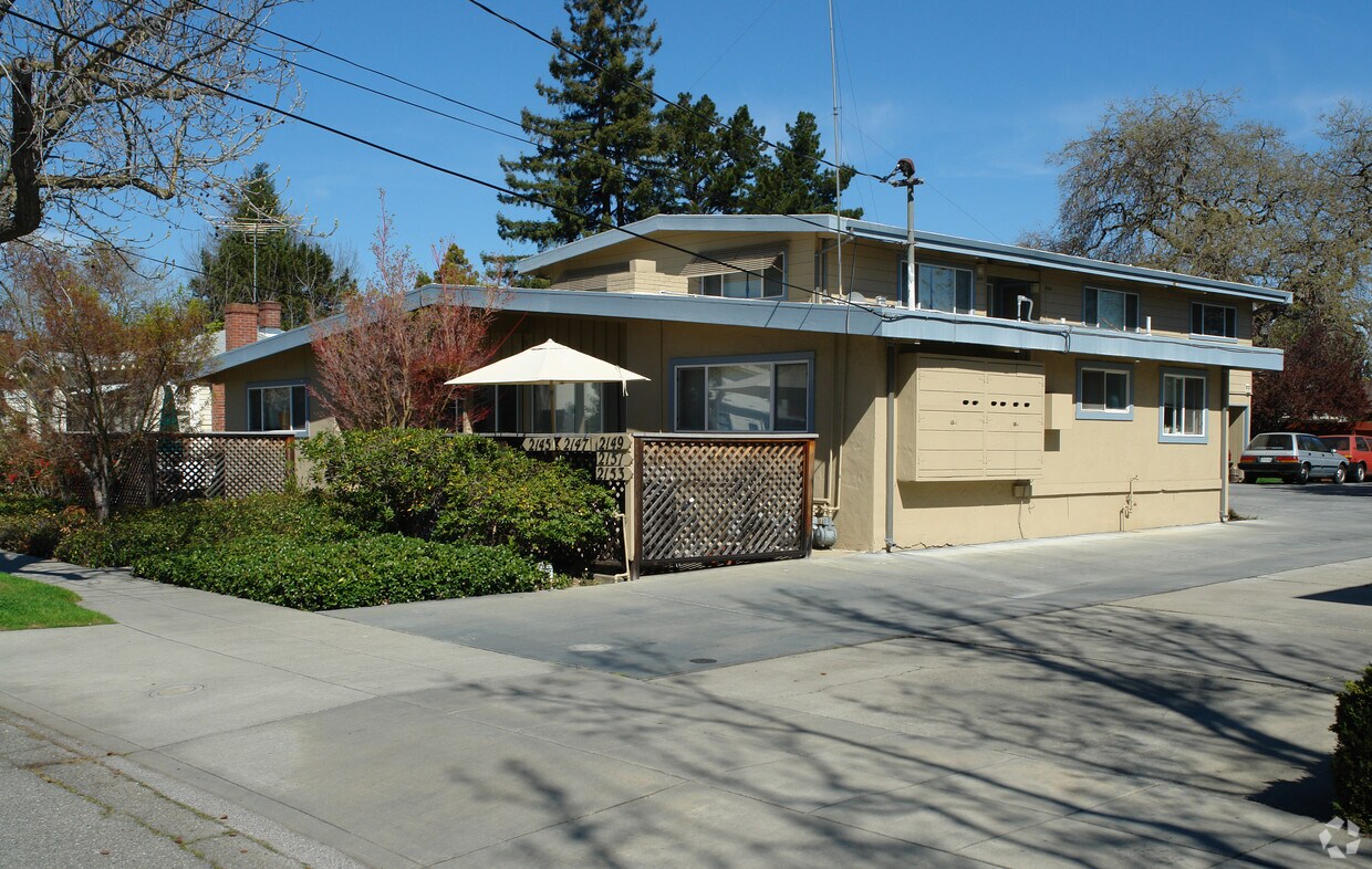
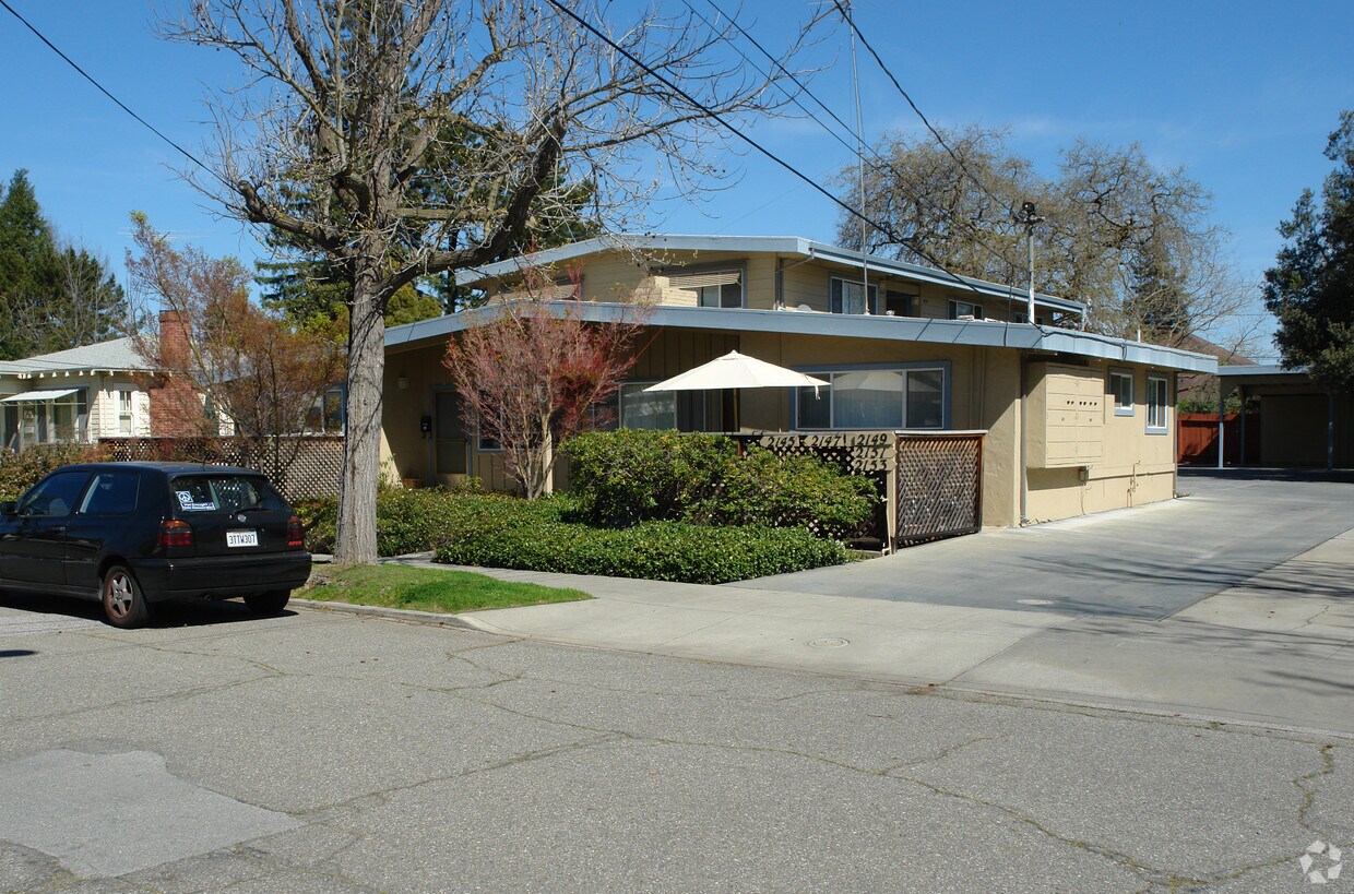
2145-2153 Williams St is ready to be your home. This community is located on Williams St. in Palo Alto. The community staff is ready to match you with your new home. Schedule a time to check out the current floorplan options. Stop by 2145-2153 Williams St today.
2145-2153 Williams St is an apartment community located in Santa Clara County and the 94306 ZIP Code. This area is served by the Palo Alto Unified School District attendance zone.
Bordering Stanford University and Escondido Village, College Terrace is home to faculty and students alike. Higher education’s influence on College Terrace is evident with streets named after East Coast institutions such as Yale, Columbia, Harvard, Dartmouth, Cornell, Princeton, Amherst, and Wellesley.
The neighborhood houses four parks and a branch of the Palo Alto Public Library, the perfect combination for those who especially enjoy reading outdoors. College Park is adjacent to the many shops, galleries, and restaurants of California Avenue as well.
Convenient to San Jose International, San Francisco International, and Oakland International Airports as well as a Caltrain station and major roadways, College Terrace allows for simple travels and commutes.
Learn more about living in College TerraceCompare neighborhood and city base rent averages by bedroom.
| College Terrace | Palo Alto, CA | |
|---|---|---|
| Studio | - | $2,963 |
| 1 Bedroom | $1,712 | $3,016 |
| 2 Bedrooms | $2,531 | $3,834 |
| 3 Bedrooms | $2,812 | $4,939 |
| Colleges & Universities | Distance | ||
|---|---|---|---|
| Colleges & Universities | Distance | ||
| Drive: | 5 min | 1.6 mi | |
| Drive: | 10 min | 3.3 mi | |
| Drive: | 9 min | 3.8 mi | |
| Drive: | 13 min | 6.9 mi |


Transportation options available in Palo Alto include Mountain View Station, located 4.9 miles from 2145-2153 Williams St. 2145-2153 Williams St is near Norman Y Mineta San Jose International, located 15.3 miles or 23 minutes away, and San Francisco International, located 23.2 miles or 33 minutes away.
| Transit / Subway | Distance | ||
|---|---|---|---|
| Transit / Subway | Distance | ||
| Drive: | 10 min | 4.9 mi | |
|
|
Drive: | 13 min | 6.1 mi |
| Drive: | 13 min | 7.7 mi | |
|
|
Drive: | 14 min | 8.4 mi |
| Drive: | 14 min | 8.7 mi |
| Commuter Rail | Distance | ||
|---|---|---|---|
| Commuter Rail | Distance | ||
| Walk: | 12 min | 0.7 mi | |
| Drive: | 5 min | 2.0 mi | |
| Drive: | 7 min | 3.0 mi | |
| Drive: | 9 min | 3.7 mi | |
| Drive: | 13 min | 5.4 mi |
| Airports | Distance | ||
|---|---|---|---|
| Airports | Distance | ||
|
Norman Y Mineta San Jose International
|
Drive: | 23 min | 15.3 mi |
|
San Francisco International
|
Drive: | 33 min | 23.2 mi |
Scores provided by
Traffic
ActiveAirport
CalmBusinesses
ActiveScores provided by
HowLoud What is a Sound Score Rating? A Sound Score Rating aggregates noise caused by vehicle traffic, airplane traffic and local sources. How It WorksTime and distance from 2145-2153 Williams St.
| Shopping Centers | Distance | ||
|---|---|---|---|
| Shopping Centers | Distance | ||
| Drive: | 3 min | 1.3 mi | |
| Drive: | 5 min | 1.7 mi | |
| Drive: | 6 min | 2.1 mi |
| Parks and Recreation | Distance | ||
|---|---|---|---|
| Parks and Recreation | Distance | ||
|
Gamble Garden
|
Drive: | 4 min | 1.4 mi |
|
Bol Park
|
Drive: | 4 min | 1.7 mi |
|
Junior Museum and Zoo
|
Drive: | 5 min | 1.8 mi |
|
Rinconada Park
|
Drive: | 6 min | 2.1 mi |
|
El Palo Alto Park
|
Drive: | 10 min | 4.0 mi |
| Hospitals | Distance | ||
|---|---|---|---|
| Hospitals | Distance | ||
| Drive: | 6 min | 2.3 mi | |
| Drive: | 7 min | 2.8 mi | |
| Drive: | 14 min | 6.1 mi |
| Military Bases | Distance | ||
|---|---|---|---|
| Military Bases | Distance | ||
| Drive: | 16 min | 8.2 mi |
Fitness Center Pool In Unit Washer & Dryer High-Speed Internet Stainless Steel Appliances Package Service
What Are Walk Score®, Transit Score®, and Bike Score® Ratings?
Walk Score® measures the walkability of any address. Transit Score® measures access to public transit. Bike Score® measures the bikeability of any address.
What is a Sound Score Rating?
A Sound Score Rating aggregates noise caused by vehicle traffic, airplane traffic and local sources.


