

$2,400 / Month
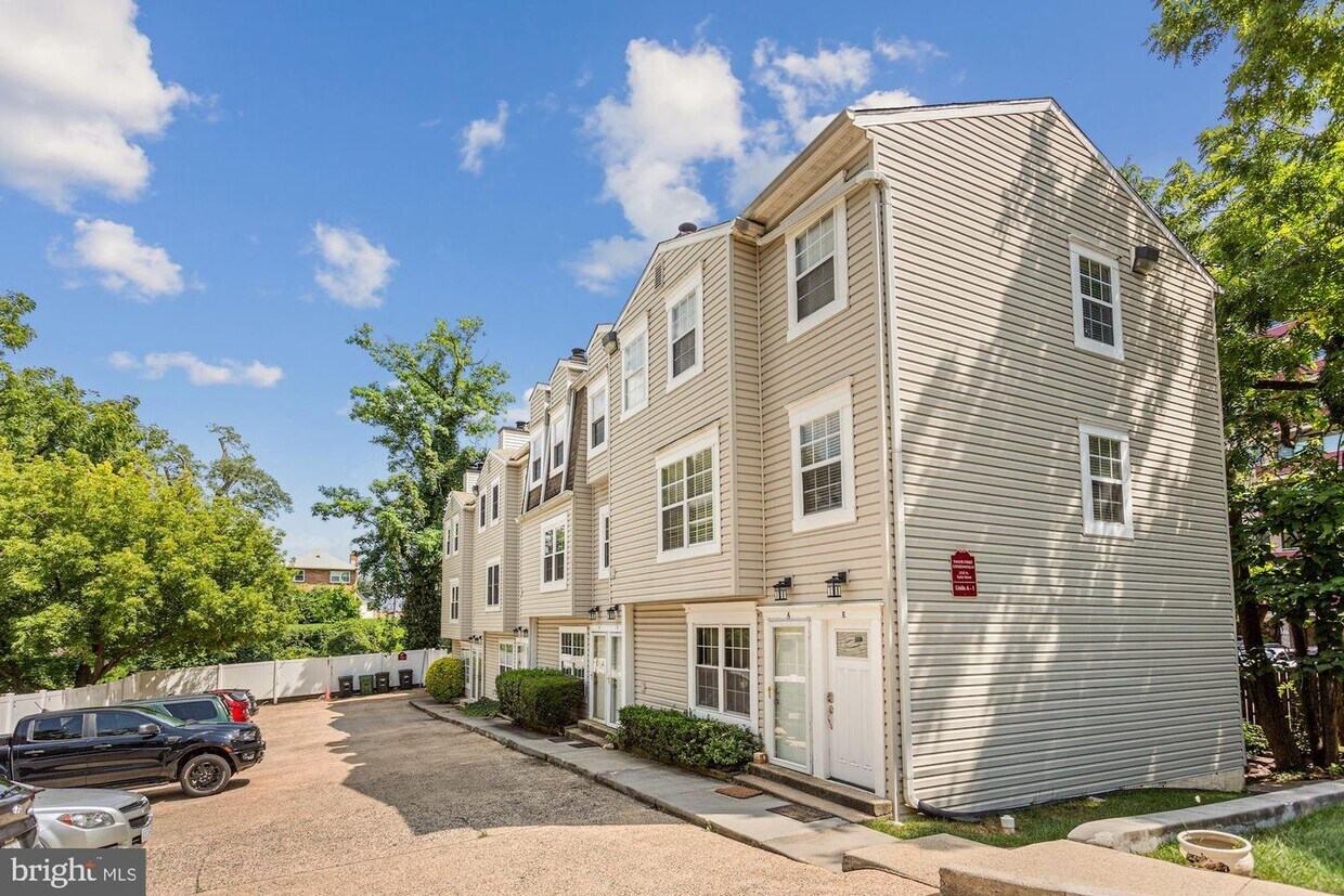
2135 N Taylor St Unit F
Arlington, VA 22207
2 Weeks Ago
Favorites
2135 N Taylor St Unit F

Favorites
Check Back Soon for Upcoming Availability
| Beds | Baths | Average SF |
|---|---|---|
| 2 Bedrooms 2 Bedrooms 2 Br | 2 Baths 2 Baths 2 Ba | 888 SF |
About This Property
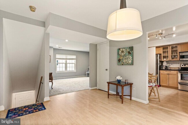
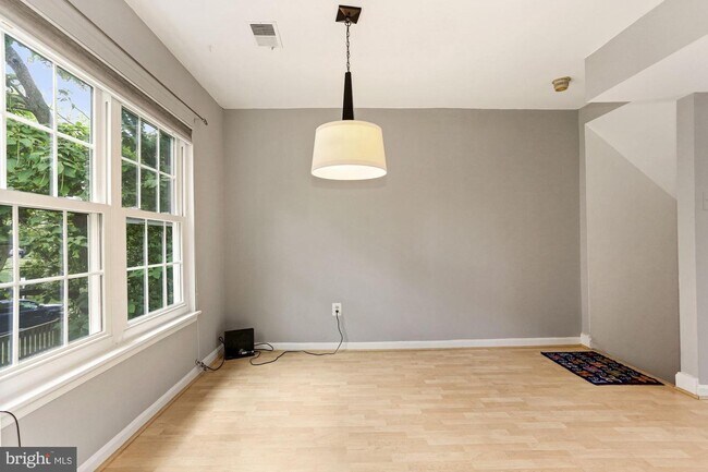
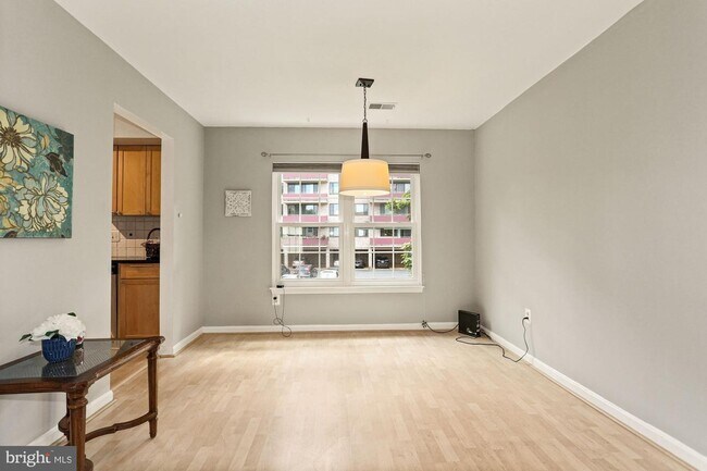
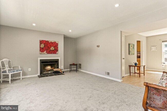
Amazing location- commuters dream! This 2 story, 2 bed/2 bath condo has its own private entrance and dedicated parking spot right in front of the home. New carpeting, new windows, home has been freshly painted throughout! Just 5 minute to Spout Run Drive, the Italian Store, Starbucks, 3 miles from Ballston Metro and just minutes to DC. Three blocks from Lee Heights Shopping center with many popular eateries, including the Lebanese Taverna Market, Starbuck,s, Chipolte, Randolph Bakery and so much more! Available by September 1.
2135 N Taylor St is a condo located in Arlington County and the 22207 ZIP Code. This area is served by the Arlington County Public Schools attendance zone.
Location
Get Directions
Located less than two miles north of Arlington, Cherrydale is a picturesque neighborhood centered on the Five Points intersection, where Old Dominion Drive, Lee Highway, Military Road, and Quincy Street meet. Cherrydale’s past dates back to its founding in 1893, and the neighborhood still contains an array of historic homes that have since been luxuriously renovated.
Cherrydale boasts a variety of rental offerings, from elegant houses to modern apartments, on tranquil tree-lined streets. Although the neighborhood is largely residential, the Cherrydale community enjoys access to a host of shops and restaurants on Old Dominion Drive. Several popular parks are convenient to the neighborhood, including Hayes Park, Quincy Park, and Potomac Overlook Regional Park. Commuting from Cherrydale is a breeze with access to Interstate 66 and several nearby Metro stations.
Learn more about living in CherrydaleBelow are rent ranges for similar nearby apartments
| Beds | Average Size | Lowest | Typical | Premium |
|---|---|---|---|---|
| Studio Studio Studio | 550 Sq Ft | $1,636 | $2,068 | $3,042 |
| 1 Bed 1 Bed 1 Bed | 700 Sq Ft | $1,925 | $2,638 | $3,771 |
| 2 Beds 2 Beds 2 Beds | 1060 Sq Ft | $2,085 | $3,510 | $6,710 |
| 3 Beds 3 Beds 3 Beds | 1402 Sq Ft | $3,205 | $3,559 | $3,830 |
| 4 Beds 4 Beds 4 Beds | 3221 Sq Ft | $4,900 | $7,650 | $13,000 |
Education
| Colleges & Universities | Distance | ||
|---|---|---|---|
| Colleges & Universities | Distance | ||
| Drive: | 3 min | 1.2 mi | |
| Drive: | 4 min | 1.5 mi | |
| Drive: | 9 min | 3.9 mi | |
| Drive: | 10 min | 4.8 mi |
2135 N Taylor St Unit F is within 3 minutes or 1.2 miles from Marymount University. It is also near George Mason Univ., Arlington and Georgetown University.
Schools


Public Elementary School
Grades PK-5
539 Students
Attendance Zone
Public Middle School
Grades 6-8
936 Students
Nearby
Public High School
Grades 9-12
2,715 Students
Attendance Zone
Private Elementary, Middle & High School
Grades 1-12
378 Students
Nearby
Private Elementary & Middle School
Grades PK-8
467 Students
Nearby
School data provided by
 The GreatSchools Rating helps parents compare schools within a state based on a variety of school quality indicators and provides a helpful picture of how effectively each school serves all of its students. Ratings are on a scale of 1 (below average) to 10 (above average) and can include test scores, college readiness, academic progress, advanced courses, equity, discipline and attendance data. We also advise parents to visit schools, consider other information on school performance and programs, and consider family needs as part of the school selection process.
View GreatSchools Rating Methodology
Data provided by GreatSchools.org © 2025. All rights reserved.
View GreatSchools Rating Methodology
Data provided by GreatSchools.org © 2025. All rights reserved.
Transportation options available in Arlington include Ballston-Mu, Orange/Silver Line Track 1 Platform, located 1.3 miles from 2135 N Taylor St Unit F. 2135 N Taylor St Unit F is near Ronald Reagan Washington Ntl, located 7.1 miles or 15 minutes away, and Washington Dulles International, located 23.8 miles or 38 minutes away.
| Transit / Subway | Distance | ||
|---|---|---|---|
| Transit / Subway | Distance | ||
| Drive: | 4 min | 1.3 mi | |
| Drive: | 5 min | 1.7 mi | |
| Drive: | 4 min | 1.7 mi | |
| Drive: | 5 min | 1.8 mi | |
| Drive: | 6 min | 2.7 mi |
| Commuter Rail | Distance | ||
|---|---|---|---|
| Commuter Rail | Distance | ||
|
|
Drive: | 12 min | 5.8 mi |
|
|
Drive: | 12 min | 6.7 mi |
|
|
Drive: | 12 min | 6.7 mi |
|
|
Drive: | 14 min | 6.9 mi |
|
|
Drive: | 14 min | 6.9 mi |
| Airports | Distance | ||
|---|---|---|---|
| Airports | Distance | ||
|
Ronald Reagan Washington Ntl
|
Drive: | 15 min | 7.1 mi |
|
Washington Dulles International
|
Drive: | 38 min | 23.8 mi |
Time and distance from 2135 N Taylor St Unit F.
| Shopping Centers | Distance | ||
|---|---|---|---|
| Shopping Centers | Distance | ||
| Walk: | 7 min | 0.4 mi | |
| Walk: | 7 min | 0.4 mi | |
| Walk: | 12 min | 0.6 mi |
2135 N Taylor St Unit F has 3 shopping centers within 0.6 mile, which is about a 12-minute walk. The miles and minutes will be for the farthest away property.
| Parks and Recreation | Distance | ||
|---|---|---|---|
| Parks and Recreation | Distance | ||
|
Cherry Valley Park
|
Walk: | 12 min | 0.6 mi |
|
David M. Brown Planetarium
|
Walk: | 15 min | 0.8 mi |
|
Donaldson Run Park
|
Drive: | 4 min | 1.4 mi |
|
Potomac Overlook Regional Park
|
Drive: | 4 min | 1.4 mi |
|
Ballston Beaver Pond Park
|
Drive: | 11 min | 6.6 mi |
2135 N Taylor St Unit F has 5 parks within 6.6 miles, including Cherry Valley Park, David M. Brown Planetarium, and Donaldson Run Park.
| Hospitals | Distance | ||
|---|---|---|---|
| Hospitals | Distance | ||
| Drive: | 4 min | 1.2 mi | |
| Drive: | 4 min | 1.7 mi | |
| Drive: | 9 min | 4.1 mi |
2135 N Taylor St Unit F has 3 hospitals within 4.1 miles, the nearest is Capital Hospice which is 1.2 miles away and a 4 minute drive.
| Military Bases | Distance | ||
|---|---|---|---|
| Military Bases | Distance | ||
| Drive: | 9 min | 4.1 mi |
2135 N Taylor St Unit F is 4.1 miles and a 9 minute drive from Fort Myer.
You May Also Like
Similar Rentals Nearby


What Are Walk Score®, Transit Score®, and Bike Score® Ratings?
Walk Score® measures the walkability of any address. Transit Score® measures access to public transit. Bike Score® measures the bikeability of any address.
What is a Sound Score Rating?
A Sound Score Rating aggregates noise caused by vehicle traffic, airplane traffic and local sources
2135 N Taylor St
Arlington, VA 22207