

$2,400
Total Monthly Price
2134 N Thomas St
Los Angeles, CA 90031
4 Days Ago
|
Edit
Favorites
626-548-3310
-
Bedrooms
2
-
Bathrooms
1
-
Square Feet
800 sq ft
-
Available
Available Now
Highlight
- Gated
2134 N Thomas St

Favorites
About This Home
12 Month Lease,
$2,400 deposit,
Available Now
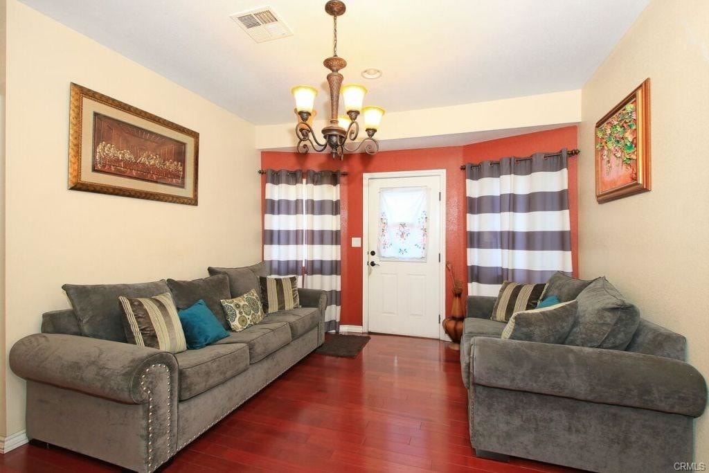
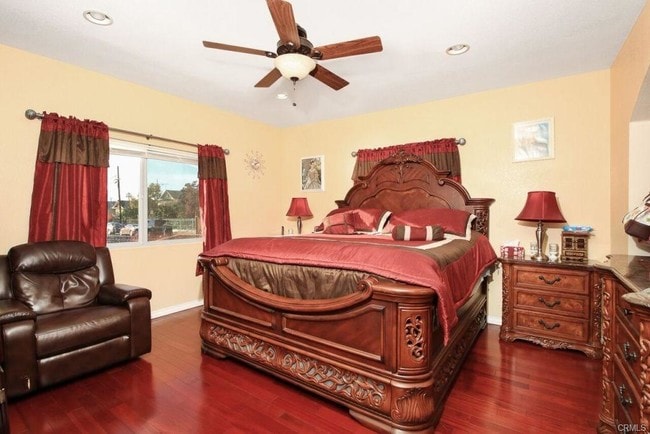
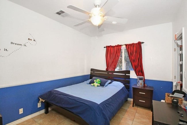
2BR/1BA in Lincoln Heights. Gated. Large kitchen with many cabinets, refrigerator, stove, microwave, dishwasher, and granite island center, washer/dryer, and storage closets.Wall attached cooling/heating, and ceiling fans. Walking distance to elementary school, Lincoln Park and Broadway shops. Minutes to Downtown L.A., USC Health Science Campus, LAC + USC Medical Center, Chinatown, 5 fwy, 10 fwy and 101 fwy.
2134 N Thomas St is a house located in Los Angeles County and the 90031 ZIP Code. This area is served by the Los Angeles Unified Rocp School District attendance zone.
* Price shown is total price based on community-supplied monthly required fees. Excludes user-selected optional fees and variable or usage-based fees and required charges due at or prior to move-in or at move-out. Price, availability, fees, and any applicable rent special are subject to change without notice.
* Square footage definitions vary. Displayed square footage is approximate.
House Features
Dishwasher
Washer/Dryer Hookup
Microwave
Refrigerator
- Washer/Dryer Hookup
- Heating
- Ceiling Fans
- Dishwasher
- Kitchen
- Microwave
- Refrigerator
- Gated
Fees and Policies
The fees listed below are community-provided and may exclude utilities or add-ons. All payments are made directly to the property and are non-refundable unless otherwise specified. Use the Cost Calculator to determine costs based on your needs.
- Parking
-
Surface Lot$150/mo
Details
Lease Options
-
12
Contact
- Listed by David Chang
- Phone Number
- Contact
Location
Get Directions
Southeast Los Angeles is directly south of the Fashion District and east of the University of Southern California (USC). This large neighborhood is minutes from downtown Los Angeles, Hollywood, and Beverly Hills, with easy access to the 110 Freeway. This great location places you near sunny beaches, nature trails, and a bevy of leading employers. Students can access both USC and California State University Long Beach from their Southeast LA apartment.
This densely populated, diverse neighborhood features everything from food trucks and corner markets to wide sidewalks and residential areas filled with bungalows, ranch, and Spanish Colonial architecture. Southeast LA features palm trees and mountain views, tampered with gritty undertones to give it a cool, funky vibe.
As for outdoor fun, take your pick between Catalina Island, Venus Beach, or the Santa Monica Pier. Nearby, you’ll find more sunny beaches like White Point, Cabrillo, and Long Beach.
Learn more about living in Southeast Los Angeles
Education
| Colleges & Universities | Distance | ||
|---|---|---|---|
| Colleges & Universities | Distance | ||
| Walk: | 20 min | 1.1 mi | |
| Drive: | 8 min | 3.2 mi | |
| Drive: | 9 min | 4.6 mi | |
| Drive: | 9 min | 4.6 mi |
2134 N Thomas St is within 20 minutes or 1.1 miles from USC, Health Sciences Campus. It is also near Cal State Los Angeles and Golden Gate Univ, Los Angeles.
Schools


Charter Elementary School
Grades K-5
75 Students
Nearby
Public Elementary School
Grades K-5
Attendance Zone
Public Middle School
Grades 6-8
Attendance Zone
Public High School
Grades 9-12
Attendance Zone
Public High School
Grades 9-12
Attendance Zone
Private Elementary & Middle School
Grades K-8
Nearby
Private Elementary & Middle School
Grades PK-8
Nearby
Private High School
Grades 9-12
Nearby
School data provided by
 The GreatSchools Rating helps parents compare schools within a state based on a variety of school quality indicators and provides a helpful picture of how effectively each school serves all of its students. Ratings are on a scale of 1 (below average) to 10 (above average) and can include test scores, college readiness, academic progress, advanced courses, equity, discipline and attendance data. We also advise parents to visit schools, consider other information on school performance and programs, and consider family needs as part of the school selection process.
View GreatSchools Rating Methodology
Data provided by GreatSchools.org © 2026. All rights reserved.
View GreatSchools Rating Methodology
Data provided by GreatSchools.org © 2026. All rights reserved.
Transportation options available in Los Angeles include Lincoln Heights/Cypress Park Station, located 1.6 miles from 2134 N Thomas St. 2134 N Thomas St is near Bob Hope, located 16.2 miles or 24 minutes away, and Los Angeles International, located 18.7 miles or 31 minutes away.
| Transit / Subway | Distance | ||
|---|---|---|---|
| Transit / Subway | Distance | ||
|
|
Drive: | 4 min | 1.6 mi |
|
|
Drive: | 5 min | 1.8 mi |
|
|
Drive: | 5 min | 2.1 mi |
|
|
Drive: | 5 min | 2.2 mi |
|
|
Drive: | 5 min | 2.6 mi |
| Commuter Rail | Distance | ||
|---|---|---|---|
| Commuter Rail | Distance | ||
|
|
Drive: | 8 min | 2.6 mi |
|
|
Drive: | 6 min | 2.7 mi |
|
|
Drive: | 11 min | 5.5 mi |
| Drive: | 9 min | 6.6 mi | |
|
|
Drive: | 16 min | 10.1 mi |
| Airports | Distance | ||
|---|---|---|---|
| Airports | Distance | ||
|
Bob Hope
|
Drive: | 24 min | 16.2 mi |
|
Los Angeles International
|
Drive: | 31 min | 18.7 mi |
Time and distance from 2134 N Thomas St.
| Shopping Centers | Distance | ||
|---|---|---|---|
| Shopping Centers | Distance | ||
| Walk: | 8 min | 0.4 mi | |
| Drive: | 4 min | 1.1 mi | |
| Drive: | 3 min | 1.2 mi |
2134 N Thomas St has 3 shopping centers within 1.2 miles, which is about a 3-minute drive. The miles and minutes will be for the farthest away property.
| Parks and Recreation | Distance | ||
|---|---|---|---|
| Parks and Recreation | Distance | ||
|
Hollenbeck Lake
|
Drive: | 6 min | 2.5 mi |
|
Audubon Center at Debs Park
|
Drive: | 7 min | 2.6 mi |
|
Chavez Ravine Arboretum
|
Drive: | 8 min | 3.6 mi |
|
Elysian Park
|
Drive: | 11 min | 3.6 mi |
|
Elyria Canyon Park
|
Drive: | 10 min | 4.2 mi |
2134 N Thomas St has 5 parks within 4.2 miles, including Hollenbeck Lake, Audubon Center at Debs Park, and Elysian Park.
| Hospitals | Distance | ||
|---|---|---|---|
| Hospitals | Distance | ||
| Walk: | 15 min | 0.8 mi | |
| Drive: | 4 min | 1.4 mi | |
| Drive: | 8 min | 4.6 mi |
2134 N Thomas St has 3 hospitals within 4.6 miles, the nearest is Keck Hospital of USC which is 0.8 mile away and a 15 minute walk.
| Military Bases | Distance | ||
|---|---|---|---|
| Military Bases | Distance | ||
| Drive: | 29 min | 20.3 mi |
2134 N Thomas St is 20.3 miles and a 29 minute drive from Los Angeles Air Force Base.
Amenities
- Washer/Dryer Hookup
- Heating
- Ceiling Fans
- Dishwasher
- Kitchen
- Microwave
- Refrigerator
- Gated
2134 N Thomas St Photos
What Are Walk Score®, Transit Score®, and Bike Score® Ratings?
Walk Score® measures the walkability of any address. Transit Score® measures access to public transit. Bike Score® measures the bikeability of any address.
What is a Sound Score Rating?
A Sound Score Rating aggregates noise caused by vehicle traffic, airplane traffic and local sources.

2134 N Thomas St
Los Angeles, CA 90031