
$800
/ Month
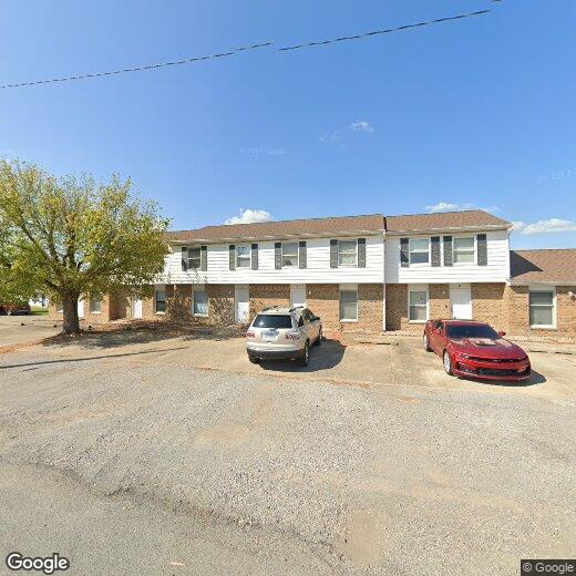
2110 Melanie Ln Unit E
Marion, IL 62959
Favorites
2110 Melanie Ln Unit E

Favorites
Check Back Soon for Upcoming Availability
| Beds | Baths | Average SF |
|---|---|---|
| 2 Bedrooms 2 Bedrooms 2 Br | 1 Bath 1 Bath 1 Ba | — |
About This Property
Welcome to your new place in Marion, IL. This well-maintained apartment unit for rent is located in Marion, IL at 2110 Melanie Ln, where you'll have convenient access to many fantastic popular destinations. With this great space, you're home. Let us assist you! Contact us now to discuss the next steps!
2110 Melanie Ln is an apartment community located in Williamson County and the 62959 ZIP Code.
2110 Melanie Ln,
Marion,
IL
62959
The city of Marion is a cozy community along Interstate 57 in Southern Illinois. Marion is a major commercial hub for the region, with the Illinois Star Centre mall serving as one of the city’s most popular attractions. Downtown features a vibrant collective of cafes, neighborhood bars, and specialty shops surrounding the Old Town Square, with the iconic Marion Clock Tower serving as the centerpiece.
Southern Illinois Miners baseball games at Rent One Park attract droves of fans in the summertime, and the Marion Cultural and Civic Center brings concerts and theater productions to town throughout the year. Shawnee National Forest is only a few minutes to the southeast, providing an excellent venue for spending quality time outdoors.
Learn more about living in Marion
Education
| Colleges & Universities | Distance | ||
|---|---|---|---|
| Colleges & Universities | Distance | ||
| Drive: | 16 min | 9.6 mi | |
| Drive: | 28 min | 17.5 mi | |
| Drive: | 39 min | 32.5 mi |
2110 Melanie Ln Unit E is within 16 minutes or 9.6 miles from John A. Logan College. It is also near Southern Ill. Univ. Carbondale and Rend Lake College.
Walkability Near 2110 Melanie Ln Marion, IL 62959
Getting Around
 What do Walkability, Transit, Drivability, and Bikeability mean?
Walkability measures the walking distance to day-to-day needs.
Transit measures access to public transportation.
Drivability measures congestion, parking availability, and access to major roads.
Bikeability measures the suitability for cycling.
How It Works
What do Walkability, Transit, Drivability, and Bikeability mean?
Walkability measures the walking distance to day-to-day needs.
Transit measures access to public transportation.
Drivability measures congestion, parking availability, and access to major roads.
Bikeability measures the suitability for cycling.
How It Works
Fairly Walkable
Walkability
40
/ 100
Exceptionally Drivable
Drivability
100
/ 100
Fairly Bikeable
Bikeability
40
/ 100
Scores provided by
Active
Soundscore™
77
/ 100
Traffic
ActiveAirport
CalmBusinesses
ActiveScores provided by
HowLoud What is a Sound Score Rating? A Sound Score Rating aggregates noise caused by vehicle traffic, airplane traffic and local sources. How It WorksYou May Also Like
Similar Rentals Nearby


What Are Walk Score®, Transit Score®, and Bike Score® Ratings?
Walk Score® measures the walkability of any address. Transit Score® measures access to public transit. Bike Score® measures the bikeability of any address.
What is a Sound Score Rating?
A Sound Score Rating aggregates noise caused by vehicle traffic, airplane traffic and local sources.
2110 Melanie Ln
Marion, IL 62959