
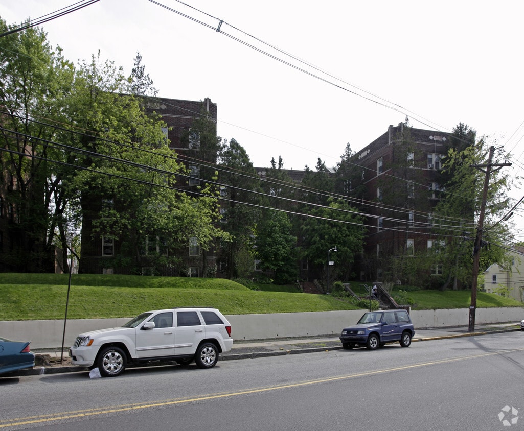
Parkway Lofts
5 Lawrence St,
Bloomfield, NJ 07003
$2,025 - $3,855
Studio - 2 Beds

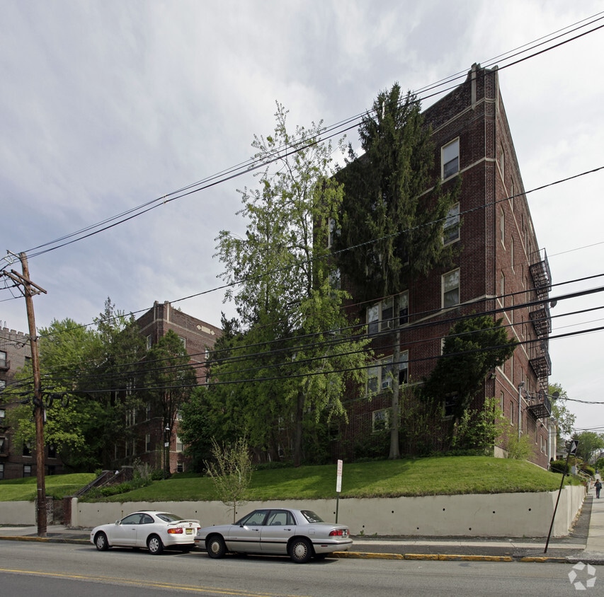

Discover your new home at 210 Franklin St. This community is located in the 7003 area of Bloomfield. From pricing to features, the leasing team is available to help you find your perfect new place. Providing 1 to 3 bedroom floor plans. Stop looking and get moving. Contact or stop by 210 Franklin St to learn more about our community!
210 Franklin St is an apartment community located in Essex County and the 07003 ZIP Code. This area is served by the Bloomfield Board Of Education School District attendance zone.
Laundry Facilities
24 Hour Access
Property Manager on Site
Maintenance on site
Air Conditioning
Refrigerator
Freezer
Oven
Located 12 miles from Manhattan, Bloomfield combines small-town atmosphere with metropolitan accessibility. This Essex County township features established neighborhoods with housing options from classic single-family homes to contemporary apartment communities. The historic Bloomfield Green, anchored by the Presbyterian Church dating to 1794, serves as the town center. With two NJ Transit stations connecting to New York City and Newark, Bloomfield offers convenient transportation options for commuters. Current rental data shows one-bedroom apartments averaging $2,012, while three-bedroom units average $2,828.
Brookdale Park, spanning 77 acres, provides recreational opportunities with walking paths and athletic facilities. The downtown area near Bloomfield College features local shops and dining establishments. The Garden State Parkway and other major routes make commuting convenient from Bloomfield.
Learn more about living in Bloomfield| Colleges & Universities | Distance | ||
|---|---|---|---|
| Colleges & Universities | Distance | ||
| Walk: | 14 min | 0.7 mi | |
| Drive: | 7 min | 3.9 mi | |
| Drive: | 8 min | 4.0 mi | |
| Drive: | 8 min | 4.3 mi |


Transportation options available in Bloomfield include Grove Street, located 0.8 mile from 210 Franklin St. 210 Franklin St is near Newark Liberty International, located 9.7 miles or 16 minutes away, and LaGuardia, located 25.7 miles or 44 minutes away.
| Transit / Subway | Distance | ||
|---|---|---|---|
| Transit / Subway | Distance | ||
|
|
Walk: | 15 min | 0.8 mi |
|
|
Drive: | 2 min | 1.1 mi |
|
|
Drive: | 3 min | 1.2 mi |
|
|
Drive: | 3 min | 1.6 mi |
|
|
Drive: | 3 min | 2.1 mi |
| Commuter Rail | Distance | ||
|---|---|---|---|
| Commuter Rail | Distance | ||
|
|
Walk: | 14 min | 0.7 mi |
|
|
Walk: | 15 min | 0.8 mi |
|
|
Drive: | 2 min | 1.3 mi |
|
|
Drive: | 4 min | 1.9 mi |
|
|
Drive: | 6 min | 2.8 mi |
| Airports | Distance | ||
|---|---|---|---|
| Airports | Distance | ||
|
Newark Liberty International
|
Drive: | 16 min | 9.7 mi |
|
LaGuardia
|
Drive: | 44 min | 25.7 mi |
Scores provided by
Traffic
-Airport
-Businesses
-Scores provided by
HowLoud What is a Sound Score Rating? A Sound Score Rating aggregates noise caused by vehicle traffic, airplane traffic and local sources. How It WorksTime and distance from 210 Franklin St.
| Shopping Centers | Distance | ||
|---|---|---|---|
| Shopping Centers | Distance | ||
| Walk: | 12 min | 0.7 mi | |
| Walk: | 14 min | 0.8 mi | |
| Drive: | 3 min | 1.7 mi |
| Parks and Recreation | Distance | ||
|---|---|---|---|
| Parks and Recreation | Distance | ||
|
Branch Brook Park
|
Drive: | 6 min | 2.8 mi |
|
Van Vleck House & Gardens
|
Drive: | 6 min | 3.3 mi |
|
Edison National Historic Site
|
Drive: | 9 min | 3.8 mi |
|
Newark Museum and Dreyfuss Planetarium
|
Drive: | 7 min | 4.0 mi |
|
Kearny Marsh
|
Drive: | 12 min | 5.7 mi |
| Hospitals | Distance | ||
|---|---|---|---|
| Hospitals | Distance | ||
| Drive: | 6 min | 3.3 mi | |
| Drive: | 7 min | 3.9 mi | |
| Drive: | 8 min | 4.3 mi |
| Military Bases | Distance | ||
|---|---|---|---|
| Military Bases | Distance | ||
| Drive: | 22 min | 13.5 mi | |
| Drive: | 32 min | 15.5 mi | |
| Drive: | 37 min | 21.6 mi |
What Are Walk Score®, Transit Score®, and Bike Score® Ratings?
Walk Score® measures the walkability of any address. Transit Score® measures access to public transit. Bike Score® measures the bikeability of any address.
What is a Sound Score Rating?
A Sound Score Rating aggregates noise caused by vehicle traffic, airplane traffic and local sources.
210 Franklin St
Bloomfield, NJ 07003


