

$2,400 / Month
21 Tremont St
Chelsea, MA 02150
2 Weeks Ago
Favorites
21 Tremont St

Favorites
Check Back Soon for Upcoming Availability
| Beds | Baths | Average SF |
|---|---|---|
| 2 Bedrooms 2 Bedrooms 2 Br | 1 Bath 1 Bath 1 Ba | 1,220 SF |
Fees and Policies
The fees below are based on community-supplied data and may exclude additional fees and utilities.
Pet policies are negotiable.
About This Property
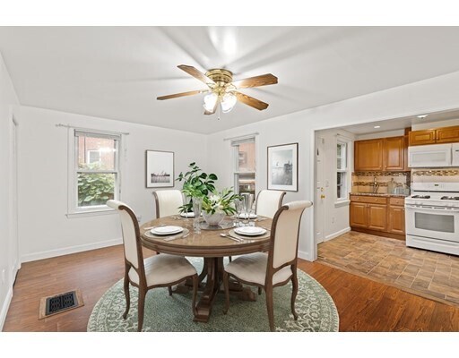
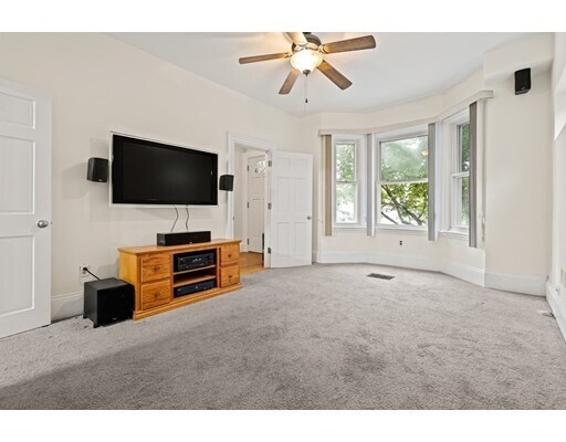
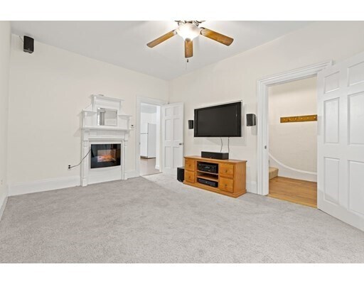
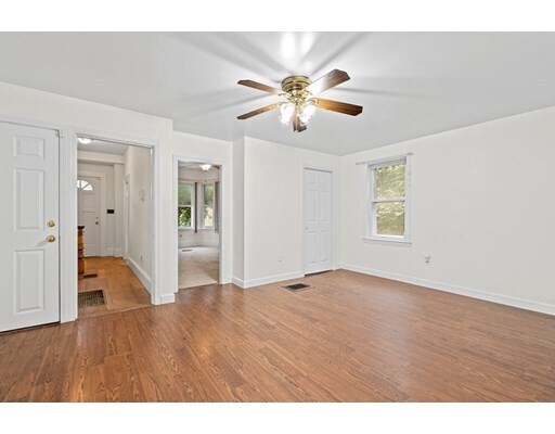
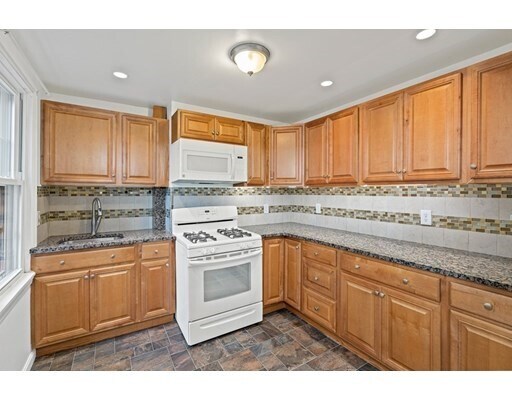
Live in this entire single family home conveniently located in the Historic Chelsea Square neighborhood. The first floor features an updated kitchen and spacious dining/living area with Massport bay windows bringing in lots of natural light. Head upstairs to the second floor consisting of two bedrooms and one full bath, including a huge Master bedroom with a flexible bonus room that could function as a home office or a variety of other uses. Located within walking distance of many great restaurants, shopping, bus stops, Palonia Park and the pet friendly MDC Mary O'Malley Park. There is a full basement with laundry and a private backyard with lots of potential. Easy access to Route 1, I-93, and downtown Boston. Tenant is responsible for all utilities.
21 Tremont St is a house located in Suffolk County and the 02150 ZIP Code. This area is served by the Chelsea attendance zone.
House Features
Microwave
Refrigerator
Freezer
Range
- Cable Ready
- Microwave
- Range
- Refrigerator
- Freezer
- Walking/Biking Trails
- Fenced Lot
Location
Get Directions
While it may be the smallest city in Massachusetts, Chelsea is one of its most populated. This busy city is three miles northeast of Boston, wrapped by the Mystic River. This historic city was first settled in 1624, and much of its history is still evident in its Victorian architecture and narrow streets. Chelsea is filled with charm and personality, from its corner markets and tree-lined streets to its blend of historic brick buildings and sleek, modern complexes.
When you move to your apartment in Chelsea, you'll discover a fast-paced but friendly city filled with unique landmarks. This is the home of Bunker Hill Community College, Mystic Mall, and Mary O'Malley State Park. Commuters can take the MBTA train from Bellingham Square or the 111 bus into downtown Boston. The Tobin Bridge leads Chelsea residents to the Boston National Historical Park, the Bunker Hill Monument, the USS Constitution, and Downtown Boston in minutes.
Learn more about living in ChelseaBelow are rent ranges for similar nearby apartments
Amenities
- Cable Ready
- Microwave
- Range
- Refrigerator
- Freezer
- Fenced Lot
- Walking/Biking Trails
Education
| Colleges & Universities | Distance | ||
|---|---|---|---|
| Colleges & Universities | Distance | ||
| Drive: | 9 min | 3.3 mi | |
| Drive: | 10 min | 3.8 mi | |
| Drive: | 8 min | 4.1 mi | |
| Drive: | 9 min | 5.3 mi |
21 Tremont St is within 9 minutes or 3.3 miles from Suffolk University. It is also near Bunker Hill Community College and Emerson College.
Schools


Public Elementary & Middle School
Grades PK-8
581 Students
Nearby
Public Elementary & Middle School
Grades 5-8
451 Students
Nearby
Public Elementary School
Grades PK-1
823 Students
Nearby
Public High School
Grades 9-12
1,611 Students
Attendance Zone
Private Elementary & Middle School
Grades PK-8
210 Students
Nearby
Private Middle & High School
Grades 8-12
31 Students
Nearby
School data provided by
 The GreatSchools Rating helps parents compare schools within a state based on a variety of school quality indicators and provides a helpful picture of how effectively each school serves all of its students. Ratings are on a scale of 1 (below average) to 10 (above average) and can include test scores, college readiness, academic progress, advanced courses, equity, discipline and attendance data. We also advise parents to visit schools, consider other information on school performance and programs, and consider family needs as part of the school selection process.
View GreatSchools Rating Methodology
Data provided by GreatSchools.org © 2025. All rights reserved.
View GreatSchools Rating Methodology
Data provided by GreatSchools.org © 2025. All rights reserved.
Transportation options available in Chelsea include Maverick Station, located 1.6 miles from 21 Tremont St. 21 Tremont St is near General Edward Lawrence Logan International, located 3.0 miles or 7 minutes away.
| Transit / Subway | Distance | ||
|---|---|---|---|
| Transit / Subway | Distance | ||
|
|
Drive: | 4 min | 1.6 mi |
|
|
Drive: | 5 min | 1.9 mi |
|
|
Drive: | 8 min | 3.3 mi |
|
|
Drive: | 8 min | 3.6 mi |
|
|
Drive: | 9 min | 4.7 mi |
| Commuter Rail | Distance | ||
|---|---|---|---|
| Commuter Rail | Distance | ||
| Walk: | 16 min | 0.9 mi | |
|
|
Drive: | 7 min | 3.4 mi |
|
|
Drive: | 8 min | 3.9 mi |
|
|
Drive: | 8 min | 4.9 mi |
|
|
Drive: | 13 min | 5.4 mi |
| Airports | Distance | ||
|---|---|---|---|
| Airports | Distance | ||
|
General Edward Lawrence Logan International
|
Drive: | 7 min | 3.0 mi |
Time and distance from 21 Tremont St.
| Shopping Centers | Distance | ||
|---|---|---|---|
| Shopping Centers | Distance | ||
| Walk: | 13 min | 0.7 mi | |
| Drive: | 3 min | 1.2 mi | |
| Drive: | 4 min | 1.5 mi |
21 Tremont St has 3 shopping centers within 1.5 miles, which is about a 4-minute walk. The miles and minutes will be for the farthest away property.
| Parks and Recreation | Distance | ||
|---|---|---|---|
| Parks and Recreation | Distance | ||
|
Museum of Science
|
Drive: | 9 min | 3.5 mi |
|
Boston African American National Historic Site
|
Drive: | 9 min | 3.5 mi |
|
New England Aquarium
|
Drive: | 8 min | 4.5 mi |
|
Boston National Historical Park
|
Drive: | 8 min | 4.5 mi |
|
Boston Harbor Islands National Recreation Area
|
Drive: | 8 min | 4.6 mi |
21 Tremont St has 5 parks within 4.6 miles, including New England Aquarium, Boston National Historical Park, and Boston African American National Historic Site.
| Hospitals | Distance | ||
|---|---|---|---|
| Hospitals | Distance | ||
| Drive: | 9 min | 3.3 mi | |
| Drive: | 8 min | 4.4 mi | |
| Drive: | 10 min | 5.4 mi |
21 Tremont St has 3 hospitals within 5.4 miles, the nearest is Shriners Hospital for Children - Boston which is 3.3 miles away and a 9 minute drive.
| Military Bases | Distance | ||
|---|---|---|---|
| Military Bases | Distance | ||
| Drive: | 26 min | 15.0 mi | |
| Drive: | 31 min | 16.0 mi |
21 Tremont St is 15.0 miles from Fort Miller, and is convenient to other military bases, including Hanscom Air Force Base.
You May Also Like
Similar Rentals Nearby


What Are Walk Score®, Transit Score®, and Bike Score® Ratings?
Walk Score® measures the walkability of any address. Transit Score® measures access to public transit. Bike Score® measures the bikeability of any address.
What is a Sound Score Rating?
A Sound Score Rating aggregates noise caused by vehicle traffic, airplane traffic and local sources
21 Tremont St
Chelsea, MA 02150