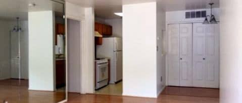
$1,450
/ Month
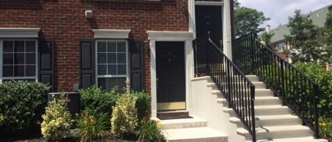
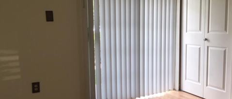
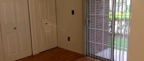
21 Mulberry St
Jersey City, NJ 07305
Favorites
-
Bedrooms
1
-
Bathrooms
1
-
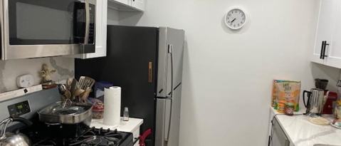
Square Feet
672 sq ft
21 Mulberry St

Favorites
About This Home
---- SCHEDULE A SHOWING ONLINE AT: ----
21 Mulberry St is a condo located in Hudson County and the 07305 ZIP Code.
* Price shown is base rent. Excludes user-selected optional fees and variable or usage-based fees and required charges due at or prior to move-in or at move-out. Price, availability, fees, and any applicable rent special are subject to change without notice.
* Square footage definitions vary. Displayed square footage is approximate.
Contact
- Listed by Locayt
Location
Get Directions
Located on the west side of Jersey City, the Hackensack River Waterfront offers residents a suburban home environment with plenty of beautiful outdoor spaces to explore. The community boasts a broad range of apartments, condos, and townhomes available for rent in a scenic locale.
Although the community is largely residential, the Hackensack River Waterfront also provides excellent shopping and dining options at Hudson Mall, along with easy access to a vibrant stretch of diverse eateries, boutiques, and bars on West Side Avenue. The expansive Lincoln Park borders the community to the north, offering multi-use trails, athletic facilities, wildlife habitats, artistic statues, and a dog park close to home. Liberty State Park is also just a short drive away.
The community’s close proximity to New Jersey City University and Saint Peter’s University makes it a top choice for many students, faculty, and staff.
Learn more about living in Hackensack River Waterfront
Education
| Colleges & Universities | Distance | ||
|---|---|---|---|
| Colleges & Universities | Distance | ||
| Drive: | 6 min | 1.7 mi | |
| Drive: | 8 min | 3.3 mi | |
| Drive: | 9 min | 3.7 mi | |
| Drive: | 15 min | 6.8 mi |
21 Mulberry St is within 6 minutes or 1.7 miles from New Jersey City University. It is also near Saint Peter's College and Hudson Co. Comm. College.
Transportation options available in Jersey City include West Side Avenue, located 1.8 miles from 21 Mulberry St. 21 Mulberry St is near Newark Liberty International, located 8.2 miles or 15 minutes away, and LaGuardia, located 17.6 miles or 38 minutes away.
| Transit / Subway | Distance | ||
|---|---|---|---|
| Transit / Subway | Distance | ||
|
|
Drive: | 6 min | 1.8 mi |
|
|
Drive: | 7 min | 2.4 mi |
|
|
Drive: | 8 min | 2.5 mi |
|
|
Drive: | 9 min | 3.7 mi |
|
|
Drive: | 9 min | 4.0 mi |
| Commuter Rail | Distance | ||
|---|---|---|---|
| Commuter Rail | Distance | ||
|
|
Drive: | 9 min | 3.7 mi |
|
|
Drive: | 11 min | 4.8 mi |
|
|
Drive: | 13 min | 5.4 mi |
|
|
Drive: | 14 min | 5.8 mi |
|
|
Drive: | 14 min | 5.9 mi |
| Airports | Distance | ||
|---|---|---|---|
| Airports | Distance | ||
|
Newark Liberty International
|
Drive: | 15 min | 8.2 mi |
|
LaGuardia
|
Drive: | 38 min | 17.6 mi |
Getting Around
 What do Walkability, Transit, Drivability, and Bikeability mean?
Walkability measures the walking distance to day-to-day needs.
Transit measures access to public transportation.
Drivability measures congestion, parking availability, and access to major roads.
Bikeability measures the suitability for cycling.
How It Works
What do Walkability, Transit, Drivability, and Bikeability mean?
Walkability measures the walking distance to day-to-day needs.
Transit measures access to public transportation.
Drivability measures congestion, parking availability, and access to major roads.
Bikeability measures the suitability for cycling.
How It Works
Fairly Walkable
Walkability
50
/ 100
Limited Public Transit
Transit
30
/ 100
Exceptionally Drivable
Drivability
100
/ 100
Moderately Bikeable
Bikeability
70
/ 100
Scores provided by
-
Soundscore™
-
/ 100
Traffic
-Airport
-Businesses
-Scores provided by
HowLoud What is a Sound Score Rating? A Sound Score Rating aggregates noise caused by vehicle traffic, airplane traffic and local sources. How It WorksTime and distance from 21 Mulberry St.
| Shopping Centers | Distance | ||
|---|---|---|---|
| Shopping Centers | Distance | ||
| Walk: | 16 min | 0.9 mi | |
| Drive: | 5 min | 1.2 mi | |
| Drive: | 5 min | 1.8 mi |
21 Mulberry St has 3 shopping centers within 1.8 miles, which is about a 5-minute drive. The miles and minutes will be for the farthest away property.
| Parks and Recreation | Distance | ||
|---|---|---|---|
| Parks and Recreation | Distance | ||
|
Stephen Gregg Park
|
Drive: | 8 min | 2.9 mi |
|
Liberty Science Center
|
Drive: | 11 min | 4.3 mi |
|
Liberty Landing Marina
|
Drive: | 12 min | 4.8 mi |
|
Statue of Liberty
|
Drive: | 17 min | 5.7 mi |
|
Ellis Island National Monument
|
Drive: | 17 min | 5.7 mi |
21 Mulberry St has 5 parks within 5.7 miles, including Stephen Gregg Park, Liberty Science Center, and Liberty Landing Marina.
| Hospitals | Distance | ||
|---|---|---|---|
| Hospitals | Distance | ||
| Drive: | 10 min | 4.1 mi | |
| Drive: | 10 min | 4.7 mi | |
| Drive: | 10 min | 4.9 mi |
21 Mulberry St has 3 hospitals within 4.9 miles, the nearest is Jersey City Medical Center which is 4.1 miles away and a 10 minute drive.
| Military Bases | Distance | ||
|---|---|---|---|
| Military Bases | Distance | ||
| Drive: | 11 min | 4.7 mi | |
| Drive: | 21 min | 9.8 mi | |
| Drive: | 29 min | 13.0 mi |
21 Mulberry St has 3 military bases within 13.0 miles, the nearest is Military Ocean Terminal which is 4.7 miles away and a 11 minute drive.
You May Also Like
How do I access Social Services in New Jersey?
Statewide service is free, confidential, multilingual and always open. Three easy ways to reach Social Services in NJ: Dial 2-1-1; text your zip code to 898-211; or chat at https://www.nj211.org
Similar Rentals Nearby


What Are Walk Score®, Transit Score®, and Bike Score® Ratings?
Walk Score® measures the walkability of any address. Transit Score® measures access to public transit. Bike Score® measures the bikeability of any address.
What is a Sound Score Rating?
A Sound Score Rating aggregates noise caused by vehicle traffic, airplane traffic and local sources.

21 Mulberry St
Jersey City, NJ 07305