


$2,250 / Month
21 Manning St
Medford, MA 02155
2 Weeks Ago
Favorites
21 Manning St

Favorites
Check Back Soon for Upcoming Availability
| Beds | Baths | Average SF |
|---|---|---|
| 3 Bedrooms 3 Bedrooms 3 Br | 1 Bath 1 Bath 1 Ba | 9,999 SF |
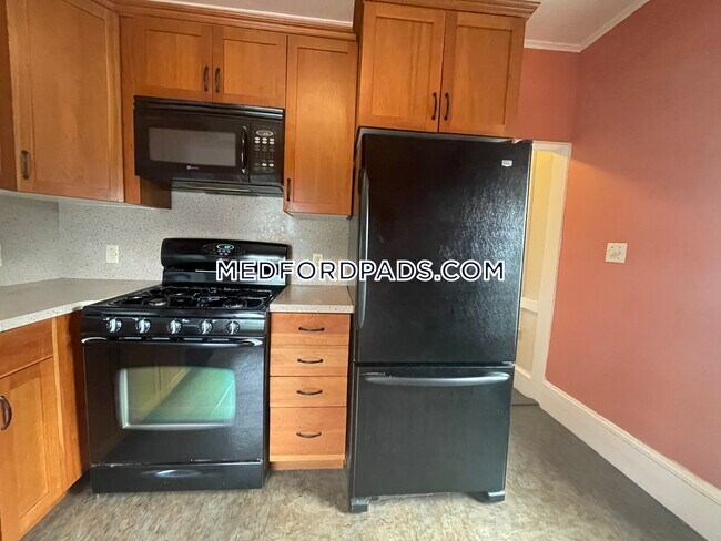
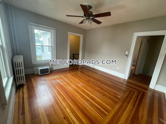
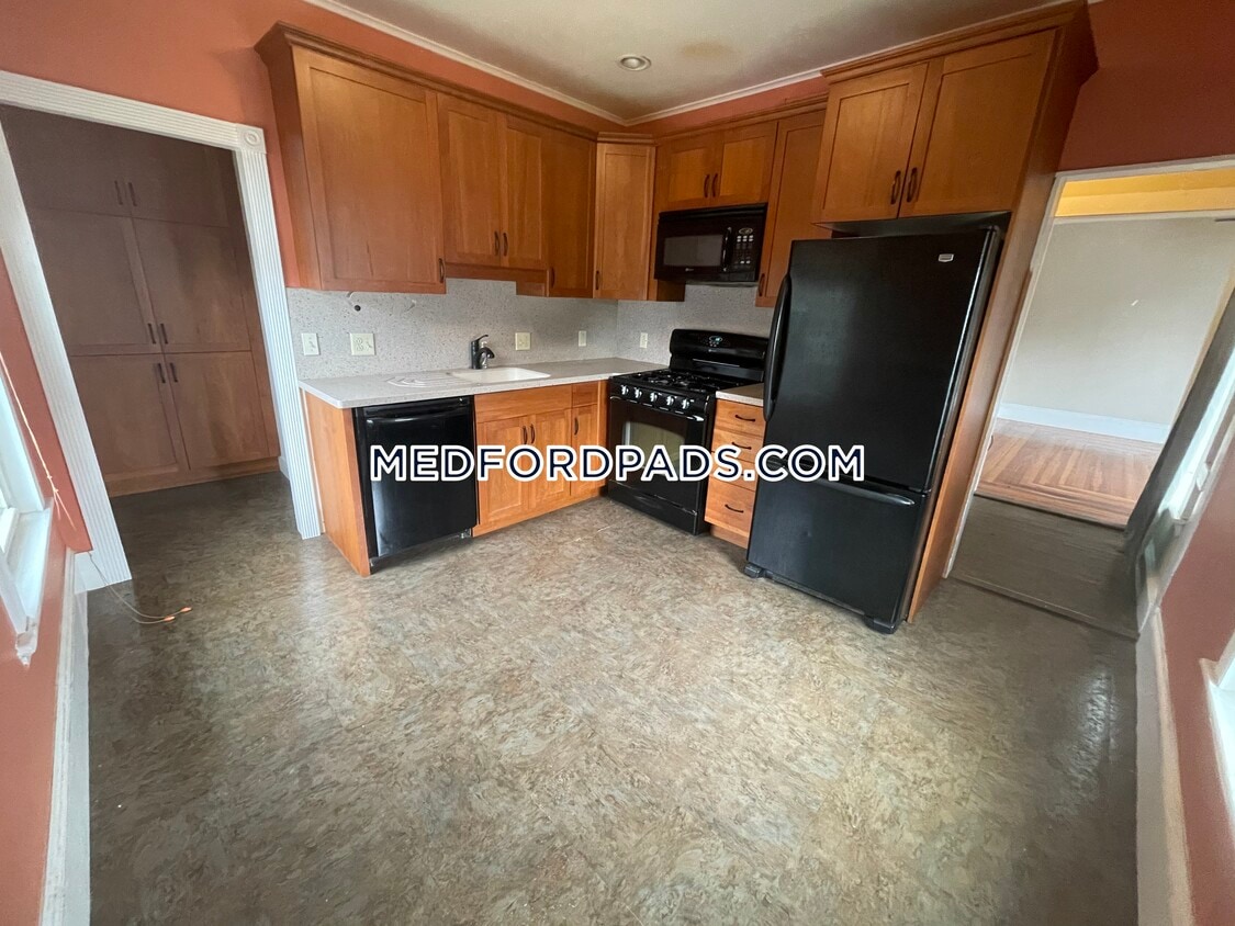
About This Property
Lovely 3 Bed 1 Bath on Manning St. Call for More Details!!
21 Manning St is a house located in Middlesex County and the 02155 ZIP Code.
Location
Get Directions
Located along Mystic River and Interstate 93, South Medford is an ideal neighborhood for outdoor recreation and quick commutes. Barry Park is one of South Medford’s community green spaces, offering picnic areas and playgrounds, while Columbus Memorial Park offers ball fields and a basketball court. South Medford is home to a section of Tufts University, so this urban neighborhood has a college town vibe and is home to several historic sites.
With family-friendly amenities and safe residential streets, South Medford is a welcoming community that’s supportive of its fellow residents. Residents enjoy the neighborhood’s local treasures and small businesses like Oasis Café & Bakery and Bob’s Italian Foods. South Medford is just three miles north of Cambridge and five miles northwest of Boston and the Boston Logan International Airport.
Learn more about living in South MedfordBelow are rent ranges for similar nearby apartments
Education
| Colleges & Universities | Distance | ||
|---|---|---|---|
| Colleges & Universities | Distance | ||
| Drive: | 2 min | 1.2 mi | |
| Drive: | 7 min | 2.8 mi | |
| Drive: | 7 min | 3.1 mi | |
| Drive: | 9 min | 3.8 mi |
21 Manning St is within 2 minutes or 1.2 miles from Tufts Univ., Medford. It is also near Lesley University, Porter and Lesley University.
Transportation options available in Medford include Medford/Tufts, located 0.9 mile from 21 Manning St. 21 Manning St is near General Edward Lawrence Logan International, located 8.1 miles or 15 minutes away.
| Transit / Subway | Distance | ||
|---|---|---|---|
| Transit / Subway | Distance | ||
| Walk: | 16 min | 0.9 mi | |
| Drive: | 4 min | 1.6 mi | |
|
|
Drive: | 4 min | 1.9 mi |
| Drive: | 5 min | 2.1 mi | |
| Drive: | 6 min | 2.6 mi |
| Commuter Rail | Distance | ||
|---|---|---|---|
| Commuter Rail | Distance | ||
|
|
Drive: | 3 min | 1.5 mi |
|
|
Drive: | 6 min | 2.7 mi |
|
|
Drive: | 6 min | 2.9 mi |
|
|
Drive: | 8 min | 3.1 mi |
|
|
Drive: | 6 min | 3.2 mi |
| Airports | Distance | ||
|---|---|---|---|
| Airports | Distance | ||
|
General Edward Lawrence Logan International
|
Drive: | 15 min | 8.1 mi |
Time and distance from 21 Manning St.
| Shopping Centers | Distance | ||
|---|---|---|---|
| Shopping Centers | Distance | ||
| Walk: | 8 min | 0.4 mi | |
| Walk: | 9 min | 0.5 mi | |
| Drive: | 4 min | 1.9 mi |
21 Manning St has 3 shopping centers within 1.9 miles, which is about a 4-minute walk. The miles and minutes will be for the farthest away property.
| Parks and Recreation | Distance | ||
|---|---|---|---|
| Parks and Recreation | Distance | ||
|
Mystic River Reservation
|
Drive: | 4 min | 2.0 mi |
|
Harvard-Smithsonian Center for Astrophysics
|
Drive: | 9 min | 3.4 mi |
|
Mineralogical and Geological Museum
|
Drive: | 8 min | 3.4 mi |
|
Harvard Museum of Natural History
|
Drive: | 8 min | 3.4 mi |
|
Longfellow National Historic Site
|
Drive: | 9 min | 3.9 mi |
21 Manning St has 5 parks within 3.9 miles, including Mystic River Reservation, Harvard Museum of Natural History, and Mineralogical and Geological Museum.
| Hospitals | Distance | ||
|---|---|---|---|
| Hospitals | Distance | ||
| Drive: | 9 min | 4.3 mi | |
| Drive: | 9 min | 4.6 mi | |
| Drive: | 10 min | 4.7 mi |
21 Manning St has 3 hospitals within 4.7 miles, the nearest is Winchester Hospital which is 4.3 miles away and a 9 minute drive.
| Military Bases | Distance | ||
|---|---|---|---|
| Military Bases | Distance | ||
| Drive: | 22 min | 12.7 mi | |
| Drive: | 33 min | 17.3 mi |
21 Manning St is 12.7 miles from Hanscom Air Force Base, and is convenient to other military bases, including Fort Pickering.
You May Also Like
Similar Rentals Nearby


What Are Walk Score®, Transit Score®, and Bike Score® Ratings?
Walk Score® measures the walkability of any address. Transit Score® measures access to public transit. Bike Score® measures the bikeability of any address.
What is a Sound Score Rating?
A Sound Score Rating aggregates noise caused by vehicle traffic, airplane traffic and local sources
21 Manning St
Medford, MA 02155