
$1,645
/ Month
2077 Camel Ln
Walnut Creek, CA 94596
2 Weeks Ago
|
Edit
Favorites
2077 Camel Ln

Favorites
Check Back Soon for Upcoming Availability
| Beds | Baths | Average SF |
|---|---|---|
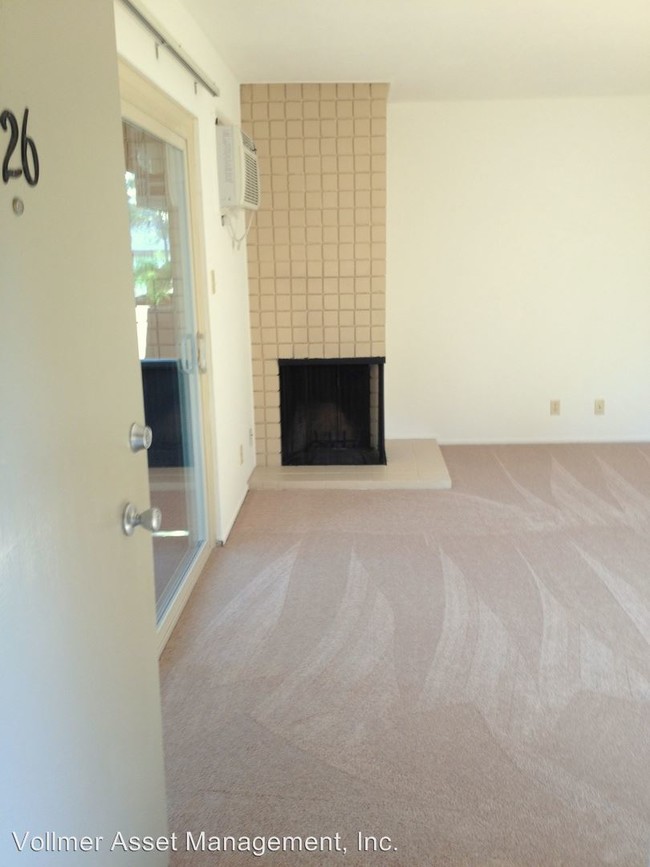
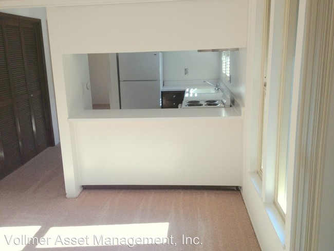
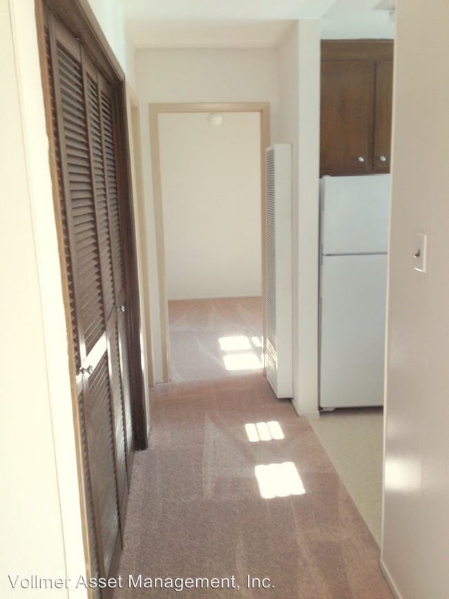
| 1 Bedroom 1 Bedroom 1 Br | 1 Bath 1 Bath 1 Ba | 620 SF |
About This Property
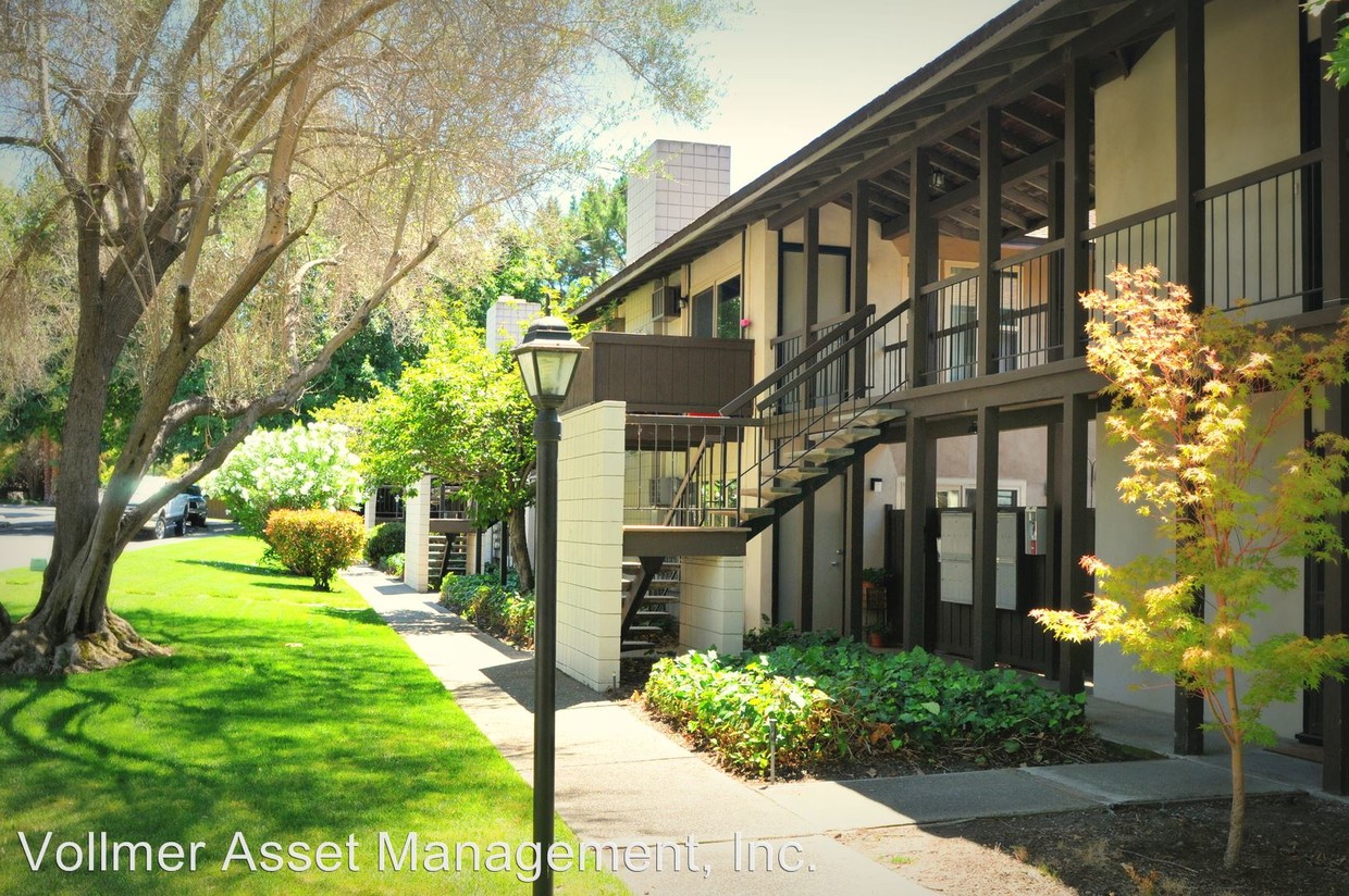
(925) 787-7981 - Charming Apartment Near Downtown Walnut Creek & Broadway Plaza - Camelback South is located within a short drive of the vibrant downtown Walnut Creek and great shopping and fine dining at Broadway Plaza. It is conveniently located near highways 680 and 24, several exits from Walnut Creek BART train station offering easy access to airports and downtown San Francisco, and within walking distance of several prestigious schools and various recreational parks and trails. Management covers water, trash, and sewer expenses. Each apartment has one assigned, covered parking space, and the community/neighborhood has ample visitor parking. Shared amenities include pool, on-site laundry facility, and club-room. If you have any questions or would like to view the apt, please contact Michael at (925) 787-7981. Pets not accepted at this time. (RLNE1956347)
2077 Camel Ln is a condo located in Contra Costa County and the 94596 ZIP Code. This area is served by the Walnut Creek Elementary attendance zone.
Location
Get Directions
Nestled in the East Bay region of the San Francisco Bay Area, Walnut Creek combines suburban comfort with city amenities. The city encompasses 1,800 acres of open space, featuring Shell Ridge and Lime Ridge trails for hiking and outdoor recreation. Downtown Walnut Creek features Broadway Plaza shopping district, while the Lesher Center for the Arts hosts performances and cultural events. The rental market shows a 1.7% annual increase, with one-bedroom units averaging $2,476 and two-bedroom homes typically renting for $2,953. Notable areas include Parkmead, Walnut Heights, and the Northgate district.
Established in 1849 along what early settlers called "Nuts Creek," Walnut Creek has grown into a community of over 70,000 residents. The Mediterranean climate makes it ideal for exploring outdoor spaces like Heather Farm Park and the Ruth Bancroft Garden.
Learn more about living in Walnut Creek
Education
| Colleges & Universities | Distance | ||
|---|---|---|---|
| Colleges & Universities | Distance | ||
| Drive: | 17 min | 7.5 mi | |
| Drive: | 13 min | 7.8 mi | |
| Drive: | 25 min | 15.2 mi | |
| Drive: | 28 min | 18.9 mi |
2077 Camel Ln is within 13 minutes or 7.8 miles from Diablo Valley, Pleasant Hill. It is also near Saint Marys Coll. of Calif. and UC Berkeley.
Schools


Public Elementary School
Grades K-5
364 Students
Nearby
Public Elementary School
Grades K-5
377 Students
Attendance Zone
Public Middle School
Grades 6-8
985 Students
Attendance Zone
Public High School
Grades 9-12
1,571 Students
Attendance Zone
Private Elementary & Middle School
Grades K-8
302 Students
Nearby
Private Elementary School
Grades PK-6
96 Students
Nearby
Private Middle School
Grades 7
Nearby
Private Middle & High School
Grades 8-12
Nearby
School data provided by
 The GreatSchools Rating helps parents compare schools within a state based on a variety of school quality indicators and provides a helpful picture of how effectively each school serves all of its students. Ratings are on a scale of 1 (below average) to 10 (above average) and can include test scores, college readiness, academic progress, advanced courses, equity, discipline and attendance data. We also advise parents to visit schools, consider other information on school performance and programs, and consider family needs as part of the school selection process.
View GreatSchools Rating Methodology
Data provided by GreatSchools.org © 2025. All rights reserved.
View GreatSchools Rating Methodology
Data provided by GreatSchools.org © 2025. All rights reserved.
Transportation options available in Walnut Creek include Walnut Creek Station, located 2.9 miles from 2077 Camel Ln. 2077 Camel Ln is near Metro Oakland International, located 25.0 miles or 35 minutes away, and San Francisco International, located 36.9 miles or 53 minutes away.
| Transit / Subway | Distance | ||
|---|---|---|---|
| Transit / Subway | Distance | ||
|
|
Drive: | 5 min | 2.9 mi |
|
|
Drive: | 6 min | 4.5 mi |
|
|
Drive: | 7 min | 5.0 mi |
|
|
Drive: | 13 min | 8.6 mi |
|
|
Drive: | 13 min | 9.1 mi |
| Commuter Rail | Distance | ||
|---|---|---|---|
| Commuter Rail | Distance | ||
|
|
Drive: | 18 min | 14.1 mi |
|
|
Drive: | 25 min | 16.4 mi |
|
|
Drive: | 24 min | 18.1 mi |
|
|
Drive: | 28 min | 20.0 mi |
|
|
Drive: | 33 min | 20.3 mi |
| Airports | Distance | ||
|---|---|---|---|
| Airports | Distance | ||
|
Metro Oakland International
|
Drive: | 35 min | 25.0 mi |
|
San Francisco International
|
Drive: | 53 min | 36.9 mi |
Time and distance from 2077 Camel Ln.
| Shopping Centers | Distance | ||
|---|---|---|---|
| Shopping Centers | Distance | ||
| Drive: | 2 min | 1.2 mi | |
| Drive: | 3 min | 1.4 mi | |
| Drive: | 3 min | 1.5 mi |
2077 Camel Ln has 3 shopping centers within 1.5 miles, which is about a 3-minute drive. The miles and minutes will be for the farthest away property.
| Parks and Recreation | Distance | ||
|---|---|---|---|
| Parks and Recreation | Distance | ||
|
Rudgear Park
|
Drive: | 3 min | 1.4 mi |
|
Lar Rieu Park
|
Drive: | 4 min | 1.8 mi |
|
Civic Park
|
Drive: | 3 min | 1.9 mi |
|
Contra Costa Canal Regional Trail
|
Drive: | 5 min | 2.3 mi |
|
Howe Homestead Park
|
Drive: | 5 min | 2.4 mi |
2077 Camel Ln has 5 parks within 2.4 miles, including Rudgear Park, Lar Rieu Park, and Civic Park.
| Hospitals | Distance | ||
|---|---|---|---|
| Hospitals | Distance | ||
| Drive: | 3 min | 1.3 mi | |
| Drive: | 6 min | 3.3 mi | |
| Drive: | 12 min | 9.1 mi |
2077 Camel Ln has 3 hospitals within 9.1 miles, the nearest is Kaiser Foundation Hospital - Walnut Creek which is 1.3 miles away and a 3 minute drive.
You May Also Like
Similar Rentals Nearby


What Are Walk Score®, Transit Score®, and Bike Score® Ratings?
Walk Score® measures the walkability of any address. Transit Score® measures access to public transit. Bike Score® measures the bikeability of any address.
What is a Sound Score Rating?
A Sound Score Rating aggregates noise caused by vehicle traffic, airplane traffic and local sources

2077 Camel Ln
Walnut Creek, CA 94596