
$3,800 / Month
2052 E Loraine St
West Covina, CA 91792
Today
Favorites
626-757-4323
-
Bedrooms
4
-
Bathrooms
3
-
Square Feet
1,907 sq ft
-
Available
Available Sep 1
2052 E Loraine St

Favorites
About This Home
$3,800 deposit,
Available Sep 1
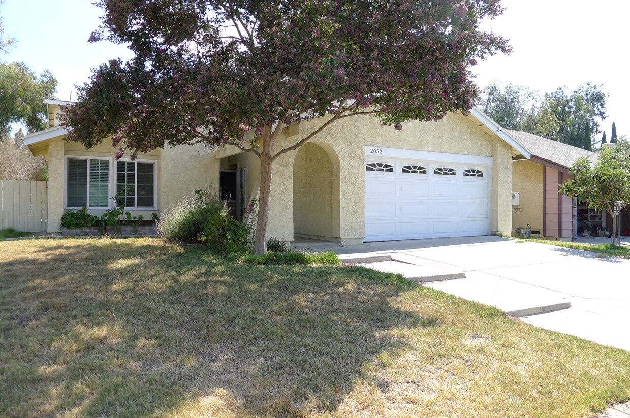
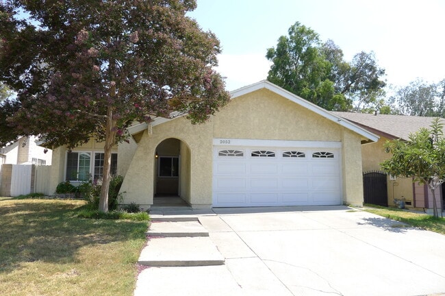
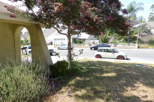
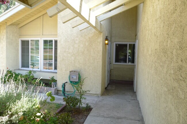
Amazing 4 bedroom, 3 bathroom house with excellent location in West Covina! This property is minutes away from a shopping center, gym, Walnut Ranch Park, and schools. This spacious property features 2 master suites with recently upgraded flooring throughout the house and newer kitchen cabinets/counter tops. The backyard offers a nice view and a variety of fruit trees for your picking. Please call or text David Chung at to schedule a viewing.
2052 E Loraine St is a house located in Los Angeles County and the 91792 ZIP Code. This area is served by the Rowland Unified attendance zone.
* Price shown is base rent and may not include non-optional fees and utilities.
Price, availability, fees, and any applicable rent special are subject to change without notice.
* Square footage definitions vary. Displayed square footage is approximate.
Fees and Policies
The fees below are based on community-supplied data and may exclude additional fees and utilities.
- Dogs Allowed
-
Fees not specified
- Cats Allowed
-
Fees not specified
Contact
- Listed by David Chung
- Phone Number
- Contact
Location
Get Directions
Located approximately 20 miles east of Los Angeles, Rowland is a small neighborhood in the City of Industry. This prosperous community sits at the south end of the San Gabriel Valley and offers a central location for commuters. With easy access to shopping and major roadways, Rowland serves its residents with plenty of convenience, while its parks and wilderness areas let you stay connected to California’s natural beauty. Residents enjoy the abundant entertainment options, including retailers, movie theaters, fitness centers, department stores, and restaurants, as well as outdoor options like Peter F. Schabarum Regional Park, a 575-acre park with tennis courts and beautiful nature trails.
Learn more about living in Rowland
Education
| Colleges & Universities | Distance | ||
|---|---|---|---|
| Colleges & Universities | Distance | ||
| Drive: | 6 min | 3.8 mi | |
| Drive: | 12 min | 6.3 mi | |
| Drive: | 13 min | 6.8 mi | |
| Drive: | 16 min | 9.0 mi |
2052 E Loraine St is within 6 minutes or 3.8 miles from Mt. San Antonio College. It is also near Cal Poly Pomona and DeVry University-California.
Schools


Public Elementary School
Grades K-6
329 Students
Nearby
Public Elementary School
Grades K-6
375 Students
Attendance Zone
Public Middle School
Grades 7-8
489 Students
Attendance Zone
Public High School
Grades 9-12
1,668 Students
Attendance Zone
Private Elementary, Middle & High School
Grades PK-12
330 Students
Nearby
Private Elementary & Middle School
Grades K-8
221 Students
Nearby
Private High School
Grades 9-12
Nearby
School data provided by
 The GreatSchools Rating helps parents compare schools within a state based on a variety of school quality indicators and provides a helpful picture of how effectively each school serves all of its students. Ratings are on a scale of 1 (below average) to 10 (above average) and can include test scores, college readiness, academic progress, advanced courses, equity, discipline and attendance data. We also advise parents to visit schools, consider other information on school performance and programs, and consider family needs as part of the school selection process.
View GreatSchools Rating Methodology
Data provided by GreatSchools.org © 2025. All rights reserved.
View GreatSchools Rating Methodology
Data provided by GreatSchools.org © 2025. All rights reserved.
Transportation options available in West Covina include Azusa Downtown Station, located 8.3 miles from 2052 E Loraine St. 2052 E Loraine St is near Ontario International, located 19.9 miles or 30 minutes away, and Long Beach (Daugherty Field), located 30.3 miles or 41 minutes away.
| Transit / Subway | Distance | ||
|---|---|---|---|
| Transit / Subway | Distance | ||
| Drive: | 14 min | 8.3 mi | |
| Drive: | 17 min | 9.4 mi | |
| Drive: | 16 min | 9.5 mi | |
| Drive: | 19 min | 12.2 mi | |
| Drive: | 21 min | 13.7 mi |
| Commuter Rail | Distance | ||
|---|---|---|---|
| Commuter Rail | Distance | ||
|
|
Drive: | 9 min | 4.6 mi |
|
|
Drive: | 11 min | 6.4 mi |
|
|
Drive: | 13 min | 7.5 mi |
|
|
Drive: | 17 min | 9.7 mi |
|
|
Drive: | 17 min | 10.2 mi |
| Airports | Distance | ||
|---|---|---|---|
| Airports | Distance | ||
|
Ontario International
|
Drive: | 30 min | 19.9 mi |
|
Long Beach (Daugherty Field)
|
Drive: | 41 min | 30.3 mi |
Time and distance from 2052 E Loraine St.
| Shopping Centers | Distance | ||
|---|---|---|---|
| Shopping Centers | Distance | ||
| Walk: | 10 min | 0.5 mi | |
| Walk: | 14 min | 0.7 mi | |
| Walk: | 16 min | 0.8 mi |
2052 E Loraine St has 3 shopping centers within 0.8 mile, which is about a 16-minute walk. The miles and minutes will be for the farthest away property.
| Parks and Recreation | Distance | ||
|---|---|---|---|
| Parks and Recreation | Distance | ||
|
Galster Wilderness Park Nature Center
|
Drive: | 6 min | 2.8 mi |
|
Schabarum Regional Park
|
Drive: | 10 min | 4.8 mi |
|
Covina Park
|
Drive: | 9 min | 5.7 mi |
|
La Habra Historical Museum
|
Drive: | 16 min | 9.3 mi |
|
Frank G. Bonelli Regional Park
|
Drive: | 18 min | 11.1 mi |
2052 E Loraine St has 5 parks within 11.1 miles, including Galster Wilderness Park Nature Center, Schabarum Regional Park, and Covina Park.
| Hospitals | Distance | ||
|---|---|---|---|
| Hospitals | Distance | ||
| Drive: | 10 min | 4.9 mi | |
| Drive: | 10 min | 5.9 mi | |
| Drive: | 10 min | 6.2 mi |
2052 E Loraine St has 3 hospitals within 6.2 miles, the nearest is West Covina Medical Center which is 4.9 miles away and a 10 minute drive.
| Military Bases | Distance | ||
|---|---|---|---|
| Military Bases | Distance | ||
| Drive: | 38 min | 22.1 mi |
2052 E Loraine St is 22.1 miles and a 38 minute drive from Los Alamitos Army Airfield.
You May Also Like
Similar Rentals Nearby


What Are Walk Score®, Transit Score®, and Bike Score® Ratings?
Walk Score® measures the walkability of any address. Transit Score® measures access to public transit. Bike Score® measures the bikeability of any address.
What is a Sound Score Rating?
A Sound Score Rating aggregates noise caused by vehicle traffic, airplane traffic and local sources

2052 E Loraine St
West Covina, CA 91792