$900
/ Month
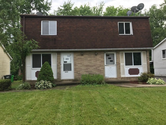
2033 Massachusetts Ave SE
Massillon, OH 44646
2 Weeks Ago
|
Edit
Favorites
2033 Massachusetts Ave SE

Favorites
Check Back Soon for Upcoming Availability
| Beds | Baths | Average SF |
|---|---|---|
| 2 Bedrooms 2 Bedrooms 2 Br | 1 Bath 1 Bath 1 Ba | 760 SF |
Fees and Policies
The fees listed below are community-provided and may exclude utilities or add-ons. All payments are made directly to the property and are non-refundable unless otherwise specified.
Details
Utilities Included
-
Sewer
About This Property
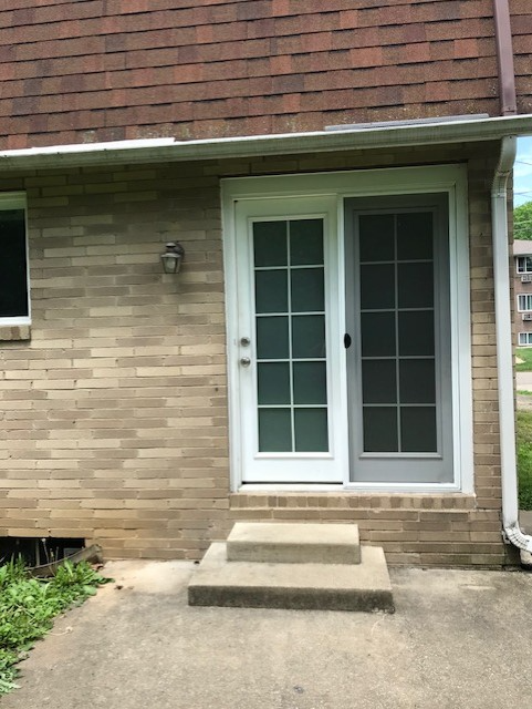
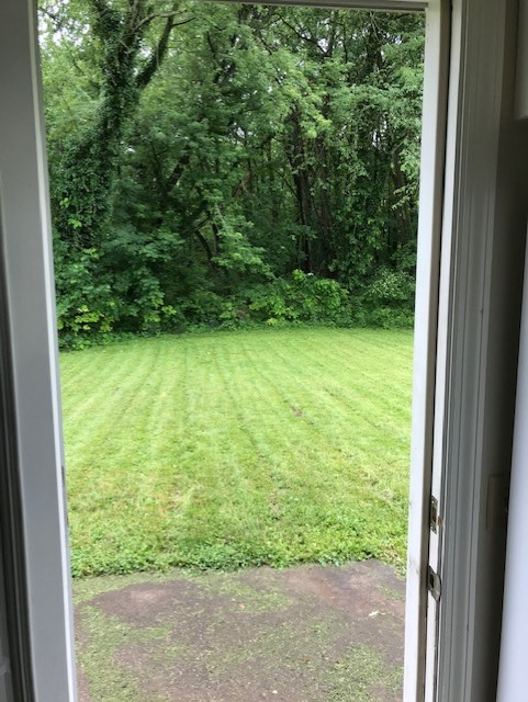
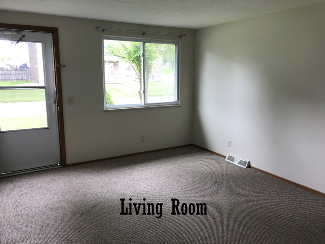
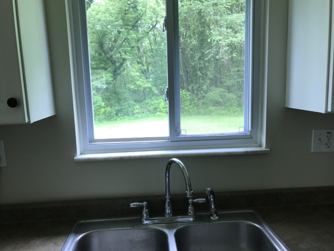
Property Id: 656192 Town House located near Target and Giant Eagle shopping center on East side of Massillon, Ohio. Nice backyard bordering a wooded area. Two bedrooms and full bath upstairs with living room and eat-in kitchen downstairs. New carpet. Basement with laundry hookups. Bath completely remodeled. Includes Range/Oven, Refrigerator. New natural gas water heater and new forced air heat with central air conditioning. Truly "White Glove" clean. Renters pay all utilities except for sewer. Complete the Turbo Tenant "pre-screen" to schedule a showing of the Townhouse. Planning to rent for May 1, 2025.
2033 Massachusetts Ave Se is a townhome located in Stark County and the 44646 ZIP Code. This area is served by the Massillon City School District attendance zone.
Townhome Features
Refrigerator
Oven
Vinyl Flooring
Cable Ready
- Cable Ready
- Oven
- Refrigerator
- Vinyl Flooring
- Lawn
2033 Massachusetts Ave SE,
Massillon,
OH
44646
Massillon sits along the Tuscarawas River in western Stark County, about eight miles west of Canton and roughly 30 miles south of Akron, occupying a steady, grounded place in northeast Ohio's landscape. The city carries a strong sense of identity rooted in its industrial past and a high school football tradition that draws intense community pride each season at Paul Brown Tiger Stadium, named after the legendary coach who got his start here. Lincoln Way serves as the central commercial corridor, anchoring everyday life with local businesses, shops, and services within a walkable stretch of the historic downtown.
The surrounding area spans around 21 square miles, offering a range of neighborhoods from tree-lined residential streets near the river to quieter pockets on the city's edges. The Massillon Museum, free to the public, reflects the city's commitment to arts and local history.
Learn more about living in Massillon
Amenities
- Cable Ready
- Oven
- Refrigerator
- Vinyl Flooring
- Lawn
Expenses
Utilities Included
Sewer
Included
Education
| Colleges & Universities | Distance | ||
|---|---|---|---|
| Colleges & Universities | Distance | ||
| Drive: | 18 min | 8.2 mi | |
| Drive: | 17 min | 8.6 mi | |
| Drive: | 19 min | 8.9 mi | |
| Drive: | 23 min | 12.5 mi |
2033 Massachusetts Ave SE is within 18 minutes or 8.2 miles from Kent State University, Stark. It is also near Stark State College and Malone University.
Schools


Public Elementary School
Grades K-5
Nearby
Public Elementary School
Grades K-5
Nearby
Public Elementary School
Grades K-5
Attendance Zone
Public Middle School
Grades 6-8
Attendance Zone
Public High School
Grades 9-12
Attendance Zone
Private Elementary, Middle & High School
Grades K-12
Nearby
Private Elementary & Middle School
Grades PK-8
Nearby
School data provided by
 The GreatSchools Rating helps parents compare schools within a state based on a variety of school quality indicators and provides a helpful picture of how effectively each school serves all of its students. Ratings are on a scale of 1 (below average) to 10 (above average) and can include test scores, college readiness, academic progress, advanced courses, equity, discipline and attendance data. We also advise parents to visit schools, consider other information on school performance and programs, and consider family needs as part of the school selection process.
View GreatSchools Rating Methodology
Data provided by GreatSchools.org © 2026. All rights reserved.
View GreatSchools Rating Methodology
Data provided by GreatSchools.org © 2026. All rights reserved.
Walkability Near 2033 Massachusetts Ave SE Massillon, OH 44646
Getting Around
 What do Walkability, Transit, Drivability, and Bikeability mean?
Walkability measures the walking distance to day-to-day needs.
Transit measures access to public transportation.
Drivability measures congestion, parking availability, and access to major roads.
Bikeability measures the suitability for cycling.
How It Works
What do Walkability, Transit, Drivability, and Bikeability mean?
Walkability measures the walking distance to day-to-day needs.
Transit measures access to public transportation.
Drivability measures congestion, parking availability, and access to major roads.
Bikeability measures the suitability for cycling.
How It Works
Fairly Walkable
Walkability
40
/ 100
Limited Public Transit
Transit
30
/ 100
Very Drivable
Drivability
80
/ 100
Fairly Bikeable
Bikeability
40
/ 100
Scores provided by
-
Soundscore™
-
/ 100
Traffic
-Airport
-Businesses
-Scores provided by
HowLoud What is a Sound Score Rating? A Sound Score Rating aggregates noise caused by vehicle traffic, airplane traffic and local sources. How It WorksYou May Also Like
Similar Rentals Nearby
-
-
1 / 13

-
-
-
-
-
-
-
-


What Are Walk Score®, Transit Score®, and Bike Score® Ratings?
Walk Score® measures the walkability of any address. Transit Score® measures access to public transit. Bike Score® measures the bikeability of any address.
What is a Sound Score Rating?
A Sound Score Rating aggregates noise caused by vehicle traffic, airplane traffic and local sources.

2033 Massachusetts Ave SE
Massillon, OH 44646