

$4,500
/ Month
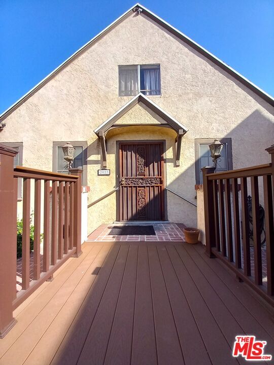
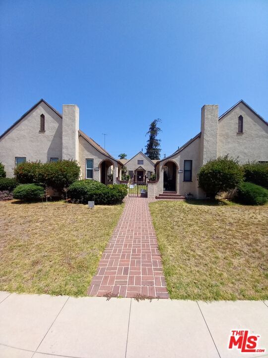
2027 Addison Way
Los Angeles, CA 90041
2 Weeks Ago
|
Edit
Favorites
2027 Addison Way

Favorites
Check Back Soon for Upcoming Availability
| Beds | Baths | Average SF |
|---|---|---|
| 4 Bedrooms 4 Bedrooms 4 Br | 2 Baths 2 Baths 2 Ba | 1,855 SF |
About This Property
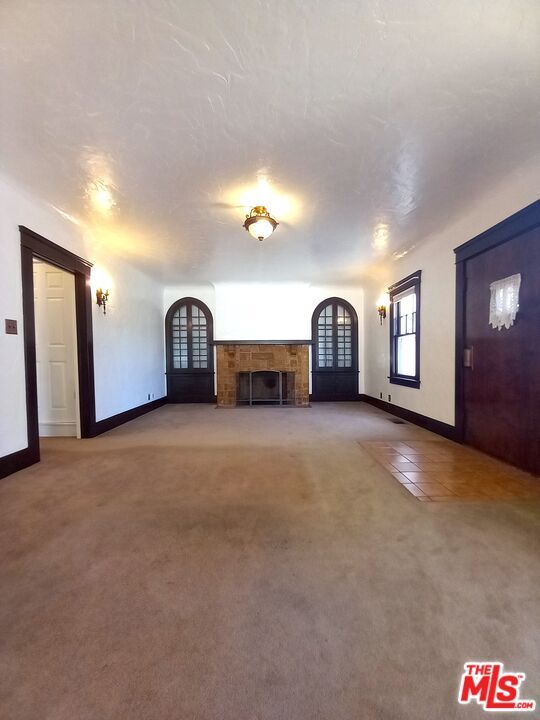
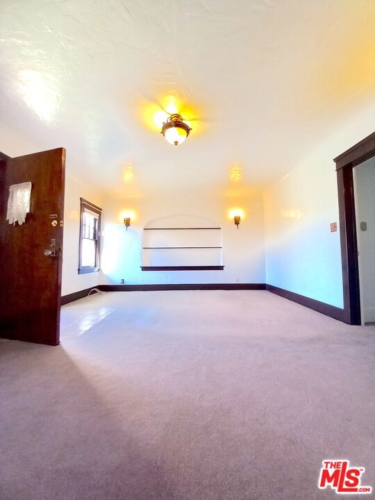
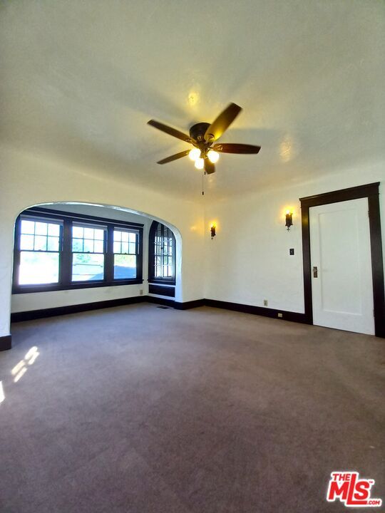
Prime Eagle Rock house for lease! Located on a quiet street one block from Eagle Rock Blvd and walking distance to Yosemite park, Sprouts, CVS, Eagle Rock Elementary, and all the great spots in Eagle Rock. House has vintage fixtures and charm but updated systems and ice cold central AC. HUGE attic with a big bedroom upstairs. Detached Two Car garage and lots of driveway parking.
2027 Addison Way is a house located in Los Angeles County and the 90041 ZIP Code. This area is served by the Los Angeles Unified attendance zone.
House Features
- Washer/Dryer Hookup
- Carpet
Location
Get Directions
A large sector of the city, Northeast Los Angeles encompasses neighborhoods like Echo Park and Highland Park. This expansive LA area offers rentals for every type of renter and every budget. Abundant apartments, houses, condos, and townhomes can be found in Northeast Los Angeles, ranging from affordable to upscale. Residents of this area can enjoy the great outdoors at locales like Ernest E. Debs Regional Park, Hermon Park, Rio De Los Angeles State Park, and Elysian Park. Although Northeast LA offers an escape from big-city living, residents can easily travel into downtown for work or leisure. Amenities and attractions like Dodger Stadium, Los Angeles State Historic Park, and Chinatown are all within reach of this sprawling district.
Learn more about living in Northeast Los AngelesBelow are rent ranges for similar nearby apartments
Amenities
- Washer/Dryer Hookup
- Carpet
Education
| Colleges & Universities | Distance | ||
|---|---|---|---|
| Colleges & Universities | Distance | ||
| Walk: | 15 min | 0.8 mi | |
| Drive: | 7 min | 3.5 mi | |
| Drive: | 11 min | 5.9 mi | |
| Drive: | 13 min | 5.9 mi |
2027 Addison Way is within 15 minutes or 0.8 mile from Occidental College. It is also near Glendale Community College and Art Center College of Design.
Schools


Public Elementary School
Grades K-6
756 Students
Attendance Zone
Charter Elementary School
Grades K-5
75 Students
Nearby
Public Middle & High School
Grades 7-12
2,069 Students
Attendance Zone
Private Elementary & Middle School
Grades K-8
Nearby
Private Elementary, Middle & High School
Grades PK-12
27 Students
Nearby
School data provided by
 The GreatSchools Rating helps parents compare schools within a state based on a variety of school quality indicators and provides a helpful picture of how effectively each school serves all of its students. Ratings are on a scale of 1 (below average) to 10 (above average) and can include test scores, college readiness, academic progress, advanced courses, equity, discipline and attendance data. We also advise parents to visit schools, consider other information on school performance and programs, and consider family needs as part of the school selection process.
View GreatSchools Rating Methodology
Data provided by GreatSchools.org © 2026. All rights reserved.
View GreatSchools Rating Methodology
Data provided by GreatSchools.org © 2026. All rights reserved.
Transportation options available in Los Angeles include Highland Park Station, located 3.4 miles from 2027 Addison Way. 2027 Addison Way is near Bob Hope, located 13.1 miles or 20 minutes away, and Los Angeles International, located 22.0 miles or 36 minutes away.
| Transit / Subway | Distance | ||
|---|---|---|---|
| Transit / Subway | Distance | ||
|
|
Drive: | 8 min | 3.4 mi |
|
|
Drive: | 8 min | 3.6 mi |
|
|
Drive: | 10 min | 4.4 mi |
|
|
Drive: | 10 min | 4.6 mi |
|
|
Drive: | 10 min | 5.4 mi |
| Commuter Rail | Distance | ||
|---|---|---|---|
| Commuter Rail | Distance | ||
|
|
Drive: | 7 min | 3.8 mi |
|
|
Drive: | 14 min | 7.0 mi |
|
|
Drive: | 16 min | 7.0 mi |
|
|
Drive: | 12 min | 7.6 mi |
| Drive: | 18 min | 11.1 mi |
| Airports | Distance | ||
|---|---|---|---|
| Airports | Distance | ||
|
Bob Hope
|
Drive: | 20 min | 13.1 mi |
|
Los Angeles International
|
Drive: | 36 min | 22.0 mi |
Time and distance from 2027 Addison Way.
| Shopping Centers | Distance | ||
|---|---|---|---|
| Shopping Centers | Distance | ||
| Walk: | 7 min | 0.4 mi | |
| Walk: | 10 min | 0.5 mi | |
| Walk: | 12 min | 0.7 mi |
2027 Addison Way has 3 shopping centers within 0.7 mile, which is about a 12-minute walk. The miles and minutes will be for the farthest away property.
| Parks and Recreation | Distance | ||
|---|---|---|---|
| Parks and Recreation | Distance | ||
|
Elyria Canyon Park
|
Drive: | 8 min | 3.4 mi |
|
Audubon Center at Debs Park
|
Drive: | 10 min | 4.1 mi |
|
Marsh Park
|
Drive: | 9 min | 4.2 mi |
|
Kidspace Children's Museum
|
Drive: | 9 min | 4.5 mi |
|
Elysian Park
|
Drive: | 13 min | 6.1 mi |
2027 Addison Way has 5 parks within 6.1 miles, including Elyria Canyon Park, Audubon Center at Debs Park, and Kidspace Children's Museum.
| Hospitals | Distance | ||
|---|---|---|---|
| Hospitals | Distance | ||
| Drive: | 5 min | 2.2 mi | |
| Drive: | 7 min | 3.8 mi | |
| Drive: | 9 min | 5.2 mi |
2027 Addison Way has 3 hospitals within 5.2 miles, the nearest is Glendale Adventist Medical Center which is 2.2 miles away and a 5 minute drive.
| Military Bases | Distance | ||
|---|---|---|---|
| Military Bases | Distance | ||
| Drive: | 34 min | 23.6 mi |
2027 Addison Way is 23.6 miles and a 34 minute drive from Los Angeles Air Force Base.
You May Also Like
Similar Rentals Nearby


What Are Walk Score®, Transit Score®, and Bike Score® Ratings?
Walk Score® measures the walkability of any address. Transit Score® measures access to public transit. Bike Score® measures the bikeability of any address.
What is a Sound Score Rating?
A Sound Score Rating aggregates noise caused by vehicle traffic, airplane traffic and local sources
2027 Addison Way
Los Angeles, CA 90041