$2,950 / Month
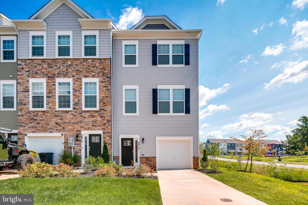
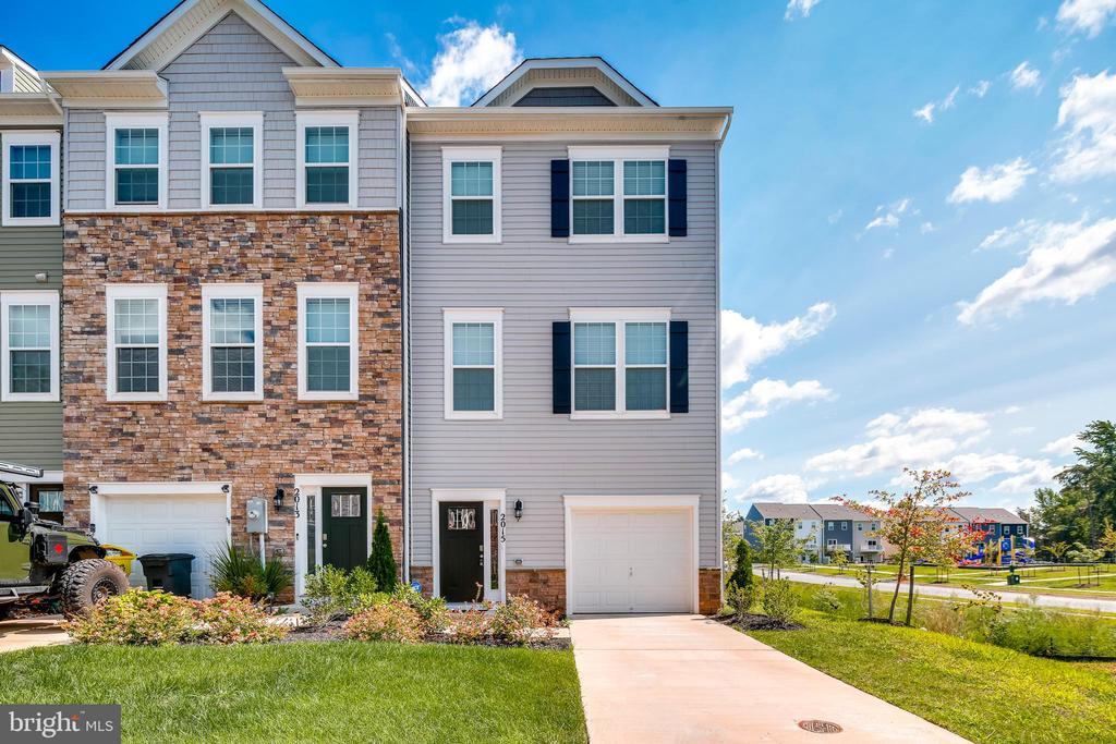
2015 Thornbrook Wy
Odenton, MD 21113
Today
Favorites
240-832-7303
-
Bedrooms
3
-
Bathrooms
2.5
-
Square Feet
2,120 sq ft
-
Available
Available Now
Highlights
- Colonial Architecture
- 1 Car Attached Garage
- Central Air
- Heat Pump System
2015 Thornbrook Wy

Favorites
About This Home
Available Now
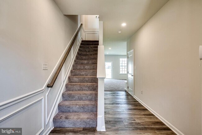
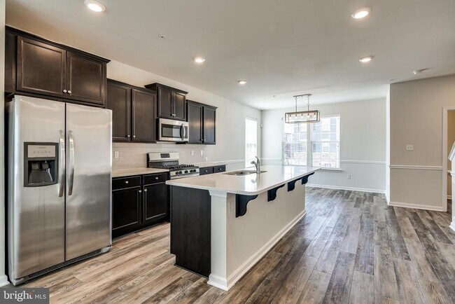
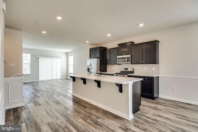
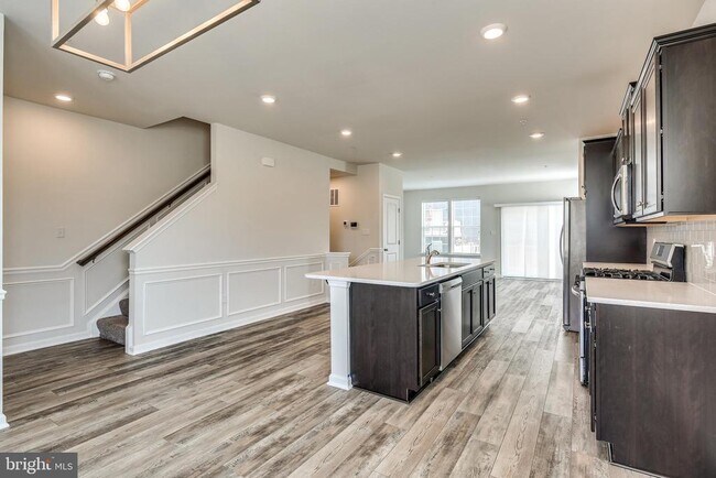
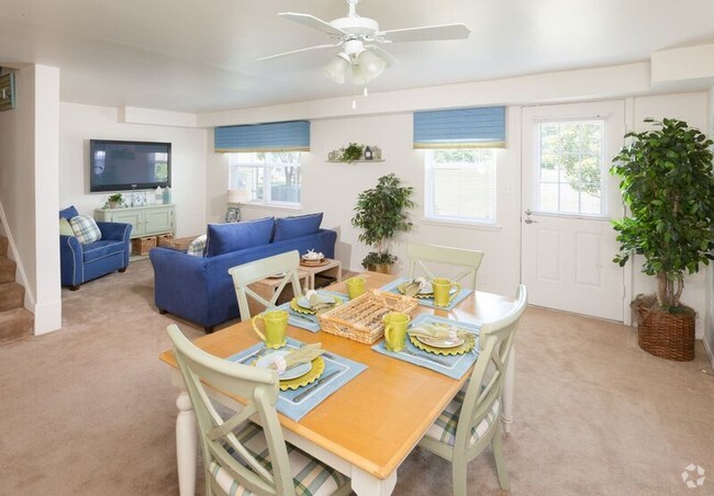
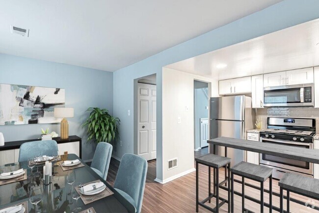
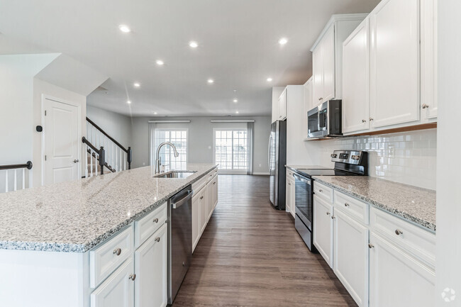
This end unit townhouse is absolutely beautiful with dark hardwood floors, walk-out lower level with 1 car garage. Main level has an amazing kitchen with huge island and stainless steel appliances. Dining area and separate living area with deck off rear. Upper level has 3 bedrooms, 2 full bathrooms and washer/dryer.
2015 Thornbrook Wy is a townhome located in Anne Arundel County and the 21113 ZIP Code. This area is served by the Anne Arundel County Public Schools attendance zone.
* Price shown is base rent and may not include non-optional fees and utilities.
Price, availability, fees, and any applicable rent special are subject to change without notice.
* Square footage definitions vary. Displayed square footage is approximate.
Home Details
Home Type
End Unit Townhome
Year Built
Built in 2019
Accessible Home Design
Entry on the 1st floor
Bedrooms and Bathrooms
2.5 Bathrooms
3 Bedrooms
Home Design
Colonial Architecture
Aluminum Siding
Slab Foundation
Interior Spaces
2,120 Sq Ft Home
Property has 3 Levels
Kitchen
Stove
Microwave
Dishwasher
Laundry
Dryer
Washer
Listing and Financial Details
Security Deposit $2,950
12-Month Min and 24-Month Max Lease Term
Available 5/30/25
$45 Application Fee
Assessor Parcel Number 020468090247899
No Smoking Allowed
Residential Lease
Lot Details
2,000 Sq Ft Lot
Parking
1 Car Attached Garage
Front Facing Garage
1 Driveway Space
Utilities
Central Air
Heat Pump System
Municipal Trash
Community Details
Overview
Property Manager
Odenton Town Center Subdivision
Pet Policy
No Pets Allowed
Contact
- Listed by Shannon Vane | Weichert Realtors - McKenna & Vane
- Phone Number
- Contact
-
Source
 Bright MLS, Inc.
Copyright © 2025 Bright MLS, Inc.
Location
Get Directions
Amenities
- Dishwasher
Situated in Anne Arundel County, Odenton is centrally located between Annapolis, Washington D.C., and Baltimore. The city is continuously growing in population, largely due to its proximity to Fort George G. Meade military base and the developing Piney Orchard neighborhood.
In Odenton, you’ll discover a lot of great shopping centers like Waugh Chapel Towne Centre. Hikers will enjoy the plethora of trails that reside within the community, including Little Patuxent River Trail, Wild Turkey Way, and Merganser Pond Trail, among others. Midland Park is a large green space just minutes from Bowie State University. This Baltimore suburb contains highly rated public schools, plus access to Interstate 97 and Odenton Station.
Learn more about living in Odenton
Education
| Colleges & Universities | Distance | ||
|---|---|---|---|
| Colleges & Universities | Distance | ||
| Drive: | 25 min | 13.8 mi | |
| Drive: | 26 min | 14.3 mi | |
| Drive: | 27 min | 14.8 mi | |
| Drive: | 28 min | 16.5 mi |
2015 Thornbrook Wy is within 25 minutes or 13.8 miles from UMBC. It is also near CCBC Cantonsville and Anne Arundel Community College.
Schools


Public Elementary School
Grades PK-5
575 Students
Attendance Zone
Public Middle School
Grades 6-8
1,286 Students
Attendance Zone
Public High School
Grades 9-12
1,617 Students
Attendance Zone
Private Elementary, Middle & High School
Grades 2-12
7 Students
Nearby
Private Elementary, Middle & High School
Grades PK-12
181 Students
Nearby
School data provided by
 The GreatSchools Rating helps parents compare schools within a state based on a variety of school quality indicators and provides a helpful picture of how effectively each school serves all of its students. Ratings are on a scale of 1 (below average) to 10 (above average) and can include test scores, college readiness, academic progress, advanced courses, equity, discipline and attendance data. We also advise parents to visit schools, consider other information on school performance and programs, and consider family needs as part of the school selection process.
View GreatSchools Rating Methodology
View GreatSchools Rating Methodology
Transportation options available in Odenton include Dorsey, located 8.2 miles from 2015 Thornbrook Wy. 2015 Thornbrook Wy is near Baltimore/Washington International Thurgood Marshall, located 9.0 miles or 18 minutes away, and Ronald Reagan Washington Ntl, located 31.9 miles or 51 minutes away.
| Transit / Subway | Distance | ||
|---|---|---|---|
| Transit / Subway | Distance | ||
|
|
Drive: | 16 min | 8.2 mi |
|
|
Drive: | 17 min | 8.8 mi |
|
Bwi Airport (Northbound)
|
Drive: | 19 min | 9.3 mi |
|
|
Drive: | 17 min | 9.5 mi |
|
|
Drive: | 18 min | 9.9 mi |
| Commuter Rail | Distance | ||
|---|---|---|---|
| Commuter Rail | Distance | ||
|
|
Drive: | 5 min | 2.0 mi |
|
|
Drive: | 13 min | 5.9 mi |
| Drive: | 17 min | 8.2 mi | |
| Drive: | 17 min | 8.2 mi | |
|
|
Drive: | 14 min | 8.4 mi |
| Airports | Distance | ||
|---|---|---|---|
| Airports | Distance | ||
|
Baltimore/Washington International Thurgood Marshall
|
Drive: | 18 min | 9.0 mi |
|
Ronald Reagan Washington Ntl
|
Drive: | 51 min | 31.9 mi |
Time and distance from 2015 Thornbrook Wy.
| Shopping Centers | Distance | ||
|---|---|---|---|
| Shopping Centers | Distance | ||
| Drive: | 4 min | 1.3 mi | |
| Drive: | 4 min | 1.6 mi | |
| Drive: | 4 min | 1.8 mi |
2015 Thornbrook Wy has 3 shopping centers within 1.8 miles, which is about a 4-minute drive. The miles and minutes will be for the farthest away property.
| Parks and Recreation | Distance | ||
|---|---|---|---|
| Parks and Recreation | Distance | ||
|
Patuxent Research Refuge - North Tract
|
Drive: | 13 min | 6.1 mi |
|
Kinder Farm Park
|
Drive: | 22 min | 11.1 mi |
|
Patuxent Research Refuge - South Tract
|
Drive: | 26 min | 14.3 mi |
2015 Thornbrook Wy has 3 parks within 14.3 miles, including Patuxent Research Refuge - North Tract, Kinder Farm Park, and Patuxent Research Refuge - South Tract.
| Hospitals | Distance | ||
|---|---|---|---|
| Hospitals | Distance | ||
| Drive: | 17 min | 8.8 mi | |
| Drive: | 23 min | 12.1 mi |
2015 Thornbrook Wy is 8.8 miles from University of Maryland Baltimore Washington Medical Center, and is convenient to other hospitals, including Laurel Regional Medical Center.
| Military Bases | Distance | ||
|---|---|---|---|
| Military Bases | Distance | ||
| Drive: | 7 min | 2.8 mi |
2015 Thornbrook Wy is 2.8 miles and a 7 minute drive from Fort George Meade.
You May Also Like
Similar Rentals Nearby


What Are Walk Score®, Transit Score®, and Bike Score® Ratings?
Walk Score® measures the walkability of any address. Transit Score® measures access to public transit. Bike Score® measures the bikeability of any address.
What is a Sound Score Rating?
A Sound Score Rating aggregates noise caused by vehicle traffic, airplane traffic and local sources
2015 Thornbrook Wy
Odenton, MD 21113