
Presidential Towers
555 W Madison St,
Chicago, IL 60661
$1,793 - $5,054
Studio - 2 Beds
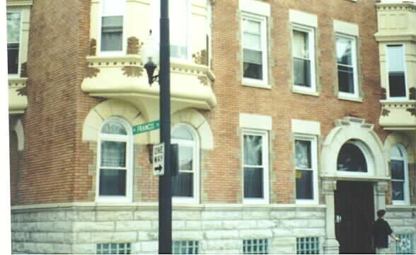
Discover 2015 N California Ave. The address for this community is in Chicago on N. California Ave. Make sure you to see the current floorplan options. The leasing team is waiting to show you all that this community has in store. Get moving on finding your next place. Contact or stop by the 2015 N California Ave leasing office to check the availability and set up a tour today.
2015 N California Ave is an apartment community located in Cook County and the 60647 ZIP Code. This area is served by the Chicago Public Schools attendance zone.
Hip, trendy, and yet somehow still sensible, Logan Square has long been one of Chicago's favorite neighborhoods. The area developed in the early 1800s, when a public green space was designed by landscape architect Jens Jensen. Today, Logan Square Park is located in the heart of the neighborhood, wrapped by Logan Boulevard and divided by Milwaukee Avenue.
Bicycle-friendly Logan Square is all about living local, from its craft breweries to local artists and restaurants. With its wide sidewalks and compact design, Logan Square is very walkable. If you choose a Logan Square apartment, you'll be about five miles from Downtown Chicago, with easy access to mass transit -- just hop on the L's Blue Line from the Logan Square Blue Line Station and you'll be downtown in minutes.
Learn more about living in Logan SquareCompare neighborhood and city base rent averages by bedroom.
| Logan Square | Chicago, IL | |
|---|---|---|
| Studio | $1,374 | $1,633 |
| 1 Bedroom | $1,732 | $2,027 |
| 2 Bedrooms | $2,194 | $2,545 |
| 3 Bedrooms | $2,524 | $3,058 |
| Colleges & Universities | Distance | ||
|---|---|---|---|
| Colleges & Universities | Distance | ||
| Drive: | 4 min | 2.1 mi | |
| Drive: | 5 min | 2.8 mi | |
| Drive: | 7 min | 3.8 mi | |
| Drive: | 7 min | 3.9 mi |

Transportation options available in Chicago include California Station (Blue Line - O'hare Branch), located 0.3 mile from 2015 N California Ave. 2015 N California Ave is near Chicago Midway International, located 11.1 miles or 20 minutes away, and Chicago O'Hare International, located 13.4 miles or 21 minutes away.
| Transit / Subway | Distance | ||
|---|---|---|---|
| Transit / Subway | Distance | ||
|
|
Walk: | 5 min | 0.3 mi |
|
|
Walk: | 11 min | 0.6 mi |
|
|
Walk: | 20 min | 1.0 mi |
|
|
Drive: | 3 min | 1.3 mi |
|
|
Drive: | 4 min | 2.0 mi |
| Commuter Rail | Distance | ||
|---|---|---|---|
| Commuter Rail | Distance | ||
|
|
Drive: | 3 min | 1.6 mi |
|
|
Drive: | 4 min | 2.0 mi |
|
|
Drive: | 4 min | 2.3 mi |
|
|
Drive: | 4 min | 2.6 mi |
|
|
Drive: | 6 min | 2.8 mi |
| Airports | Distance | ||
|---|---|---|---|
| Airports | Distance | ||
|
Chicago Midway International
|
Drive: | 20 min | 11.1 mi |
|
Chicago O'Hare International
|
Drive: | 21 min | 13.4 mi |
Scores provided by
Traffic
-Airport
-Businesses
-Scores provided by
HowLoud What is a Sound Score Rating? A Sound Score Rating aggregates noise caused by vehicle traffic, airplane traffic and local sources. How It WorksTime and distance from 2015 N California Ave.
| Shopping Centers | Distance | ||
|---|---|---|---|
| Shopping Centers | Distance | ||
| Walk: | 1 min | 0.1 mi | |
| Drive: | 3 min | 1.4 mi | |
| Drive: | 4 min | 1.9 mi |
| Parks and Recreation | Distance | ||
|---|---|---|---|
| Parks and Recreation | Distance | ||
|
Humboldt Park
|
Drive: | 2 min | 1.1 mi |
|
Wrightwood Park
|
Drive: | 5 min | 2.3 mi |
|
Kilbourn Park
|
Drive: | 6 min | 3.3 mi |
|
Garfield Park and Golden Dome Field House
|
Drive: | 7 min | 3.6 mi |
|
Oz Park
|
Drive: | 7 min | 3.7 mi |
| Hospitals | Distance | ||
|---|---|---|---|
| Hospitals | Distance | ||
| Drive: | 2 min | 1.4 mi | |
| Drive: | 3 min | 1.8 mi | |
| Drive: | 6 min | 3.2 mi |
| Military Bases | Distance | ||
|---|---|---|---|
| Military Bases | Distance | ||
| Drive: | 29 min | 21.0 mi |
What Are Walk Score®, Transit Score®, and Bike Score® Ratings?
Walk Score® measures the walkability of any address. Transit Score® measures access to public transit. Bike Score® measures the bikeability of any address.
What is a Sound Score Rating?
A Sound Score Rating aggregates noise caused by vehicle traffic, airplane traffic and local sources.

2015 N California Ave
Chicago, IL 60647


