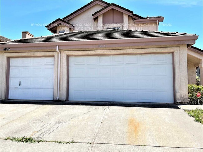
$4,100 / Month
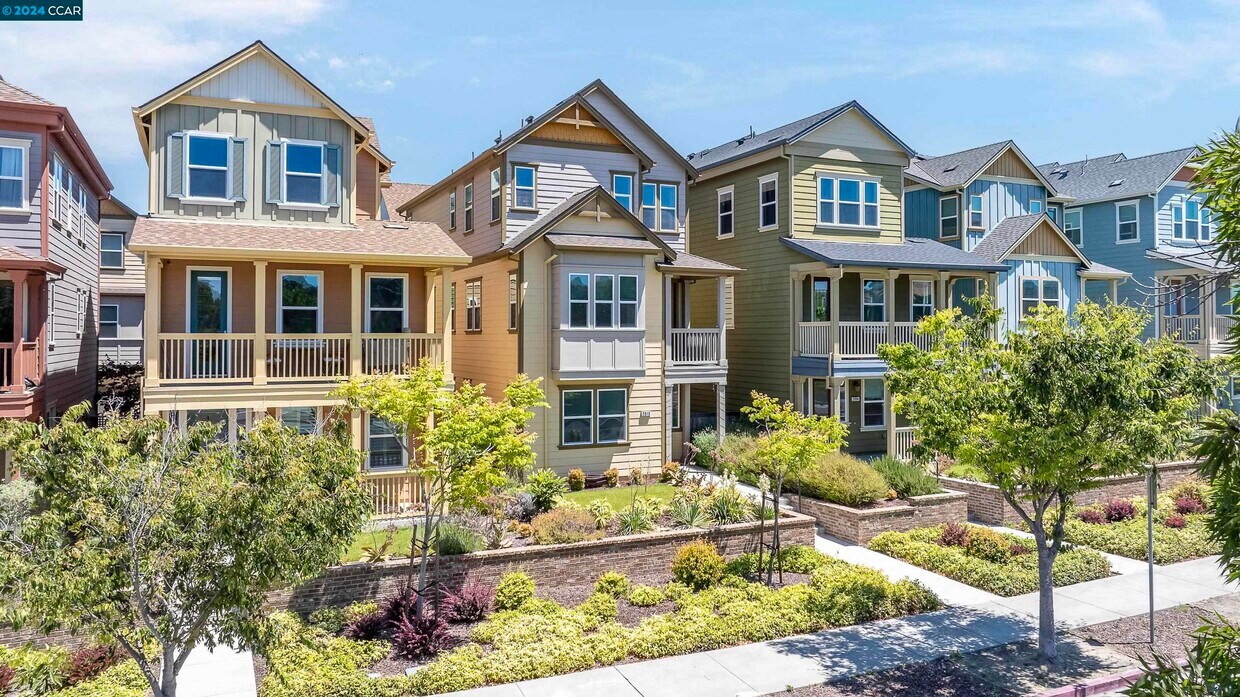
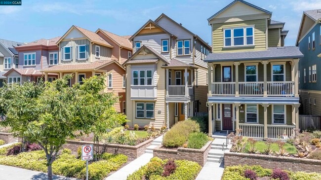
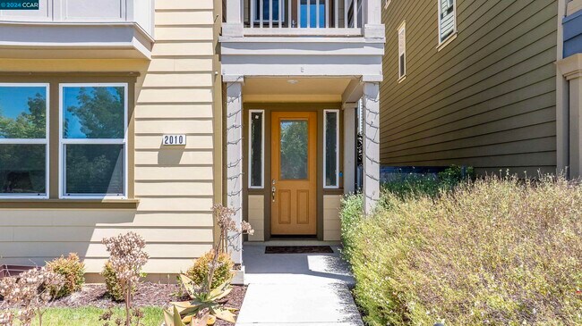
2010 John Muir Pkwy
Hercules, CA 94547
2 Weeks Ago
Favorites
2010 John Muir Pkwy

Favorites
Check Back Soon for Upcoming Availability
| Beds | Baths | Average SF |
|---|---|---|
| 4 Bedrooms 4 Bedrooms 4 Br | 4 Baths 4 Baths 4 Ba | 2,441 SF |
About This Property
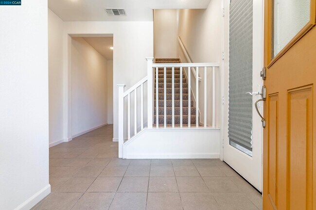
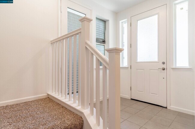
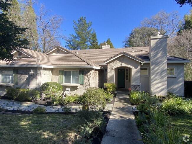
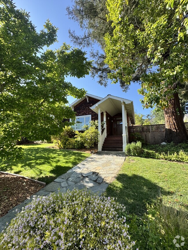
This gorgeous tri-level home is located in the highly sought after Muir Pointe community. The fusion of this incredibly convenient location for an active lifestyle with the the tranquil atmosphere for the days when you just want to relax make this the perfect place to call home! The main entry level offers a well appointed bedroom,full bathroom,large storage closet and access to the 2-car attached garage. Just up the stairs is the main level with an open kitchen w/ gas range,ample cabinet space & spacious living area w/ patio. This level also features a large bedroom & full bathroom. The upper level includes a primary suite & 4th bedroom,both equipped w/ private bathrooms & walk in closets. Enjoy this sophisticated yet comfortable location just seconds from the Hercules Bayfront and its pedestrian friendly village of cafe's,restaurants,shops and parks. Centrally located along the I-80 corridor,this home offers easy access to nearby cities such as Berkeley,Oakland and San Francisco. Credit application is $37/adult Income must be at least 3x the rent Rental history of 3 years required Deposit is $4,100 Small pets ok Contact Erica Mackie (realtor) for additional information or to schedule a tour: or email
2010 John Muir Pkwy is a house located in Contra Costa County and the 94547 ZIP Code. This area is served by the West Contra Costa Unified attendance zone.
Location
Get Directions
Located midway between San Francisco and Napa along the coast of San Pablo Bay, Hercules is a stunning waterfront community with a small-town atmosphere, diverse population, and innovative plans for the future. Among Hercules’ exciting planned developments are a new waterfront, town center, and a train and ferry terminal.
Convenience to the San Pablo Bay as well as a host of parks, trails, and athletic programs allows for plenty of recreational activities in Hercules. A peaceful reprieve from city life, Hercules offers residents picturesque homes in quiet neighborhoods with dazzling views of the bay. Shopping opportunities abound at the nearby Shops at Hilltop in addition to several plazas and shopping centers in town. Getting around from Hercules is easy with access to Interstate 80 and State Route 4.
Learn more about living in HerculesBelow are rent ranges for similar nearby apartments
Education
| Colleges & Universities | Distance | ||
|---|---|---|---|
| Colleges & Universities | Distance | ||
| Drive: | 10 min | 6.0 mi | |
| Drive: | 22 min | 12.1 mi | |
| Drive: | 23 min | 15.1 mi | |
| Drive: | 27 min | 16.2 mi |
2010 John Muir Pkwy is within 10 minutes or 6.0 miles from Contra Costa College. It is also near Touro University California and UC Berkeley.
Schools


Public Elementary School
Grades K-5
371 Students
Attendance Zone
Public Elementary School
Grades K-5
440 Students
Nearby
Public Middle School
Grades 6-8
590 Students
Attendance Zone
Public High School
Grades 9-12
734 Students
Attendance Zone
Private Elementary & Middle School
Grades PK-8
389 Students
Nearby
Private Elementary, Middle & High School
Grades K-12
16 Students
Nearby
School data provided by
 The GreatSchools Rating helps parents compare schools within a state based on a variety of school quality indicators and provides a helpful picture of how effectively each school serves all of its students. Ratings are on a scale of 1 (below average) to 10 (above average) and can include test scores, college readiness, academic progress, advanced courses, equity, discipline and attendance data. We also advise parents to visit schools, consider other information on school performance and programs, and consider family needs as part of the school selection process.
View GreatSchools Rating Methodology
View GreatSchools Rating Methodology
Transportation options available in Hercules include El Cerrito Del Norte Station, located 9.2 miles from 2010 John Muir Pkwy. 2010 John Muir Pkwy is near Metro Oakland International, located 28.1 miles or 38 minutes away, and San Francisco International, located 35.7 miles or 50 minutes away.
| Transit / Subway | Distance | ||
|---|---|---|---|
| Transit / Subway | Distance | ||
|
|
Drive: | 13 min | 9.2 mi |
|
|
Drive: | 14 min | 9.4 mi |
|
|
Drive: | 16 min | 11.0 mi |
| Commuter Rail | Distance | ||
|---|---|---|---|
| Commuter Rail | Distance | ||
|
|
Drive: | 17 min | 11.7 mi |
|
|
Drive: | 18 min | 13.7 mi |
|
|
Drive: | 21 min | 15.5 mi |
| Drive: | 29 min | 18.6 mi | |
| Drive: | 38 min | 26.3 mi |
| Airports | Distance | ||
|---|---|---|---|
| Airports | Distance | ||
|
Metro Oakland International
|
Drive: | 38 min | 28.1 mi |
|
San Francisco International
|
Drive: | 50 min | 35.7 mi |
Time and distance from 2010 John Muir Pkwy.
| Shopping Centers | Distance | ||
|---|---|---|---|
| Shopping Centers | Distance | ||
| Walk: | 10 min | 0.5 mi | |
| Walk: | 12 min | 0.6 mi | |
| Walk: | 12 min | 0.7 mi |
2010 John Muir Pkwy has 3 shopping centers within 0.7 mile, which is about a 12-minute walk. The miles and minutes will be for the farthest away property.
| Parks and Recreation | Distance | ||
|---|---|---|---|
| Parks and Recreation | Distance | ||
|
Ohlone Wilderness
|
Drive: | 3 min | 1.3 mi |
|
Fernandez Ranch
|
Drive: | 6 min | 4.4 mi |
|
Crockett Hills Regional Park
|
Drive: | 8 min | 5.2 mi |
|
Point Pinole Regional Shoreline
|
Drive: | 11 min | 6.3 mi |
|
Sobrante Ridge Regional Preserve
|
Drive: | 13 min | 6.4 mi |
2010 John Muir Pkwy has 5 parks within 6.4 miles, including Ohlone Wilderness, Fernandez Ranch, and Crockett Hills Regional Park.
| Hospitals | Distance | ||
|---|---|---|---|
| Hospitals | Distance | ||
| Drive: | 15 min | 10.1 mi | |
| Drive: | 15 min | 10.8 mi | |
| Drive: | 16 min | 10.9 mi |
2010 John Muir Pkwy has 3 hospitals within 10.9 miles, the nearest is Adventist Health Vallejo which is 10.1 miles away and a 15 minute drive.
| Military Bases | Distance | ||
|---|---|---|---|
| Military Bases | Distance | ||
| Drive: | 11 min | 6.7 mi | |
| Drive: | 20 min | 11.5 mi |
2010 John Muir Pkwy is 6.7 miles from Armory West Contra Costa, and is convenient to other military bases, including Mare Island Naval Reserve.
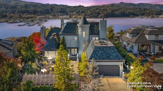
You May Also Like
Similar Rentals Nearby

What Are Walk Score®, Transit Score®, and Bike Score® Ratings?
Walk Score® measures the walkability of any address. Transit Score® measures access to public transit. Bike Score® measures the bikeability of any address.
What is a Sound Score Rating?
A Sound Score Rating aggregates noise caused by vehicle traffic, airplane traffic and local sources

2010 John Muir Pkwy
Hercules, CA 94547