
$975
Total Monthly Price
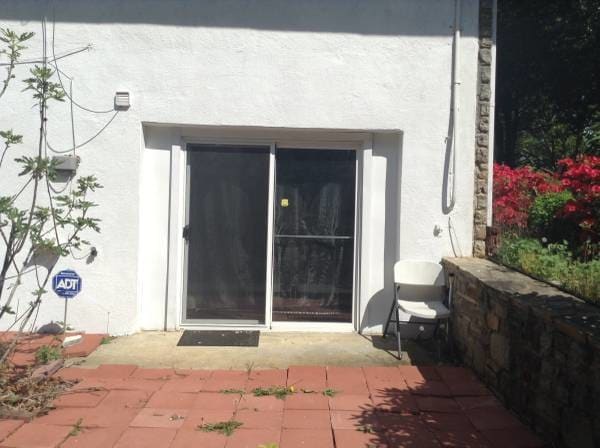
2010 Cedar Cir Dr
Catonsville, MD 21228
Favorites
667-206-6512
-
Bedrooms
1
-
Bathrooms
1
-
Square Feet
500 sq ft
-
Available
Available Jul 1
Highlights
- Pets Allowed
- Furnished
- Security System
2010 Cedar Cir Dr

Favorites
About This Home
12 Month Lease,
$975 deposit,
Available Jul 1
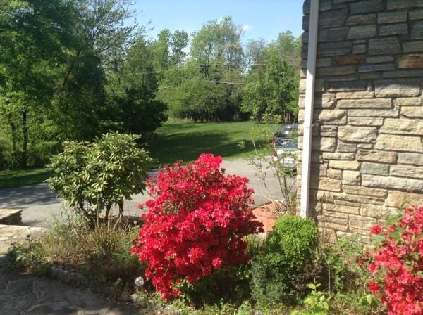
Near 695 and Rt 40. Next to Howard county , Near Umbc shuttle stop. Near shopping center , in a nice upscale location. 9 cedar closets.
2010 Cedar Cir Dr is a house located in Baltimore County and the 21228 ZIP Code. This area is served by the Baltimore County Public Schools attendance zone.
* Price shown is total price based on community-supplied monthly required fees. Excludes user-selected optional fees and variable or usage-based fees and required charges due at or prior to move-in or at move-out. Price, availability, fees, and any applicable rent special are subject to change without notice.
* Square footage definitions vary. Displayed square footage is approximate.
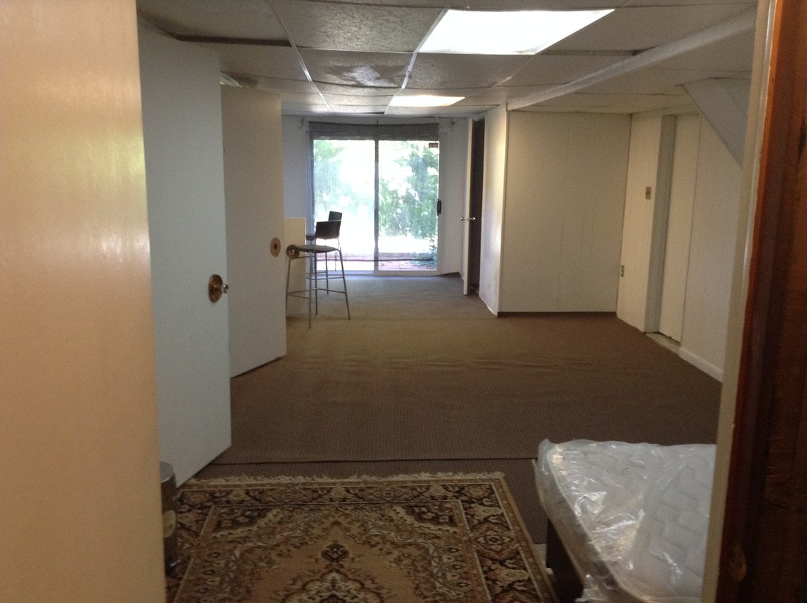
House Features
Washer/Dryer
High Speed Internet Access
Wi-Fi
Tub/Shower
- High Speed Internet Access
- Wi-Fi
- Washer/Dryer
- Heating
- Cable Ready
- Satellite TV
- Security System
- Storage Space
- Tub/Shower
- Wheelchair Accessible (Rooms)
- Furnished
- Laundry Facilities
Fees and Policies
The fees listed below are community-provided and may exclude utilities or add-ons. All payments are made directly to the property and are non-refundable unless otherwise specified.
- Dogs Allowed
-
Fees not specified
- Cats Allowed
-
Fees not specified
- Parking
-
Surface Lot--
Details
Utilities Included
-
Trash Removal
-
Sewer
Lease Options
-
12
Property Information
-
Furnished Units Available
Contact
- Listed by Henry Omid
- Phone Number
- Contact
Location
Get Directions
Catonsville sits just west of Baltimore along the Patapsco River corridor, earning the official nickname "Music City, Maryland" for its deep-rooted love of live performance and local arts culture. The community of roughly 44,000 spans 15 square miles in Baltimore County, offering a pace that feels distinctly residential while keeping downtown Baltimore within easy reach. The University of Maryland, Baltimore County anchors much of the city's intellectual and creative energy, bringing a steady presence of students, faculty, and cultural programming to the area. Frederick Road serves as the beating heart of the community, lined with galleries, cafes, and locally owned shops that give the streetscape real character.
Learn more about living in Catonsville
Education
| Colleges & Universities | Distance | ||
|---|---|---|---|
| Colleges & Universities | Distance | ||
| Drive: | 11 min | 4.5 mi | |
| Drive: | 13 min | 5.1 mi | |
| Drive: | 17 min | 7.3 mi | |
| Drive: | 18 min | 7.9 mi |
2010 Cedar Cir Dr is within 11 minutes or 4.5 miles from CCBC Cantonsville. It is also near UMBC and Coppin State University.
Schools


Public Elementary School
Grades PK-5
451 Students
Attendance Zone
Public Middle School
Grades 6-8
739 Students
Attendance Zone
Public High School
Grades 9-12
1,815 Students
Attendance Zone
Private Elementary, Middle & High School
Grades K-12
140 Students
Nearby
Private Elementary School
Grades PK-5
134 Students
Nearby
School data provided by
 The GreatSchools Rating helps parents compare schools within a state based on a variety of school quality indicators and provides a helpful picture of how effectively each school serves all of its students. Ratings are on a scale of 1 (below average) to 10 (above average) and can include test scores, college readiness, academic progress, advanced courses, equity, discipline and attendance data. We also advise parents to visit schools, consider other information on school performance and programs, and consider family needs as part of the school selection process.
View GreatSchools Rating Methodology
Data provided by GreatSchools.org © 2026. All rights reserved.
View GreatSchools Rating Methodology
Data provided by GreatSchools.org © 2026. All rights reserved.
Transportation options available in Catonsville include Rogers Avenue, located 6.9 miles from 2010 Cedar Cir Dr. 2010 Cedar Cir Dr is near Baltimore/Washington International Thurgood Marshall, located 10.5 miles or 19 minutes away, and Ronald Reagan Washington Ntl, located 39.7 miles or 63 minutes away.
| Transit / Subway | Distance | ||
|---|---|---|---|
| Transit / Subway | Distance | ||
| Drive: | 17 min | 6.9 mi | |
| Drive: | 18 min | 7.3 mi | |
| Drive: | 16 min | 8.2 mi | |
| Drive: | 18 min | 8.5 mi | |
| Drive: | 18 min | 8.9 mi |
| Commuter Rail | Distance | ||
|---|---|---|---|
| Commuter Rail | Distance | ||
| Drive: | 11 min | 6.1 mi | |
| Drive: | 11 min | 6.1 mi | |
| Drive: | 15 min | 6.4 mi | |
| Drive: | 14 min | 7.9 mi | |
| Drive: | 19 min | 10.7 mi |
| Airports | Distance | ||
|---|---|---|---|
| Airports | Distance | ||
|
Baltimore/Washington International Thurgood Marshall
|
Drive: | 19 min | 10.5 mi |
|
Ronald Reagan Washington Ntl
|
Drive: | 63 min | 39.7 mi |
Getting Around
 What do Walkability, Transit, Drivability, and Bikeability mean?
Walkability measures the walking distance to day-to-day needs.
Transit measures access to public transportation.
Drivability measures congestion, parking availability, and access to major roads.
Bikeability measures the suitability for cycling.
How It Works
What do Walkability, Transit, Drivability, and Bikeability mean?
Walkability measures the walking distance to day-to-day needs.
Transit measures access to public transportation.
Drivability measures congestion, parking availability, and access to major roads.
Bikeability measures the suitability for cycling.
How It Works
Fairly Walkable
Walkability
50
/ 100
Limited Public Transit
Transit
20
/ 100
Exceptionally Drivable
Drivability
90
/ 100
Moderately Bikeable
Bikeability
60
/ 100
Scores provided by
Active
Soundscore™
77
/ 100
Traffic
ActiveAirport
CalmBusinesses
ActiveScores provided by
HowLoud What is a Sound Score Rating? A Sound Score Rating aggregates noise caused by vehicle traffic, airplane traffic and local sources. How It WorksTime and distance from 2010 Cedar Cir Dr.
| Shopping Centers | Distance | ||
|---|---|---|---|
| Shopping Centers | Distance | ||
| Walk: | 9 min | 0.5 mi | |
| Walk: | 11 min | 0.6 mi | |
| Drive: | 3 min | 1.2 mi |
2010 Cedar Cir Dr has 3 shopping centers within 1.2 miles, which is about a 3-minute drive. The miles and minutes will be for the farthest away property.
| Parks and Recreation | Distance | ||
|---|---|---|---|
| Parks and Recreation | Distance | ||
|
Benjamin Banneker Historical Park and Museum
|
Drive: | 7 min | 2.5 mi |
|
Banneker Planetarium
|
Drive: | 11 min | 4.5 mi |
|
Gwynns Falls Trail
|
Drive: | 11 min | 4.5 mi |
|
Carrie Murray Nature Center
|
Drive: | 10 min | 4.6 mi |
|
Gwynns Falls - Leakin Park
|
Drive: | 11 min | 4.7 mi |
2010 Cedar Cir Dr has 5 parks within 4.7 miles, including Benjamin Banneker Historical Park and Museum, Banneker Planetarium, and Carrie Murray Nature Center.
| Hospitals | Distance | ||
|---|---|---|---|
| Hospitals | Distance | ||
| Drive: | 7 min | 3.1 mi | |
| Drive: | 9 min | 4.3 mi | |
| Drive: | 15 min | 6.2 mi |
2010 Cedar Cir Dr has 3 hospitals within 6.2 miles, the nearest is Spring Grove Hospital Center which is 3.1 miles away and a 7 minute drive.
| Military Bases | Distance | ||
|---|---|---|---|
| Military Bases | Distance | ||
| Drive: | 33 min | 18.5 mi | |
| Drive: | 49 min | 32.9 mi | |
| Drive: | 57 min | 36.3 mi |
2010 Cedar Cir Dr has 3 military bases within 36.3 miles, the nearest is Fort George Meade which is 18.5 miles away and a 33 minute drive.
Amenities
- High Speed Internet Access
- Wi-Fi
- Washer/Dryer
- Heating
- Cable Ready
- Satellite TV
- Security System
- Storage Space
- Tub/Shower
- Wheelchair Accessible (Rooms)
- Furnished
- Laundry Facilities
2010 Cedar Cir Dr Photos
2010 Cedar Cir Dr
Catonsville, MD 21228