
$2,800
/ Month
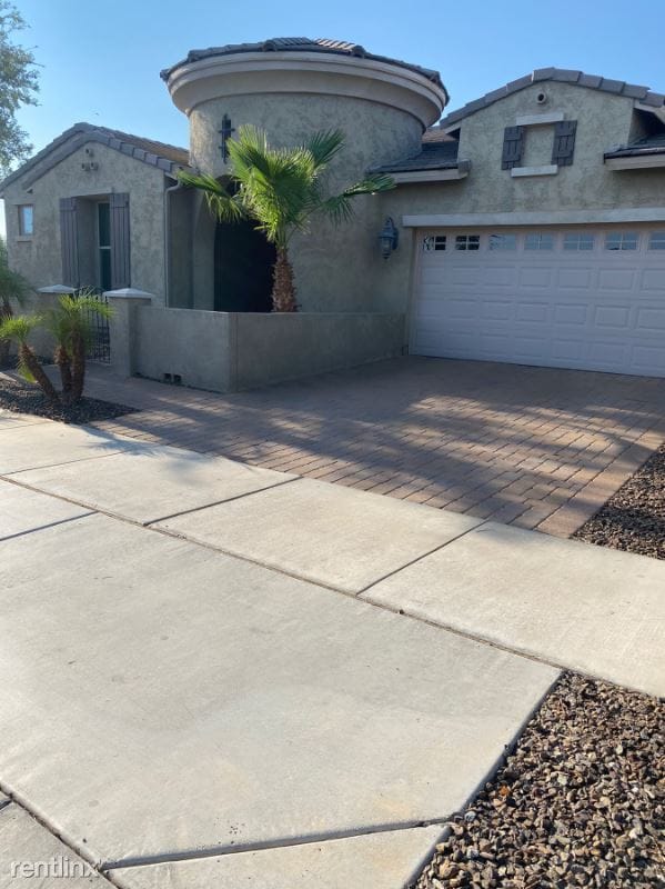
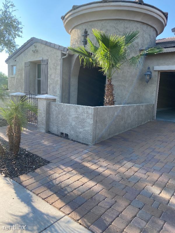
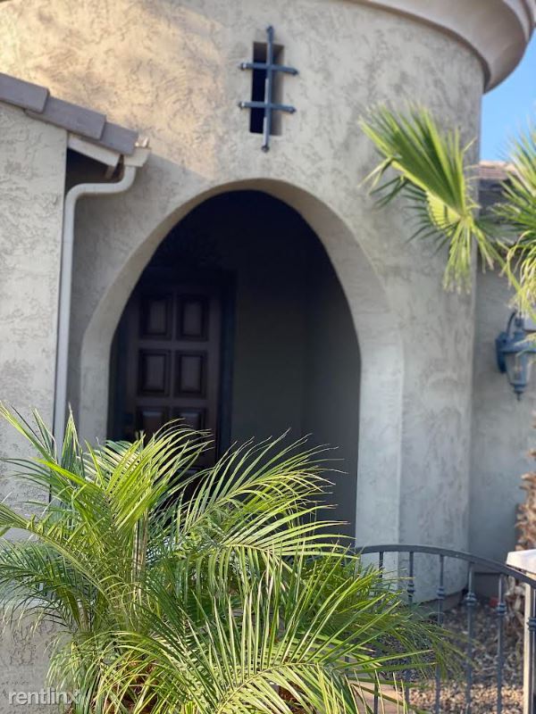
20044 E Escalante Ct
Queen Creek, AZ 85142
2 Weeks Ago
|
Edit
Favorites
20044 E Escalante Ct

Favorites
Check Back Soon for Upcoming Availability
| Beds | Baths | Average SF |
|---|---|---|
| 4 Bedrooms 4 Bedrooms 4 Br | 3 Baths 3 Baths 3 Ba | 2,751 SF |
Fees and Policies
The fees listed below are community-provided and may exclude utilities or add-ons. All payments are made directly to the property and are non-refundable unless otherwise specified.
Details
Utilities Included
-
Gas
-
Water
-
Electricity
About This Property
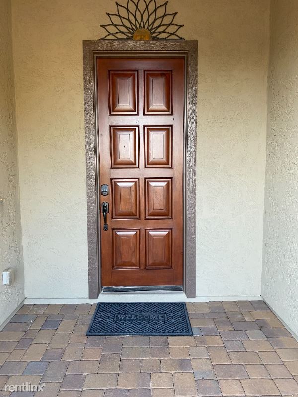
(480) 793-0035 - House for rent! - Property Id: 692373 For Rent! Nestled on a private corner home site! Steps from the Large Community park, Queen Creek Wash, Amaselao Carter Oasis park and Queen Creek Market Place. Breathtaking floor plan to a formal dining and living room. Large grassy backyard with/garden beds, 3 car garage 4 Bedroom, 3 complete Bathrooms and a good size Porch. A Home office. This Georgeus home is fully upgrated and Energy Certified for low summerbills. Apply at TurboTenant: http://rental.turbotenant.com/p/20044-e-escalante-ct-queen-creek-az/692373 Property Id 692373 No Pets Allowed (RLNE6862139) Other Amenities: Other (Cooling System: Wall). Appliances: Dishwasher, Range, Oven, Garbage Disposal, Microwave. Lease lengths: Other (Contact for details). Utilities: Electricity Included, Gas Included, Water Included, Trash Pick-up Included. Pet policies: No Dogs Allowed, No Pets Allowed.
20044 E Escalante Ct is a house located in Maricopa County and the 85142 ZIP Code. This area is served by the Queen Creek Unified District attendance zone.
Unique Features
- No Dogs Allowed, No Pets Allowed, Lease Lengths - Contact for details, Oven, Amenities - Cooling Sys
House Features
- Dishwasher
20044 E Escalante Ct,
Queen Creek,
AZ
85142
Queen Creek sits at the southeastern edge of the Phoenix metro, where the open Sonoran Desert gives way to a growing town that has steadily built its own identity apart from the big city 38 miles to the northwest. Originally rooted in agriculture, the area traces its name back to the Silver Queen Mine, and that working-land heritage still shows in the town's grounded, unpretentious character. Today, Queen Creek spans 43 square miles and draws renters looking for more space, lower density, and direct access to the outdoors, particularly San Tan Mountain Regional Park, which borders the town to the south with over 10,000 acres of desert trails.
The housing mix leans toward single-family rentals and townhomes, though newer apartment communities have taken shape near the Rittenhouse Road and Ellsworth Loop corridor, which also serves as the town's main commercial hub.
Learn more about living in Queen Creek
Amenities
- Dishwasher
- No Dogs Allowed, No Pets Allowed, Lease Lengths - Contact for details, Oven, Amenities - Cooling Sys
Expenses
Utilities Included
Gas, Water, Electricity
Included
Education
| Colleges & Universities | Distance | ||
|---|---|---|---|
| Colleges & Universities | Distance | ||
| Drive: | 11 min | 5.1 mi | |
| Drive: | 12 min | 5.5 mi | |
| Drive: | 21 min | 10.9 mi | |
| Drive: | 22 min | 11.8 mi |
20044 E Escalante Ct is within 11 minutes or 5.1 miles from Arizona State Univ., Polytech. It is also near Chandler-Gilbert C.C., Mesa and Chandler-Gilbert C.C., Pecos.
Schools


Public Elementary School
Grades PK-5
Attendance Zone
Public Middle School
Grades 6-8
Attendance Zone
Public High School
Grades 9-12
Attendance Zone
Private Elementary, Middle & High School
Grades K-12
Nearby
Private Elementary School
Grades PK-5
Nearby
School data provided by
 The GreatSchools Rating helps parents compare schools within a state based on a variety of school quality indicators and provides a helpful picture of how effectively each school serves all of its students. Ratings are on a scale of 1 (below average) to 10 (above average) and can include test scores, college readiness, academic progress, advanced courses, equity, discipline and attendance data. We also advise parents to visit schools, consider other information on school performance and programs, and consider family needs as part of the school selection process.
View GreatSchools Rating Methodology
Data provided by GreatSchools.org © 2026. All rights reserved.
View GreatSchools Rating Methodology
Data provided by GreatSchools.org © 2026. All rights reserved.
Walkability Near 20044 E Escalante Ct Queen Creek, AZ 85142
Getting Around
 What do Walkability, Transit, Drivability, and Bikeability mean?
Walkability measures the walking distance to day-to-day needs.
Transit measures access to public transportation.
Drivability measures congestion, parking availability, and access to major roads.
Bikeability measures the suitability for cycling.
How It Works
What do Walkability, Transit, Drivability, and Bikeability mean?
Walkability measures the walking distance to day-to-day needs.
Transit measures access to public transportation.
Drivability measures congestion, parking availability, and access to major roads.
Bikeability measures the suitability for cycling.
How It Works
Somewhat Walkable
Walkability
30
/ 100
Very Drivable
Drivability
80
/ 100
Fairly Bikeable
Bikeability
50
/ 100
Scores provided by
-
Soundscore™
-
/ 100
Traffic
-Airport
-Businesses
-Scores provided by
HowLoud What is a Sound Score Rating? A Sound Score Rating aggregates noise caused by vehicle traffic, airplane traffic and local sources. How It WorksYou May Also Like
Similar Rentals Nearby


What Are Walk Score®, Transit Score®, and Bike Score® Ratings?
Walk Score® measures the walkability of any address. Transit Score® measures access to public transit. Bike Score® measures the bikeability of any address.
What is a Sound Score Rating?
A Sound Score Rating aggregates noise caused by vehicle traffic, airplane traffic and local sources.

20044 E Escalante Ct
Queen Creek, AZ 85142